
$2,500 / Month
280 Easy St
Mountain View, CA 94043
2 Weeks Ago
Favorites
-
Bedrooms
2
-
Bathrooms
1
-
Square Feet
967 sq ft
280 Easy St

Favorites
About This Home
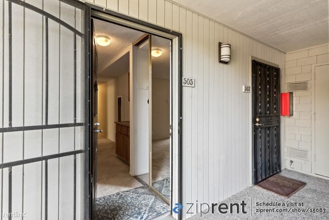
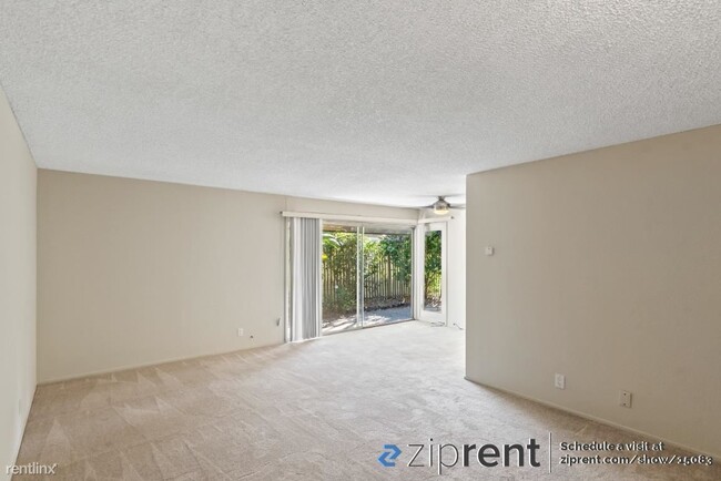
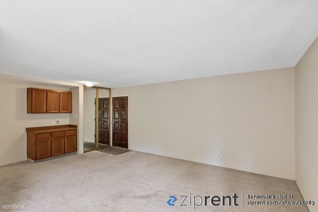
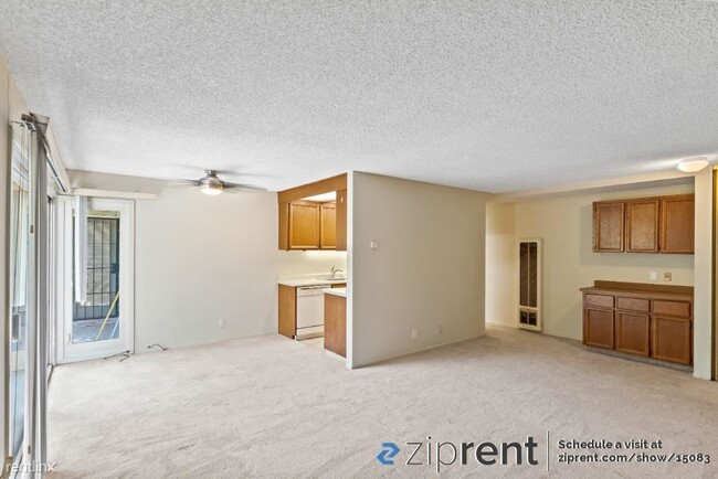
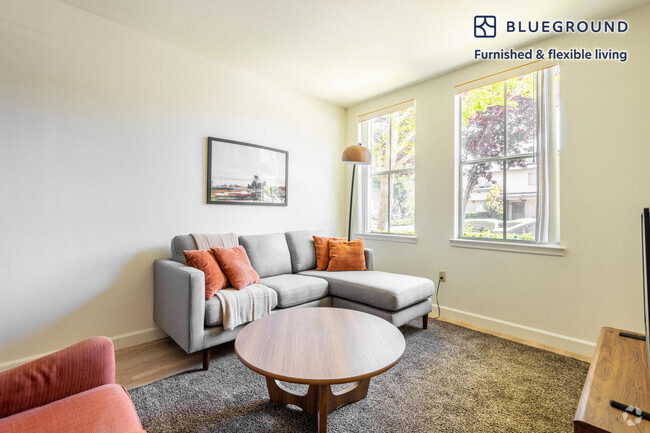
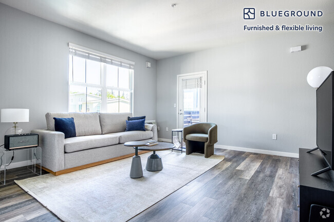
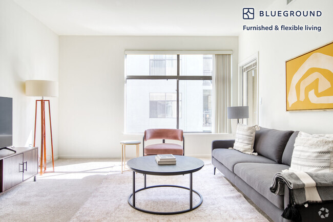
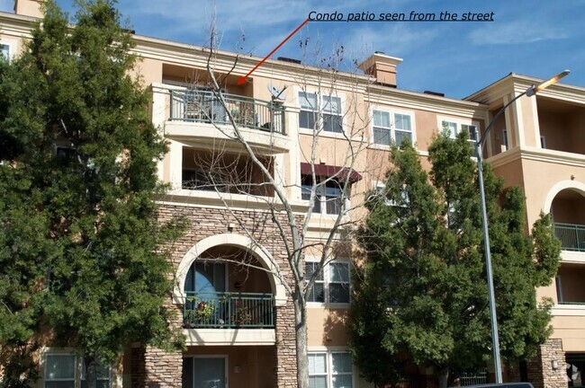
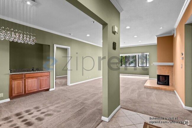
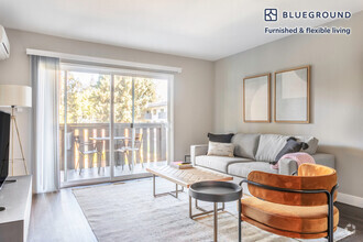
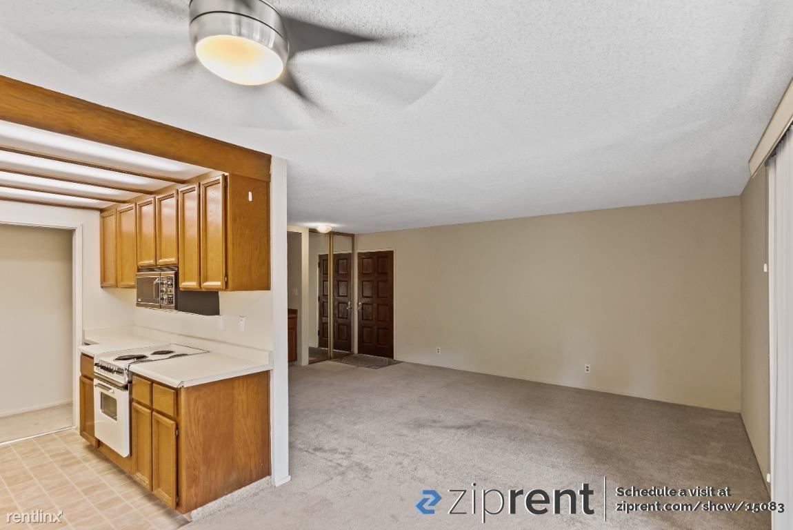
- This property is available. Please inquire on this site to schedule a showing. Available 10/7/2023! Bright 2BR/1BA ground floor unit with large windows/sliding glass doors, sunny and private patio accessible from all rooms, and a small garden. The unit is about 900 sq ft. There is new kitchen fooring being installed. The front door opens to the newly carpeted living room where you will find a dry bar with cabinetry - great for entertaining, The entryway also offers a mirrored closet for extra clothes storage. Galley kitchen comes with a microwave, electric range, new dishwasher, and new refrigerator. The two spacious bedrooms both have access to the patio. Bathroom has ample storage and shower/tub combo enclosed with sliding glass. The complex features a heated pool/spa and shared laundry facilities. There is one covered carport and one open parking space for each unit. Extra storage cabinet is assigned in the carport area. Located near 85, 101, and 237 freeways, close to downtown Mountain View, CalTrain station, Google, LinkedIn, NASA, and Lockheed. Also close to city parks and trails including, Stevens Creek Trail, Magnolia Park, Chetwood Park, and Whisman Park The security deposit is equal to one month's rent. Included utilities: gas, water, sewage, and garbage. All other utilities are the tenant's responsibility. Landscaping services are included. Pets allowed on case-by-case basis with additional $500 pet deposit per pet. Heating: Wall Cooling: None Laundry: Shared Parking: Carport, Off Street, 2 spaces Pets: Case by Case Security deposit: $2,500.00 Included Utilities: Garbage, Gas, Sewage, Water Additional Deposit/Pet: $500.00 Disclaimer: Ziprent is acting as the agent for the owner. Information Deemed Reliable but not Guaranteed. All information should be independently verified by renter. (RLNE8250845) Other Amenities: Parking (2). Lease lengths: 12 Months.
280 Easy St is a condo located in Santa Clara County and the 94043 ZIP Code.
* Price shown is base rent and may not include non-optional fees and utilities.
Price, availability, fees, and any applicable rent special are subject to change without notice.
* Square footage definitions vary. Displayed square footage is approximate.
Location
Get Directions
Known for its fantastic views of the Santa Cruz Mountains, the Wagon Wheel neighborhood of Mountain View, California lies 12 miles southeast of Palo Alto via US-101S. Residents of Wagon Wheel's apartments and home rentals enjoy convenient transportation via light rail, bus, and private shuttle. Featuring an online chat group, this community values resident participation in planning activities such as ice cream socials, community breakfasts, and pumpkin festivals at the local park.
Two parks serve this neighborhood where residents can picnic, relax in an arbor, or join a pick-up baseball game. Whisman Park provides access to the Stevens Creek Trail, with its paved paths for walking, biking, or jogging through scenic natural areas.
Learn more about living in Wagon Wheel
Education
| Colleges & Universities | Distance | ||
|---|---|---|---|
| Colleges & Universities | Distance | ||
| Drive: | 7 min | 3.5 mi | |
| Drive: | 14 min | 5.8 mi | |
| Drive: | 17 min | 7.1 mi | |
| Drive: | 11 min | 7.3 mi |
280 Easy St is within 7 minutes or 3.5 miles from Foothill College, Middlefield. It is also near Foothill Coll., Los Altos and De Anza College.
Transportation options available in Mountain View include Whisman Station, located 0.8 mile from 280 Easy St. 280 Easy St is near Norman Y Mineta San Jose International, located 9.1 miles or 14 minutes away, and San Francisco International, located 25.4 miles or 32 minutes away.
| Transit / Subway | Distance | ||
|---|---|---|---|
| Transit / Subway | Distance | ||
|
|
Walk: | 15 min | 0.8 mi |
|
|
Walk: | 18 min | 1.0 mi |
|
|
Walk: | 18 min | 1.0 mi |
|
|
Drive: | 4 min | 1.7 mi |
|
|
Drive: | 5 min | 2.5 mi |
| Commuter Rail | Distance | ||
|---|---|---|---|
| Commuter Rail | Distance | ||
| Drive: | 6 min | 2.2 mi | |
| Drive: | 7 min | 3.0 mi | |
| Drive: | 7 min | 3.6 mi | |
| Drive: | 10 min | 4.9 mi | |
| Drive: | 11 min | 5.6 mi |
| Airports | Distance | ||
|---|---|---|---|
| Airports | Distance | ||
|
Norman Y Mineta San Jose International
|
Drive: | 14 min | 9.1 mi |
|
San Francisco International
|
Drive: | 32 min | 25.4 mi |
Time and distance from 280 Easy St.
| Shopping Centers | Distance | ||
|---|---|---|---|
| Shopping Centers | Distance | ||
| Walk: | 14 min | 0.8 mi | |
| Drive: | 3 min | 1.3 mi | |
| Drive: | 5 min | 2.1 mi |
280 Easy St has 3 shopping centers within 2.1 miles, which is about a 5-minute walk. The miles and minutes will be for the farthest away property.
| Parks and Recreation | Distance | ||
|---|---|---|---|
| Parks and Recreation | Distance | ||
|
Stevens Creek Shoreline Nature Study Area
|
Drive: | 8 min | 3.3 mi |
|
J. Pearce Mitchell Park
|
Drive: | 10 min | 4.3 mi |
|
Terman Park
|
Drive: | 10 min | 4.7 mi |
|
Esther Clark Nature Preserve
|
Drive: | 13 min | 5.8 mi |
|
Redwood Grove
|
Drive: | 13 min | 6.0 mi |
280 Easy St has 5 parks within 6.0 miles, including Stevens Creek Shoreline Nature Study Area, J. Pearce Mitchell Park, and Terman Park.
| Hospitals | Distance | ||
|---|---|---|---|
| Hospitals | Distance | ||
| Drive: | 6 min | 2.8 mi | |
| Drive: | 13 min | 8.3 mi | |
| Drive: | 14 min | 8.5 mi |
280 Easy St has 3 hospitals within 8.5 miles, the nearest is El Camino Hospital which is 2.8 miles away and a 6 minute drive.
| Military Bases | Distance | ||
|---|---|---|---|
| Military Bases | Distance | ||
| Drive: | 7 min | 2.4 mi |
280 Easy St is 2.4 miles and a 7 minute drive from Ames Research Center.
You May Also Like
Similar Rentals Nearby
-
-
-

-
-
-
-
-
-
 $4,2703 Beds, 2 Baths, 1,300 sq ftApartment for Rent
 -
 $4,5002 Beds, 2 Baths, 936 sq ftApartment for Rent
What Are Walk Score®, Transit Score®, and Bike Score® Ratings?
Walk Score® measures the walkability of any address. Transit Score® measures access to public transit. Bike Score® measures the bikeability of any address.
What is a Sound Score Rating?
A Sound Score Rating aggregates noise caused by vehicle traffic, airplane traffic and local sources
280 Easy St
Mountain View, CA 94043