-
Monthly Rent
$2,600
-
Bedrooms
4 bd
-
Bathrooms
2.5 ba
-
Square Feet
1,150 sq ft
Details

With its shady, tree-lined streets and attractive homes on manicured lawns, Temple Hills is a cozy suburb situated about 10 miles southeast of Washington, DC and roughly six miles east of Alexandria, Virginia. Commuters enjoy easy access to the Capital Beltway, Highway 5, and I-295 as well as mass transit -- particularly the Metrorail Green Line -- to travel throughout the region. Temple Hills is close to Joint Base Andrews, Joint Base Anacostia-Bolling, and the Pentagon. It is also close to the National Harbor along the Potomac River, with attractions that include the Capital Wheel, the Gaylord National Resort and Convention Center, and Tanger Outlet National Harbor.
Temple Hills is mostly residential, but residents can follow Oxon Hill Road just outside of the community to find a shopping and dining district, complete with a movie theater. More stores, including a grocery store, banks, and hair salons, are located off Brinkley Road.
Learn more about living in Temple Hills| Colleges & Universities | Distance | ||
|---|---|---|---|
| Colleges & Universities | Distance | ||
| Drive: | 16 min | 6.5 mi | |
| Drive: | 14 min | 6.8 mi | |
| Drive: | 14 min | 6.8 mi | |
| Drive: | 16 min | 7.4 mi |
Transportation options available in Temple Hills include Naylor Road, located 1.4 miles from 2803 Keating St. 2803 Keating St is near Ronald Reagan Washington Ntl, located 10.4 miles or 21 minutes away, and Baltimore/Washington International Thurgood Marshall, located 33.1 miles or 51 minutes away.
| Transit / Subway | Distance | ||
|---|---|---|---|
| Transit / Subway | Distance | ||
|
|
Drive: | 3 min | 1.4 mi |
|
|
Drive: | 6 min | 1.9 mi |
|
|
Drive: | 8 min | 2.3 mi |
|
|
Drive: | 6 min | 2.6 mi |
|
|
Drive: | 8 min | 2.9 mi |
| Commuter Rail | Distance | ||
|---|---|---|---|
| Commuter Rail | Distance | ||
|
|
Drive: | 15 min | 6.2 mi |
|
|
Drive: | 13 min | 6.4 mi |
|
|
Drive: | 18 min | 9.1 mi |
|
|
Drive: | 17 min | 9.7 mi |
|
|
Drive: | 21 min | 12.3 mi |
| Airports | Distance | ||
|---|---|---|---|
| Airports | Distance | ||
|
Ronald Reagan Washington Ntl
|
Drive: | 21 min | 10.4 mi |
|
Baltimore/Washington International Thurgood Marshall
|
Drive: | 51 min | 33.1 mi |
Time and distance from 2803 Keating St.
| Shopping Centers | Distance | ||
|---|---|---|---|
| Shopping Centers | Distance | ||
| Walk: | 4 min | 0.2 mi | |
| Walk: | 11 min | 0.6 mi | |
| Walk: | 12 min | 0.6 mi |
| Parks and Recreation | Distance | ||
|---|---|---|---|
| Parks and Recreation | Distance | ||
|
Oxon Cove Park
|
Drive: | 4 min | 1.6 mi |
|
Suitland Bog
|
Drive: | 6 min | 3.0 mi |
|
Frederick Douglass National Historic Site
|
Drive: | 10 min | 3.7 mi |
|
Fort Dupont Park
|
Drive: | 9 min | 3.9 mi |
|
Kenilworth Park & Aquatic Gardens
|
Drive: | 10 min | 4.1 mi |
| Hospitals | Distance | ||
|---|---|---|---|
| Hospitals | Distance | ||
| Drive: | 7 min | 2.6 mi | |
| Drive: | 18 min | 8.4 mi | |
| Drive: | 18 min | 8.7 mi |
| Military Bases | Distance | ||
|---|---|---|---|
| Military Bases | Distance | ||
| Drive: | 11 min | 4.4 mi | |
| Drive: | 14 min | 4.8 mi | |
| Drive: | 11 min | 5.1 mi |
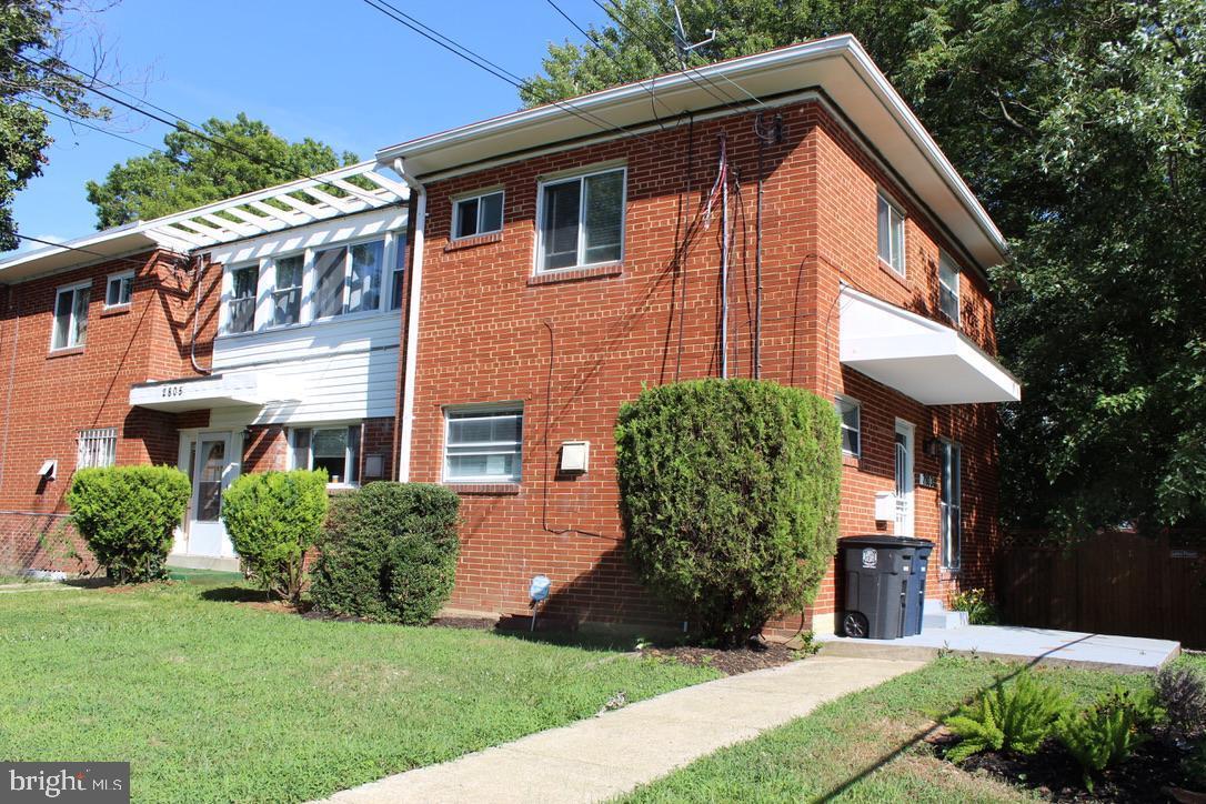
2803 Keating St Photos
What Are Walk Score®, Transit Score®, and Bike Score® Ratings?
Walk Score® measures the walkability of any address. Transit Score® measures access to public transit. Bike Score® measures the bikeability of any address.
What is a Sound Score Rating?
A Sound Score Rating aggregates noise caused by vehicle traffic, airplane traffic and local sources

