$1,800 / Mes
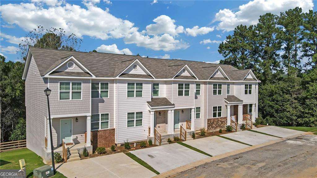
2836 Laurel Ridge Cir
East Point, GA 30344
Hoy
Favoritos
678-878-7590
-
Habitaciones
3
-
Baños
2.5
-
Pies cuadrados
1,492 pies²
-
Disponible
No está disponible
2836 Laurel Ridge Cir

Favoritos
Acerca de esta casa
No está disponible
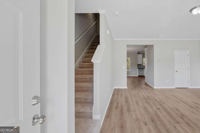
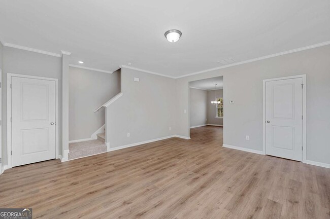
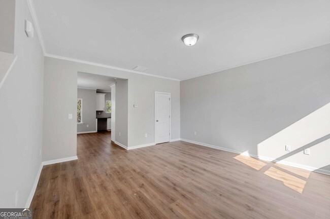
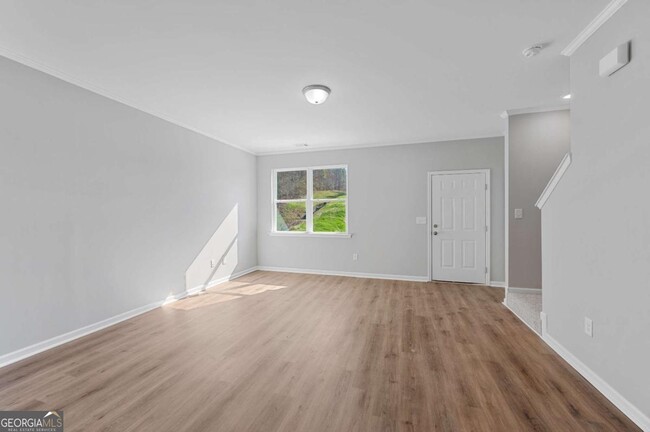
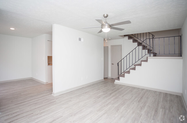
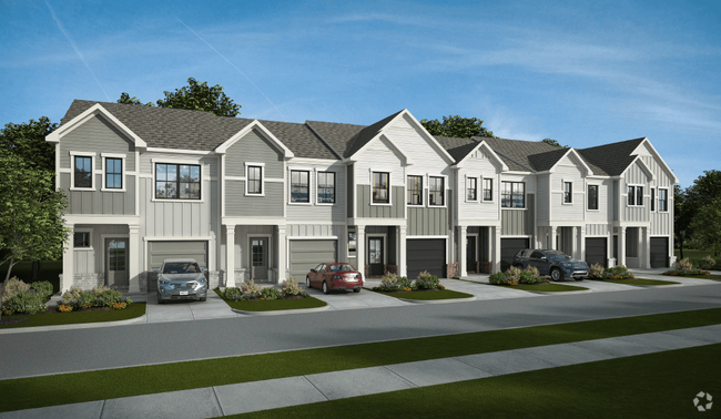
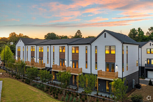
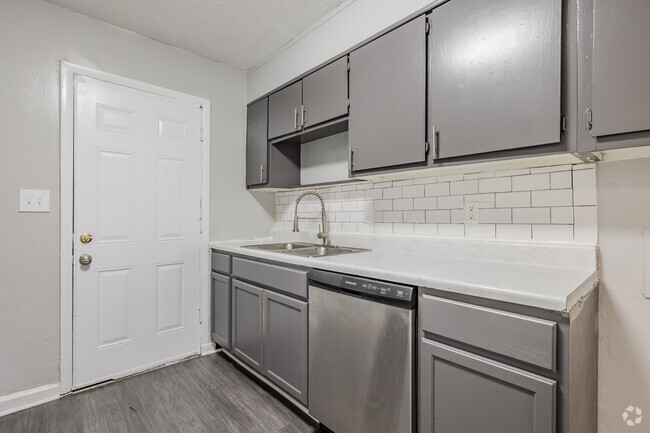
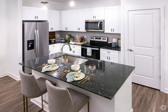
ALQUILER DE UN MES GRATIS con CONTRATO DE ARRENDAMIENTO DE 13 MESES. ¡Sé el PRIMERO en vivir en esta impecable casa adosada de nueva construcción! Esta casa adosada de nueva construcción de 3 habitaciones y 2,5 baños cuenta con un plano de planta increíble con pisos LVP en todo el nivel principal. Amplia cocina comedor personalizada con electrodomésticos de acero inoxidable (que se agregarán al mudarse), encimeras de granito. Dormitorio principal de gran tamaño. Baño grande con combinación de bañera y ducha. 2 dormitorios auxiliares grandes con baño completo compartido. Gran cantidad de espacio de almacenamiento con el sótano COMPLETO, LIMPIO y sin terminar. ¡Excelente ubicación! A 5 minutos de Camp Creek Marketplace, uno de los centros comerciales más grandes de Atlanta. A minutos de la I-285, el centro de Atlanta y el aeropuerto de ATL. (Ten en cuenta que los electrodomésticos en las imágenes no son electrodomésticos reales, el propietario instalará NUEVOS electrodomésticos de acero inoxidable más cerca de la mudanza del inquilino).
2836 Laurel Ridge Cir se encuentra en Fulton County en el código postal 30344. Esta área está atendida por la zona de asistencia del Fulton County.
* El precio que se muestra es el alquiler base y es posible que no incluya cuotas o servicios básicos obligatorios.
El precio, la disponibilidad, las tarifas y cualquier oferta especial de alquiler aplicable están sujetos a cambios sin previo aviso.
* Las definiciones de la superficie varían. La superficie cuadrada que se muestra es aproximada.
Características de la casa adosada
Lavavajillas
Microondas
Nevera
Zona de eliminación de desechos
- Lavavajillas
- Zona de eliminación de desechos
- Despensa
- Microondas
- Nevera
- Rincón para el desayuno
- Sala familiar
Contactar
- Listado Por Andy Griffith | Engel & V?lkers Atlanta
- Número de Teléfono
- Contactar
-
Fuente
 Georgia Multiple Listing Service
Copyright © 2025 Georgia Multiple Listing Service. All rights reserved. All information provided by the listing agent / broker is deemed reliable but is not guaranteed and should be independently verified.
Ubicación
Obtén las direcciones
Comodidades
- Lavavajillas
- Zona de eliminación de desechos
- Despensa
- Microondas
- Nevera
- Rincón para el desayuno
- Sala familiar
Educación
| Institutos y Universidades | Distancia de | ||
|---|---|---|---|
| Institutos y Universidades | Dist. | ||
| En coche: | 16 minutos | 10.1 mi | |
| En coche: | 18 minutos | 10.5 mi | |
| En coche: | 20 minutos | 10.7 mi | |
| En coche: | 20 minutos | 10.8 mi |
2836 Laurel Ridge Cir está a 16 minutos o 10.1 millas de Atlanta Metropolitan State. También está cerca de Atlanta Technical College et Morehouse School of Medicine.
Escuelas


Escuela primaria pública
Grados PK-5
416 Alumnos
Zona de asistencia
Escuela intermedia pública
Grados 6-8
799 Alumnos
Zona de asistencia
Escuela secundaria pública
Grados 9-12
1,483 Alumnos
Zona de asistencia
Escuela primaria, intermedia et secundaria privada
Grados PK-12
127 Alumnos
Propiedades
Escuela primaria privada
Grados PK-5
Propiedades
Datos de escuelas proporcionados por
 La Calificación de GreatSchools ayuda a los padres a comparar las escuelas dentro de un Estado basado en una variedad de indicadores de calidad y proporciona una imagen útil de la eficacia con la que cada escuela sirve a todos sus estudiantes. Las calificaciones están en una escala de 1 (por debajo del promedio) a 10 (encima del promedio) y puede incluir los puntajes de prueba, preparación universitaria, progreso académico, cursos avanzados, equidad, disciplina y datos de asistencia. Nosotros también recomendamos a los padres visitar las escuelas, considerar otra información sobre el desempeño y los programas escolares, y tener en cuenta las necesidades de la familia como parte del proceso de selección de la escuela.
Ver la metodología de calificación de GreatSchools
Ver la metodología de calificación de GreatSchools
Las opciones de transporte disponibles en East Point incluyen College Park, a 3.6 millas de 2836 Laurel Ridge Cir. 2836 Laurel Ridge Cir está cerca de Hartsfield - Jackson Atlanta International, a 9.1 millas o 16 minutos de distancia.
| Tránsito / metro | Distancia de | ||
|---|---|---|---|
| Tránsito / metro | Dist. | ||
|
|
En coche: | 7 minutos | 3.6 mi |
|
|
En coche: | 8 minutos | 4.0 mi |
|
|
En coche: | 11 minutos | 5.5 mi |
|
|
En coche: | 13 minutos | 7.4 mi |
|
|
En coche: | 14 minutos | 8.2 mi |
| Tren suburbano | Distancia de | ||
|---|---|---|---|
| Tren suburbano | Dist. | ||
|
|
En coche: | 26 minutos | 16.6 mi |
| Aeropuertos | Distancia de | ||
|---|---|---|---|
| Aeropuertos | Dist. | ||
|
Hartsfield - Jackson Atlanta International
|
En coche: | 16 minutos | 9.1 mi |
Tiempo y distancia desde 2836 Laurel Ridge Cir.
| Centros comerciales | Distancia de | ||
|---|---|---|---|
| Centros comerciales | Dist. | ||
| A pie: | 20 minutos | 1.1 mi | |
| En coche: | 5 minutos | 1.7 mi | |
| En coche: | 4 minutos | 1.7 mi |
2836 Laurel Ridge Cir tiene 3 centros comerciales en un radio de 1.7 millas, lo que supone 4 minutos caminando. Las millas y los minutos serán para la propiedad más alejada.
| Parques y recreación | Distancia de | ||
|---|---|---|---|
| Parques y recreación | Dist. | ||
|
Cascade Springs Nature Preserve
|
En coche: | 11 minutos | 7.1 mi |
|
West Atlanta Watershed Alliance (WAWA)
|
En coche: | 16 minutos | 8.9 mi |
|
Atlanta BeltLine Southwest Connector Spur Trail
|
En coche: | 16 minutos | 9.4 mi |
|
Park Pride
|
En coche: | 19 minutos | 11.2 mi |
|
Zoo Atlanta
|
En coche: | 21 minutos | 12.5 mi |
2836 Laurel Ridge Cir tiene 5 parques en un radio de 12.5 millas, incluyendo Cascade Springs Nature Preserve, West Atlanta Watershed Alliance (WAWA), et Atlanta BeltLine Southwest Connector Spur Trail.
| Medico | Distancia de | ||
|---|---|---|---|
| Medico | Dist. | ||
| En coche: | 13 minutos | 6.6 mi | |
| En coche: | 18 minutos | 9.5 mi | |
| En coche: | 17 minutos | 10.2 mi |
2836 Laurel Ridge Cir tiene 3 medico en un radio de 10.2 millas; la más cercana es Southern Crescent Behavioral Health System - Anchor Hospital Campus que está a 6.6 millas y a 13 minutos en automóvil.
| Bases militares | Distancia de | ||
|---|---|---|---|
| Bases militares | Dist. | ||
| En coche: | 15 minutos | 8.0 mi | |
| En coche: | 25 minutos | 15.4 mi |
2836 Laurel Ridge Cir está a 8.0 millas de Fort McPherson, y está en una ubicación conveniente de otras bases militares, incluyendo Fort Gillem.
También te puede gustar
Alquileres Similares Cercanos


¿Qué son las clasificaciones Walk Score®, Transit Score® y Bike Score®?
Walk Score® mide la viabilidad peatonal de cualquier dirección. Transit Score® mide el acceso a transporte público. Bike Score® mide la infraestructura de rutas para bicicletas de cualquier dirección.
¿Qué es una clasificación de puntaje de ruido?
La clasificación de puntaje de ruido es el conjunto del ruido provocado por el transito de vehículos o de aviones y de fuentes locales.

2836 Laurel Ridge Cir
East Point, GA 30344