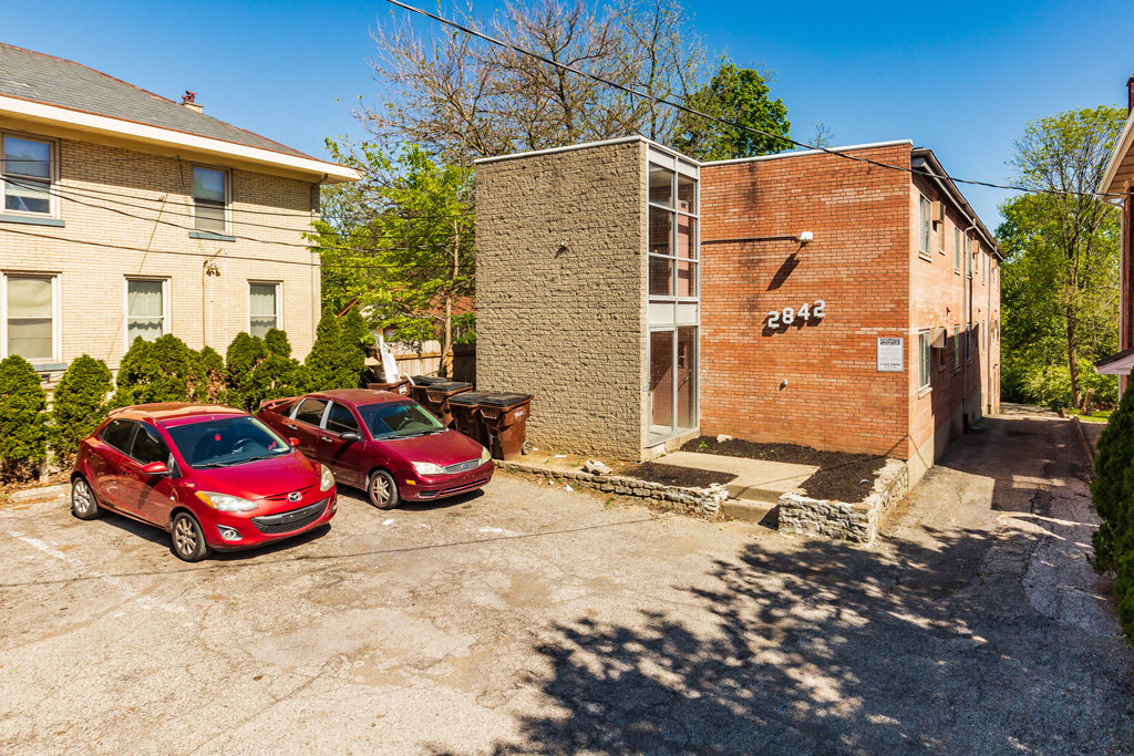
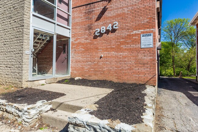

2842 Montana Ave
2842 Montana Ave,
Cincinnati,
OH
45211
-
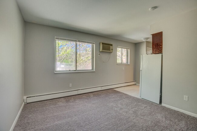
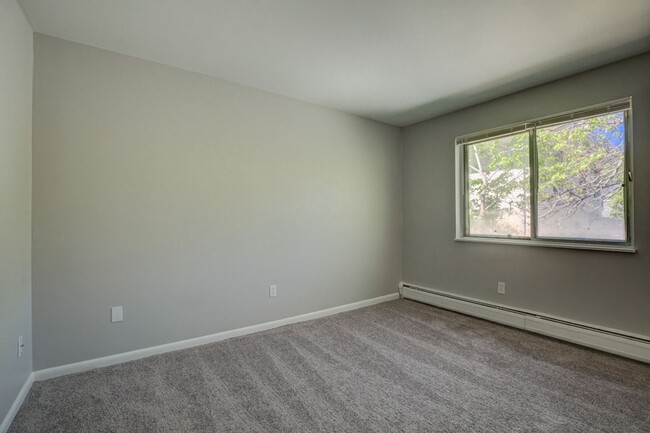
Monthly Rent
$700
-
Bedrooms
1 bd
-
Bathrooms
1 ba
-
Square Feet
390 sq ft

2842 Montana
Pricing & Floor Plans
-
Unit 2842 Montana Avenue - 6price $700square feet 390availibility Now
-
Unit 2842 Montana Avenue - 9price $700square feet 390availibility Now
-
Unit 2842 Montana Avenue - 6price $700square feet 390availibility Now
-
Unit 2842 Montana Avenue - 9price $700square feet 390availibility Now
About 2842 Montana Ave
2842 Montana
2842 Montana Ave is an apartment community located in Hamilton County and the 45211 ZIP Code. This area is served by the Cincinnati Public Schools attendance zone.
Contact
Fees and Policies
Details
Property Information
-
Built in 1968
-
13 units/2 stories
| Monday | 12am - 12am |
|---|---|
| Tuesday | 12am - 12am |
| Wednesday | 12am - 12am |
| Thursday | 12am - 12am |
| Friday | 12am - 12am |
| Saturday | 12am - 12am |
| Sunday | 12am - 12am |
Situated about five miles northwest of Downtown Cincinnati, Westwood is the largest neighborhood in the city. Residents flock to Westwood for its many affordable historic homes and modern apartments available for rent in addition to its close proximity to I-74, I-75, and all that Downtown Cincinnati has to offer.
While Westwood is a predominantly residential neighborhood, it is also home to a slew of convenient stores and restaurants. Shopping opportunities abound in Westwood, with plenty of national retailers in Western Hills Plaza and local shops in the growing Town Hall District. Numerous neighborhood parks provide ample space to enjoy the outdoors in town as well as the sprawling 1,400-acre Mount Airy Forest, which is partially located in Westwood.
Learn more about living in Westwood| Colleges & Universities | Distance | ||
|---|---|---|---|
| Colleges & Universities | Distance | ||
| Drive: | 12 min | 4.7 mi | |
| Drive: | 10 min | 5.0 mi | |
| Drive: | 12 min | 5.4 mi | |
| Drive: | 14 min | 6.1 mi |


View GreatSchools Rating Methodology
Transportation options available in Cincinnati include Brewery District Station, Elm & Henry, located 5.7 miles from 2842 Montana Ave. 2842 Montana Ave is near Cincinnati/Northern Kentucky International, located 19.7 miles or 35 minutes away.
| Transit / Subway | Distance | ||
|---|---|---|---|
| Transit / Subway | Distance | ||
| Drive: | 12 min | 5.7 mi | |
| Drive: | 12 min | 5.8 mi | |
| Drive: | 12 min | 5.9 mi | |
| Drive: | 12 min | 5.9 mi | |
| Drive: | 12 min | 6.0 mi |
| Commuter Rail | Distance | ||
|---|---|---|---|
| Commuter Rail | Distance | ||
|
|
Drive: | 11 min | 5.7 mi |
| Airports | Distance | ||
|---|---|---|---|
| Airports | Distance | ||
|
Cincinnati/Northern Kentucky International
|
Drive: | 35 min | 19.7 mi |
Time and distance from 2842 Montana Ave.
| Shopping Centers | Distance | ||
|---|---|---|---|
| Shopping Centers | Distance | ||
| Drive: | 5 min | 1.8 mi | |
| Drive: | 5 min | 2.2 mi | |
| Drive: | 6 min | 2.4 mi |
| Parks and Recreation | Distance | ||
|---|---|---|---|
| Parks and Recreation | Distance | ||
|
Mt. Airy Forest
|
Drive: | 6 min | 2.8 mi |
|
Buttercup Valley
|
Drive: | 8 min | 3.6 mi |
|
LaBoiteaux Woods
|
Drive: | 11 min | 4.8 mi |
|
Imago Earth Center
|
Drive: | 13 min | 5.1 mi |
|
Wilson Commons
|
Drive: | 13 min | 5.7 mi |
| Hospitals | Distance | ||
|---|---|---|---|
| Hospitals | Distance | ||
| Drive: | 8 min | 3.2 mi | |
| Drive: | 9 min | 4.2 mi | |
| Drive: | 12 min | 5.5 mi |
| Military Bases | Distance | ||
|---|---|---|---|
| Military Bases | Distance | ||
| Drive: | 71 min | 54.5 mi | |
| Drive: | 77 min | 59.5 mi | |
| Drive: | 80 min | 62.8 mi |
2842 Montana Ave Photos
-
2842 Montana Ave
-
-
-
-
-
-
-
-
Nearby Apartments
Within 50 Miles of 2842 Montana Ave
-
Kirby's Dreamland
4344-4348 Kirby Ave
Cincinnati, OH 45223
2 Br $1,095 2.8 mi
-
830 Nebraska Ave
830 Nebraska Ave
Cincinnati, OH 45238
2 Br $950 2.8 mi
-
W. 8th St
4126 W Eighth St
Cincinnati, OH 45205
1 Br $800 2.9 mi
-
2131 Staebler St
2131 Staebler St
Cincinnati, OH 45204
2 Br $1,175 3.8 mi
-
5729 Montgomery Rd
5729-5733 Montgomery Rd
Cincinnati, OH 45212
1 Br $995 8.5 mi
-
Clough Pike Apartments
824 Clough Pike
Cincinnati, OH 45245
1 Br $895 17.5 mi
2842 Montana Ave has one bedroom available with rent ranges from $700/mo. to $700/mo.
Yes, to view the floor plan in person, please schedule a personal tour.
2842 Montana Ave is in Westwood in the city of Cincinnati. Here you’ll find three shopping centers within 2.4 miles of the property. Five parks are within 5.7 miles, including Mt. Airy Forest, Buttercup Valley, and Imago Earth Center.
What Are Walk Score®, Transit Score®, and Bike Score® Ratings?
Walk Score® measures the walkability of any address. Transit Score® measures access to public transit. Bike Score® measures the bikeability of any address.
What is a Sound Score Rating?
A Sound Score Rating aggregates noise caused by vehicle traffic, airplane traffic and local sources

2842 Montana Ave
Cincinnati, OH 45211
Responded To This Review