

$6,275 / Month
285 Avenue 64
Pasadena, CA 91105
Today
Favorites
424-268-8595
Westside Rentals
-
Bedrooms
3
-
Bathrooms
2
-
Square Feet
1,463 sq ft
-
Available
Available Apr 1
Highlight
- Pets Allowed
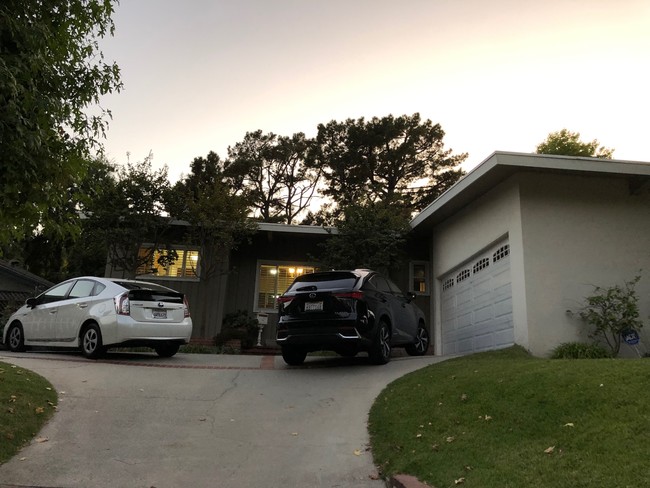
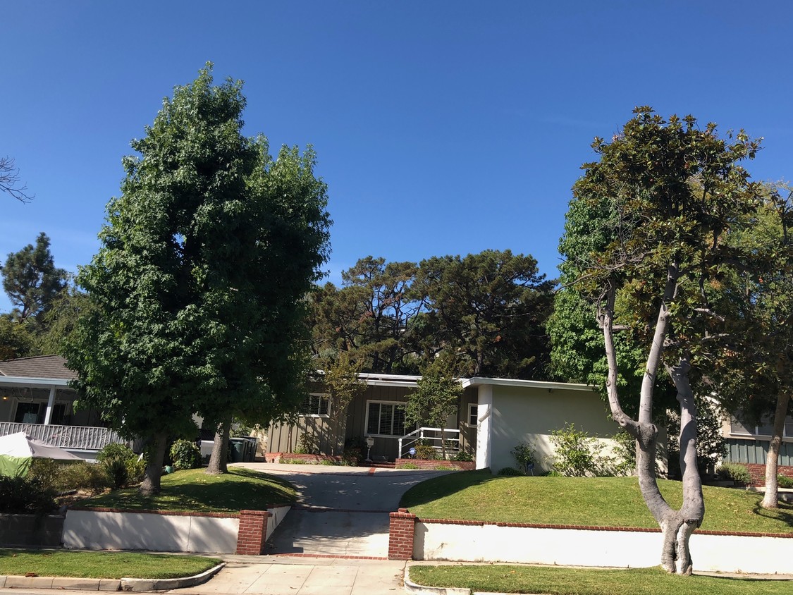
285 Avenue 64
Westside Rentals
Favorites
About This Home
12 Month Lease,
$6,275 deposit,
Available Apr 1
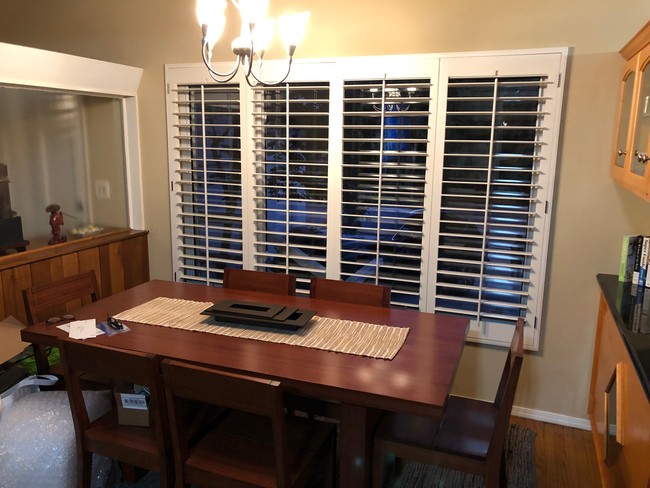
Location, location, location!!! Located in one of the most desirable areas in Pasadena, the San Rafael Hills. This single-story, 2 bedroom, 2 bath home with convertible den/office/3rd bedroom (has built-in closet) is located directly across the street from the San Rafael Public Library and 1 block to San Rafael Elementary School. Has attached 2 car garage. This is the ideal location to raise a Family!
285 Avenue 64 is a house located in Los Angeles County and the 91105 ZIP Code. This area is served by the Pasadena Unified attendance zone.
* Price shown is base rent and may not include non-optional fees and utilities.
Price, availability, fees, and any applicable rent special are subject to change without notice.
* Square footage definitions vary. Displayed square footage is approximate.
House Features
Washer/Dryer
Air Conditioning
Dishwasher
Tub/Shower
- Washer/Dryer
- Air Conditioning
- Heating
- Ceiling Fans
- Smoke Free
- Storage Space
- Tub/Shower
- Fireplace
- Dishwasher
- Office
- Den
Fees and Policies
The fees below are based on community-supplied data and may exclude additional fees and utilities.
- Dogs Allowed
-
Fees not specified
- Cats Allowed
-
Fees not specified
- Parking
-
Garage--
Details
Lease Options
-
12
Contact
- Phone Number (424) 268-8595
- Contact
$7,147 / month
$1,275,000 Listing Price
4 Beds
•2 Baths
•
1,436 Sq Ft
$7,035 / month
$1,185,000 Listing Price
3 Beds
•2 Baths
•
1,856 Sq Ft
$6,307 / month
$1,100,000 Listing Price
3 Beds
•2 Baths
•
1,036 Sq Ft
Location
Get Directions
Annandale is nestled in a quaint, high-end section of Pasadena in the outskirts of Los Angeles. Many visitors pass through Annandale to cross the landmark Colorado Street Bridge or exit the Ventura Freeway heading to events at the Rose Bowl. The neighborhood contains mostly million-dollar homes and grand estates, along with a few upscale rental properties. The only commercial zone rests along Colorado Boulevard, comprising of a few small businesses. The Arroyo Seco defines the eastern border, a dry riverbed that extends from the San Gabriel Mountains down to Elysian Park. Annandale sits only two miles west of Pasadena City Hall and nine miles northeast of Downtown Los Angeles.
Learn more about living in Annandale
Education
| Colleges & Universities | Distance | ||
|---|---|---|---|
| Colleges & Universities | Distance | ||
| Drive: | 5 min | 3.0 mi | |
| Drive: | 6 min | 3.5 mi | |
| Drive: | 8 min | 3.5 mi | |
| Drive: | 8 min | 3.6 mi |
285 Avenue 64 is within 6 minutes or 3.5 miles from Art Center College of Design. It is also near Occidental College and Fuller Theological Seminary.
Schools
Charter Elementary School
Grades K-5
75 Students
Nearby
Public Elementary School
Grades K-5
385 Students
Attendance Zone
5
Out of 10
Public Middle & High School
Grades 6-12
1,117 Students
Attendance Zone
5
Out of 10
Private Elementary & Middle School
Grades PK-8
237 Students
Nearby
Private Elementary, Middle & High School
Grades 1-12
71 Students
Nearby
Private Middle & High School
Grades 6-12
39 Students
Nearby
School data provided by
GreatSchools
The GreatSchools Rating helps parents compare schools within a state based on a variety of school quality indicators and provides a helpful picture of how effectively each school serves all of its students. Ratings are on a scale of 1 (below average) to 10 (above average) and can include test scores, college readiness, academic progress, advanced courses, equity, discipline and attendance data. We also advise parents to visit schools, consider other information on school performance and programs, and consider family needs as part of the school selection process.
Transportation options available in Pasadena include Memorial Park Station, located 2.3 miles from 285 Avenue 64. 285 Avenue 64 is near Bob Hope, located 15.4 miles or 21 minutes away, and Los Angeles International, located 22.6 miles or 36 minutes away.
| Transit / Subway | Distance | ||
|---|---|---|---|
| Transit / Subway | Distance | ||
|
|
Drive: | 4 min | 2.3 mi |
|
|
Drive: | 4 min | 2.3 mi |
|
|
Drive: | 6 min | 2.4 mi |
|
|
Drive: | 7 min | 2.7 mi |
|
|
Drive: | 5 min | 2.9 mi |
| Commuter Rail | Distance | ||
|---|---|---|---|
| Commuter Rail | Distance | ||
|
|
Drive: | 14 min | 7.5 mi |
|
|
Drive: | 16 min | 7.6 mi |
|
|
Drive: | 11 min | 7.9 mi |
|
|
Drive: | 14 min | 10.0 mi |
| Drive: | 17 min | 11.6 mi |
| Airports | Distance | ||
|---|---|---|---|
| Airports | Distance | ||
|
Bob Hope
|
Drive: | 21 min | 15.4 mi |
|
Los Angeles International
|
Drive: | 36 min | 22.6 mi |
Time and distance from 285 Avenue 64.
| Shopping Centers | Distance | ||
|---|---|---|---|
| Shopping Centers | Distance | ||
| Drive: | 3 min | 1.7 mi | |
| Drive: | 4 min | 1.9 mi | |
| Drive: | 5 min | 2.5 mi |
285 Avenue 64 has 3 shopping centers within 2.5 miles, which is about a 5-minute drive. The miles and minutes will be for the farthest away property.
| Parks and Recreation | Distance | ||
|---|---|---|---|
| Parks and Recreation | Distance | ||
|
Kidspace Children's Museum
|
Drive: | 4 min | 2.1 mi |
|
Audubon Center at Debs Park
|
Drive: | 7 min | 3.6 mi |
|
Jet Propulsion Laboratory
|
Drive: | 8 min | 4.7 mi |
|
Huntington Botanical Gardens
|
Drive: | 11 min | 5.3 mi |
|
Elyria Canyon Park
|
Drive: | 12 min | 6.0 mi |
285 Avenue 64 has 5 parks within 6.0 miles, including Kidspace Children's Museum, Audubon Center at Debs Park, and Jet Propulsion Laboratory.
| Hospitals | Distance | ||
|---|---|---|---|
| Hospitals | Distance | ||
| Drive: | 4 min | 2.8 mi | |
| Drive: | 8 min | 4.5 mi | |
| Drive: | 12 min | 5.1 mi |
285 Avenue 64 has 3 hospitals within 5.1 miles, the nearest is Huntington Memorial Hospital which is 2.8 miles away and a 4 minute drive.
| Military Bases | Distance | ||
|---|---|---|---|
| Military Bases | Distance | ||
| Drive: | 34 min | 24.2 mi | |
| Drive: | 47 min | 31.6 mi |
285 Avenue 64 is 24.2 miles from Los Angeles Air Force Base, and is convenient to other military bases, including Los Alamitos Army Airfield.
Amenities
- Washer/Dryer
- Air Conditioning
- Heating
- Ceiling Fans
- Smoke Free
- Storage Space
- Tub/Shower
- Fireplace
- Dishwasher
- Office
- Den
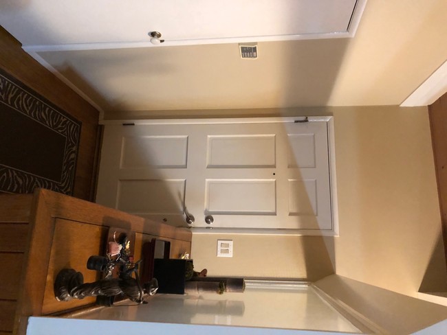
285 Avenue 64 Photos
What Are Walk Score®, Transit Score®, and Bike Score® Ratings?
Walk Score® measures the walkability of any address. Transit Score® measures access to public transit. Bike Score® measures the bikeability of any address.
What is a Sound Score Rating?
A Sound Score Rating aggregates noise caused by vehicle traffic, airplane traffic and local sources
285 Avenue 64
Pasadena, CA 91105