-
Monthly Rent
$3,850
-
Bedrooms
2 bd
-
Bathrooms
2 ba
-
Square Feet
930 sq ft
Details
About This Property
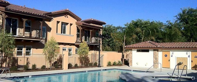
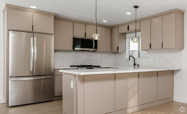
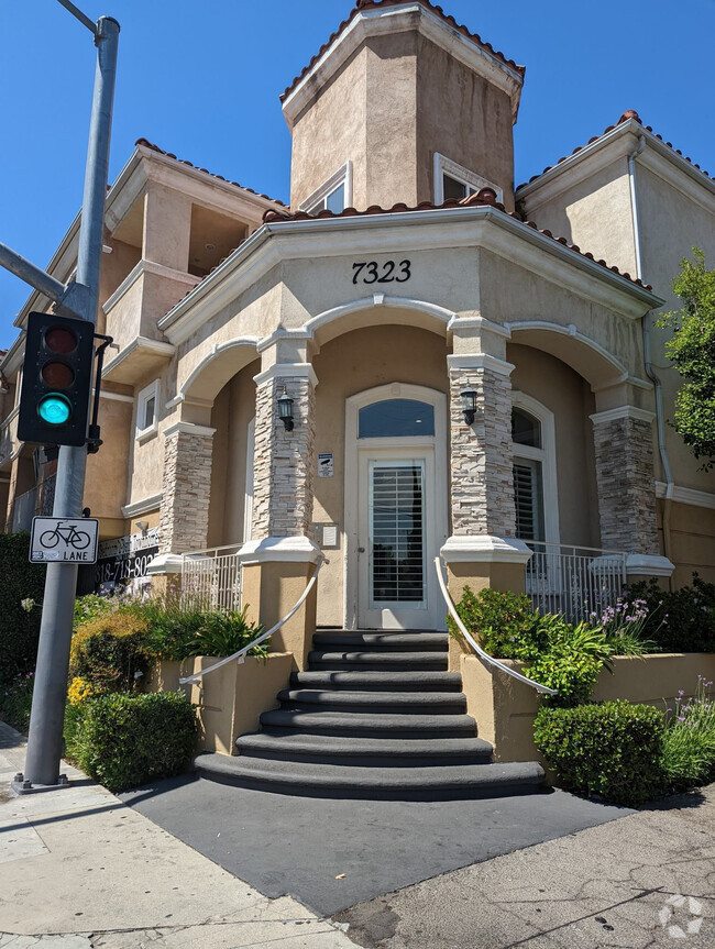
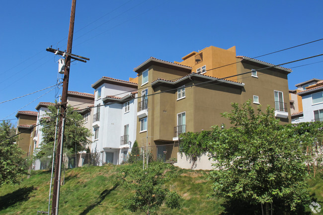
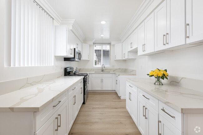
Charming Annadale townhouse in a great location facing open space and with only 1 shared wall. This desirable & beautifully remodeled unit has 2 bedrooms & 2 baths. Open floor plan with lots of natural lighting, the living space has an inviting fireplace framed by floor-to-ceiling windows, and a sliding door to 1 of 2 private patios. The kitchen is open to a bar-like counter, and dining room, plus boasts quartz countertops, a farmhouse stainless steel sink, and newer appliances. The master bedroom has its own private patio, 2 closets, and a bathroom with a shower.Additionally, there is an Inside laundry with a stacked washer & dryer, a freshly painted interior, newer wood-like vinyl flooring, recessed lighting, updated bathrooms, and newer windows. It also includes 2 assigned carport spaces plus 2 permits for street parking. Community pool, spa & clubhouse, and is close to schools, restaurants, shopping centers & bike trails. Water is included in the rent.
28552 Conejo View Dr is a townhome located in Los Angeles County and the 91301 ZIP Code. This area is served by the Las Virgenes Unified attendance zone.
Discover Homeownership
Renting vs. Buying
-
Housing Cost Per Month: $3,850
-
Rent for 30 YearsRenting doesn't build equity Future EquityRenting isn't tax deductible Mortgage Interest Tax Deduction$0 Net Return
-
Buy Over 30 Years$1.49M - $2.65M Future Equity$688K Mortgage Interest Tax Deduction$100K - $1.26M Gain Net Return
-
Contact
 This Property
 Available Property
Between cattle ranches and modern apartment homes, what’s not to love about East Agoura? The community is just minutes from the Shoppes at Westlake Village, located in Los Angeles County. From lavender fields to expansive green spaces and walking trails, locals look forward to outdoor recreation at Old Agoura Park. The park is south of Cheeseboro and Palo Comado Canyon, a great destination for a family hike.
Route 101, or Ventura Freeway as it’s also called, houses many of the local businesses and restaurants. Residents are comforted by their close proximity to a major roadway, bus stations, and a Trader Joe’s.
Learn more about living in East Agoura| Colleges & Universities | Distance | ||
|---|---|---|---|
| Colleges & Universities | Distance | ||
| Drive: | 21 min | 12.2 mi | |
| Drive: | 19 min | 12.9 mi | |
| Drive: | 21 min | 13.1 mi | |
| Drive: | 26 min | 18.3 mi |
Transportation options available in Agoura Hills include Expo / Sepulveda Station, located 27.8 miles from 28552 Conejo View Dr. 28552 Conejo View Dr is near Bob Hope, located 27.3 miles or 37 minutes away, and Los Angeles International, located 35.5 miles or 47 minutes away.
| Transit / Subway | Distance | ||
|---|---|---|---|
| Transit / Subway | Distance | ||
| Drive: | 35 min | 27.8 mi | |
|
|
Drive: | 36 min | 28.7 mi |
|
|
Drive: | 39 min | 30.0 mi |
|
|
Drive: | 39 min | 30.5 mi |
|
|
Drive: | 40 min | 31.2 mi |
| Commuter Rail | Distance | ||
|---|---|---|---|
| Commuter Rail | Distance | ||
|
|
Drive: | 27 min | 16.1 mi |
|
|
Drive: | 24 min | 17.1 mi |
|
|
Drive: | 26 min | 17.2 mi |
|
|
Drive: | 25 min | 18.7 mi |
|
|
Drive: | 33 min | 22.2 mi |
| Airports | Distance | ||
|---|---|---|---|
| Airports | Distance | ||
|
Bob Hope
|
Drive: | 37 min | 27.3 mi |
|
Los Angeles International
|
Drive: | 47 min | 35.5 mi |
Time and distance from 28552 Conejo View Dr.
| Shopping Centers | Distance | ||
|---|---|---|---|
| Shopping Centers | Distance | ||
| Drive: | 3 min | 1.4 mi | |
| Drive: | 4 min | 1.6 mi | |
| Drive: | 5 min | 1.9 mi |
| Parks and Recreation | Distance | ||
|---|---|---|---|
| Parks and Recreation | Distance | ||
|
Malibu Creek State Park
|
Drive: | 11 min | 5.5 mi |
|
King Gillette Ranch
|
Drive: | 11 min | 6.2 mi |
|
Orcutt Ranch Horticultural Center
|
Drive: | 20 min | 13.0 mi |
|
Upper Las Virgenes Canyon Open Space Preserve
|
Drive: | 27 min | 14.6 mi |
|
Sage Ranch
|
Drive: | 29 min | 16.5 mi |
| Hospitals | Distance | ||
|---|---|---|---|
| Hospitals | Distance | ||
| Drive: | 15 min | 11.0 mi | |
| Drive: | 17 min | 11.0 mi | |
| Drive: | 19 min | 11.8 mi |
| Military Bases | Distance | ||
|---|---|---|---|
| Military Bases | Distance | ||
| Drive: | 44 min | 26.8 mi |
You May Also Like
Similar Rentals Nearby
What Are Walk Score®, Transit Score®, and Bike Score® Ratings?
Walk Score® measures the walkability of any address. Transit Score® measures access to public transit. Bike Score® measures the bikeability of any address.
What is a Sound Score Rating?
A Sound Score Rating aggregates noise caused by vehicle traffic, airplane traffic and local sources

