
C$2,300 / Month
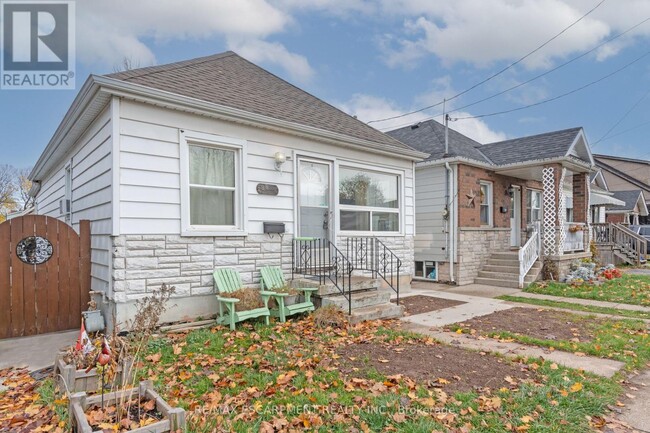
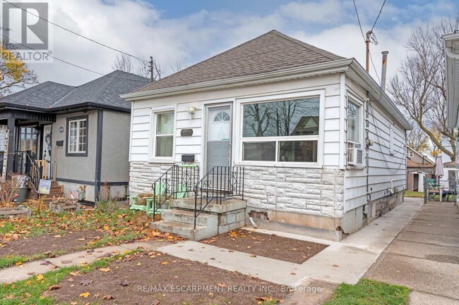
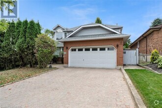
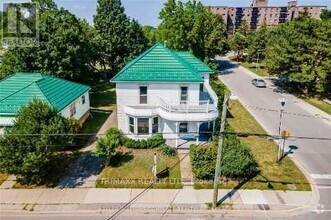
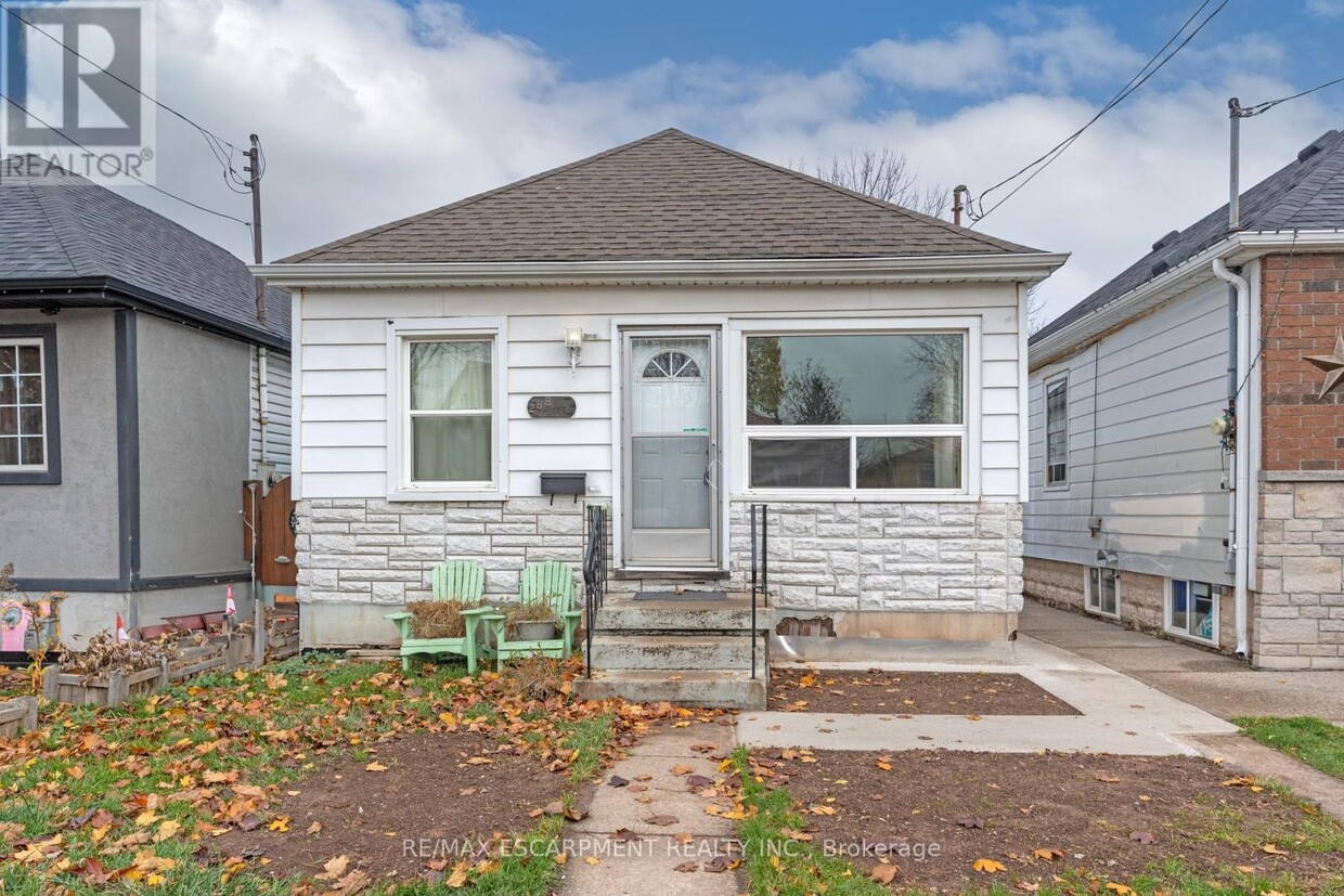
289 ROXBOROUGH Ave
Hamilton (Crown Point), ON L8H 1P9
Today
Favorites
905-575-5478
-
Bedrooms
3
-
Bathrooms
1
-
Square Feet
--
-
Available
Available Now
289 ROXBOROUGH Ave

Favorites
About This Home
Available Now
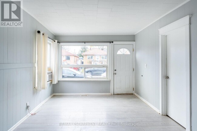
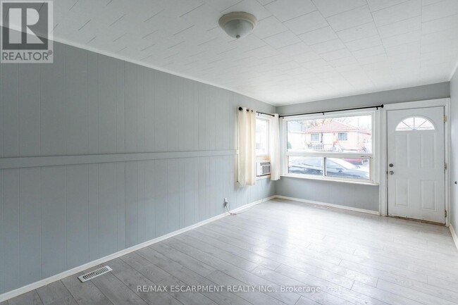
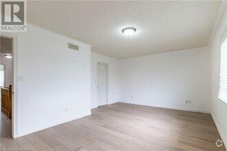
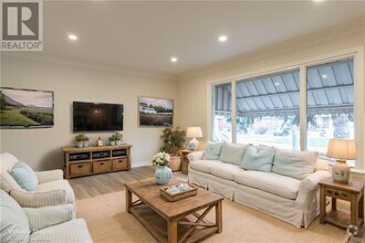
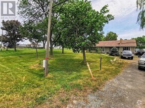
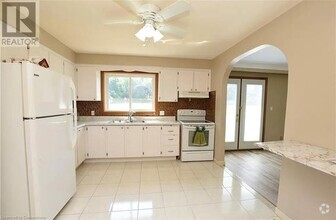
WHOLE HOUSE IN EXCELLENT LOCATION! This 3-bed,1-bath home is bright and spacious. Full backyard with shed. Close to schools,parks,shopping,bus route. Application includes proof of employment,credit report,2 recent pay stubs,rental application and government ID. First and last deposit required,as well as tenants insurance. All bills extra. (id:52069) ID#: 2163008
289 ROXBOROUGH Ave is a AA house located in Hamilton (Crown Point), ON and the L8H 1P9 Postal Code. This listing has rentals from C$2300
* Price shown is base rent and may not include non-optional fees and utilities.
Price, availability, fees, and any applicable rent special are subject to change without notice.
* Square footage definitions vary. Displayed square footage is approximate.
House Features
- Air Conditioning
Contact
- Listed by JESSICA HUME
- Phone Number (905) 575-5478
- Website View Property Website
- Contact
-
Source

Location
Get Directions
Amenities
- Air Conditioning
Education
| Colleges & Universities | Distance | ||
|---|---|---|---|
| Colleges & Universities | Distance | ||
| Drive: | 16 min | 11.0 km | |
| Drive: | 22 min | 16.4 km | |
| Drive: | 43 min | 45.2 km | |
| Drive: | 49 min | 59.7 km |
289 ROXBOROUGH Ave is within 16 minutes or 11.0 kilometers from McMaster University. It is also near Redeemer University College and Wilfrid Laurier, Brantford.
Transportation options available in Hamilton (Crown Point) include Long Branch Loop, located 56.7 kilometers from 289 ROXBOROUGH Ave. 289 ROXBOROUGH Ave is near John C. Munro Hamilton International Airport, located 22.0 kilometers or 28 minutes away, and Toronto Pearson International, located 65.7 kilometers or 58 minutes away.
| Transit / Subway | Distance | ||
|---|---|---|---|
| Transit / Subway | Distance | ||
|
|
Drive: | 47 min | 56.7 km |
|
|
Drive: | 48 min | 57.0 km |
|
|
Drive: | 48 min | 57.3 km |
|
|
Drive: | 48 min | 57.5 km |
|
|
Drive: | 49 min | 57.6 km |
| Commuter Rail | Distance | ||
|---|---|---|---|
| Commuter Rail | Distance | ||
|
|
Drive: | 8 min | 5.7 km |
|
|
Drive: | 8 min | 5.8 km |
|
|
Drive: | 18 min | 13.8 km |
|
|
Drive: | 18 min | 13.9 km |
|
|
Drive: | 17 min | 16.5 km |
| Airports | Distance | ||
|---|---|---|---|
| Airports | Distance | ||
|
John C. Munro Hamilton International Airport
|
Drive: | 28 min | 22.0 km |
|
Toronto Pearson International
|
Drive: | 58 min | 65.7 km |
Time and distance from 289 ROXBOROUGH Ave.
| Shopping Centers | Distance | ||
|---|---|---|---|
| Shopping Centers | Distance | ||
| Walk: | 10 min | 0.9 km | |
| Walk: | 12 min | 1.0 km | |
| Drive: | 3 min | 1.9 km |
289 ROXBOROUGH Ave has 3 shopping centers within 1.9 kilometers, which is about a 3-minute drive. The kilometers and minutes will be for the farthest away property.
You May Also Like
Similar Rentals Nearby
What Are Walk Score®, Transit Score®, and Bike Score® Ratings?
Walk Score® measures the walkability of any address. Transit Score® measures access to public transit. Bike Score® measures the bikeability of any address.
What is a Sound Score Rating?
A Sound Score Rating aggregates noise caused by vehicle traffic, airplane traffic and local sources
289 ROXBOROUGH Ave
Hamilton (Crown Point), ON L8H 1P9