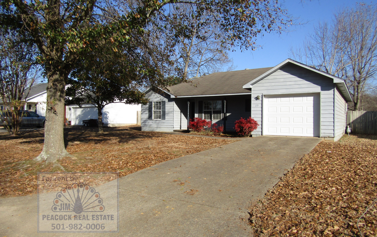
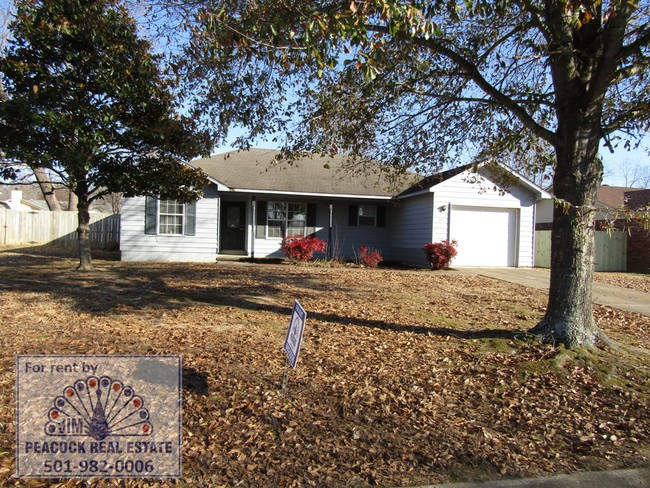
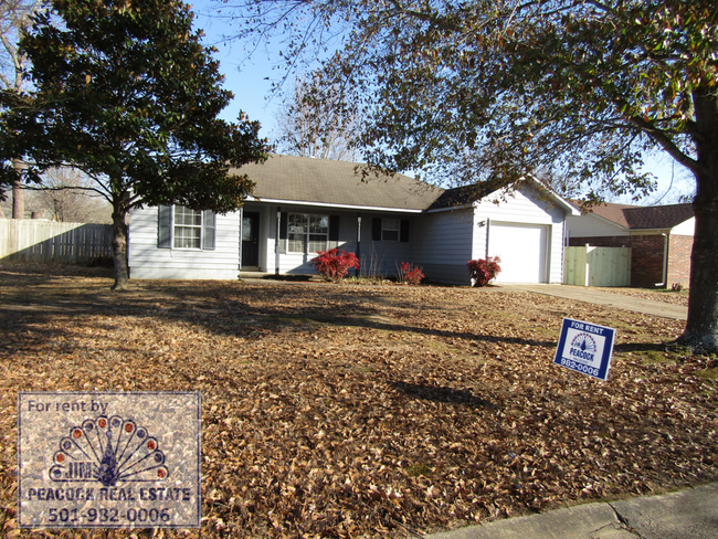
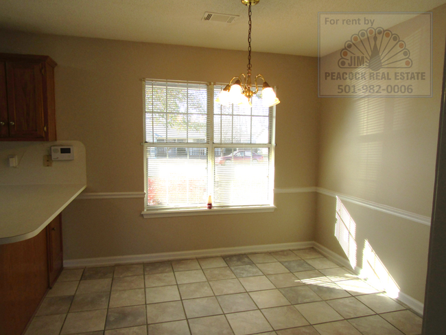
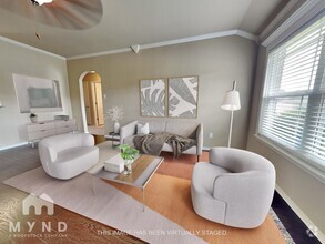
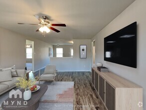
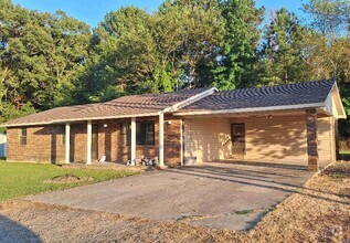
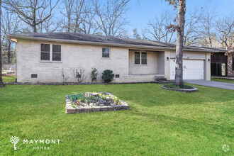
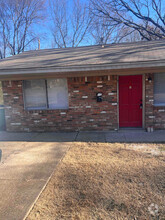
29 Burns Dr
Cabot, AR 72023
Favorites
501-982-0006

-
Monthly Rent
$1,350
-
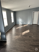
Bedrooms
3 bd
-
Bathrooms
2 ba
-
Square Feet
1,185 sq ft
Details
$700 deposit,
Available Now
* Price shown is base rent and may not include non-optional fees and utilities.
Price, availability, fees, and any applicable rent special are subject to change without notice.
* Square footage definitions vary. Displayed square footage is approximate.
29 Burns Dr
Favorites
29 Burns Dr is a house located in Lonoke County and the 72023 ZIP Code. This area is served by the Cabot attendance zone.
Discover Homeownership
Renting vs. Buying
-
Housing Cost Per Month: $1,350
-
Rent for 30 YearsRenting doesn't build equity Future EquityRenting isn't tax deductible Mortgage Interest Tax Deduction$0 Net Return
-
Buy Over 30 Years$529K - $942K Future Equity$239K Mortgage Interest Tax Deduction$43K - $456K Gain Net Return
-
$788 / month
$129,900 Listing Price
3 Beds
•2 Baths
•
1,020 Sq Ft
$1,318 / month
$221,000 Listing Price
4 Beds
•2 Baths
•
1,944 Sq Ft
$1,511 / month
$255,000 Listing Price
3 Beds
•2 Baths
•
2,096 Sq Ft
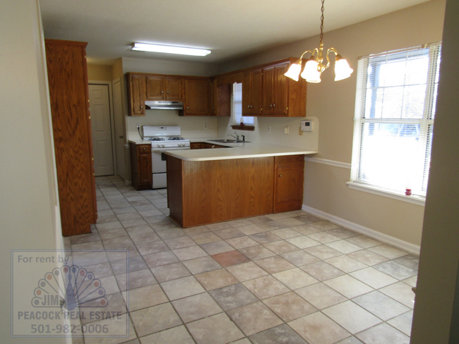
House Features
- Dishwasher
Fees and Policies
Property Address:
29 Burns Dr,
Cabot,
AR
72023
 This Property
 Available Property
Amenities
- Dishwasher
Located about 25 miles northeast of Little Rock, bordering the Little Rock Air Force Base, Cabot continues to draw families for its top-ranked public schools, friendly small-town atmosphere, and close proximity to Little Rock. A host of city parks, athletic fields, and walking trails provide space for all kinds of outdoor recreation in Cabot as well as the dynamic Community Center. Cabot hosts a range of special events for the community, including the annual Strawberry Festival, Cabot Fest, and the Lonoke County Fair. Commuting and traveling from Cabot is easy with access to U.S. 167 and the Bill and Hillary Clinton National Airport.
Learn more about living in Cabot
Education
| Colleges & Universities | Distance | ||
|---|---|---|---|
| Colleges & Universities | Distance | ||
| Drive: | 33 min | 23.4 mi | |
| Drive: | 33 min | 24.5 mi | |
| Drive: | 37 min | 26.2 mi | |
| Drive: | 41 min | 29.3 mi |
29 Burns Dr is within 33 minutes or 23.4 miles from Pulaski Technical College. It is also near Philander Smith College and Univ. of Ark. Medical Scis..
Schools
Public Elementary School
Grades PK-4
400 Students
Attendance Zone
9
Out of 10
Public Elementary School
Grades 5-6
717 Students
Attendance Zone
6
Out of 10
Public Middle School
Grades 7-8
710 Students
Attendance Zone
6
Out of 10
Charter Middle & High School
Grades 7-12
321 Students
Nearby
4
Out of 10
Public High School
Grades 9-12
2,198 Students
Attendance Zone
7
Out of 10
Private Elementary School
Grades PK
Nearby
Private Elementary, Middle & High School
Grades K-10
18 Students
Nearby
Private Elementary School
Grades PK-4
Nearby
School data provided by
GreatSchools
The GreatSchools Rating helps parents compare schools within a state based on a variety of school quality indicators and provides a helpful picture of how effectively each school serves all of its students. Ratings are on a scale of 1 (below average) to 10 (above average) and can include test scores, college readiness, academic progress, advanced courses, equity, discipline and attendance data. We also advise parents to visit schools, consider other information on school performance and programs, and consider family needs as part of the school selection process.
Transportation options available in Cabot include Main St & Bishop Lindsey Ave, located 22.1 miles from 29 Burns Dr. 29 Burns Dr is near Bill and Hillary Clinton Ntl/Adams Field, located 25.4 miles or 33 minutes away.
| Transit / Subway | Distance | ||
|---|---|---|---|
| Transit / Subway | Distance | ||
| Drive: | 29 min | 22.1 mi | |
| Drive: | 29 min | 22.2 mi | |
| Drive: | 29 min | 22.4 mi | |
| Drive: | 29 min | 22.4 mi | |
| Drive: | 29 min | 22.4 mi |
| Commuter Rail | Distance | ||
|---|---|---|---|
| Commuter Rail | Distance | ||
|
|
Drive: | 32 min | 23.9 mi |
| Airports | Distance | ||
|---|---|---|---|
| Airports | Distance | ||
|
Bill and Hillary Clinton Ntl/Adams Field
|
Drive: | 33 min | 25.4 mi |
Time and distance from 29 Burns Dr.
| Shopping Centers | Distance | ||
|---|---|---|---|
| Shopping Centers | Distance | ||
| Drive: | 4 min | 1.5 mi | |
| Drive: | 6 min | 2.2 mi | |
| Drive: | 7 min | 3.0 mi |
29 Burns Dr has 3 shopping centers within 3.0 miles, which is about a 7-minute drive. The miles and minutes will be for the farthest away property.
| Hospitals | Distance | ||
|---|---|---|---|
| Hospitals | Distance | ||
| Drive: | 15 min | 9.9 mi |
29 Burns Dr is 9.9 miles and a 15 minutes drive from North Metro Medical Center.
| Military Bases | Distance | ||
|---|---|---|---|
| Military Bases | Distance | ||
| Drive: | 27 min | 15.6 mi | |
| Drive: | 49 min | 21.7 mi | |
| Drive: | 52 min | 32.9 mi |
29 Burns Dr has 3 military bases within 32.9 miles, the nearest is Little Rock Air Force Base which is 15.6 miles away and a 27 minutes .
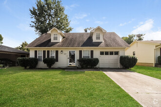
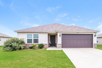
You May Also Like
Similar Rentals Nearby
-
-
 $1,5794 Beds, 2 Baths, 1,544 sq ftHouse for Rent
 -
 $1,1953 Beds, 2 Baths, 1,254 sq ftHouse for Rent
 -
-
 $1,3953 Beds, 2 Baths, 1,673 sq ftHouse for Rent
 -
 $1,4953 Beds, 2 Baths, 1,344 sq ftHouse for Rent
 -
-
 $1,5953 Beds, 2 Baths, 1,363 sq ftHouse for Rent
 -
 $1,1503 Beds, 1 Bath, 950 sq ftHouse for Rent
 -
 $9004 Beds, 2 Baths, 2,128 sq ftHouse for Rent
What Are Walk Score®, Transit Score®, and Bike Score® Ratings?
Walk Score® measures the walkability of any address. Transit Score® measures access to public transit. Bike Score® measures the bikeability of any address.
What is a Sound Score Rating?
A Sound Score Rating aggregates noise caused by vehicle traffic, airplane traffic and local sources

29 Burns Dr
Cabot, AR 72023