
29 Saunders St Unit 29
North Andover, MA 01845
-
Bedrooms
3
-
Bathrooms
1
-
Square Feet
1,484 sq ft
-
Available
Available Now
Highlights
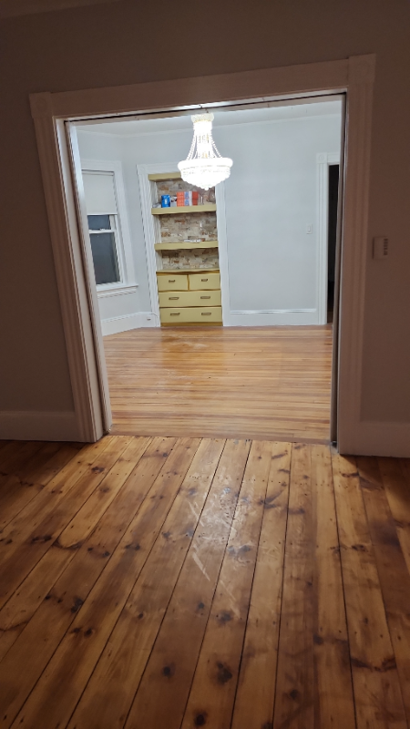
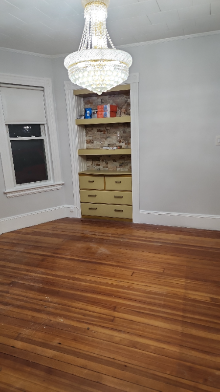
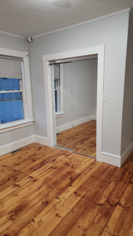
- Hardwood Floors
- Fenced Lot
About This Home
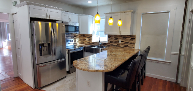
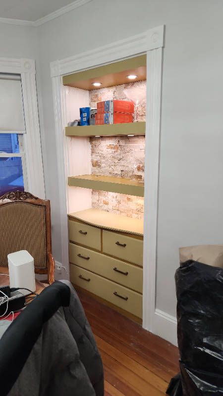
Property Id: 1575795 Welcome to your new home at 29 Saunders St in North Andover, MA! This cozy 3 bedroom, 1 bathroom unit is available starting March 1, 2025 for $3200/month. Enjoy amenities such as a fenced yard, on-site laundry, and off-street parking, Patio with Gazebo, beautiful kitchen offering a breakfast area and sitting for four people. Don't miss out on this gem!
29 Saunders St is an apartment community located in Essex County and the 01845 ZIP Code.
Features
Washer/Dryer
Hardwood Floors
Microwave
Refrigerator
- Washer/Dryer
- Cable Ready
- Microwave
- Oven
- Refrigerator
- Hardwood Floors
- Tile Floors
- Bicycle Storage
- Fenced Lot
- Lawn
Fees and Policies
The fees below are based on community-supplied data and may exclude additional fees and utilities.
Details
Utilities Included
-
Water
-
Trash Removal
-
Sewer
Contact
- Phone Number (603) 703-2550
- Contact
-
Source

- Washer/Dryer
- Cable Ready
- Microwave
- Oven
- Refrigerator
- Hardwood Floors
- Tile Floors
- Fenced Lot
- Lawn
- Bicycle Storage
| Colleges & Universities | Distance | ||
|---|---|---|---|
| Colleges & Universities | Distance | ||
| Drive: | 7 min | 3.1 mi | |
| Drive: | 17 min | 11.3 mi | |
| Drive: | 19 min | 12.2 mi | |
| Drive: | 21 min | 13.1 mi |
Transportation options available in North Andover include Oak Grove Station, located 23.3 miles from 29 Saunders St Unit 29. 29 Saunders St Unit 29 is near Manchester Boston Regional, located 28.1 miles or 45 minutes away, and General Edward Lawrence Logan International, located 31.2 miles or 43 minutes away.
| Transit / Subway | Distance | ||
|---|---|---|---|
| Transit / Subway | Distance | ||
|
|
Drive: | 33 min | 23.3 mi |
|
|
Drive: | 33 min | 24.6 mi |
| Drive: | 33 min | 24.8 mi | |
| Drive: | 34 min | 25.3 mi | |
|
|
Drive: | 35 min | 25.9 mi |
| Commuter Rail | Distance | ||
|---|---|---|---|
| Commuter Rail | Distance | ||
|
|
Drive: | 2 min | 1.2 mi |
|
|
Drive: | 8 min | 3.8 mi |
|
|
Drive: | 13 min | 6.2 mi |
|
|
Drive: | 11 min | 7.7 mi |
|
|
Drive: | 12 min | 8.0 mi |
| Airports | Distance | ||
|---|---|---|---|
| Airports | Distance | ||
|
Manchester Boston Regional
|
Drive: | 45 min | 28.1 mi |
|
General Edward Lawrence Logan International
|
Drive: | 43 min | 31.2 mi |
Time and distance from 29 Saunders St Unit 29.
| Shopping Centers | Distance | ||
|---|---|---|---|
| Shopping Centers | Distance | ||
| Walk: | 5 min | 0.3 mi | |
| Walk: | 20 min | 1.1 mi | |
| Drive: | 4 min | 1.5 mi |
| Parks and Recreation | Distance | ||
|---|---|---|---|
| Parks and Recreation | Distance | ||
|
Lawrence Heritage State Park
|
Drive: | 3 min | 1.8 mi |
|
Stevens-Coolidge Place
|
Drive: | 4 min | 2.0 mi |
|
Smolak Farms
|
Drive: | 10 min | 4.3 mi |
|
Bradford Ski Area
|
Drive: | 17 min | 6.1 mi |
|
Windrush Farm
|
Drive: | 17 min | 7.2 mi |
| Hospitals | Distance | ||
|---|---|---|---|
| Hospitals | Distance | ||
| Drive: | 7 min | 3.5 mi | |
| Drive: | 13 min | 8.6 mi |
| Military Bases | Distance | ||
|---|---|---|---|
| Military Bases | Distance | ||
| Drive: | 41 min | 20.7 mi | |
| Drive: | 47 min | 23.9 mi | |
| Drive: | 38 min | 26.6 mi |
You May Also Like
What Are Walk Score®, Transit Score®, and Bike Score® Ratings?
Walk Score® measures the walkability of any address. Transit Score® measures access to public transit. Bike Score® measures the bikeability of any address.
What is a Sound Score Rating?
A Sound Score Rating aggregates noise caused by vehicle traffic, airplane traffic and local sources
29 Saunders St
North Andover, MA 01845