
$1,131 / Month
2900 Laurel Ridge Way
East Point, GA 30344
Today
Favorites
626-281-8301
-
Bedrooms
1
-
Bathrooms
1
-
Square Feet
--
-
Available
Available Now
Highlight
- Smoke Free
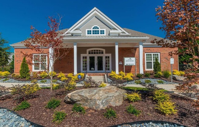
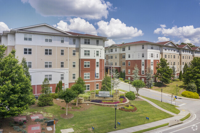
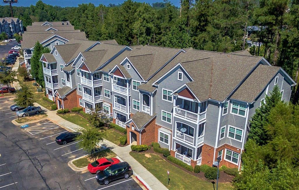
2900 Laurel Ridge Way

Favorites
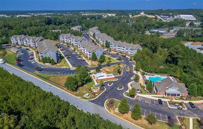
2900 Laurel Ridge Way is an apartment community located in Fulton County and the 30344 ZIP Code.
* Price shown is base rent and may not include non-optional fees and utilities.
Price, availability, fees, and any applicable rent special are subject to change without notice.
* Square footage definitions vary. Displayed square footage is approximate.
Home Details
Year Built
Built in 2005
Bedrooms and Bathrooms
1 Full Bathroom
1 Bedroom
Home Design
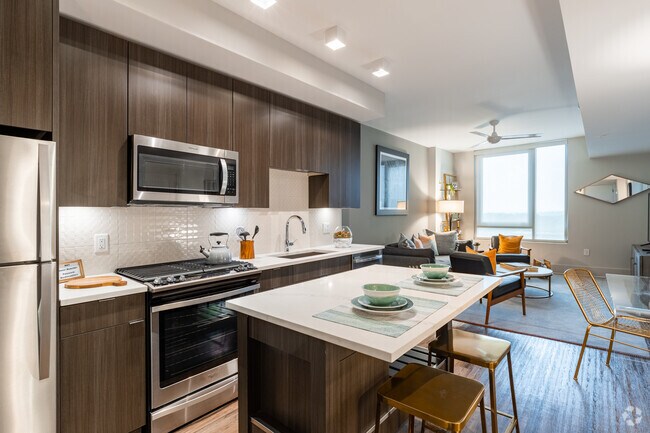
Apartment
Listing and Financial Details
Property Available on 1/5/25
Community Details
Overview
Rpm Living Association
Pet Policy
No Pets Allowed
Fees and Policies
Details
Lease Options
-
12 Months
Contact
- Listed by Rick Rivera | Rental Housing Deals
- Phone Number
- Contact
-
Source
 Houston Association of REALTORS®
Copyright © 2025 Houston Association of Realtors. All rights reserved. All information provided by the listing agent/broker is deemed reliable but is not guaranteed and should be independently verified.
Location
Get Directions
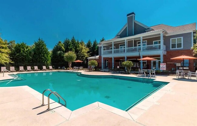
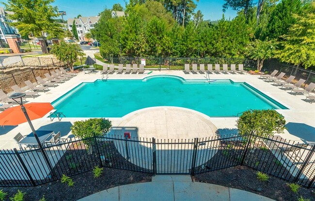
Amenities
- Smoke Free
Aerotropolis refers to an array of Southside Atlanta communities surrounding Hartsfield-Jackson Atlanta International Airport, the world’s busiest airport. The cities of College Park, Chattahoochee Hills, East Point, Fairburn, Forest Park, Union City, Hapeville, Morrow, and Palmetto are all a part of the Aerotropolis Alliance, working together on initiatives to improve their respective communities.
Aerotropolis’ close proximity to the airport makes the region an ideal choice for local employees and frequent travelers alike. A wide variety of rentals are available throughout the region, from luxury apartments and cozy condos to charming townhomes and spacious houses. Getting around from Aerotropolis is easy with access to I-75, I-85, and I-285.
Learn more about living in Aerotropolis
Education
| Colleges & Universities | Distance | ||
|---|---|---|---|
| Colleges & Universities | Distance | ||
| Drive: | 17 min | 10.2 mi | |
| Drive: | 19 min | 10.6 mi | |
| Drive: | 21 min | 10.9 mi | |
| Drive: | 21 min | 10.9 mi |
2900 Laurel Ridge Way is within 17 minutes or 10.2 miles from Atlanta Metropolitan State. It is also near Atlanta Technical College and Morehouse School of Medicine.
Transportation options available in East Point include College Park, located 3.8 miles from 2900 Laurel Ridge Way. 2900 Laurel Ridge Way is near Hartsfield - Jackson Atlanta International, located 9.3 miles or 17 minutes away.
| Transit / Subway | Distance | ||
|---|---|---|---|
| Transit / Subway | Distance | ||
|
|
Drive: | 8 min | 3.8 mi |
|
|
Drive: | 9 min | 4.2 mi |
|
|
Drive: | 12 min | 5.7 mi |
|
|
Drive: | 14 min | 7.5 mi |
|
|
Drive: | 15 min | 8.3 mi |
| Commuter Rail | Distance | ||
|---|---|---|---|
| Commuter Rail | Distance | ||
|
|
Drive: | 27 min | 16.7 mi |
| Airports | Distance | ||
|---|---|---|---|
| Airports | Distance | ||
|
Hartsfield - Jackson Atlanta International
|
Drive: | 17 min | 9.3 mi |
Time and distance from 2900 Laurel Ridge Way.
| Shopping Centers | Distance | ||
|---|---|---|---|
| Shopping Centers | Distance | ||
| Drive: | 6 min | 1.9 mi | |
| Drive: | 5 min | 1.9 mi | |
| Drive: | 5 min | 1.9 mi |
2900 Laurel Ridge Way has 3 shopping centers within 1.9 miles, which is about a 5-minute drive. The miles and minutes will be for the farthest away property.
| Parks and Recreation | Distance | ||
|---|---|---|---|
| Parks and Recreation | Distance | ||
|
Cascade Springs Nature Preserve
|
Drive: | 12 min | 7.3 mi |
|
West Atlanta Watershed Alliance (WAWA)
|
Drive: | 17 min | 9.1 mi |
|
Atlanta BeltLine Southwest Connector Spur Trail
|
Drive: | 17 min | 9.6 mi |
|
Park Pride
|
Drive: | 20 min | 11.4 mi |
|
Zoo Atlanta
|
Drive: | 22 min | 12.6 mi |
2900 Laurel Ridge Way has 5 parks within 12.6 miles, including Cascade Springs Nature Preserve, West Atlanta Watershed Alliance (WAWA), and Atlanta BeltLine Southwest Connector Spur Trail.
| Hospitals | Distance | ||
|---|---|---|---|
| Hospitals | Distance | ||
| Drive: | 14 min | 6.8 mi | |
| Drive: | 19 min | 9.7 mi | |
| Drive: | 18 min | 10.4 mi |
2900 Laurel Ridge Way has 3 hospitals within 10.4 miles, the nearest is Southern Crescent Behavioral Health System - Anchor Hospital Campus which is 6.8 miles away and a 14 minute drive.
| Military Bases | Distance | ||
|---|---|---|---|
| Military Bases | Distance | ||
| Drive: | 16 min | 8.2 mi | |
| Drive: | 26 min | 15.6 mi |
2900 Laurel Ridge Way is 8.2 miles from Fort McPherson, and is convenient to other military bases, including Fort Gillem.
You May Also Like
Similar Rentals Nearby


What Are Walk Score®, Transit Score®, and Bike Score® Ratings?
Walk Score® measures the walkability of any address. Transit Score® measures access to public transit. Bike Score® measures the bikeability of any address.
What is a Sound Score Rating?
A Sound Score Rating aggregates noise caused by vehicle traffic, airplane traffic and local sources
2900 Laurel Ridge Way
East Point, GA 30344