$11,600
4 Beds, 4.5 Baths, 4,053 sq ft
House for Rent

Bedrooms
4
Bathrooms
2.5
Square Feet
1,962 sq ft
Available
Available Now

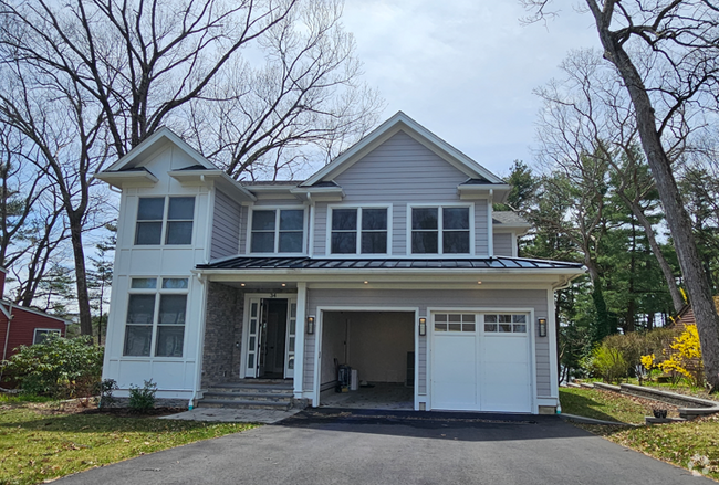
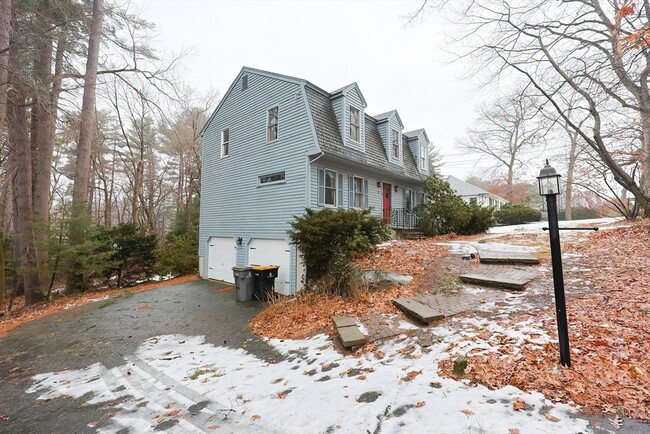
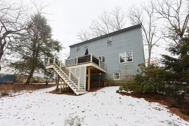
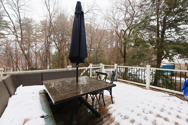
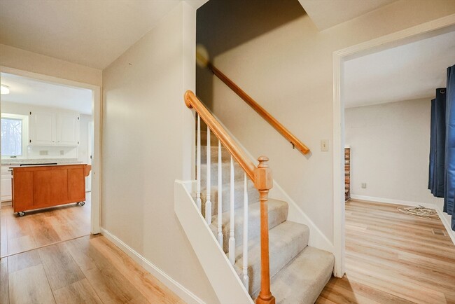
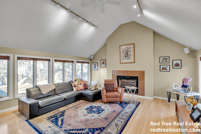
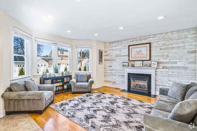
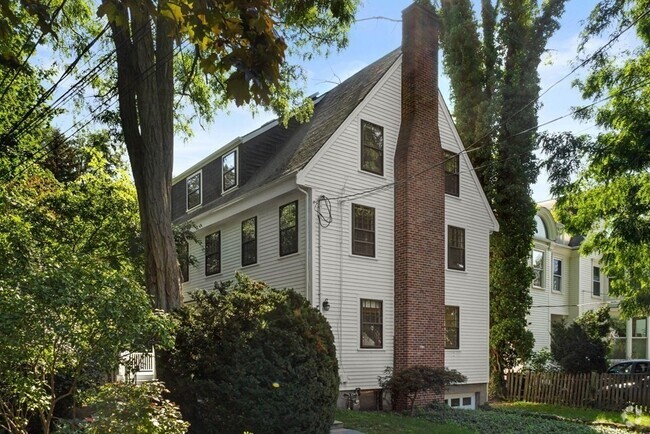
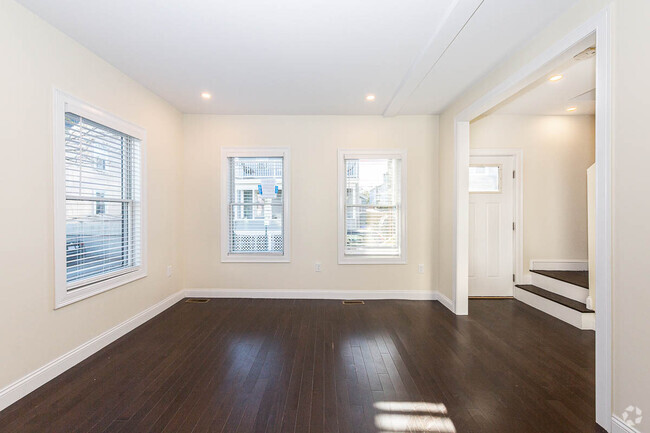
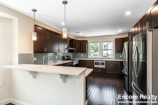
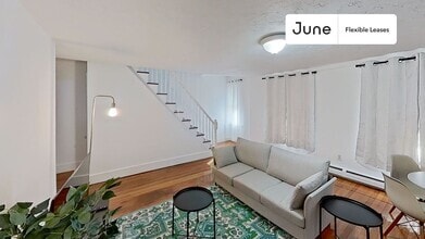
Welcome to this cozy and inviting two-story,4-bedroom home with an attached two-car garage! Nestled in a desirable Framingham community,this beautiful residence offers 4 bedrooms and 2.5 bathrooms,featuring modern stainless-steel appliances—perfect for cooking and entertaining. Conveniently located near local amenities,this home is move-in ready! Open House Sat 11-1230PM
291 Central St is a house located in Middlesex County and the 01701 ZIP Code. This area is served by the Framingham attendance zone.
Home Type
Year Built
Accessible Home Design
Bedrooms and Bathrooms
Interior Spaces
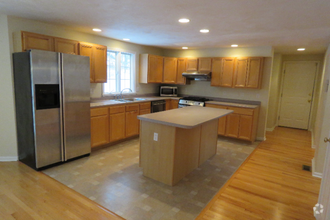
Kitchen
Laundry
Listing and Financial Details
Lot Details
Outdoor Features
Parking
Utilities
Overview
Pet Policy
Just west of Boston and East of Worcester sits Metro West, a region that houses a group of towns and cities with significant historical backgrounds. A total of 19 municipalities make up the core of this community, but other municipalities are considered to be a part of the Interstate 495/Metro West Corridor.
Learn more about living in Metro West| Colleges & Universities | Distance | ||
|---|---|---|---|
| Colleges & Universities | Distance | ||
| Drive: | 4 min | 2.3 mi | |
| Drive: | 17 min | 8.7 mi | |
| Drive: | 18 min | 9.6 mi | |
| Drive: | 21 min | 12.3 mi |
Transportation options available in Framingham include Riverside Station, located 11.3 miles from 291 Central St. 291 Central St is near General Edward Lawrence Logan International, located 24.4 miles or 36 minutes away, and Worcester Regional, located 26.2 miles or 45 minutes away.
| Transit / Subway | Distance | ||
|---|---|---|---|
| Transit / Subway | Distance | ||
|
|
Drive: | 19 min | 11.3 mi |
|
|
Drive: | 19 min | 11.6 mi |
|
|
Drive: | 22 min | 12.3 mi |
|
|
Drive: | 20 min | 12.3 mi |
|
|
Drive: | 22 min | 12.5 mi |
| Commuter Rail | Distance | ||
|---|---|---|---|
| Commuter Rail | Distance | ||
|
|
Drive: | 8 min | 3.9 mi |
|
|
Drive: | 8 min | 4.0 mi |
|
|
Drive: | 11 min | 5.2 mi |
|
|
Drive: | 10 min | 5.4 mi |
|
|
Drive: | 20 min | 7.5 mi |
| Airports | Distance | ||
|---|---|---|---|
| Airports | Distance | ||
|
General Edward Lawrence Logan International
|
Drive: | 36 min | 24.4 mi |
|
Worcester Regional
|
Drive: | 45 min | 26.2 mi |
Time and distance from 291 Central St.
| Shopping Centers | Distance | ||
|---|---|---|---|
| Shopping Centers | Distance | ||
| Walk: | 18 min | 0.9 mi | |
| Drive: | 2 min | 1.2 mi | |
| Drive: | 4 min | 2.3 mi |
| Parks and Recreation | Distance | ||
|---|---|---|---|
| Parks and Recreation | Distance | ||
|
Garden in the Woods
|
Drive: | 7 min | 3.2 mi |
|
Nobscot Scout Reservation
|
Drive: | 7 min | 3.5 mi |
|
Callahan State Park
|
Drive: | 6 min | 3.6 mi |
|
Hop Brook Natural Area
|
Drive: | 7 min | 3.8 mi |
|
Cochituate State Park
|
Drive: | 17 min | 10.8 mi |
| Hospitals | Distance | ||
|---|---|---|---|
| Hospitals | Distance | ||
| Drive: | 6 min | 3.3 mi | |
| Drive: | 20 min | 11.0 mi | |
| Drive: | 18 min | 11.4 mi |
| Military Bases | Distance | ||
|---|---|---|---|
| Military Bases | Distance | ||
| Drive: | 10 min | 5.1 mi | |
| Drive: | 28 min | 14.8 mi |
What Are Walk Score®, Transit Score®, and Bike Score® Ratings?
Walk Score® measures the walkability of any address. Transit Score® measures access to public transit. Bike Score® measures the bikeability of any address.
What is a Sound Score Rating?
A Sound Score Rating aggregates noise caused by vehicle traffic, airplane traffic and local sources
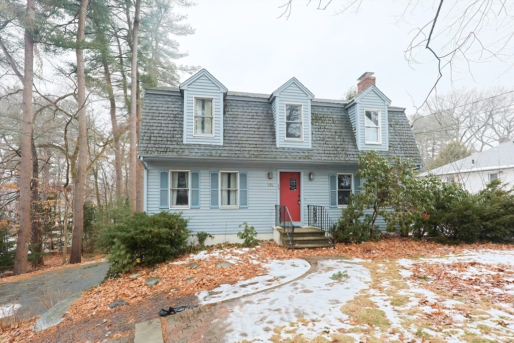
291 Central St
Framingham, MA 01701