$2,195 / Month
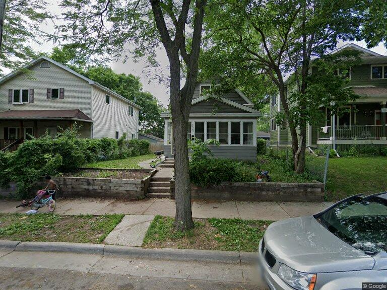
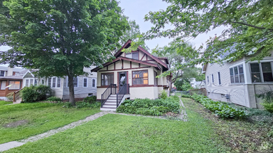
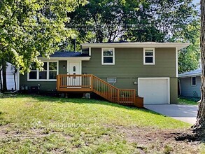
2943 N Bryant Ave
Minneapolis, MN 55411
2 Weeks Ago
Favorites
2943 N Bryant Ave

Favorites
Check Back Soon for Upcoming Availability
| Beds | Baths | Average SF |
|---|---|---|
| 5 Bedrooms 5 Bedrooms 5 Br | 1.5 Baths 1.5 Baths 1.5 Ba | 1,608 SF |
About This Property
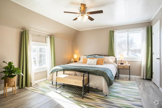
Property Id: 1237362 Available September 1st. Rent and security deposit is $2,195.00 each. Max of 5 occupants, no evictions, no criminal, good rental history, minimum credit score of 600. Pets under 20 lbs allowed with extra deposit and pet rent. Large two story home with 3 season porch on front. Main floor has living room, dining room and two bedrooms with hardwood floors. Kitchen has center island and vinyl flooring. Main floor bath has tile flooring. Second floor has three bedrooms and a half bathroom. Bedrooms are carpeted. Basement has washer/dryer hook-ups. Oversized 1 car garage is detached. Pets under 20 lbs allowed with additional $300 security deposit and $30 per month, per pet.
2943 N Bryant Ave is a house located in Hennepin County and the 55411 ZIP Code. This area is served by the Minneapolis Public School Dist. attendance zone.
House Features
Dishwasher
Hardwood Floors
Refrigerator
Tile Floors
- Dishwasher
- Oven
- Refrigerator
- Hardwood Floors
- Tile Floors
- Vinyl Flooring
- Lawn
Fees and Policies
The fees below are based on community-supplied data and may exclude additional fees and utilities.
- Dogs Allowed
-
Fees not specified
- Cats Allowed
-
Fees not specified
- Parking
-
Garage--
Property Address:
2943 N Bryant Ave,
Minneapolis,
MN
55411
Urban amenities and outdoor opportunities abound in Hawthorne, a friendly neighborhood that lies three miles north of downtown Minneapolis. Residents come for the charming historic homes and the convenient location, and they stay for the welcoming community atmosphere.
In the center of the neighborhood, Fairview Park attracts crowds with its wading pool, playground, and sports fields. The large hill at the center of the park provides a beautiful view of the Minneapolis skyline. If you're a runner or biker, make the short trek east to the extensive paved path that lines the Mississippi River.
In the south section of Hawthorne, West Broadway Avenue serves as the neighborhood's commercial and social center. For a dose of Minnesota charm, head to Sammy's Avenue Eatery for a sweet tea and the restaurant's legendary turkey pastrami sandwich. At breakfast, it's hard to beat Breaking Bread Cafe, where locals rave about the shrimp and grits.
Learn more about living in HawthorneBelow are rent ranges for similar nearby apartments
Amenities
- Dishwasher
- Oven
- Refrigerator
- Hardwood Floors
- Tile Floors
- Vinyl Flooring
- Lawn
Education
| Colleges & Universities | Distance | ||
|---|---|---|---|
| Colleges & Universities | Distance | ||
| Drive: | 10 min | 3.1 mi | |
| Drive: | 8 min | 3.5 mi | |
| Drive: | 12 min | 3.9 mi | |
| Drive: | 12 min | 6.6 mi |
2943 N Bryant Ave is within 10 minutes or 3.1 miles from University of St. Thomas. It is also near Minneapolis College and North Central University.
Schools
Public Elementary School
Grades PK-5
201 Students
Attendance Zone
1
Out of 10
Public Middle School
Grades 6-8
320 Students
Attendance Zone
1
Out of 10
Public High School
Grades 9-12
487 Students
Attendance Zone
3
Out of 10
Private Elementary & Middle School
Grades PK-8
196 Students
Nearby
Private Elementary & Middle School
Grades K-8
245 Students
Nearby
Private High School
Grades 9-12
Nearby
School data provided by
GreatSchools
The GreatSchools Rating helps parents compare schools within a state based on a variety of school quality indicators and provides a helpful picture of how effectively each school serves all of its students. Ratings are on a scale of 1 (below average) to 10 (above average) and can include test scores, college readiness, academic progress, advanced courses, equity, discipline and attendance data. We also advise parents to visit schools, consider other information on school performance and programs, and consider family needs as part of the school selection process.
Transportation options available in Minneapolis include Target Field Station Platform 2, located 2.5 miles from 2943 N Bryant Ave. 2943 N Bryant Ave is near Minneapolis-St Paul International/Wold-Chamberlain, located 14.6 miles or 28 minutes away.
| Transit / Subway | Distance | ||
|---|---|---|---|
| Transit / Subway | Distance | ||
| Drive: | 8 min | 2.5 mi | |
|
|
Drive: | 8 min | 2.7 mi |
|
|
Drive: | 9 min | 3.0 mi |
|
|
Drive: | 9 min | 3.2 mi |
|
|
Drive: | 10 min | 3.3 mi |
| Commuter Rail | Distance | ||
|---|---|---|---|
| Commuter Rail | Distance | ||
|
|
Drive: | 8 min | 2.6 mi |
|
|
Drive: | 12 min | 6.0 mi |
|
|
Drive: | 23 min | 14.4 mi |
|
|
Drive: | 26 min | 16.8 mi |
|
|
Drive: | 27 min | 18.5 mi |
| Airports | Distance | ||
|---|---|---|---|
| Airports | Distance | ||
|
Minneapolis-St Paul International/Wold-Chamberlain
|
Drive: | 28 min | 14.6 mi |
Time and distance from 2943 N Bryant Ave.
| Shopping Centers | Distance | ||
|---|---|---|---|
| Shopping Centers | Distance | ||
| Walk: | 16 min | 0.9 mi | |
| Drive: | 4 min | 1.1 mi | |
| Drive: | 4 min | 1.2 mi |
2943 N Bryant Ave has 3 shopping centers within 1.2 miles, which is about a 4-minute drive. The miles and minutes will be for the farthest away property.
| Parks and Recreation | Distance | ||
|---|---|---|---|
| Parks and Recreation | Distance | ||
|
Farview Park
|
Walk: | 5 min | 0.3 mi |
|
Jordan Park
|
Walk: | 11 min | 0.6 mi |
|
Perkins Hill Park
|
Walk: | 13 min | 0.7 mi |
|
Glen Gale Park
|
Walk: | 16 min | 0.9 mi |
|
Cottage Park
|
Drive: | 5 min | 1.4 mi |
2943 N Bryant Ave has 5 parks within 1.4 miles, including Farview Park, Jordan Park, and Perkins Hill Park.
| Hospitals | Distance | ||
|---|---|---|---|
| Hospitals | Distance | ||
| Drive: | 4 min | 1.6 mi | |
| Drive: | 11 min | 3.9 mi | |
| Drive: | 14 min | 6.9 mi |
2943 N Bryant Ave has 3 hospitals within 6.9 miles, the nearest is North Memorial Health which is 1.6 miles away and a 4 minutes drive.
| Military Bases | Distance | ||
|---|---|---|---|
| Military Bases | Distance | ||
| Drive: | 22 min | 11.6 mi |
2943 N Bryant Ave is 11.6 miles and a 22 minutes from Fort Snelling Military Reservation.
You May Also Like
Similar Rentals Nearby
-
-
-
-
1 / 35
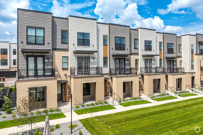
-
 $3,5006 Beds, 3 Baths, 1,837 sq ftHouse for Rent
 -
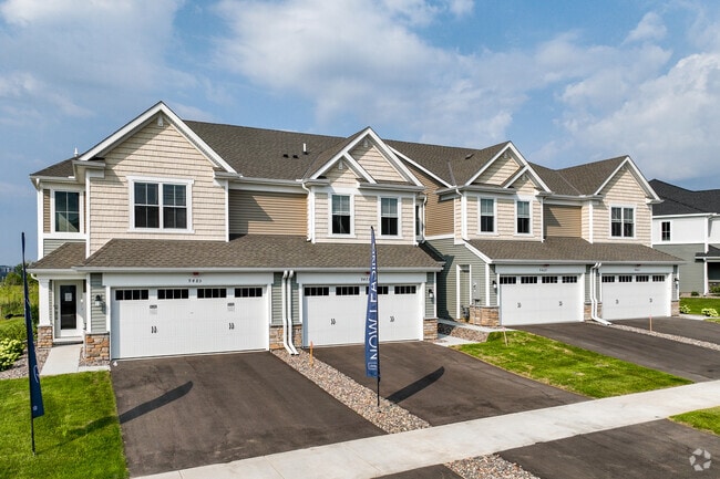
 $3,6504 Beds, 3 Baths, 2,550 sq ftHouse for Rent
 -
 $2,7154 Beds, 2.5 Baths, 2,041 sq ftHouse for Rent
 -
 $3,4454 Beds, 2.5 Baths, 2,730 sq ftHouse for Rent
 -
 $2,8805 Beds, 2 Baths, 1,880 sq ftHouse for Rent
 -
 $2,5004 Beds, 2 Baths, 1,800 sq ftHouse for Rent
What Are Walk Score®, Transit Score®, and Bike Score® Ratings?
Walk Score® measures the walkability of any address. Transit Score® measures access to public transit. Bike Score® measures the bikeability of any address.
What is a Sound Score Rating?
A Sound Score Rating aggregates noise caused by vehicle traffic, airplane traffic and local sources

2943 N Bryant Ave
Minneapolis, MN 55411