$1,895 / Month
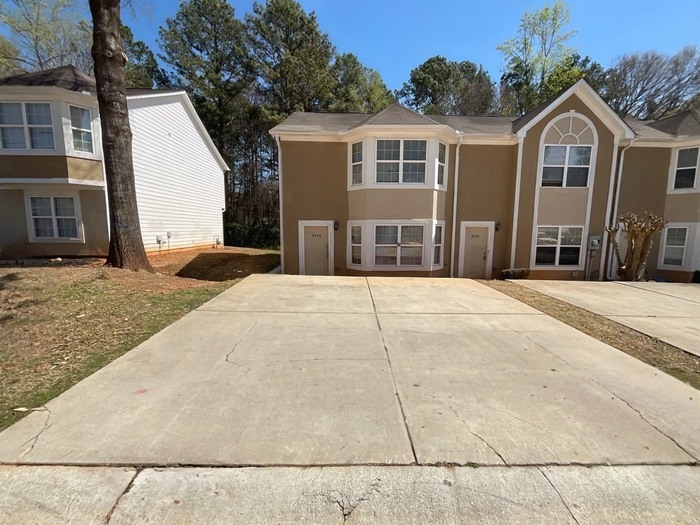
2948 Fields Dr
Stonecrest, GA 30038
Today
Favorites
816-287-3699
-
Bedrooms
3
-
Bathrooms
2
-
Square Feet
1,314 sq ft
-
Available
Available Now
2948 Fields Dr

Favorites
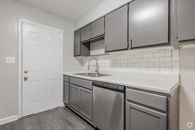
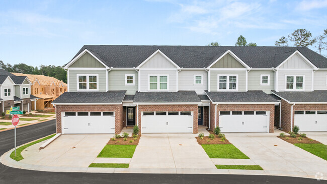
About This Home
Available Now
Contact us to schedule a showing.
2948 Fields Dr is a townhome located in DeKalb County and the 30038 ZIP Code. This area is served by the DeKalb County attendance zone.
* Price shown is base rent and may not include non-optional fees and utilities.
Price, availability, fees, and any applicable rent special are subject to change without notice.
* Square footage definitions vary. Displayed square footage is approximate.
Contact
- Listed by Summit Residential Management
- Phone Number
- Contact
Location
Get Directions
The South DeKalb neighborhood of Atlanta sits just to the east of Interstate 75 and contains sections of both Interstate 20 and Interstate 285. Residents of this mostly residential area enjoy sprawling subdivisions full of affordable family homes, plenty of natural scenery and easy access to major thoroughfares and other modern amenities. While this quiet part of Atlanta might not be teeming with the same amount of activity and nightlife as more central parts of the city, locals appreciate having the option of enjoying a quiet evening at home or heading out for a night on the town. They can experience the advantages of both a suburban setting and a big city location.
Learn more about living in Southeast DeKalb
Education
| Colleges & Universities | Distance | ||
|---|---|---|---|
| Colleges & Universities | Distance | ||
| Drive: | 19 min | 10.3 mi | |
| Drive: | 21 min | 12.3 mi | |
| Drive: | 21 min | 12.5 mi | |
| Drive: | 26 min | 15.6 mi |
2948 Fields Dr is within 19 minutes or 10.3 miles from Georgia Perim. Coll., Decatur. It is also near Georgia Perim., Clarkston and Agnes Scott College.
Schools


Public Elementary School
Grades PK-5
996 Students
Attendance Zone
Public Middle School
Grades 6-8
1,214 Students
Attendance Zone
Public High School
Grades 9-12
1,483 Students
Attendance Zone
Private Elementary, Middle & High School
Grades PK-11
33 Students
Nearby
Private Elementary, Middle & High School
Grades K-12
8 Students
Nearby
School data provided by
 The GreatSchools Rating helps parents compare schools within a state based on a variety of school quality indicators and provides a helpful picture of how effectively each school serves all of its students. Ratings are on a scale of 1 (below average) to 10 (above average) and can include test scores, college readiness, academic progress, advanced courses, equity, discipline and attendance data. We also advise parents to visit schools, consider other information on school performance and programs, and consider family needs as part of the school selection process.
View GreatSchools Rating Methodology
View GreatSchools Rating Methodology
Transportation options available in Stonecrest include Indian Creek, located 10.2 miles from 2948 Fields Dr. 2948 Fields Dr is near Hartsfield - Jackson Atlanta International, located 20.2 miles or 33 minutes away.
| Transit / Subway | Distance | ||
|---|---|---|---|
| Transit / Subway | Distance | ||
|
|
Drive: | 16 min | 10.2 mi |
|
|
Drive: | 19 min | 11.1 mi |
|
|
Drive: | 21 min | 12.7 mi |
|
|
Drive: | 22 min | 13.5 mi |
|
|
Drive: | 23 min | 13.7 mi |
| Commuter Rail | Distance | ||
|---|---|---|---|
| Commuter Rail | Distance | ||
|
|
Drive: | 31 min | 20.6 mi |
| Airports | Distance | ||
|---|---|---|---|
| Airports | Distance | ||
|
Hartsfield - Jackson Atlanta International
|
Drive: | 33 min | 20.2 mi |
Time and distance from 2948 Fields Dr.
| Shopping Centers | Distance | ||
|---|---|---|---|
| Shopping Centers | Distance | ||
| Walk: | 11 min | 0.6 mi | |
| Drive: | 5 min | 1.6 mi | |
| Drive: | 5 min | 1.6 mi |
2948 Fields Dr has 3 shopping centers within 1.6 miles, which is about a 5-minute walk. The miles and minutes will be for the farthest away property.
| Parks and Recreation | Distance | ||
|---|---|---|---|
| Parks and Recreation | Distance | ||
|
Arabia Mountain Heritage Area and Nature Center
|
Drive: | 10 min | 4.1 mi |
|
Panola Mountain State Park
|
Drive: | 16 min | 7.1 mi |
|
DeShong Park
|
Drive: | 21 min | 9.5 mi |
|
Ferns of the World Garden
|
Drive: | 17 min | 10.1 mi |
|
Stone Mountain State Memorial Park
|
Drive: | 27 min | 11.6 mi |
2948 Fields Dr has 5 parks within 11.6 miles, including Arabia Mountain Heritage Area and Nature Center, Panola Mountain State Park, and Ferns of the World Garden.
| Hospitals | Distance | ||
|---|---|---|---|
| Hospitals | Distance | ||
| Walk: | 14 min | 0.7 mi | |
| Drive: | 16 min | 9.7 mi | |
| Drive: | 18 min | 9.7 mi |
2948 Fields Dr has 3 hospitals within 9.7 miles, the nearest is Emory Hillandale Hospital which is 0.7 mile away and a 14 minute walk.
| Military Bases | Distance | ||
|---|---|---|---|
| Military Bases | Distance | ||
| Drive: | 29 min | 17.9 mi | |
| Drive: | 31 min | 20.9 mi |
2948 Fields Dr is 17.9 miles from Fort Gillem, and is convenient to other military bases, including Fort McPherson.
You May Also Like
Similar Rentals Nearby


What Are Walk Score®, Transit Score®, and Bike Score® Ratings?
Walk Score® measures the walkability of any address. Transit Score® measures access to public transit. Bike Score® measures the bikeability of any address.
What is a Sound Score Rating?
A Sound Score Rating aggregates noise caused by vehicle traffic, airplane traffic and local sources

2948 Fields Dr
Stonecrest, GA 30038