$1,950 / Month
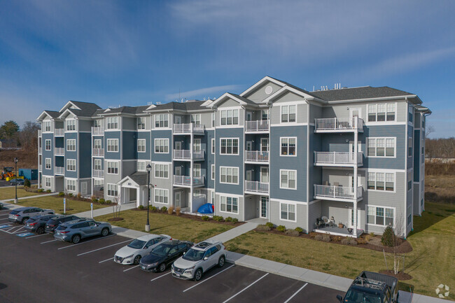
298 N Main St Unit R1
Raynham, MA 02767
2 Weeks Ago
Favorites
298 N Main St Unit R1

Favorites
Check Back Soon for Upcoming Availability
| Beds | Baths | Average SF |
|---|---|---|
| 1 Bedroom 1 Bedroom 1 Br | 1 Bath 1 Bath 1 Ba | 495 SF |
About This Property
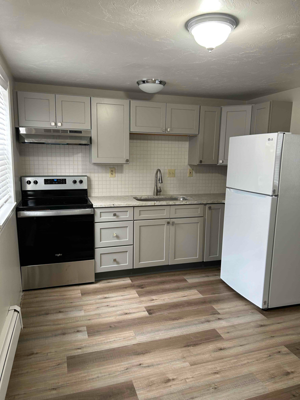
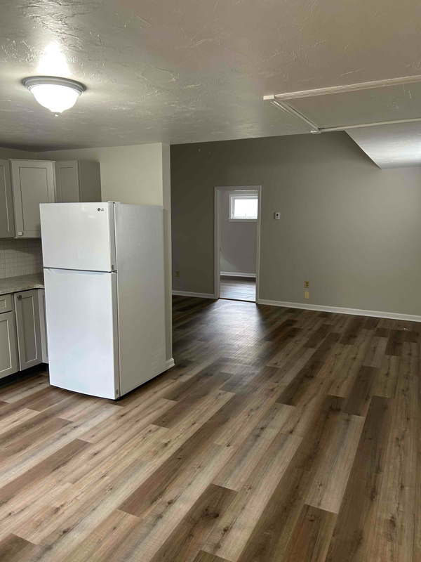
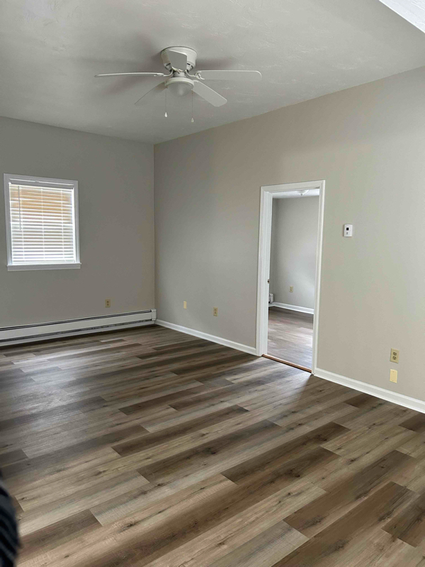
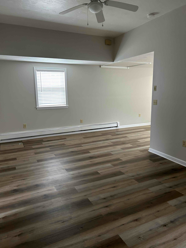
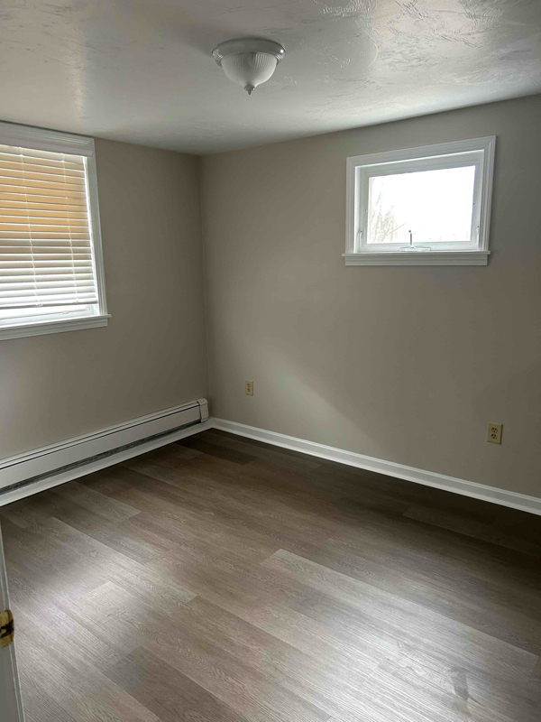
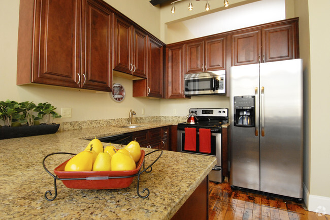
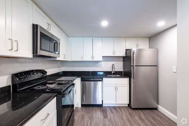
Property Id: 1425650 One bedroom two bathroom fully renovated new kitchen new appliances, new bathroom, new flooring. Includes gas heat. Minutes to route 24, 495, 138, 44, 104. Close to shopping and restaurants. Walk to Johnson's Pond. Off street parking private yard on Dedon Street only two units in building.
298 N Main St is an apartment community located in Bristol County and the 02767 ZIP Code.
Features
- Oven
- Refrigerator
- Vaulted Ceiling
- Lawn
Fees and Policies
The fees below are based on community-supplied data and may exclude additional fees and utilities.
Details
Utilities Included
-
Gas
-
Water
-
Trash Removal
-
Sewer
Location
Get Directions
Nestled alongside the Taunton River in southeastern Massachusetts, Raynham is a peaceful town with a laidback atmosphere and distinct New England charm. Raynham residents enjoy access to all kinds of outdoor activities, with Massasoit State Park, the Taunton River, and numerous golf and country clubs all located within close proximity.
Shopping options in Raynham range from various finds at the Raynham Flea Market to national retailers in suburban shopping centers and the nearby Silver City Galleria. Big-city amenities are also nearby Raynham, with Boston and Providence, Rhode Island both within an hour’s drive away. Getting around from Raynham is simple with convenience to Routes 24 and 44 as well as I-495.
Learn more about living in Raynham
Amenities
- Oven
- Refrigerator
- Vaulted Ceiling
- Lawn
Expenses
Utilities Included
Gas, Water, Trash Removal, Sewer
Included
Education
| Colleges & Universities | Distance | ||
|---|---|---|---|
| Colleges & Universities | Distance | ||
| Drive: | 13 min | 7.0 mi | |
| Drive: | 15 min | 9.8 mi | |
| Drive: | 17 min | 10.2 mi | |
| Drive: | 25 min | 13.8 mi |
298 N Main St Unit R1 is within 13 minutes or 7.0 miles from Bridgewater State University. It is also near Wheaton College, Norton and Stonehill College.
Transportation options available in Raynham include Braintree Station, located 23.5 miles from 298 N Main St Unit R1. 298 N Main St Unit R1 is near Rhode Island Tf Green International, located 28.9 miles or 50 minutes away, and General Edward Lawrence Logan International, located 36.5 miles or 51 minutes away.
| Transit / Subway | Distance | ||
|---|---|---|---|
| Transit / Subway | Distance | ||
|
|
Drive: | 37 min | 23.5 mi |
|
|
Drive: | 34 min | 24.9 mi |
|
|
Drive: | 37 min | 26.4 mi |
|
|
Drive: | 36 min | 26.4 mi |
|
|
Drive: | 37 min | 27.5 mi |
| Commuter Rail | Distance | ||
|---|---|---|---|
| Commuter Rail | Distance | ||
|
|
Drive: | 16 min | 7.7 mi |
|
|
Drive: | 17 min | 9.6 mi |
|
|
Drive: | 20 min | 11.5 mi |
|
|
Drive: | 21 min | 14.2 mi |
|
|
Drive: | 21 min | 14.9 mi |
| Airports | Distance | ||
|---|---|---|---|
| Airports | Distance | ||
|
Rhode Island Tf Green International
|
Drive: | 50 min | 28.9 mi |
|
General Edward Lawrence Logan International
|
Drive: | 51 min | 36.5 mi |
Time and distance from 298 N Main St Unit R1.
| Shopping Centers | Distance | ||
|---|---|---|---|
| Shopping Centers | Distance | ||
| Drive: | 5 min | 2.0 mi | |
| Drive: | 4 min | 2.1 mi | |
| Drive: | 6 min | 3.0 mi |
298 N Main St Unit R1 has 3 shopping centers within 3.0 miles, which is about a 6-minute drive. The miles and minutes will be for the farthest away property.
| Parks and Recreation | Distance | ||
|---|---|---|---|
| Parks and Recreation | Distance | ||
|
Boyden Refuge
|
Drive: | 11 min | 6.2 mi |
|
Massasoit State Park
|
Drive: | 22 min | 8.5 mi |
|
The Children's Museum in Easton
|
Drive: | 17 min | 11.2 mi |
|
Dighton Rock State Park
|
Drive: | 22 min | 11.7 mi |
298 N Main St Unit R1 has 4 parks within 11.7 miles, including Boyden Refuge, Massasoit State Park, and Dighton Rock State Park.
| Hospitals | Distance | ||
|---|---|---|---|
| Hospitals | Distance | ||
| Drive: | 8 min | 3.8 mi | |
| Drive: | 8 min | 4.1 mi | |
| Drive: | 16 min | 9.5 mi |
298 N Main St Unit R1 has 3 hospitals within 9.5 miles, the nearest is Morton Hospital which is 3.8 miles away and a 8 minute drive.
| Military Bases | Distance | ||
|---|---|---|---|
| Military Bases | Distance | ||
| Drive: | 56 min | 38.5 mi |
298 N Main St Unit R1 is 38.5 miles and a 56 minute drive from US Military Reservation.
You May Also Like
Similar Rentals Nearby


What Are Walk Score®, Transit Score®, and Bike Score® Ratings?
Walk Score® measures the walkability of any address. Transit Score® measures access to public transit. Bike Score® measures the bikeability of any address.
What is a Sound Score Rating?
A Sound Score Rating aggregates noise caused by vehicle traffic, airplane traffic and local sources

298 N Main St
Raynham, MA 02767