
$1,695 / Month
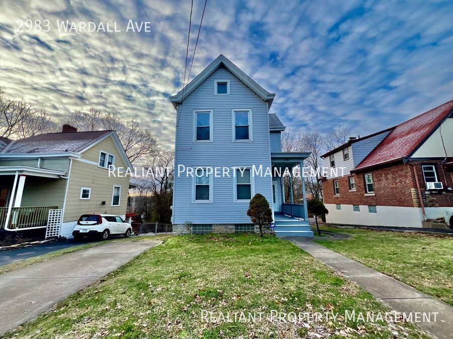
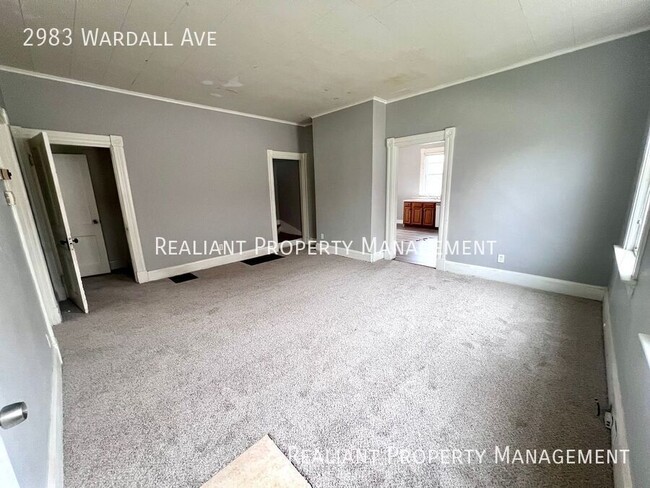
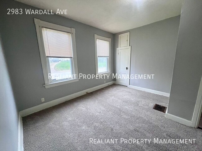
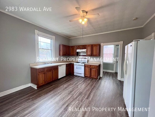
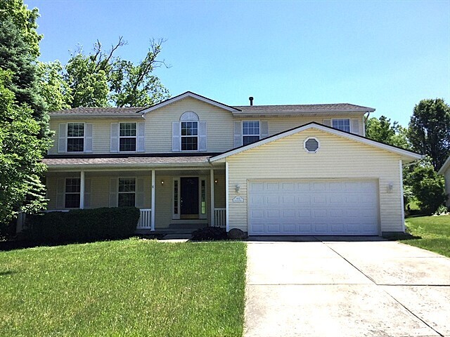
2983 Wardall Ave
Cincinnati, OH 45211
1 Day Ago
Favorites
513-951-4226
-
Bedrooms
3
-
Bathrooms
1.5
-
Square Feet
1,791 sq ft
-
Available
Available Now
2983 Wardall Ave

Favorites
About This Home
Available Now
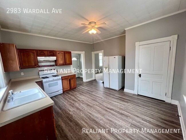
---- SCHEDULE A SHOWING ONLINE AT: ---- Now available for rent in the heart of Cheviot, this inviting 3-bedroom, 1.5-bath single-family home offers comfort, character, and practical updates throughout. Enjoy original hardwood floors, brand new carpet upstairs, and stylish new LVP flooring in the kitchen. The main level features a functional layout with a spacious kitchen that flows directly into a dedicated laundry room, making daily routines easy and efficient. Upstairs, you'll find a convenient Jack and Jill bathroom connecting two of the bedrooms—ideal for shared living while maintaining privacy. Step outside onto your private deck, perfect for relaxing or entertaining. The basement offers ample storage space, and a backyard shed provides even more room for tools or seasonal items. Located in a walkable Cheviot neighborhood with quick access to shopping, dining, and major roads, this home combines charm and convenience in one great package. 12-month lease required. The tenant pays all utilities. Interested applicants must complete a rental application and authorize a $65 credit and background check. A minimum credit score of 625 is required. Pets weighing under 30 lbs are permitted with a $300 non-refundable pet deposit and $50/mo pet rent per pet. Schedule your showing today at Rentals--Cincinnati, OH. Schedule your showing today! Back Deck Front Porch Jack And Jill Bathroom Primary Suite Storage Shed Unfinshed Basement
2983 Wardall Ave is a house located in Hamilton County and the 45211 ZIP Code. This area is served by the Cincinnati Public Schools attendance zone.
* Price shown is base rent and may not include non-optional fees and utilities.
Price, availability, fees, and any applicable rent special are subject to change without notice.
* Square footage definitions vary. Displayed square footage is approximate.
Contact
- Listed by Realiant Leasing
- Phone Number
- Contact
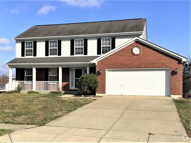
$1,492 / month
$230,000 Listing Price
4 Beds
•1.5 Baths
•
1,350 Sq Ft
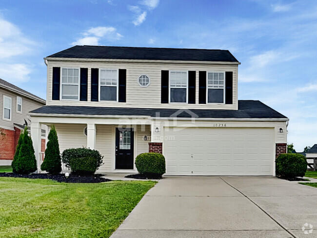
$1,675 / month
$260,000 Listing Price
3 Beds
•1.5 Baths
•
1,632 Sq Ft
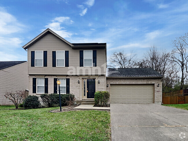
$1,452 / month
$264,900 Listing Price
3 Beds
•1.5 Baths
•
1,595 Sq Ft
Location
Get Directions
Situated about five miles northwest of Downtown Cincinnati, Westwood is the largest neighborhood in the city. Residents flock to Westwood for its many affordable historic homes and modern apartments available for rent in addition to its close proximity to I-74, I-75, and all that Downtown Cincinnati has to offer.
While Westwood is a predominantly residential neighborhood, it is also home to a slew of convenient stores and restaurants. Shopping opportunities abound in Westwood, with plenty of national retailers in Western Hills Plaza and local shops in the growing Town Hall District. Numerous neighborhood parks provide ample space to enjoy the outdoors in town as well as the sprawling 1,400-acre Mount Airy Forest, which is partially located in Westwood.
Learn more about living in Westwood
Education
| Colleges & Universities | Distance | ||
|---|---|---|---|
| Colleges & Universities | Distance | ||
| Drive: | 13 min | 5.3 mi | |
| Drive: | 11 min | 5.5 mi | |
| Drive: | 13 min | 6.0 mi | |
| Drive: | 14 min | 6.2 mi |
2983 Wardall Ave is within 13 minutes or 5.3 miles from Cincinnati State. It is also near University of Cincinnati and Univ. of Cincinnati, Medical.
Schools

Public Elementary & Middle School
Grades K-7
380 Students
Attendance Zone
Public Middle & High School
Grades 7-12
897 Students
Attendance Zone
Public Middle & High School
Grades 7-12
760 Students
Attendance Zone
Private Elementary & Middle School
Grades K-8
189 Students
Nearby
Private Elementary & Middle School
Grades K-8
164 Students
Nearby
Private High School
Grades 9-12
495 Students
Nearby
School data provided by
 The GreatSchools Rating helps parents compare schools within a state based on a variety of school quality indicators and provides a helpful picture of how effectively each school serves all of its students. Ratings are on a scale of 1 (below average) to 10 (above average) and can include test scores, college readiness, academic progress, advanced courses, equity, discipline and attendance data. We also advise parents to visit schools, consider other information on school performance and programs, and consider family needs as part of the school selection process.
View GreatSchools Rating Methodology
View GreatSchools Rating Methodology
Transportation options available in Cincinnati include Brewery District Station, Elm & Henry, located 6.3 miles from 2983 Wardall Ave. 2983 Wardall Ave is near Cincinnati/Northern Kentucky International, located 20.3 miles or 37 minutes away.
| Transit / Subway | Distance | ||
|---|---|---|---|
| Transit / Subway | Distance | ||
| Drive: | 13 min | 6.3 mi | |
| Drive: | 13 min | 6.4 mi | |
| Drive: | 13 min | 6.4 mi | |
| Drive: | 14 min | 6.5 mi | |
| Drive: | 14 min | 6.6 mi |
| Commuter Rail | Distance | ||
|---|---|---|---|
| Commuter Rail | Distance | ||
|
|
Drive: | 12 min | 6.2 mi |
| Airports | Distance | ||
|---|---|---|---|
| Airports | Distance | ||
|
Cincinnati/Northern Kentucky International
|
Drive: | 37 min | 20.3 mi |
Time and distance from 2983 Wardall Ave.
| Shopping Centers | Distance | ||
|---|---|---|---|
| Shopping Centers | Distance | ||
| Drive: | 6 min | 2.0 mi | |
| Drive: | 6 min | 2.3 mi | |
| Drive: | 6 min | 2.4 mi |
2983 Wardall Ave has 3 shopping centers within 2.4 miles, which is about a 6-minute drive. The miles and minutes will be for the farthest away property.
| Parks and Recreation | Distance | ||
|---|---|---|---|
| Parks and Recreation | Distance | ||
|
Mt. Airy Forest
|
Drive: | 6 min | 2.5 mi |
|
Buttercup Valley
|
Drive: | 10 min | 4.2 mi |
|
Imago Earth Center
|
Drive: | 14 min | 5.3 mi |
|
LaBoiteaux Woods
|
Drive: | 13 min | 5.4 mi |
|
Wilson Commons
|
Drive: | 15 min | 6.3 mi |
2983 Wardall Ave has 5 parks within 6.3 miles, including Mt. Airy Forest, Buttercup Valley, and Imago Earth Center.
| Hospitals | Distance | ||
|---|---|---|---|
| Hospitals | Distance | ||
| Drive: | 7 min | 2.5 mi | |
| Drive: | 10 min | 4.8 mi | |
| Drive: | 13 min | 6.0 mi |
2983 Wardall Ave has 3 hospitals within 6.0 miles, the nearest is Mercy Health - West Hospital which is 2.5 miles away and a 7 minute drive.
| Military Bases | Distance | ||
|---|---|---|---|
| Military Bases | Distance | ||
| Drive: | 73 min | 55.0 mi | |
| Drive: | 79 min | 60.1 mi | |
| Drive: | 81 min | 63.4 mi |
2983 Wardall Ave has 3 military bases within 63.4 miles, the nearest is Gentile Air Force Station which is 55.0 miles away and a 73 minute drive.
You May Also Like
Similar Rentals Nearby
What Are Walk Score®, Transit Score®, and Bike Score® Ratings?
Walk Score® measures the walkability of any address. Transit Score® measures access to public transit. Bike Score® measures the bikeability of any address.
What is a Sound Score Rating?
A Sound Score Rating aggregates noise caused by vehicle traffic, airplane traffic and local sources

2983 Wardall Ave
Cincinnati, OH 45211