$2,900 / Month
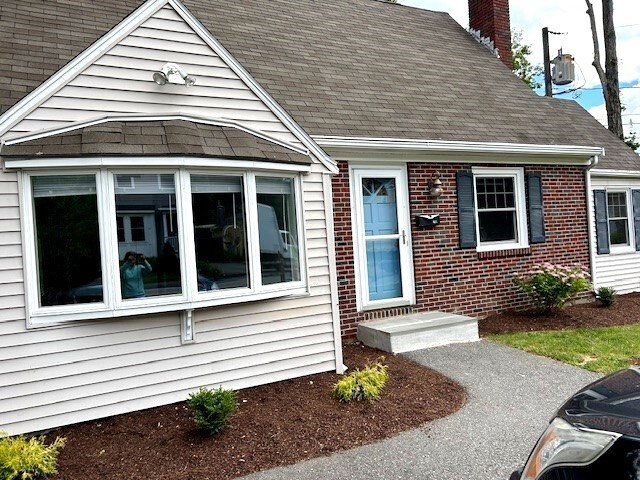
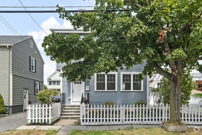
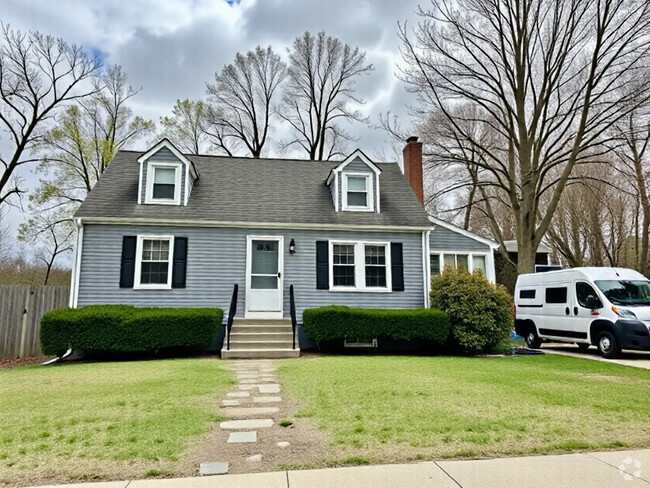
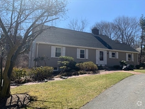
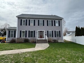
299 Central St
Acton, MA 01720
2 Weeks Ago
Favorites
299 Central St

Favorites
Check Back Soon for Upcoming Availability
| Beds | Baths | Average SF |
|---|---|---|
| 3 Bedrooms 3 Bedrooms 3 Br | 1.5 Baths 1.5 Baths 1.5 Ba | 1,336 SF |
About This Property
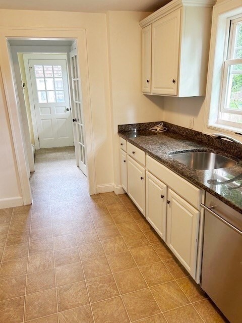
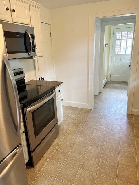
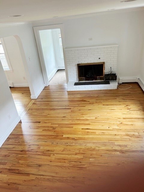
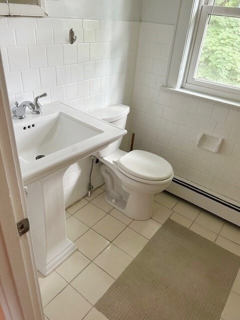
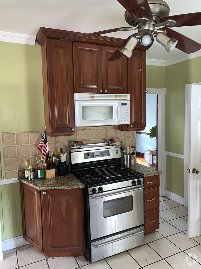
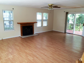
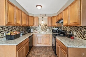
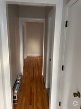
Three bedroom cape in mint condition. Hardwood floors,fireplaces living room. Updated white kitchen,den,1/2 bath and bedroom on first level. Two bedrooms and full bath on second level. Conveniently located close to idylwilde farm,west Acton village shops and restaurants. A short distance to commuter rail. Easy access to highway. Tenant responsible for utilities,snow removal and lawn care. Dogs possible,no smoking,Tenant to pay first,last and their agent fee.
299 Central St is a house located in Middlesex County and the 01720 ZIP Code. This area is served by the Acton-Boxborough attendance zone.
Location
Get Directions
Carlisle is a charming suburban community located in Middlesex County. Known for its picturesque landscapes and tight-knit community, the town offers a tranquil environment with a blend of rural and suburban living. With excellent schools and a variety of outdoor activities, Carlisle is an ideal place for renters of all lifestyles. The town also hosts numerous community events throughout the year, fostering connections among residents and enhancing the sense of belonging.
Learn more about living in CarlisleBelow are rent ranges for similar nearby apartments
Education
| Colleges & Universities | Distance | ||
|---|---|---|---|
| Colleges & Universities | Distance | ||
| Drive: | 31 min | 14.5 mi | |
| Drive: | 28 min | 14.9 mi | |
| Drive: | 28 min | 18.7 mi | |
| Drive: | 32 min | 18.7 mi |
299 Central St is within 31 minutes or 14.5 miles from Middlesex C.C., Bedford Campus. It is also near Framingham State College and Brandeis University.
Schools


Public Elementary School
Grades PK-5
498 Students
Nearby
Public Elementary School
Grades K-6
377 Students
Attendance Zone
Public Elementary School
Grades K-6
350 Students
Attendance Zone
Public Middle School
Grades 7-8
825 Students
Attendance Zone
Public High School
Grades 9-12
1,683 Students
Attendance Zone
Private Elementary & Middle School
Grades PK-8
163 Students
Nearby
Private Elementary & Middle School
Grades PK-8
87 Students
Nearby
Private Middle & High School
Grades 6-12
71 Students
Nearby
School data provided by
 The GreatSchools Rating helps parents compare schools within a state based on a variety of school quality indicators and provides a helpful picture of how effectively each school serves all of its students. Ratings are on a scale of 1 (below average) to 10 (above average) and can include test scores, college readiness, academic progress, advanced courses, equity, discipline and attendance data. We also advise parents to visit schools, consider other information on school performance and programs, and consider family needs as part of the school selection process.
View GreatSchools Rating Methodology
View GreatSchools Rating Methodology
Transportation options available in Acton include Riverside Station, located 19.9 miles from 299 Central St. 299 Central St is near General Edward Lawrence Logan International, located 28.2 miles or 46 minutes away, and Worcester Regional, located 32.2 miles or 46 minutes away.
| Transit / Subway | Distance | ||
|---|---|---|---|
| Transit / Subway | Distance | ||
|
|
Drive: | 32 min | 19.9 mi |
|
|
Drive: | 32 min | 20.3 mi |
|
|
Drive: | 34 min | 21.0 mi |
|
|
Drive: | 36 min | 22.5 mi |
|
|
Drive: | 36 min | 22.8 mi |
| Commuter Rail | Distance | ||
|---|---|---|---|
| Commuter Rail | Distance | ||
|
|
Drive: | 5 min | 2.0 mi |
|
|
Drive: | 10 min | 4.4 mi |
|
|
Drive: | 10 min | 5.0 mi |
|
|
Drive: | 13 min | 6.7 mi |
|
|
Drive: | 18 min | 10.2 mi |
| Airports | Distance | ||
|---|---|---|---|
| Airports | Distance | ||
|
General Edward Lawrence Logan International
|
Drive: | 46 min | 28.2 mi |
|
Worcester Regional
|
Drive: | 46 min | 32.2 mi |
Time and distance from 299 Central St.
| Shopping Centers | Distance | ||
|---|---|---|---|
| Shopping Centers | Distance | ||
| Walk: | 6 min | 0.4 mi | |
| Drive: | 3 min | 1.4 mi | |
| Drive: | 3 min | 1.5 mi |
299 Central St has 3 shopping centers within 1.5 miles, which is about a 3-minute walk. The miles and minutes will be for the farthest away property.
| Parks and Recreation | Distance | ||
|---|---|---|---|
| Parks and Recreation | Distance | ||
|
The Discovery Museums
|
Drive: | 4 min | 1.9 mi |
|
Nashoba Valley Ski Area
|
Drive: | 13 min | 5.3 mi |
|
Honey Pot Hill Orchards
|
Drive: | 13 min | 5.5 mi |
|
Oxbow National Wildlife Refuge
|
Drive: | 13 min | 6.9 mi |
|
Mass Audubon's Nashoba Brook Wildlife Sanctuary
|
Drive: | 15 min | 8.8 mi |
299 Central St has 5 parks within 8.8 miles, including The Discovery Museums, Nashoba Valley Ski Area, and Honey Pot Hill Orchards.
| Hospitals | Distance | ||
|---|---|---|---|
| Hospitals | Distance | ||
| Drive: | 10 min | 5.7 mi | |
| Drive: | 23 min | 10.7 mi | |
| Drive: | 20 min | 11.2 mi |
299 Central St has 3 hospitals within 11.2 miles, the nearest is Emerson Hospital which is 5.7 miles away and a 10 minute drive.
You May Also Like
Similar Rentals Nearby
What Are Walk Score®, Transit Score®, and Bike Score® Ratings?
Walk Score® measures the walkability of any address. Transit Score® measures access to public transit. Bike Score® measures the bikeability of any address.
What is a Sound Score Rating?
A Sound Score Rating aggregates noise caused by vehicle traffic, airplane traffic and local sources

299 Central St
Acton, MA 01720