$2,095 / Month
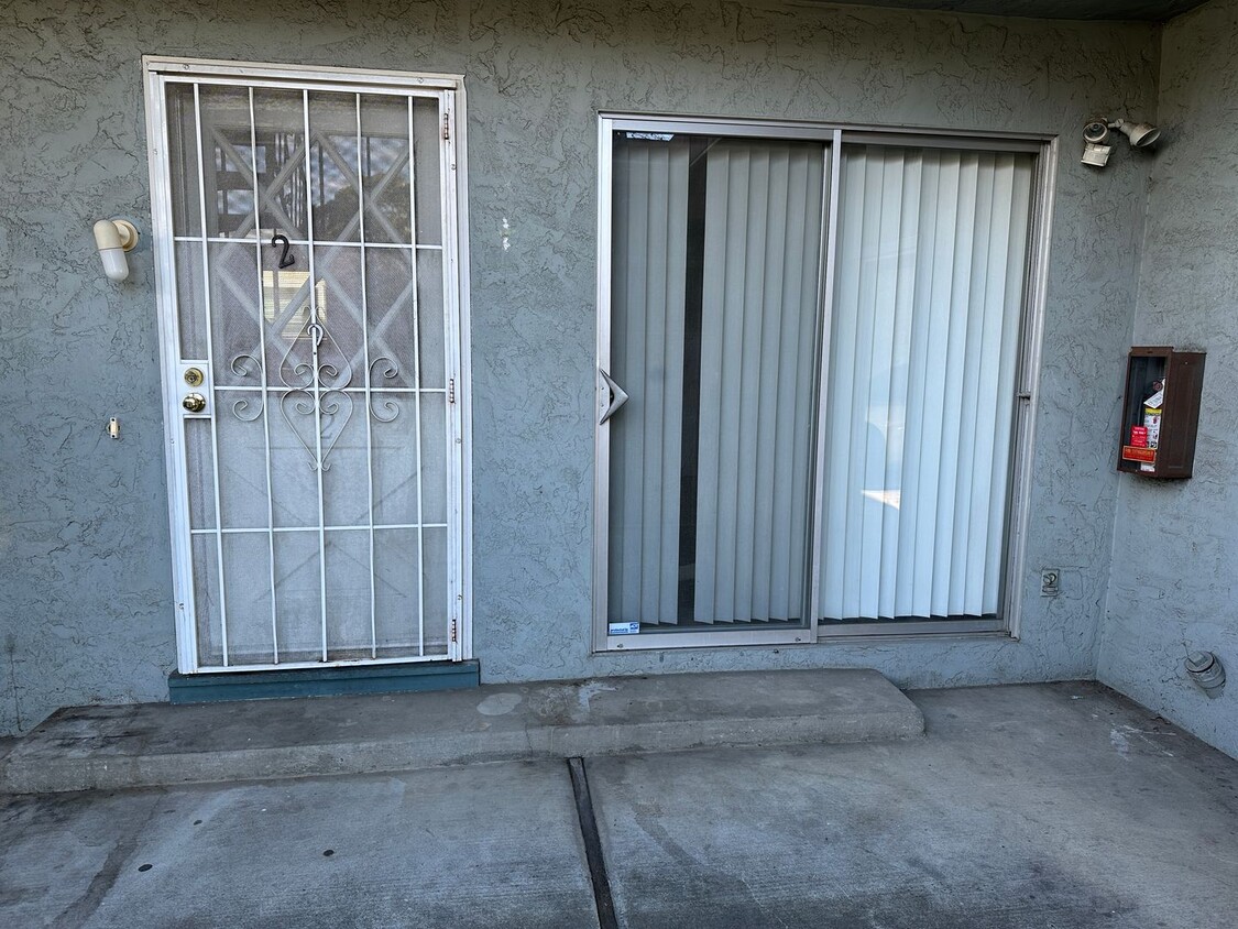
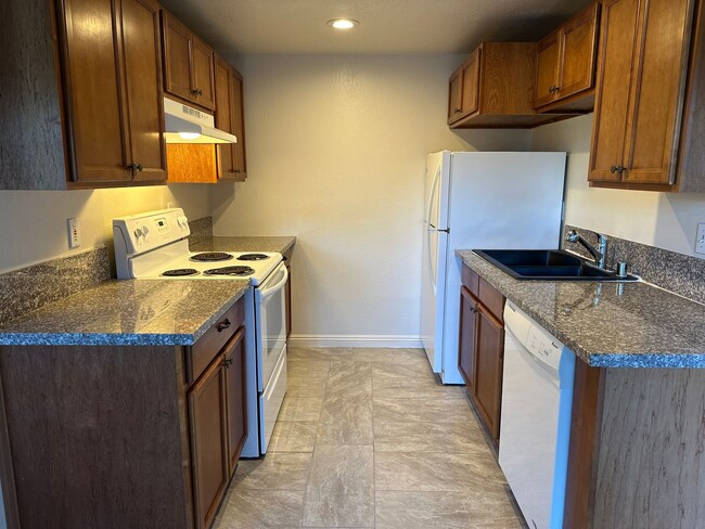
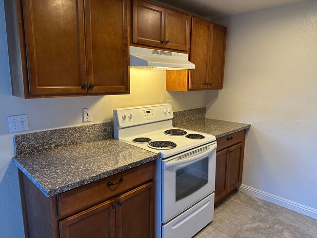
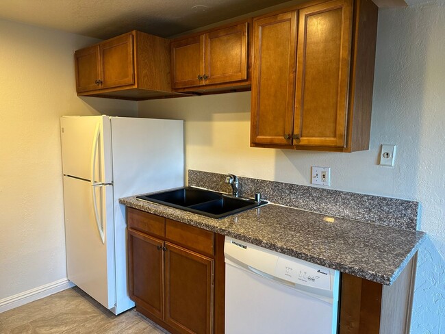
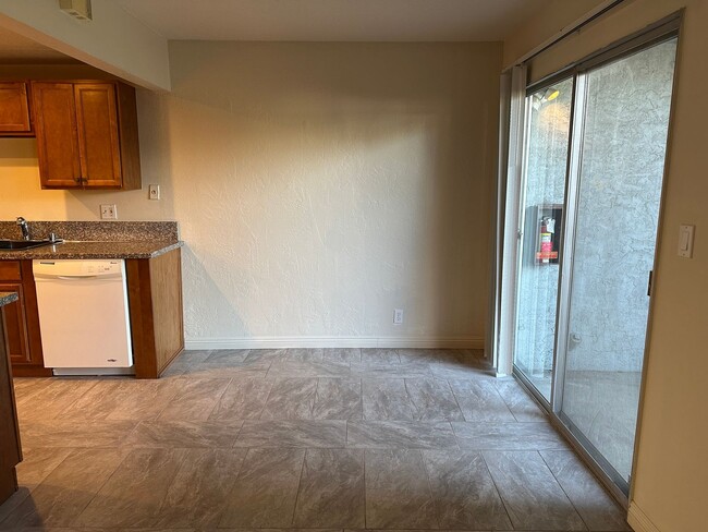
2990 Neet Ave Unit #2
San Jose, CA 95128
5 Days Ago
Favorites
-
Bedrooms
1
-
Bathrooms
1
-
Square Feet
--
2990 Neet Ave Unit #2

Favorites
Location
Get Directions
Castlemont is a small neighborhood roughly fifteen minutes southwest of downtown San Jose. Castlemont Elementary School and Monroe Middle School are both within easy walking distance from anywhere in the neighborhood, giving local schoolchildren the option of heading off to class on foot.
The retail corridor along Winchester Boulevard provides an assortment of convenient locations to grab a bite to eat or pick up day-to-day necessities. Just a few blocks north, folks have convenient access to the shopping at Santana Row and Westfield Valley Fair (plus the famous Winchester Mystery House next door).
Learn more about living in Castlemont
Education
| Colleges & Universities | Distance | ||
|---|---|---|---|
| Colleges & Universities | Distance | ||
| Drive: | 6 min | 2.3 mi | |
| Drive: | 10 min | 4.3 mi | |
| Drive: | 14 min | 6.3 mi | |
| Drive: | 12 min | 6.5 mi |
2990 Neet Ave Unit #2 is within 6 minutes or 2.3 miles from San Jose City College. It is also near Santa Clara University and San Jose State University.
Transportation options available in San Jose include Hamilton Station, located 2.1 miles from 2990 Neet Ave Unit #2. 2990 Neet Ave Unit #2 is near Norman Y Mineta San Jose International, located 4.7 miles or 11 minutes away, and San Francisco International, located 36.7 miles or 46 minutes away.
| Transit / Subway | Distance | ||
|---|---|---|---|
| Transit / Subway | Distance | ||
|
|
Drive: | 4 min | 2.1 mi |
|
|
Drive: | 5 min | 2.3 mi |
|
|
Drive: | 6 min | 2.5 mi |
|
|
Drive: | 5 min | 3.0 mi |
|
|
Drive: | 6 min | 3.2 mi |
| Commuter Rail | Distance | ||
|---|---|---|---|
| Commuter Rail | Distance | ||
| Drive: | 9 min | 4.0 mi | |
| Drive: | 9 min | 4.6 mi | |
| Drive: | 9 min | 4.7 mi | |
| Drive: | 10 min | 5.5 mi | |
| Drive: | 12 min | 7.4 mi |
| Airports | Distance | ||
|---|---|---|---|
| Airports | Distance | ||
|
Norman Y Mineta San Jose International
|
Drive: | 11 min | 4.7 mi |
|
San Francisco International
|
Drive: | 46 min | 36.7 mi |
Time and distance from 2990 Neet Ave Unit #2.
| Shopping Centers | Distance | ||
|---|---|---|---|
| Shopping Centers | Distance | ||
| Walk: | 11 min | 0.6 mi | |
| Walk: | 12 min | 0.6 mi | |
| Drive: | 4 min | 1.3 mi |
2990 Neet Ave Unit #2 has 3 shopping centers within 1.3 miles, which is about a 4-minute walk. The miles and minutes will be for the farthest away property.
| Parks and Recreation | Distance | ||
|---|---|---|---|
| Parks and Recreation | Distance | ||
|
Orchard City Green
|
Drive: | 5 min | 2.5 mi |
|
John D. Morgan Park
|
Drive: | 6 min | 2.7 mi |
|
Edith Morley Park
|
Drive: | 8 min | 3.6 mi |
|
Los Gatos Creek Trail
|
Drive: | 7 min | 4.0 mi |
|
Jack Fischer Park
|
Drive: | 10 min | 4.4 mi |
2990 Neet Ave Unit #2 has 5 parks within 4.4 miles, including Orchard City Green, John D. Morgan Park, and Los Gatos Creek Trail.
| Hospitals | Distance | ||
|---|---|---|---|
| Hospitals | Distance | ||
| Drive: | 3 min | 2.0 mi | |
| Drive: | 8 min | 4.8 mi | |
| Drive: | 10 min | 5.8 mi |
2990 Neet Ave Unit #2 has 3 hospitals within 5.8 miles, the nearest is Santa Clara Valley Medical Center which is 2.0 miles away and a 3 minute drive.
| Military Bases | Distance | ||
|---|---|---|---|
| Military Bases | Distance | ||
| Drive: | 21 min | 13.7 mi |
2990 Neet Ave Unit #2 is 13.7 miles and a 21 minute drive from Ames Research Center.
You May Also Like
Similar Rentals Nearby


What Are Walk Score®, Transit Score®, and Bike Score® Ratings?
Walk Score® measures the walkability of any address. Transit Score® measures access to public transit. Bike Score® measures the bikeability of any address.
What is a Sound Score Rating?
A Sound Score Rating aggregates noise caused by vehicle traffic, airplane traffic and local sources

2990 Neet Ave
San Jose, CA 95128