
$1,500 / Month
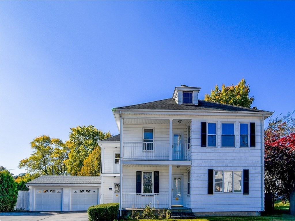
30 Suffolk St
Bellingham, MA 02019
2 Weeks Ago
Favorites
30 Suffolk St Unit 2

Favorites
Check Back Soon for Upcoming Availability
| Beds | Baths | Average SF |
|---|---|---|
| 2 Bedrooms 2 Bedrooms 2 Br | 1 Bath 1 Bath 1 Ba | 1,200 SF |
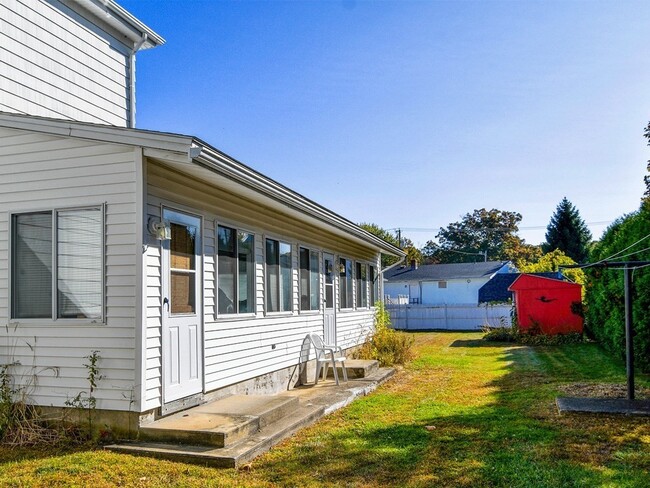
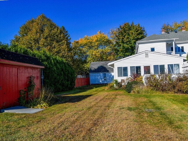
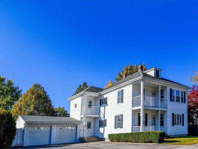
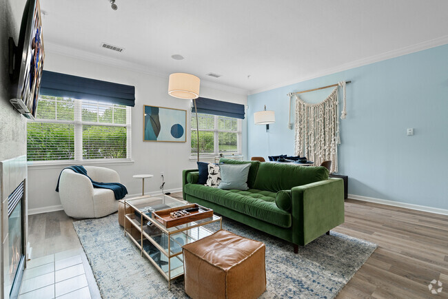
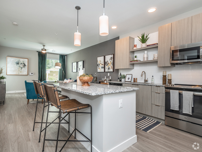
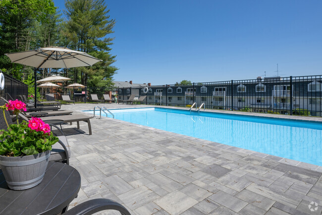
About This Property
Check out this great property in Bellingham, MA. Living at this 30 Suffolk St location in Bellingham, you'll have easy access to great shops and restaurants. Get a head start on finding your new space. Let us assist you! Contact us now to learn more about this property!
30 Suffolk St is an apartment community located in Norfolk County and the 02019 ZIP Code.
Property Address:
30 Suffolk St,
Bellingham,
MA
02019
495-South is a large area surrounding Interstate 495 about 20 miles south of Boston. This suburban town features peaceful neighborhoods nestled in forested areas paired with commercial developments. Renters have the choice of moderately priced to luxury apartments, condos, and single-family homes. An abundance of shopping and dining choices are scattered along the town’s major thoroughfares. Ponds, creeks, and large natural areas like Franklin State Forest and DelCarte Conservation Area provide relaxing outdoor activities. Residents have access to big-city amenities by driving a bit north into Boston, and the eclectic downtown districts of Worcester and Framingham are situated outside of the western and eastern corners of town.
Learn more about living in 495-South
Education
| Colleges & Universities | Distance | ||
|---|---|---|---|
| Colleges & Universities | Distance | ||
| Drive: | 16 min | 8.5 mi | |
| Drive: | 18 min | 10.4 mi | |
| Drive: | 21 min | 15.3 mi | |
| Drive: | 23 min | 15.8 mi |
30 Suffolk St Unit 2 is within 16 minutes or 8.5 miles from Bryant University. It is also near C.C. of Rhode Island, Flanagan and Providence College.
Transportation options available in Bellingham include Newton Highlands Station, located 35.7 miles from 30 Suffolk St Unit 2. 30 Suffolk St Unit 2 is near Rhode Island Tf Green International, located 24.0 miles or 36 minutes away, and Worcester Regional, located 33.5 miles or 47 minutes away.
| Transit / Subway | Distance | ||
|---|---|---|---|
| Transit / Subway | Distance | ||
|
|
Drive: | 55 min | 35.7 mi |
|
|
Drive: | 56 min | 36.4 mi |
|
|
Drive: | 53 min | 39.0 mi |
|
|
Drive: | 53 min | 39.3 mi |
|
|
Drive: | 54 min | 40.0 mi |
| Commuter Rail | Distance | ||
|---|---|---|---|
| Commuter Rail | Distance | ||
|
|
Drive: | 13 min | 7.2 mi |
|
|
Drive: | 15 min | 7.6 mi |
|
|
Drive: | 24 min | 12.4 mi |
| Drive: | 20 min | 12.6 mi | |
|
|
Drive: | 22 min | 13.9 mi |
| Airports | Distance | ||
|---|---|---|---|
| Airports | Distance | ||
|
Rhode Island Tf Green International
|
Drive: | 36 min | 24.0 mi |
|
Worcester Regional
|
Drive: | 47 min | 33.5 mi |
Time and distance from 30 Suffolk St Unit 2.
| Shopping Centers | Distance | ||
|---|---|---|---|
| Shopping Centers | Distance | ||
| Walk: | 6 min | 0.3 mi | |
| Walk: | 10 min | 0.6 mi | |
| Drive: | 3 min | 1.6 mi |
30 Suffolk St Unit 2 has 3 shopping centers within 1.6 miles, which is about a 3-minute drive. The miles and minutes will be for the farthest away property.
| Parks and Recreation | Distance | ||
|---|---|---|---|
| Parks and Recreation | Distance | ||
|
World War II Memorial State Park
|
Drive: | 2 min | 1.3 mi |
|
Blackstone River Valley National Heritage Corridor
|
Drive: | 3 min | 1.8 mi |
|
Fort Nature Refuge
|
Drive: | 11 min | 6.1 mi |
|
Blackstone River Bikeway
|
Drive: | 13 min | 8.5 mi |
|
Blackstone River and Canal Heritage State Park
|
Drive: | 23 min | 11.7 mi |
30 Suffolk St Unit 2 has 5 parks within 11.7 miles, including World War II Memorial State Park, Blackstone River Valley National Heritage Corridor, and Fort Nature Refuge.
| Hospitals | Distance | ||
|---|---|---|---|
| Hospitals | Distance | ||
| Drive: | 3 min | 1.6 mi | |
| Drive: | 16 min | 10.0 mi | |
| Drive: | 20 min | 13.7 mi |
30 Suffolk St Unit 2 has 3 hospitals within 13.7 miles, the nearest is Landmark Medical Center which is 1.6 miles away and a 3 minutes drive.
| Military Bases | Distance | ||
|---|---|---|---|
| Military Bases | Distance | ||
| Drive: | 44 min | 22.5 mi | |
| Drive: | 48 min | 35.8 mi |
30 Suffolk St Unit 2 is 22.5 miles from US Military Reservation, and is convenient to other military bases, including Rhode Island National Gaurd.
You May Also Like
Similar Rentals Nearby


What Are Walk Score®, Transit Score®, and Bike Score® Ratings?
Walk Score® measures the walkability of any address. Transit Score® measures access to public transit. Bike Score® measures the bikeability of any address.
What is a Sound Score Rating?
A Sound Score Rating aggregates noise caused by vehicle traffic, airplane traffic and local sources
30 Suffolk St
Bellingham, MA 02019