$12,000 / Month
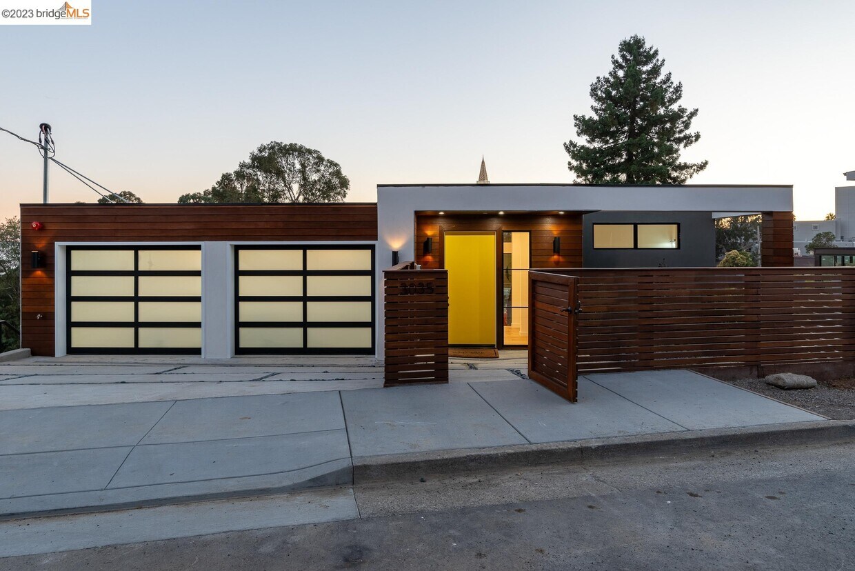
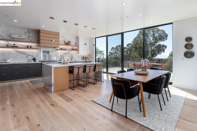
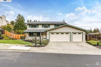
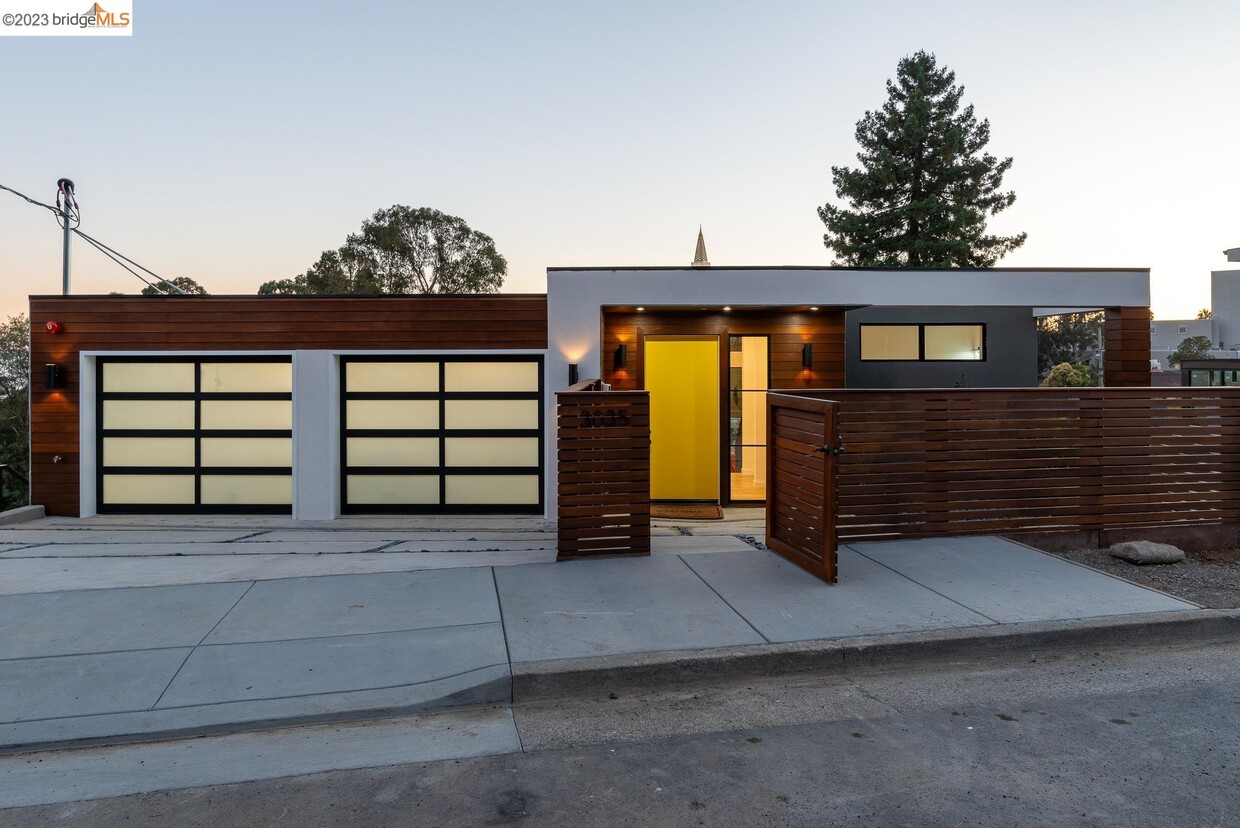
3035 Monterey Blvd
Oakland, CA 94602
2 Weeks Ago
Favorites
3035 Monterey Blvd

Favorites
Check Back Soon for Upcoming Availability
| Beds | Baths | Average SF |
|---|---|---|
| 6 Bedrooms 6 Bedrooms 6 Br | 6.5 Baths 6.5 Baths 6.5 Ba | 4,026 SF |
About This Property
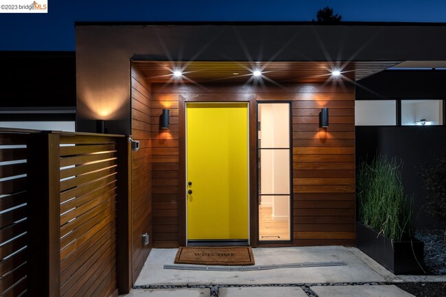
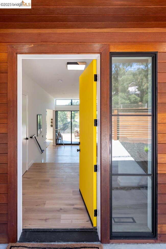
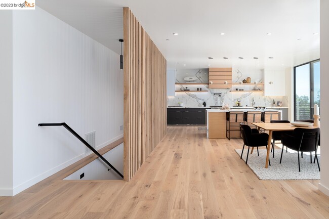
For lease and for sale!. Nestled in the heart of Lincoln Highlands,this striking new construction contemporary residence boasts a modern design and opulent finishes that are certain to leave a lasting impression. Step inside to discover soaring 12-foot ceilings and captivating vistas of Temple Hill's golden spires and the bay beyond. The main living area with floor to ceiling windows ushers in natural light. The kitchen,with generous island,is a dream for any culinary enthusiast,featuring top-of-the-line appliances and ample counter space. The living room and dining room effortlessly connect to a spacious deck that overlooks the lush yard - perfect for entertaining with panache. Venture downstairs to four en-suite bedrooms,including the exquisite primary suite. On the third level,you'll discover an expansive rear yard and an attached ADU,which can seamlessly integrate with the main residence if desired. The ADU boasts kitchen facilities,a spacious sitting area,two full bathrooms and ample storage. This backyard oasis allows space for play,gardening,or relaxation. With its abundant light,lavish amenities,and designer touches,this home is sure to captivate even the most discerning of homebuyers.
3035 Monterey Blvd is a house located in Alameda County and the 94602 ZIP Code. This area is served by the Oakland Unified attendance zone.
Fees and Policies
The fees below are based on community-supplied data and may exclude additional fees and utilities.
- Parking
-
Garage--
Location
Get Directions
The Lower Hills District of Oakland is made up of several small neighborhoods, including Piedmont, Crocker Heights, Oakmont, and Redwood Heights. Situated just seven miles to the east of Downtown Oakland on the north side of Interstate 580, the Lower Hills District maintains a small town feel despite its location among one of the Bay Area’s biggest communities. Windy, tree-lined streets house both new apartments and homes dating back to the '30s and '40s. Residents don’t have to travel far for everyday needs thanks to Oakland’s fast-growing economy. There is a plethora of shopping and dining options scattered around this sprawling community. You’ll find most of the amenities close to the MacArthur Freeway (Interstate 580) or near Park Boulevard. Access to the freeway and Bay Area Rapid Transit make getting around the rest of the Bay Area a breeze.
Learn more about living in Lower Hills DistrictBelow are rent ranges for similar nearby apartments
Education
| Colleges & Universities | Distance | ||
|---|---|---|---|
| Colleges & Universities | Distance | ||
| Drive: | 7 min | 3.1 mi | |
| Drive: | 9 min | 4.5 mi | |
| Drive: | 10 min | 4.9 mi | |
| Drive: | 10 min | 5.1 mi |
3035 Monterey Blvd is within 7 minutes or 3.1 miles from Mills College. It is also near Laney College and Lincoln University, Oakland.
Schools


Public Elementary & Middle School
Grades K-8
656 Students
Nearby
Public Elementary School
Grades K-5
449 Students
Attendance Zone
Public Middle School
Grades 6-9
446 Students
Attendance Zone
Public High School
Grades 9-12
1,590 Students
Attendance Zone
Private Elementary & Middle School
Grades PK-7
177 Students
Nearby
Private Elementary, Middle & High School
Grades K-12
900 Students
Nearby
Private Elementary & Middle School
Grades K-8
45 Students
Nearby
Private Elementary School
Grades K-1
88 Students
Nearby
School data provided by
 The GreatSchools Rating helps parents compare schools within a state based on a variety of school quality indicators and provides a helpful picture of how effectively each school serves all of its students. Ratings are on a scale of 1 (below average) to 10 (above average) and can include test scores, college readiness, academic progress, advanced courses, equity, discipline and attendance data. We also advise parents to visit schools, consider other information on school performance and programs, and consider family needs as part of the school selection process.
View GreatSchools Rating Methodology
View GreatSchools Rating Methodology
Transportation options available in Oakland include Fruitvale Station, located 3.7 miles from 3035 Monterey Blvd. 3035 Monterey Blvd is near Metro Oakland International, located 9.1 miles or 14 minutes away, and San Francisco International, located 26.7 miles or 40 minutes away.
| Transit / Subway | Distance | ||
|---|---|---|---|
| Transit / Subway | Distance | ||
|
|
Drive: | 6 min | 3.7 mi |
|
|
Drive: | 7 min | 4.7 mi |
|
|
Drive: | 10 min | 4.9 mi |
|
|
Drive: | 10 min | 5.2 mi |
|
|
Drive: | 9 min | 5.7 mi |
| Commuter Rail | Distance | ||
|---|---|---|---|
| Commuter Rail | Distance | ||
|
|
Drive: | 11 min | 5.2 mi |
|
|
Drive: | 12 min | 7.7 mi |
|
|
Drive: | 15 min | 9.8 mi |
|
|
Drive: | 19 min | 13.0 mi |
| Drive: | 21 min | 14.3 mi |
| Airports | Distance | ||
|---|---|---|---|
| Airports | Distance | ||
|
Metro Oakland International
|
Drive: | 14 min | 9.1 mi |
|
San Francisco International
|
Drive: | 40 min | 26.7 mi |
Time and distance from 3035 Monterey Blvd.
| Shopping Centers | Distance | ||
|---|---|---|---|
| Shopping Centers | Distance | ||
| Drive: | 2 min | 1.2 mi | |
| Drive: | 3 min | 1.3 mi | |
| Drive: | 3 min | 1.5 mi |
3035 Monterey Blvd has 3 shopping centers within 1.5 miles, which is about a 3-minute drive. The miles and minutes will be for the farthest away property.
| Parks and Recreation | Distance | ||
|---|---|---|---|
| Parks and Recreation | Distance | ||
|
Roberts Regional Recreation Area
|
Drive: | 5 min | 2.3 mi |
|
Chabot Space & Science Center
|
Drive: | 8 min | 3.0 mi |
|
Joaquin Miller Park
|
Drive: | 7 min | 3.0 mi |
|
Redwood Regional Park
|
Drive: | 7 min | 4.0 mi |
|
Oyster Bay Regional Shoreline
|
Drive: | 7 min | 4.1 mi |
3035 Monterey Blvd has 5 parks within 4.1 miles, including Joaquin Miller Park, Roberts Regional Recreation Area, and Chabot Space & Science Center.
| Hospitals | Distance | ||
|---|---|---|---|
| Hospitals | Distance | ||
| Drive: | 5 min | 2.3 mi | |
| Drive: | 5 min | 2.4 mi | |
| Drive: | 8 min | 4.7 mi |
3035 Monterey Blvd has 3 hospitals within 4.7 miles, the nearest is Telecare Heritage Psychiatric Health Facility which is 2.3 miles away and a 5 minute drive.
| Military Bases | Distance | ||
|---|---|---|---|
| Military Bases | Distance | ||
| Drive: | 18 min | 8.3 mi | |
| Drive: | 19 min | 10.2 mi |
3035 Monterey Blvd is 8.3 miles from Alameda/US Naval Air Station Alameda, and is convenient to other military bases, including Oakland Army Base.
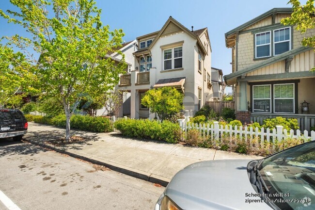
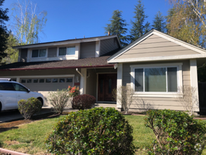
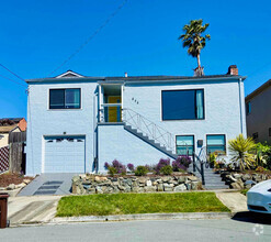
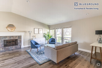
You May Also Like
Similar Rentals Nearby


What Are Walk Score®, Transit Score®, and Bike Score® Ratings?
Walk Score® measures the walkability of any address. Transit Score® measures access to public transit. Bike Score® measures the bikeability of any address.
What is a Sound Score Rating?
A Sound Score Rating aggregates noise caused by vehicle traffic, airplane traffic and local sources
3035 Monterey Blvd
Oakland, CA 94602