$3,250 / Month
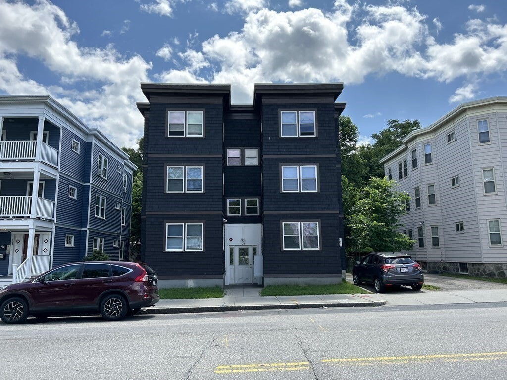
305 Cummins Hwy Unit 1R
Boston, MA 02131
2 Weeks Ago
Favorites
-
Bedrooms
3
-
Bathrooms
1
-
Square Feet
1,300 sq ft
-
Available
Available Now
Highlight
- Fitness Center
305 Cummins Hwy Unit 1R

Favorites
About This Home
12 Month Lease
,
Available Now
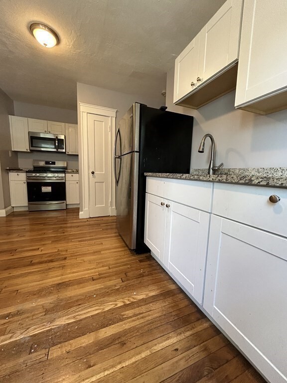
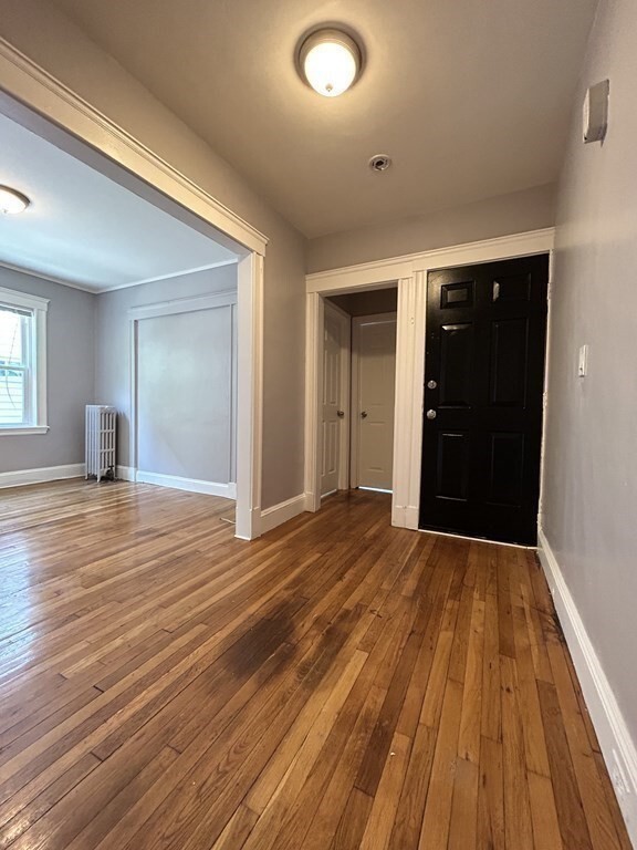
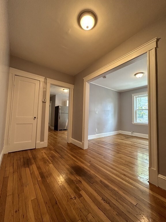
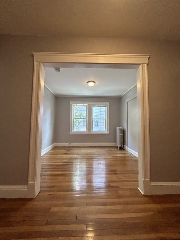
A 3 bed/1 BA unit located on Cummins Highway in Roslindale, MA. The unit is near local schools, restaurants, religious, and fitness centers. On Hyde Park Ave, three bus stops are available and in front of the building. Residents can access Walgreens, Stop & Shop, America's Food Market, and Pleant Café in the neighborhood. Cats ($50) and dogs ($100) are welcome. This unit is move-in ready; application and approval are required.
305 Cummins Hwy is a condo located in Suffolk County and the 02131 ZIP Code. This area is served by the Boston Public Schools attendance zone.
* Price shown is base rent and may not include non-optional fees and utilities.
Price, availability, fees, and any applicable rent special are subject to change without notice.
* Square footage definitions vary. Displayed square footage is approximate.
Condo Features
- Fitness Center
Fees and Policies
The fees below are based on community-supplied data and may exclude additional fees and utilities.
Contact
- Contact
Location
Get Directions
Lower Washington-Mount Hope is a walkable neighborhood about eight miles south of Boston via Interstate 93 or public transit. Despite this area’s dense population, Lower Washington-Mount Hope has many wooded areas, and large parks like Bussey Brook Meadow and Franklin Park surround the neighborhood. Along with residential neighborhoods, a few shops and eateries can be found in town along American Legion Highway. Many residents travel to the western corner of town to get to the shopping plaza off Corinth Street for all the necessities. The western part of the neighborhood is also where most of the rentals in this area are located. Apartments, condos, and townhomes ranging from moderately priced to luxury can be found here.
Learn more about living in Lower Washington-Mount Hope
Education
| Colleges & Universities | Distance | ||
|---|---|---|---|
| Colleges & Universities | Distance | ||
| Drive: | 8 min | 3.4 mi | |
| Drive: | 8 min | 4.5 mi | |
| Drive: | 9 min | 4.9 mi | |
| Drive: | 9 min | 5.0 mi |
305 Cummins Hwy Unit 1R is within 8 minutes or 3.4 miles from Curry College. It is also near Wentworth Inst. of Technology and MCPHS University, Boston.
Schools

Public Elementary School
Grades PK-6
114 Students
Attendance Zone
Public Elementary School
Grades PK-6
163 Students
Attendance Zone
Public Middle School
Grades 6-8
133 Students
Attendance Zone
Public Middle & High School
Grades 6-12
871 Students
Attendance Zone
Public Middle & High School
Grades 7-12
598 Students
Attendance Zone
Private Elementary & Middle School
Grades PK-8
264 Students
Nearby
Private High School
Grades 9-12
Nearby
School data provided by
 The GreatSchools Rating helps parents compare schools within a state based on a variety of school quality indicators and provides a helpful picture of how effectively each school serves all of its students. Ratings are on a scale of 1 (below average) to 10 (above average) and can include test scores, college readiness, academic progress, advanced courses, equity, discipline and attendance data. We also advise parents to visit schools, consider other information on school performance and programs, and consider family needs as part of the school selection process.
View GreatSchools Rating Methodology
View GreatSchools Rating Methodology
Transportation options available in Boston include Forest Hills Station, located 1.6 miles from 305 Cummins Hwy Unit 1R. 305 Cummins Hwy Unit 1R is near General Edward Lawrence Logan International, located 9.8 miles or 19 minutes away.
| Transit / Subway | Distance | ||
|---|---|---|---|
| Transit / Subway | Distance | ||
|
|
Drive: | 3 min | 1.6 mi |
|
|
Drive: | 3 min | 1.8 mi |
|
|
Drive: | 5 min | 2.4 mi |
|
|
Drive: | 4 min | 2.5 mi |
|
|
Drive: | 5 min | 2.5 mi |
| Commuter Rail | Distance | ||
|---|---|---|---|
| Commuter Rail | Distance | ||
|
|
Drive: | 3 min | 1.1 mi |
| Drive: | 3 min | 1.5 mi | |
|
|
Drive: | 3 min | 1.6 mi |
|
|
Drive: | 5 min | 1.9 mi |
|
|
Drive: | 5 min | 2.4 mi |
| Airports | Distance | ||
|---|---|---|---|
| Airports | Distance | ||
|
General Edward Lawrence Logan International
|
Drive: | 19 min | 9.8 mi |
Time and distance from 305 Cummins Hwy Unit 1R.
| Shopping Centers | Distance | ||
|---|---|---|---|
| Shopping Centers | Distance | ||
| Walk: | 7 min | 0.4 mi | |
| Walk: | 10 min | 0.6 mi | |
| Walk: | 18 min | 1.0 mi |
305 Cummins Hwy Unit 1R has 3 shopping centers within 1.0 mile, which is about a 18-minute walk. The miles and minutes will be for the farthest away property.
| Parks and Recreation | Distance | ||
|---|---|---|---|
| Parks and Recreation | Distance | ||
|
Mass Audubon's Boston Nature Center and Wildlife Sanctuary
|
Drive: | 3 min | 1.3 mi |
|
Arnold Arboretum of Harvard University
|
Drive: | 5 min | 2.0 mi |
|
Stony Brook Reservation
|
Drive: | 6 min | 2.7 mi |
|
Franklin Park Zoo
|
Drive: | 7 min | 3.8 mi |
|
Lower Neponset River Trail
|
Drive: | 7 min | 3.9 mi |
305 Cummins Hwy Unit 1R has 5 parks within 3.9 miles, including Mass Audubon's Boston Nature Center and Wildlife Sanctuary, Arnold Arboretum of Harvard University, and Stony Brook Reservation.
| Hospitals | Distance | ||
|---|---|---|---|
| Hospitals | Distance | ||
| Drive: | 7 min | 2.7 mi | |
| Drive: | 6 min | 2.9 mi | |
| Drive: | 5 min | 3.1 mi |
305 Cummins Hwy Unit 1R has 3 hospitals within 3.1 miles, the nearest is Bournewood Hospital which is 2.7 miles away and a 7 minute drive.
| Military Bases | Distance | ||
|---|---|---|---|
| Military Bases | Distance | ||
| Drive: | 30 min | 15.7 mi |
305 Cummins Hwy Unit 1R is 15.7 miles and a 30 minute drive from US Military Reservation.
Amenities
- Fitness Center
305 Cummins Hwy Unit 1R Photos
What Are Walk Score®, Transit Score®, and Bike Score® Ratings?
Walk Score® measures the walkability of any address. Transit Score® measures access to public transit. Bike Score® measures the bikeability of any address.
What is a Sound Score Rating?
A Sound Score Rating aggregates noise caused by vehicle traffic, airplane traffic and local sources

305 Cummins Hwy
Boston, MA 02131