$6,000 / Month
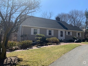
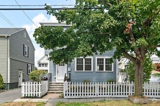
306 Grove St
Wellesley, MA 02482
Today
Favorites
617-893-6404
-
Bedrooms
4
-
Bathrooms
2
-
Square Feet
2,400 sq ft
-
Available
Available Now
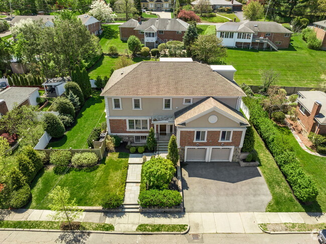
306 Grove St

Favorites
About This Home
$6,000 deposit,
Available Now
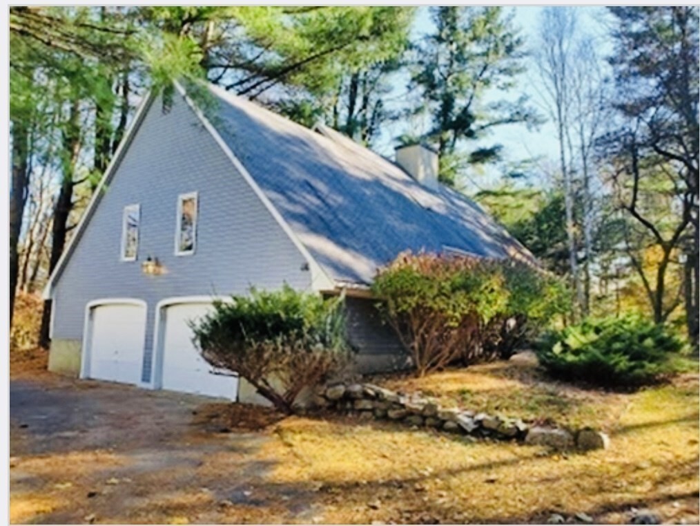
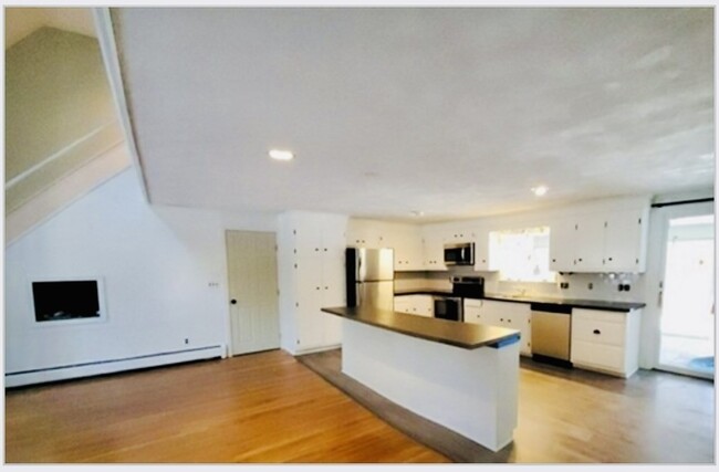
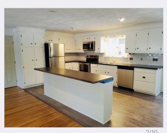
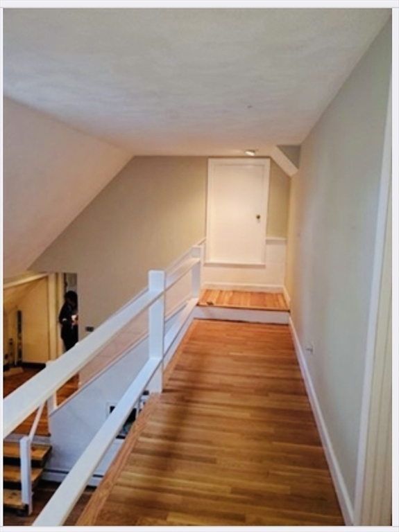
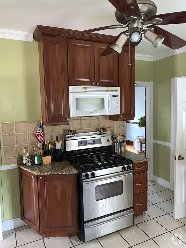
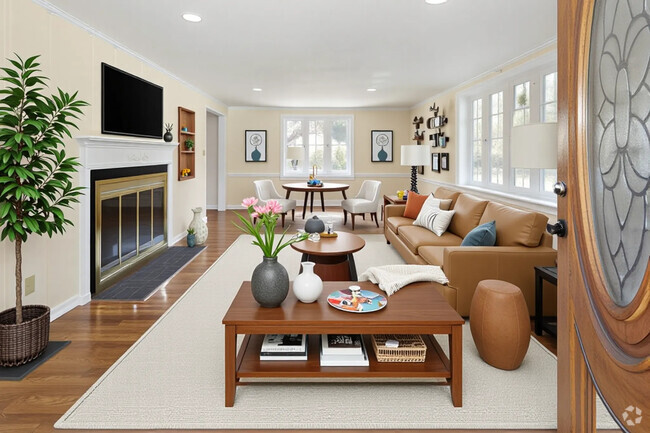
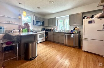
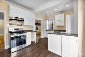
Perfect Wellesley location on a private,wooded,lot. 4 beds and 2 bathrooms on a half acre lot in one of Wellesley's best neighborhoods .Open layout kitchen with new stainless steel appliances with new kitchen island and countertops. Teo large main rooms with see-through fireplace,large windows,and screened in porch overlooking peaceful wooded backyard. Loft-like with skylights throughout,convenient two car garage and tons of basement storage. Two full bathrooms renovated whit double vanities. Four good sized bedrooms. Hunnewell school district,quiet,great neighbors. Prefer 1+ year lease but can be flexible for the right tenants.
306 Grove St is a house located in Norfolk County and the 02482 ZIP Code. This area is served by the Wellesley attendance zone.
* Price shown is base rent and may not include non-optional fees and utilities.
Price, availability, fees, and any applicable rent special are subject to change without notice.
* Square footage definitions vary. Displayed square footage is approximate.
Contact
- Listed by Samantha Berdinka | Donnelly + Co.
- Phone Number
-
Source
 MLS Property Information Network
The property listing data and information set forth herein were provided to MLS Property Information Network, Inc. from third party sources, including sellers, lessors and public records, and were compiled by MLS Property Information Network, Inc. The property listing data and information are for the personal, non-commercial use of consumers having a good faith interest in purchasing or leasing listed properties of the type displayed to them and may not be used for any purpose other than to identify prospective properties which such consumers may have a good faith interest in purchasing or leasing. MLS Property Information Network, Inc. and its subscribers disclaim any and all representations and warranties as to the accuracy of the property listing data and information set forth herein. All properties are subject to prior sale, change or withdrawal. Copyright © 2025 MLS Property Information Network, Inc. All rights reserved.
Location
Get Directions
Just west of Boston and East of Worcester sits Metro West, a region that houses a group of towns and cities with significant historical backgrounds. A total of 19 municipalities make up the core of this community, but other municipalities are considered to be a part of the Interstate 495/Metro West Corridor.
Learn more about living in Metro West
Education
| Colleges & Universities | Distance | ||
|---|---|---|---|
| Colleges & Universities | Distance | ||
| Drive: | 5 min | 1.6 mi | |
| Drive: | 6 min | 2.1 mi | |
| Drive: | 17 min | 7.6 mi | |
| Drive: | 19 min | 9.8 mi |
306 Grove St is within 5 minutes or 1.6 miles from Wellesley College. It is also near Babson College and Brandeis University.
Schools


Public Elementary School
Grades K-5
198 Students
Attendance Zone
Public Elementary School
Grades PK-5
699 Students
Nearby
Public Middle School
Grades 6-8
922 Students
Attendance Zone
Public High School
Grades 9-12
1,412 Students
Attendance Zone
Private Elementary School
Grades PK-6
191 Students
Nearby
Private Middle & High School
Grades 6-12
475 Students
Nearby
School data provided by
 The GreatSchools Rating helps parents compare schools within a state based on a variety of school quality indicators and provides a helpful picture of how effectively each school serves all of its students. Ratings are on a scale of 1 (below average) to 10 (above average) and can include test scores, college readiness, academic progress, advanced courses, equity, discipline and attendance data. We also advise parents to visit schools, consider other information on school performance and programs, and consider family needs as part of the school selection process.
View GreatSchools Rating Methodology
View GreatSchools Rating Methodology
Transportation options available in Wellesley include Woodland Station, located 5.1 miles from 306 Grove St. 306 Grove St is near General Edward Lawrence Logan International, located 19.1 miles or 32 minutes away, and Worcester Regional, located 33.3 miles or 57 minutes away.
| Transit / Subway | Distance | ||
|---|---|---|---|
| Transit / Subway | Distance | ||
|
|
Drive: | 10 min | 5.1 mi |
|
|
Drive: | 11 min | 5.2 mi |
|
|
Drive: | 11 min | 5.8 mi |
|
|
Drive: | 13 min | 6.4 mi |
|
|
Drive: | 13 min | 6.6 mi |
| Commuter Rail | Distance | ||
|---|---|---|---|
| Commuter Rail | Distance | ||
|
|
Drive: | 4 min | 1.7 mi |
|
|
Drive: | 5 min | 2.6 mi |
|
|
Drive: | 8 min | 3.6 mi |
|
|
Drive: | 9 min | 3.9 mi |
|
|
Drive: | 10 min | 4.5 mi |
| Airports | Distance | ||
|---|---|---|---|
| Airports | Distance | ||
|
General Edward Lawrence Logan International
|
Drive: | 32 min | 19.1 mi |
|
Worcester Regional
|
Drive: | 57 min | 33.3 mi |
Time and distance from 306 Grove St.
| Shopping Centers | Distance | ||
|---|---|---|---|
| Shopping Centers | Distance | ||
| Drive: | 4 min | 1.8 mi | |
| Drive: | 5 min | 1.9 mi | |
| Drive: | 5 min | 2.3 mi |
306 Grove St has 3 shopping centers within 2.3 miles, which is about a 5-minute drive. The miles and minutes will be for the farthest away property.
| Parks and Recreation | Distance | ||
|---|---|---|---|
| Parks and Recreation | Distance | ||
|
Whitin Observatory
|
Drive: | 5 min | 1.8 mi |
|
Horticultural Society at Elm Bank
|
Drive: | 5 min | 1.9 mi |
|
Lookout Farm
|
Drive: | 5 min | 2.3 mi |
|
Weezie's Garden for Children
|
Drive: | 8 min | 2.8 mi |
|
Elm Bank Reservation
|
Drive: | 8 min | 2.8 mi |
306 Grove St has 5 parks within 2.8 miles, including Whitin Observatory, Horticultural Society at Elm Bank, and Elm Bank Reservation.
| Hospitals | Distance | ||
|---|---|---|---|
| Hospitals | Distance | ||
| Drive: | 8 min | 3.6 mi | |
| Drive: | 9 min | 4.8 mi | |
| Drive: | 17 min | 8.0 mi |
306 Grove St has 3 hospitals within 8.0 miles, the nearest is Beth Israel Deaconess Hospital - Needham which is 3.6 miles away and a 8 minute drive.
| Military Bases | Distance | ||
|---|---|---|---|
| Military Bases | Distance | ||
| Drive: | 10 min | 5.0 mi | |
| Drive: | 27 min | 15.0 mi |
306 Grove St is 5.0 miles from US Military Reservation, and is convenient to other military bases, including Hanscom Air Force Base.
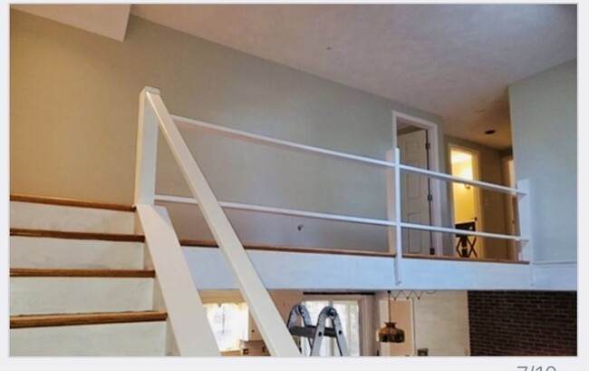
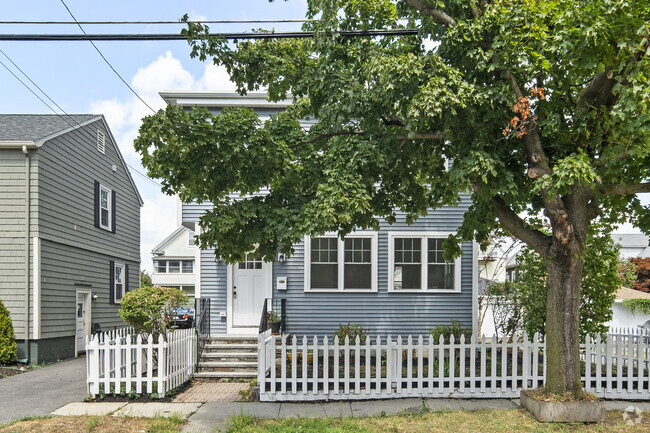
You May Also Like
Similar Rentals Nearby
What Are Walk Score®, Transit Score®, and Bike Score® Ratings?
Walk Score® measures the walkability of any address. Transit Score® measures access to public transit. Bike Score® measures the bikeability of any address.
What is a Sound Score Rating?
A Sound Score Rating aggregates noise caused by vehicle traffic, airplane traffic and local sources

306 Grove St
Wellesley, MA 02482