$1,650 / Month
307 Pershing Ave Unit 1
Carteret, NJ 07008
2 Weeks Ago
Favorites
307 Pershing Ave Unit 1

Favorites
Check Back Soon for Upcoming Availability
| Beds | Baths | Average SF |
|---|---|---|
| 2 Bedrooms 2 Bedrooms 2 Br | 1 Bath 1 Bath 1 Ba | — |
About This Property
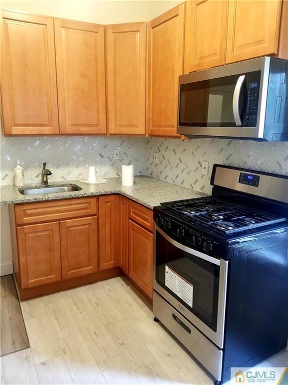
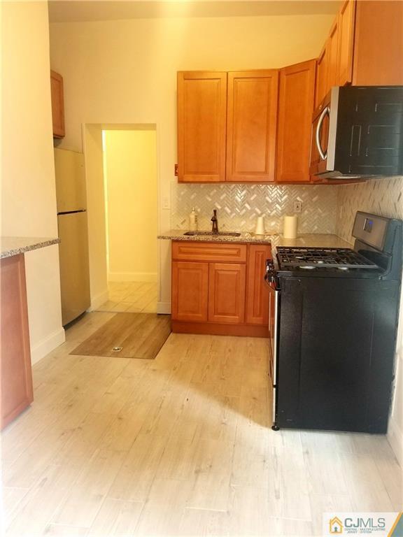
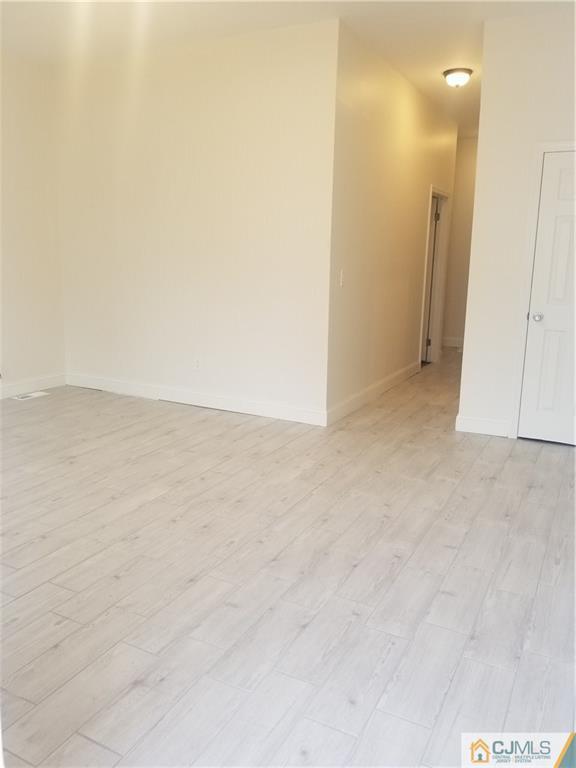
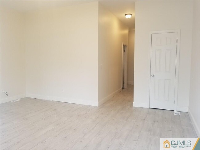
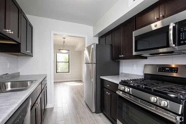
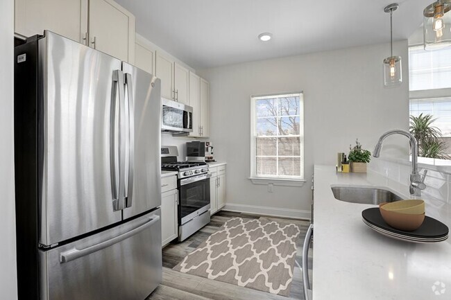
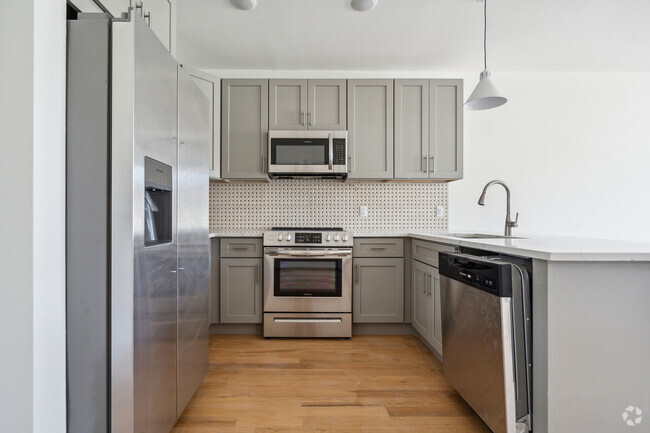
Welcome to the beautifully upgraded,2 bedroom apartment on the ground level. Stunning 10 foot ceilings,newly renovated bathroom and kitchen with brand new appliances and granite countertops. All new window treatments,walk-in closet in master bedroom,ready to move in. Great location ! One minute away from NY public transportation,close to many highways,parks,and fitness center.
307 Pershing Ave is an apartment community located in Middlesex County and the 07008 ZIP Code.
Features
Hardwood Floors
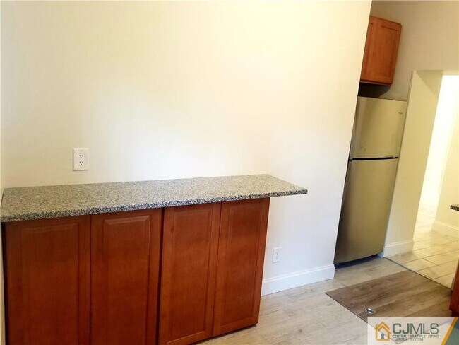
Granite Countertops
Microwave
Refrigerator
- Granite Countertops
- Kitchen
- Microwave
- Oven
- Range
- Refrigerator
- Breakfast Nook
- Hardwood Floors
- Tile Floors
- Family Room
Fees and Policies
The fees below are based on community-supplied data and may exclude additional fees and utilities.
- Parking
-
Street--
Details
Lease Options
-
12 Months
Location
Get Directions
Located directly across the Arthur Kill from Staten Island, Carteret was once part of the Woodbridge Township. It became the borough of Roosevelt in 1906 and was renamed Carteret in 1922. This popular community is bordered by the Rahway River to the north, Arthur Kill to the east, and the Ernest L. Oros Wildlife Preserve to the west. Due to its central location, the borough bills itself as the "Center of it All."
Residents enjoy a fantastic location and beautiful parks. Carteret Waterfront Park has a fishing pier and access to two hiking trails: Danielle's Garden Trail and the Waterfront Fitness Trail. Shopping in Carteret is plentiful -- the brick-paved sidewalks and outdoor cafes along Washington Avenue provide historic charm and locally-owned businesses, while the shops and restaurants along Roosevelt Avenue have a more modern feel. With just 22 miles to Manhattan, 10 miles to Newark, and 70 miles to Philadelphia, residents can easily commute to nearby cities.
Learn more about living in Carteret
Amenities
- Granite Countertops
- Kitchen
- Microwave
- Oven
- Range
- Refrigerator
- Breakfast Nook
- Hardwood Floors
- Tile Floors
- Family Room
Education
| Colleges & Universities | Distance | ||
|---|---|---|---|
| Colleges & Universities | Distance | ||
| Drive: | 14 min | 7.4 mi | |
| Drive: | 17 min | 9.0 mi | |
| Drive: | 18 min | 10.3 mi | |
| Drive: | 23 min | 13.2 mi |
307 Pershing Ave Unit 1 is within 14 minutes or 7.4 miles from Union County Coll., Elizabeth. It is also near Kean University and Coll. of Staten Island, CUNY.
Transportation options available in Carteret include 8Th Street Light Rail Station, located 11.9 miles from 307 Pershing Ave Unit 1. 307 Pershing Ave Unit 1 is near Newark Liberty International, located 13.5 miles or 21 minutes away, and Laguardia, located 30.9 miles or 50 minutes away.
| Transit / Subway | Distance | ||
|---|---|---|---|
| Transit / Subway | Distance | ||
| Drive: | 20 min | 11.9 mi | |
|
|
Drive: | 22 min | 13.1 mi |
|
|
Drive: | 21 min | 14.8 mi |
|
|
Drive: | 20 min | 14.8 mi |
|
|
Drive: | 26 min | 16.9 mi |
| Commuter Rail | Distance | ||
|---|---|---|---|
| Commuter Rail | Distance | ||
|
|
Drive: | 9 min | 4.3 mi |
|
|
Drive: | 9 min | 4.7 mi |
|
|
Drive: | 10 min | 5.2 mi |
|
|
Drive: | 21 min | 11.2 mi |
|
|
Drive: | 23 min | 12.6 mi |
| Airports | Distance | ||
|---|---|---|---|
| Airports | Distance | ||
|
Newark Liberty International
|
Drive: | 21 min | 13.5 mi |
|
Laguardia
|
Drive: | 50 min | 30.9 mi |
Time and distance from 307 Pershing Ave Unit 1.
| Shopping Centers | Distance | ||
|---|---|---|---|
| Shopping Centers | Distance | ||
| Walk: | 16 min | 0.8 mi | |
| Walk: | 19 min | 1.0 mi | |
| Drive: | 16 min | 9.7 mi |
307 Pershing Ave Unit 1 has 3 shopping centers within 9.7 miles, which is about a 16-minute walk. The miles and minutes will be for the farthest away property.
| Parks and Recreation | Distance | ||
|---|---|---|---|
| Parks and Recreation | Distance | ||
|
Liberty State Park
|
Drive: | 5 min | 1.9 mi |
|
Hawk Rise Sanctuary
|
Drive: | 12 min | 5.2 mi |
|
William T. Davis Wildlife Refuge
|
Drive: | 17 min | 10.5 mi |
|
Clay Pit Ponds State Park Preserve
|
Drive: | 22 min | 10.7 mi |
|
Freshkills Park
|
Drive: | 23 min | 13.4 mi |
307 Pershing Ave Unit 1 has 5 parks within 13.4 miles, including Liberty State Park, Hawk Rise Sanctuary, and William T. Davis Wildlife Refuge.
| Hospitals | Distance | ||
|---|---|---|---|
| Hospitals | Distance | ||
| Drive: | 12 min | 5.2 mi | |
| Drive: | 13 min | 7.1 mi | |
| Drive: | 14 min | 7.7 mi |
307 Pershing Ave Unit 1 has 3 hospitals within 7.7 miles, the nearest is Robert Wood Johnson University Hospital at Rahway which is 5.2 miles away and a 12 minute drive.
| Military Bases | Distance | ||
|---|---|---|---|
| Military Bases | Distance | ||
| Drive: | 19 min | 8.2 mi | |
| Drive: | 22 min | 9.0 mi | |
| Drive: | 27 min | 14.9 mi |
307 Pershing Ave Unit 1 has 3 military bases within 14.9 miles, the nearest is Ash Brook Reservation which is 8.2 miles away and a 19 minute drive.
You May Also Like
Similar Rentals Nearby


What Are Walk Score®, Transit Score®, and Bike Score® Ratings?
Walk Score® measures the walkability of any address. Transit Score® measures access to public transit. Bike Score® measures the bikeability of any address.
What is a Sound Score Rating?
A Sound Score Rating aggregates noise caused by vehicle traffic, airplane traffic and local sources

307 Pershing Ave
Carteret, NJ 07008