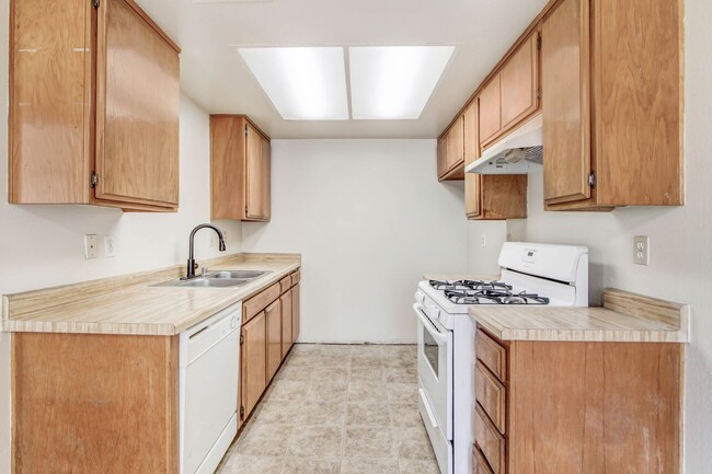
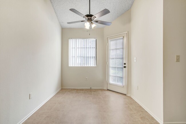
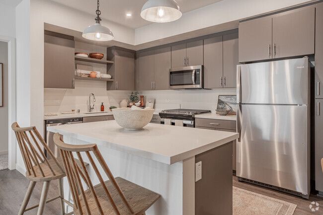
$2,495 / Month
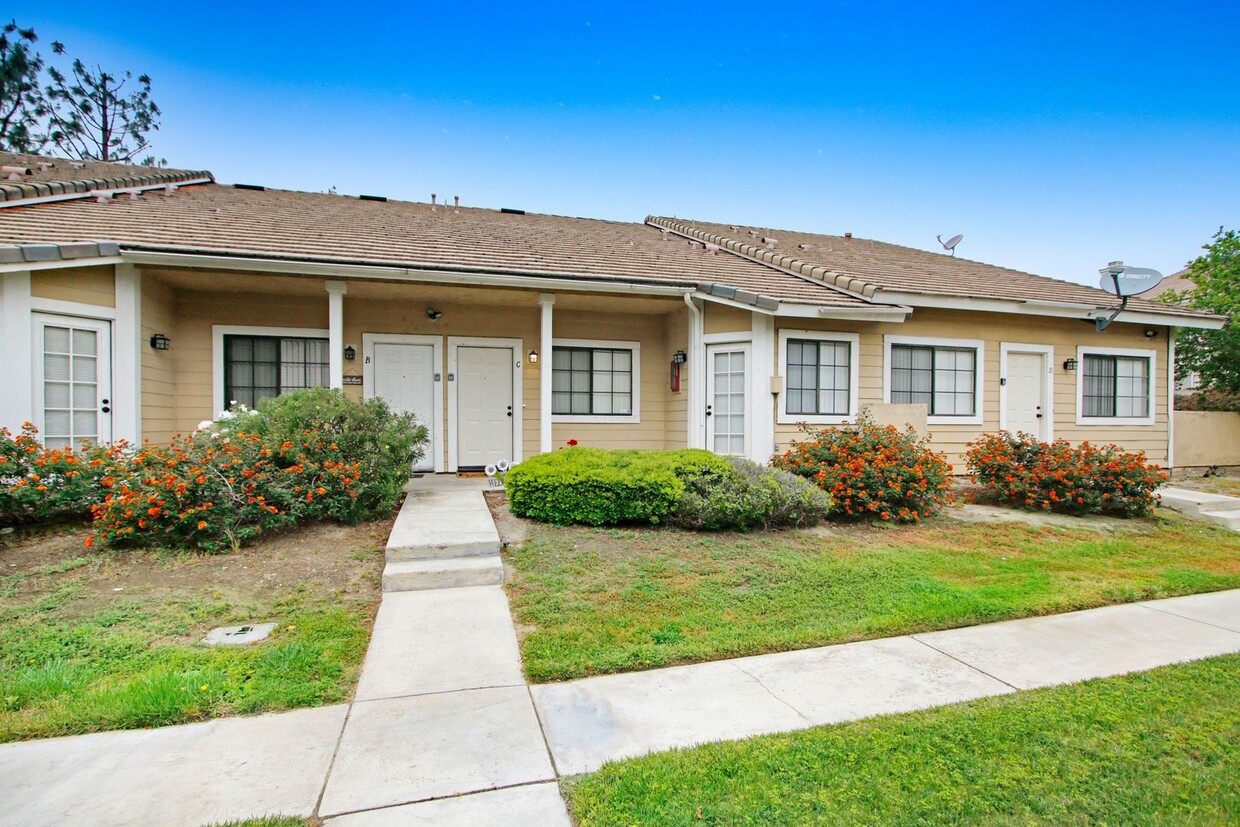
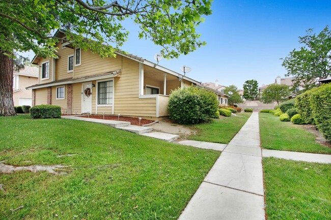
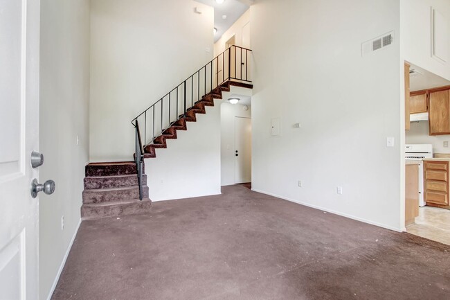
3107 Jaguar Way E Unit C
Ontario, CA 91764
2 Weeks Ago
Favorites
3107 Jaguar Way E Unit C

Favorites
Check Back Soon for Upcoming Availability
| Beds | Baths | Average SF |
|---|---|---|
| 2 Bedrooms 2 Bedrooms 2 Br | 2 Baths 2 Baths 2 Ba | 1,000 SF |
Location
Get Directions
Ontario is one of the busiest communities in the Inland Empire, with events and attractions drawing folks from all over southern California as well as locals. The city is a popular shopping destination, specifically the enormous Ontario Mills shopping mall. Next door to Ontario Mills, Citizens Business Bank Arena plays host to concerts and sporting events throughout the year, regularly drawing crowds of up to 11,000 people. Both of these attractions sit on the northeast corner of Ontario, as does the popular Cucamonga-Guasti Regional Park. Metrolink service connects Ontario to Riverside in the east (30 minutes) and Los Angeles in the west (roughly one hour).
Learn more about living in Ontario
Education
| Colleges & Universities | Distance | ||
|---|---|---|---|
| Colleges & Universities | Distance | ||
| Drive: | 11 min | 6.2 mi | |
| Drive: | 14 min | 8.9 mi | |
| Drive: | 15 min | 9.1 mi | |
| Drive: | 17 min | 11.6 mi |
3107 Jaguar Way E Unit C is within 11 minutes or 6.2 miles from Chaffey College. It is also near Pomona College and Claremont Graduate University.
Transportation options available in Ontario include Apu / Citrus College Station, located 22.8 miles from 3107 Jaguar Way E Unit C. 3107 Jaguar Way E Unit C is near Ontario International, located 2.0 miles or 5 minutes away, and John Wayne/Orange County, located 43.8 miles or 54 minutes away.
| Transit / Subway | Distance | ||
|---|---|---|---|
| Transit / Subway | Distance | ||
| Drive: | 31 min | 22.8 mi | |
| Drive: | 30 min | 23.4 mi | |
| Drive: | 32 min | 24.6 mi | |
| Drive: | 34 min | 27.1 mi | |
| Drive: | 36 min | 28.5 mi |
| Commuter Rail | Distance | ||
|---|---|---|---|
| Commuter Rail | Distance | ||
|
|
Drive: | 6 min | 3.0 mi |
|
|
Drive: | 7 min | 3.2 mi |
|
|
Drive: | 8 min | 4.7 mi |
|
|
Drive: | 8 min | 4.8 mi |
|
|
Drive: | 11 min | 7.5 mi |
| Airports | Distance | ||
|---|---|---|---|
| Airports | Distance | ||
|
Ontario International
|
Drive: | 5 min | 2.0 mi |
|
John Wayne/Orange County
|
Drive: | 54 min | 43.8 mi |
Time and distance from 3107 Jaguar Way E Unit C.
| Shopping Centers | Distance | ||
|---|---|---|---|
| Shopping Centers | Distance | ||
| Walk: | 13 min | 0.7 mi | |
| Walk: | 16 min | 0.9 mi | |
| Walk: | 18 min | 0.9 mi |
3107 Jaguar Way E Unit C has 3 shopping centers within 0.9 mile, which is about a 18-minute walk. The miles and minutes will be for the farthest away property.
| Parks and Recreation | Distance | ||
|---|---|---|---|
| Parks and Recreation | Distance | ||
|
Pitzer College Arboretum
|
Drive: | 14 min | 8.8 mi |
|
Millikan Planetarium
|
Drive: | 14 min | 8.9 mi |
|
Mary Vagle Nature Center
|
Drive: | 15 min | 10.1 mi |
|
Rancho Santa Ana Botanic Garden
|
Drive: | 15 min | 10.2 mi |
|
Chino Creek Wetlands and Educational Park
|
Drive: | 19 min | 12.1 mi |
3107 Jaguar Way E Unit C has 5 parks within 12.1 miles, including Pitzer College Arboretum, Millikan Planetarium, and Mary Vagle Nature Center.
| Hospitals | Distance | ||
|---|---|---|---|
| Hospitals | Distance | ||
| Drive: | 9 min | 5.0 mi | |
| Drive: | 10 min | 6.8 mi | |
| Drive: | 15 min | 9.3 mi |
3107 Jaguar Way E Unit C has 3 hospitals within 9.3 miles, the nearest is San Antonio Regional Hospital which is 5.0 miles away and a 9 minute drive.
| Military Bases | Distance | ||
|---|---|---|---|
| Military Bases | Distance | ||
| Drive: | 47 min | 27.9 mi |
3107 Jaguar Way E Unit C is 27.9 miles and a 47 minute drive from March Air Reserve Base.
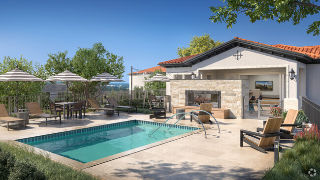
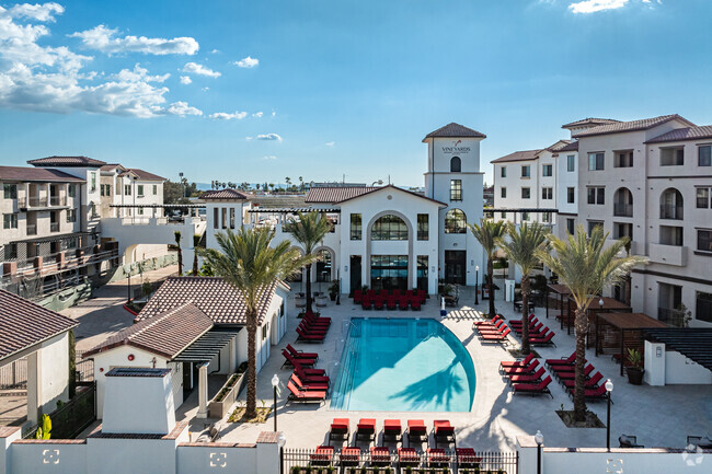
You May Also Like
Similar Rentals Nearby
-
-
-
-
-
-
-
-
-
-
1 / 13


What Are Walk Score®, Transit Score®, and Bike Score® Ratings?
Walk Score® measures the walkability of any address. Transit Score® measures access to public transit. Bike Score® measures the bikeability of any address.
What is a Sound Score Rating?
A Sound Score Rating aggregates noise caused by vehicle traffic, airplane traffic and local sources

3107 Jaguar Way E
Ontario, CA 91764