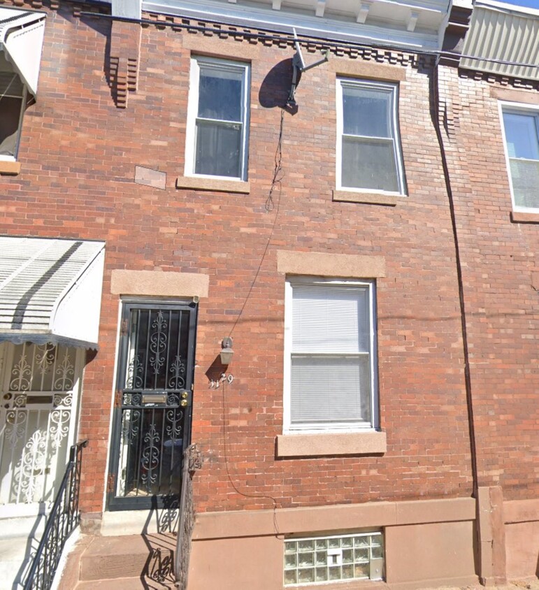
3129 N Bambrey St
Philadelphia, PA 19132
-
Bedrooms
2
-
Bathrooms
1
-
Square Feet
900 sq ft
-
Available
Available Now

Contact
- Phone Number (484) 562-6728
- Contact
Allegheny West, a neighborhood in North Philadelphia, sits three miles north of the Liberty Bell in the downtown portion of the city. Featuring a wide range of housing options that include apartments, single family homes, and townhomes, residents enjoy living in a central location surrounded by multiple bus lines just minutes from U.S. Route 13.
The neighborhood incorporates several vacant industrial sites that found new function as locations for film and television productions. Bordered to the northwest by the Roosevelt Expressway, to the east by Schuylkill River, to the south by West Lehigh Avenue, and with a portion of North Broad Street to the east, Allegheny West is considered one of North Philly's most affordable neighborhoods.
Learn more about living in Allegheny West| Colleges & Universities | Distance | ||
|---|---|---|---|
| Colleges & Universities | Distance | ||
| Drive: | 4 min | 1.6 mi | |
| Drive: | 5 min | 2.0 mi | |
| Drive: | 5 min | 2.0 mi | |
| Drive: | 8 min | 2.6 mi |
Transportation options available in Philadelphia include Allegheny (Bss), located 1.4 miles from 3129 N Bambrey St. 3129 N Bambrey St is near Philadelphia International, located 15.0 miles or 29 minutes away, and Trenton Mercer, located 32.9 miles or 52 minutes away.
| Transit / Subway | Distance | ||
|---|---|---|---|
| Transit / Subway | Distance | ||
|
|
Drive: | 3 min | 1.4 mi |
|
|
Drive: | 5 min | 2.0 mi |
|
|
Drive: | 5 min | 2.0 mi |
|
|
Drive: | 5 min | 2.2 mi |
|
|
Drive: | 7 min | 2.6 mi |
| Commuter Rail | Distance | ||
|---|---|---|---|
| Commuter Rail | Distance | ||
|
|
Walk: | 9 min | 0.5 mi |
|
|
Drive: | 4 min | 1.6 mi |
|
|
Drive: | 5 min | 1.7 mi |
|
|
Drive: | 4 min | 1.8 mi |
|
|
Drive: | 5 min | 1.9 mi |
| Airports | Distance | ||
|---|---|---|---|
| Airports | Distance | ||
|
Philadelphia International
|
Drive: | 29 min | 15.0 mi |
|
Trenton Mercer
|
Drive: | 52 min | 32.9 mi |
Time and distance from 3129 N Bambrey St.
| Shopping Centers | Distance | ||
|---|---|---|---|
| Shopping Centers | Distance | ||
| Walk: | 14 min | 0.7 mi | |
| Walk: | 14 min | 0.7 mi | |
| Walk: | 18 min | 1.0 mi |
| Parks and Recreation | Distance | ||
|---|---|---|---|
| Parks and Recreation | Distance | ||
|
Wagner Free Institute of Science
|
Drive: | 7 min | 2.6 mi |
|
Philadelphia Zoo
|
Drive: | 11 min | 3.8 mi |
|
Shofuso - Japanese House and Garden
|
Drive: | 9 min | 3.8 mi |
|
Fairmount Park
|
Drive: | 10 min | 3.9 mi |
|
Please Touch Museum
|
Drive: | 9 min | 4.1 mi |
| Hospitals | Distance | ||
|---|---|---|---|
| Hospitals | Distance | ||
| Drive: | 4 min | 1.6 mi | |
| Drive: | 4 min | 1.8 mi | |
| Drive: | 6 min | 3.0 mi |
| Military Bases | Distance | ||
|---|---|---|---|
| Military Bases | Distance | ||
| Drive: | 20 min | 10.6 mi |
3129 N Bambrey St Photos
What Are Walk Score®, Transit Score®, and Bike Score® Ratings?
Walk Score® measures the walkability of any address. Transit Score® measures access to public transit. Bike Score® measures the bikeability of any address.
What is a Sound Score Rating?
A Sound Score Rating aggregates noise caused by vehicle traffic, airplane traffic and local sources

3129 N Bambrey St
Philadelphia, PA 19132