$3,099 / Month
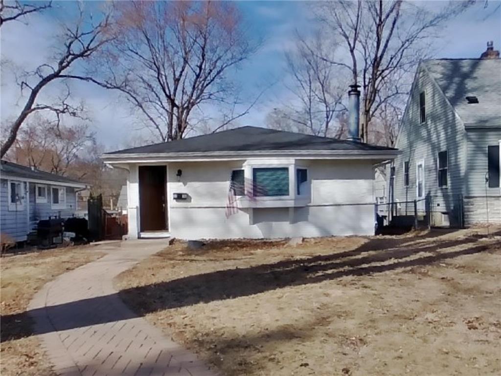
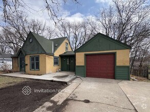
3136 Nevada Ave S
Minneapolis, MN 55426
Today
Favorites
469-921-3368
-
Bedrooms
4
-
Bathrooms
3
-
Square Feet
1,836 sq ft
-
Available
Available Now
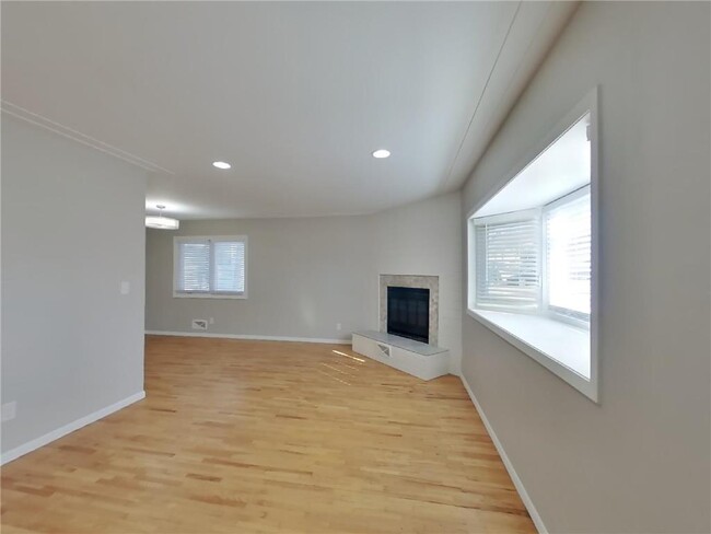
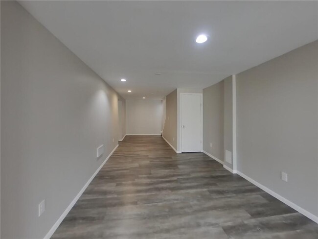
Highlights
- Fireplace
- Basement
3136 Nevada Ave S

Favorites
About This Home
$3,099 deposit,
Available Now
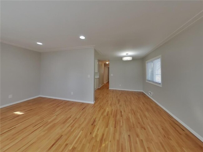
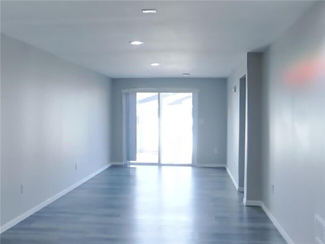
Take a look at this beautiful home featuring 4 bedrooms, 2.5 bathrooms, and approximately 1,836 square feet. Enjoy the freedom of a virtually maintenance free lifestyle while residing in a great community.
3136 Nevada Ave S is a house located in Hennepin County and the 55426 ZIP Code. This area is served by the St. Louis Park Public School Dist. attendance zone.
* Price shown is base rent and may not include non-optional fees and utilities.
Price, availability, fees, and any applicable rent special are subject to change without notice.
* Square footage definitions vary. Displayed square footage is approximate.
House Features
Washer/Dryer
Air Conditioning
Fireplace
Heating
- Washer/Dryer
- Air Conditioning
- Heating
- Fireplace
- Basement
Fees and Policies
The fees below are based on community-supplied data and may exclude additional fees and utilities.
- Parking
-
Garage--
Contact
- Listed by Anu Rettig | TAH Minnesota LLC
- Phone Number
- Contact
-
Source
 NorthstarMLS®
Copyright © 2025 Regional Multiple Listing Service of Minnesota [NorthStarMLS]. All rights reserved. All information provided by the listing agent/broker is deemed reliable but is not guaranteed and should be independently verified.
Location
Get Directions
Amenities
- Washer/Dryer
- Air Conditioning
- Heating
- Fireplace
- Basement
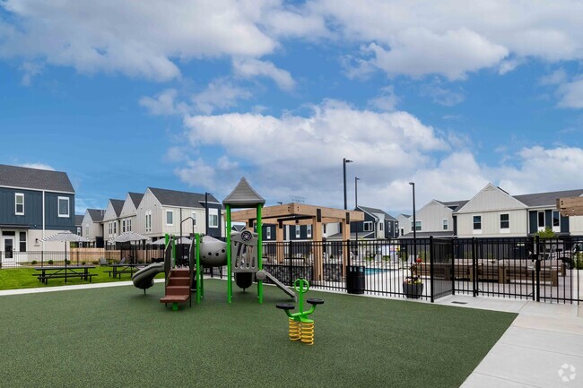
Heavily wooded and emerald green, living in Oak Hill is like living in a park. In fact, parks make up much of the neighborhood -- especially its namesake Oak Hill Park. This popular park features ball fields, basketball courts, hiking trails, and a splash pad. In winter, sledding and ice skating are popular activities. Oak Hill Park connects with Louisiana Oaks, a park with a cross-country ski trail and walking trail, ball fields, and a playground. Oregon Park and Walker Park round out the ample park space in the neighborhood.
Saint Louis Park is a suburb of Minneapolis on the city's southwest side. From an apartment in Oak Hill, you'll enjoy a short, six-mile commute via I-394. You'll find a variety of shops and restaurants just outside the neighborhood along Highway 7, including the popular Shoppes at Knollwod, which includes a Nordstrom Rack, Cub Foods, TJ Maxx, and DSW.
Learn more about living in Oak Hill
Education
| Colleges & Universities | Distance | ||
|---|---|---|---|
| Colleges & Universities | Distance | ||
| Drive: | 11 min | 6.2 mi | |
| Drive: | 12 min | 6.7 mi | |
| Drive: | 14 min | 7.5 mi | |
| Drive: | 15 min | 9.5 mi |
3136 Nevada Ave S is within 11 minutes or 6.2 miles from Minneapolis College. It is also near University of St. Thomas and North Central University.
Schools


Public Elementary School
Grades K-5
526 Students
Attendance Zone
Public Elementary School
Grades PK-6
131 Students
Nearby
Public Middle School
Grades 6-8
956 Students
Attendance Zone
Public High School
Grades 9-12
1,483 Students
Attendance Zone
Private Elementary & Middle School
Grades PK-8
178 Students
Nearby
Private Elementary, Middle & High School
Grades 2-12
267 Students
Nearby
Private Middle School
Grades 8
Nearby
School data provided by
 The GreatSchools Rating helps parents compare schools within a state based on a variety of school quality indicators and provides a helpful picture of how effectively each school serves all of its students. Ratings are on a scale of 1 (below average) to 10 (above average) and can include test scores, college readiness, academic progress, advanced courses, equity, discipline and attendance data. We also advise parents to visit schools, consider other information on school performance and programs, and consider family needs as part of the school selection process.
View GreatSchools Rating Methodology
View GreatSchools Rating Methodology
Transportation options available in Minneapolis include Target Field Station, located 7.0 miles from 3136 Nevada Ave S. 3136 Nevada Ave S is near Minneapolis-St Paul International/Wold-Chamberlain, located 16.0 miles or 24 minutes away.
| Transit / Subway | Distance | ||
|---|---|---|---|
| Transit / Subway | Distance | ||
|
|
Drive: | 12 min | 7.0 mi |
|
|
Drive: | 12 min | 7.0 mi |
| Drive: | 12 min | 7.1 mi | |
|
|
Drive: | 13 min | 7.2 mi |
|
|
Drive: | 13 min | 7.6 mi |
| Commuter Rail | Distance | ||
|---|---|---|---|
| Commuter Rail | Distance | ||
|
|
Drive: | 13 min | 7.2 mi |
|
|
Drive: | 20 min | 13.1 mi |
|
|
Drive: | 26 min | 17.3 mi |
|
|
Drive: | 30 min | 20.4 mi |
|
|
Drive: | 33 min | 22.2 mi |
| Airports | Distance | ||
|---|---|---|---|
| Airports | Distance | ||
|
Minneapolis-St Paul International/Wold-Chamberlain
|
Drive: | 24 min | 16.0 mi |
Time and distance from 3136 Nevada Ave S.
| Shopping Centers | Distance | ||
|---|---|---|---|
| Shopping Centers | Distance | ||
| Walk: | 11 min | 0.6 mi | |
| Walk: | 13 min | 0.7 mi | |
| Walk: | 17 min | 0.9 mi |
3136 Nevada Ave S has 3 shopping centers within 0.9 mile, which is about a 17-minute walk. The miles and minutes will be for the farthest away property.
| Parks and Recreation | Distance | ||
|---|---|---|---|
| Parks and Recreation | Distance | ||
|
Westwood Hills Nature Center
|
Drive: | 6 min | 2.0 mi |
|
Cedar Lake Park
|
Drive: | 8 min | 3.3 mi |
|
Brownie Lake
|
Drive: | 10 min | 4.2 mi |
|
Linden Hills Park
|
Drive: | 10 min | 4.3 mi |
|
Quaking Bog
|
Drive: | 9 min | 4.6 mi |
3136 Nevada Ave S has 5 parks within 4.6 miles, including Westwood Hills Nature Center, Cedar Lake Park, and Brownie Lake.
| Hospitals | Distance | ||
|---|---|---|---|
| Hospitals | Distance | ||
| Drive: | 4 min | 2.0 mi | |
| Drive: | 15 min | 6.0 mi | |
| Drive: | 11 min | 7.2 mi |
3136 Nevada Ave S has 3 hospitals within 7.2 miles, the nearest is Park Nicollet Methodist Hospital which is 2.0 miles away and a 4 minute drive.
| Military Bases | Distance | ||
|---|---|---|---|
| Military Bases | Distance | ||
| Drive: | 21 min | 14.3 mi |
3136 Nevada Ave S is 14.3 miles and a 21 minute drive from Fort Snelling Military Reservation.
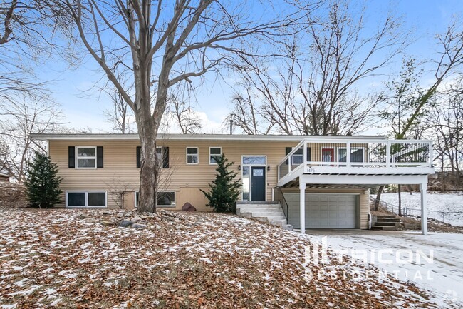
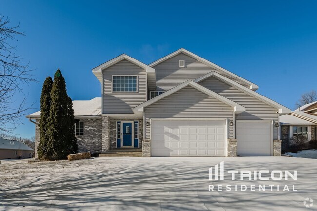
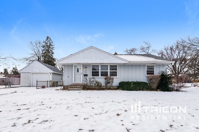
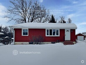
You May Also Like
Similar Rentals Nearby
What Are Walk Score®, Transit Score®, and Bike Score® Ratings?
Walk Score® measures the walkability of any address. Transit Score® measures access to public transit. Bike Score® measures the bikeability of any address.
What is a Sound Score Rating?
A Sound Score Rating aggregates noise caused by vehicle traffic, airplane traffic and local sources

3136 Nevada Ave S
Minneapolis, MN 55426