
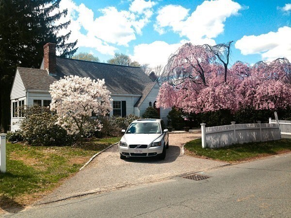
32 Clifford St
Wellesley, MA 02482
-
Bedrooms
3
-
Bathrooms
2
-
Square Feet
1,696 sq ft
-
Available
Available Jul 1

32 Clifford St is a townhome located in Norfolk County and the 02482 ZIP Code. This area is served by the Wellesley attendance zone.
Townhome Features
- Lavadora/Secadora
Contact
- Contact
Just west of Boston and East of Worcester sits Metro West, a region that houses a group of towns and cities with significant historical backgrounds. A total of 19 municipalities make up the core of this community, but other municipalities are considered to be a part of the Interstate 495/Metro West Corridor.
Learn more about living in Metro West| Colleges & Universities | Distance | ||
|---|---|---|---|
| Colleges & Universities | Distance | ||
| Drive: | 3 min | 1.3 mi | |
| Drive: | 5 min | 1.8 mi | |
| Drive: | 14 min | 6.0 mi | |
| Drive: | 15 min | 8.2 mi |


View GreatSchools Rating Methodology
Transportation options available in Wellesley include Woodland Station, located 3.5 miles from 32 Clifford St. 32 Clifford St is near General Edward Lawrence Logan International, located 17.5 miles or 29 minutes away, and Worcester Regional, located 32.6 miles or 55 minutes away.
| Transit / Subway | Distance | ||
|---|---|---|---|
| Transit / Subway | Distance | ||
|
|
Drive: | 7 min | 3.5 mi |
|
|
Drive: | 8 min | 3.6 mi |
|
|
Drive: | 8 min | 4.2 mi |
|
|
Drive: | 10 min | 4.8 mi |
|
|
Drive: | 10 min | 5.0 mi |
| Commuter Rail | Distance | ||
|---|---|---|---|
| Commuter Rail | Distance | ||
|
|
Walk: | 18 min | 1.0 mi |
|
|
Walk: | 19 min | 1.0 mi |
|
|
Drive: | 5 min | 2.3 mi |
|
|
Drive: | 5 min | 3.0 mi |
|
|
Drive: | 7 min | 3.0 mi |
| Airports | Distance | ||
|---|---|---|---|
| Airports | Distance | ||
|
General Edward Lawrence Logan International
|
Drive: | 29 min | 17.5 mi |
|
Worcester Regional
|
Drive: | 55 min | 32.6 mi |
Time and distance from 32 Clifford St.
| Shopping Centers | Distance | ||
|---|---|---|---|
| Shopping Centers | Distance | ||
| Walk: | 4 min | 0.2 mi | |
| Walk: | 12 min | 0.6 mi | |
| Walk: | 15 min | 0.8 mi |
| Parks and Recreation | Distance | ||
|---|---|---|---|
| Parks and Recreation | Distance | ||
|
Whitin Observatory
|
Drive: | 4 min | 1.3 mi |
|
Wellesley College Botanic Gardens
|
Drive: | 3 min | 1.6 mi |
|
Weezie's Garden for Children
|
Drive: | 8 min | 3.1 mi |
|
Elm Bank Reservation
|
Drive: | 8 min | 3.1 mi |
|
Horticultural Society at Elm Bank
|
Drive: | 10 min | 3.2 mi |
| Hospitals | Distance | ||
|---|---|---|---|
| Hospitals | Distance | ||
| Drive: | 6 min | 3.2 mi | |
| Drive: | 6 min | 3.2 mi | |
| Drive: | 13 min | 6.4 mi |
| Military Bases | Distance | ||
|---|---|---|---|
| Military Bases | Distance | ||
| Drive: | 9 min | 4.4 mi | |
| Drive: | 24 min | 13.4 mi |
- Lavadora/Secadora
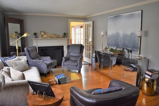
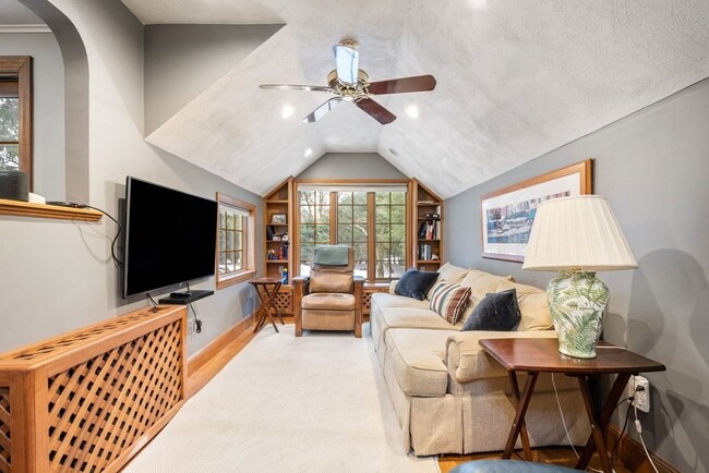
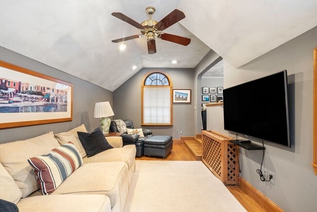
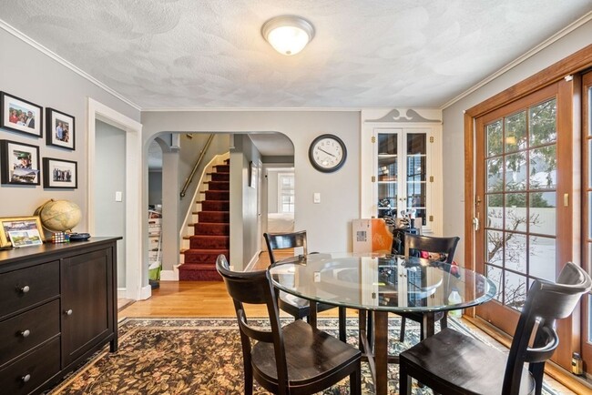
32 Clifford St Photos
What Are Walk Score®, Transit Score®, and Bike Score® Ratings?
Walk Score® measures the walkability of any address. Transit Score® measures access to public transit. Bike Score® measures the bikeability of any address.
What is a Sound Score Rating?
A Sound Score Rating aggregates noise caused by vehicle traffic, airplane traffic and local sources
32 Clifford St
Wellesley, MA 02482