
$1,100 / Month
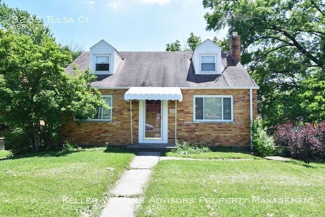
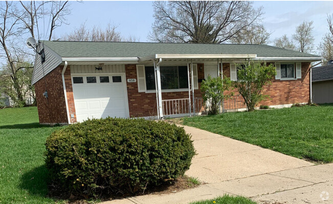
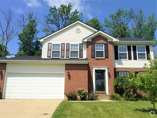
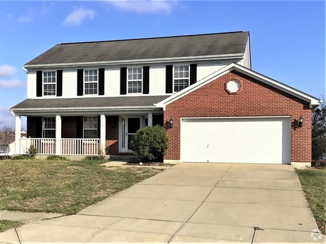
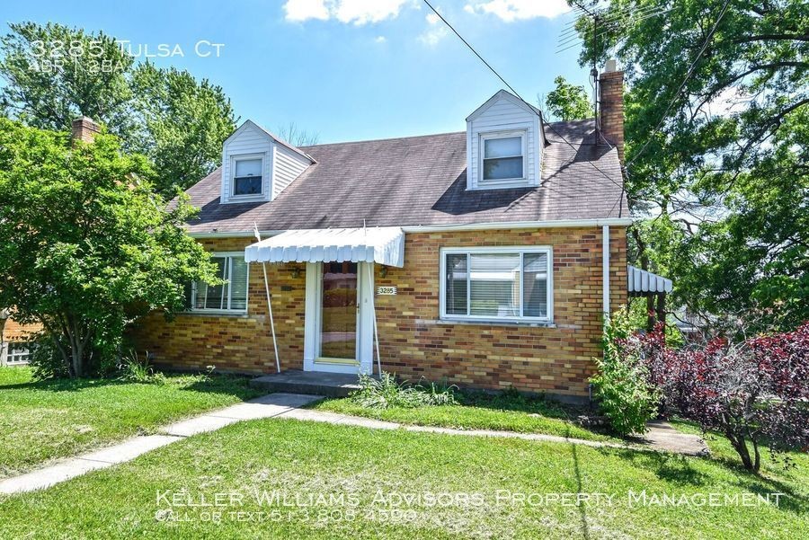
3285 Tulsa Ct
Cincinnati, OH 45238
2 Weeks Ago
Favorites
3285 Tulsa Ct

Favorites
Check Back Soon for Upcoming Availability
| Beds | Baths | Average SF |
|---|---|---|
| 4 Bedrooms 4 Bedrooms 4 Br | 1 Bath 1 Bath 1 Ba | 1,341 SF |
About This Property
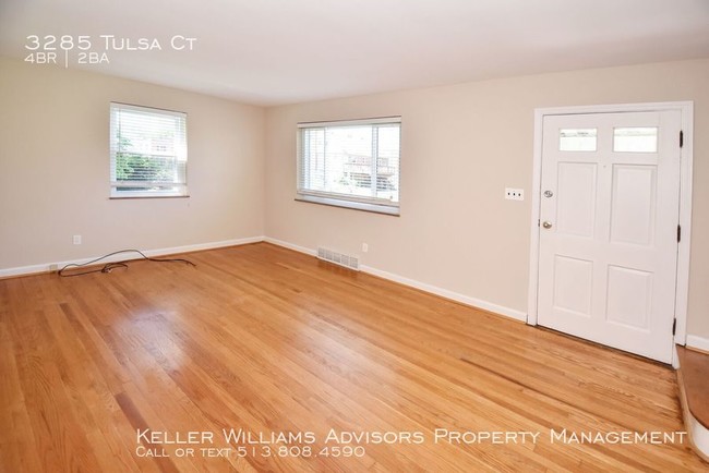
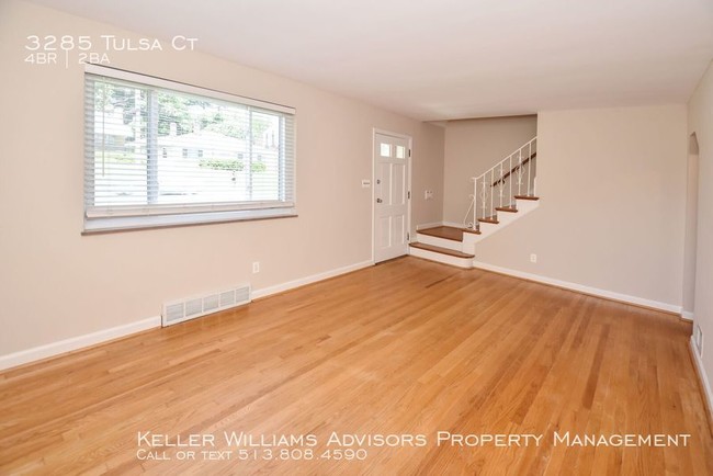
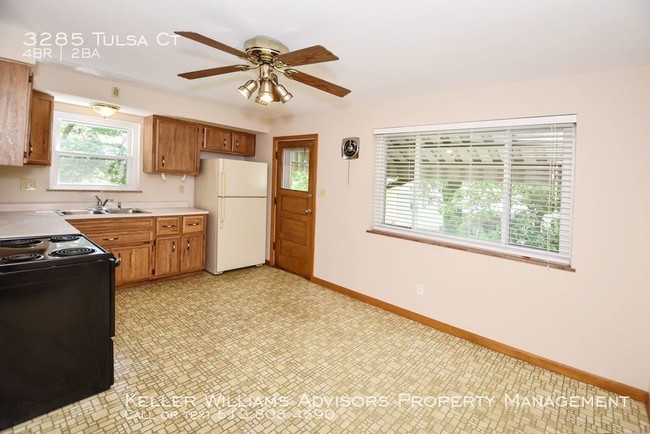
---- SCHEDULE A SHOWING ONLINE AT: http://showmojo.com/lac/c34de0f042 ---- Such an adorable little house with beautiful hardwood floors, eat-in kitchen, deep yard and an attached garage. Four bedrooms! Pets permitted with some breed restrictions, pet rent, and nonrefundable pet fee. Renter's insurance required.
3285 Tulsa Ct is a house located in Hamilton County and the 45238 ZIP Code. This area is served by the Cincinnati Public Schools attendance zone.
Unique Features
- SharedYard
House Features
Air Conditioning
Washer/Dryer Hookup
Hardwood Floors
Refrigerator
- Washer/Dryer Hookup
- Air Conditioning
- Eat-in Kitchen
- Kitchen
- Refrigerator
- Hardwood Floors
Fees and Policies
The fees below are based on community-supplied data and may exclude additional fees and utilities.
- Dogs Allowed
-
Fees not specified
- Cats Allowed
-
Fees not specified
- Parking
-
Garage--
-
Other--
Location
Get Directions
Situated about five miles northwest of Downtown Cincinnati, Westwood is the largest neighborhood in the city. Residents flock to Westwood for its many affordable historic homes and modern apartments available for rent in addition to its close proximity to I-74, I-75, and all that Downtown Cincinnati has to offer.
While Westwood is a predominantly residential neighborhood, it is also home to a slew of convenient stores and restaurants. Shopping opportunities abound in Westwood, with plenty of national retailers in Western Hills Plaza and local shops in the growing Town Hall District. Numerous neighborhood parks provide ample space to enjoy the outdoors in town as well as the sprawling 1,400-acre Mount Airy Forest, which is partially located in Westwood.
Learn more about living in WestwoodBelow are rent ranges for similar nearby apartments
| Beds | Average Size | Lowest | Typical | Premium |
|---|---|---|---|---|
| Studio Studio Studio | 438 Sq Ft | $695 | $745 | $795 |
| 1 Bed 1 Bed 1 Bed | 633-640 Sq Ft | $600 | $836 | $1,300 |
| 2 Beds 2 Beds 2 Beds | 849-851 Sq Ft | $775 | $1,136 | $1,665 |
| 3 Beds 3 Beds 3 Beds | 1354-1358 Sq Ft | $1,250 | $1,580 | $2,000 |
| 4 Beds 4 Beds 4 Beds | 1586 Sq Ft | $1,515 | $1,816 | $2,350 |
Amenities
- Washer/Dryer Hookup
- Air Conditioning
- Eat-in Kitchen
- Kitchen
- Refrigerator
- Hardwood Floors
- SharedYard
Education
| Colleges & Universities | Distance | ||
|---|---|---|---|
| Colleges & Universities | Distance | ||
| Drive: | 10 min | 4.3 mi | |
| Drive: | 17 min | 7.0 mi | |
| Drive: | 16 min | 7.2 mi | |
| Drive: | 17 min | 7.7 mi |
3285 Tulsa Ct is within 10 minutes or 4.3 miles from College of Mount St. Joseph. It is also near Cincinnati State and University of Cincinnati.
Schools


Public Elementary & Middle School
Grades PK-7 & 9
561 Students
Attendance Zone
Public Middle & High School
Grades 6-12
1,418 Students
Attendance Zone
Public Middle & High School
Grades 7-12
897 Students
Attendance Zone
Private Elementary & Middle School
Grades PK-8
381 Students
Nearby
Private Elementary & Middle School
Grades K-8
308 Students
Nearby
Private High School
Grades 9-12
495 Students
Nearby
School data provided by
 The GreatSchools Rating helps parents compare schools within a state based on a variety of school quality indicators and provides a helpful picture of how effectively each school serves all of its students. Ratings are on a scale of 1 (below average) to 10 (above average) and can include test scores, college readiness, academic progress, advanced courses, equity, discipline and attendance data. We also advise parents to visit schools, consider other information on school performance and programs, and consider family needs as part of the school selection process.
View GreatSchools Rating Methodology
View GreatSchools Rating Methodology
Transportation options available in Cincinnati include Brewery District Station, Elm & Henry, located 5.8 miles from 3285 Tulsa Ct. 3285 Tulsa Ct is near Cincinnati/Northern Kentucky International, located 20.2 miles or 39 minutes away.
| Transit / Subway | Distance | ||
|---|---|---|---|
| Transit / Subway | Distance | ||
| Drive: | 14 min | 5.8 mi | |
| Drive: | 15 min | 6.0 mi | |
| Drive: | 15 min | 6.1 mi | |
| Drive: | 15 min | 6.2 mi | |
| Drive: | 15 min | 6.4 mi |
| Commuter Rail | Distance | ||
|---|---|---|---|
| Commuter Rail | Distance | ||
|
|
Drive: | 15 min | 6.1 mi |
| Airports | Distance | ||
|---|---|---|---|
| Airports | Distance | ||
|
Cincinnati/Northern Kentucky International
|
Drive: | 39 min | 20.2 mi |
Time and distance from 3285 Tulsa Ct.
| Shopping Centers | Distance | ||
|---|---|---|---|
| Shopping Centers | Distance | ||
| Walk: | 7 min | 0.4 mi | |
| Walk: | 12 min | 0.7 mi | |
| Walk: | 15 min | 0.8 mi |
3285 Tulsa Ct has 3 shopping centers within 0.8 mile, which is about a 15-minute walk. The miles and minutes will be for the farthest away property.
| Parks and Recreation | Distance | ||
|---|---|---|---|
| Parks and Recreation | Distance | ||
|
Imago Earth Center
|
Drive: | 10 min | 3.7 mi |
|
Embshoff Woods
|
Drive: | 13 min | 4.2 mi |
|
Wilson Commons
|
Drive: | 13 min | 4.4 mi |
|
Mt. Airy Forest
|
Drive: | 11 min | 4.4 mi |
|
Cincinnati History Museum
|
Drive: | 15 min | 6.1 mi |
3285 Tulsa Ct has 5 parks within 6.1 miles, including Imago Earth Center, Embshoff Woods, and Wilson Commons.
| Hospitals | Distance | ||
|---|---|---|---|
| Hospitals | Distance | ||
| Drive: | 11 min | 4.5 mi | |
| Drive: | 14 min | 6.5 mi | |
| Drive: | 17 min | 6.9 mi |
3285 Tulsa Ct has 3 hospitals within 6.9 miles, the nearest is Mercy Health - West Hospital which is 4.5 miles away and a 11 minute drive.
| Military Bases | Distance | ||
|---|---|---|---|
| Military Bases | Distance | ||
| Drive: | 77 min | 56.7 mi | |
| Drive: | 83 min | 61.8 mi | |
| Drive: | 85 min | 65.1 mi |
3285 Tulsa Ct has 3 military bases within 65.1 miles, the nearest is Gentile Air Force Station which is 56.7 miles away and a 77 minute drive.
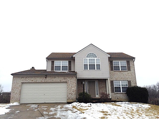
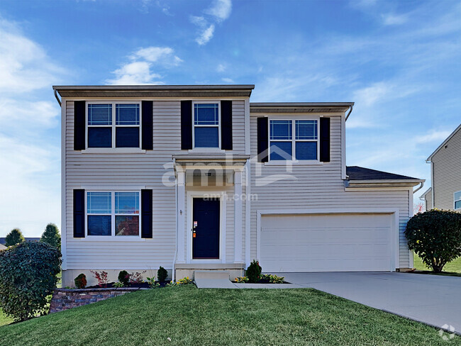
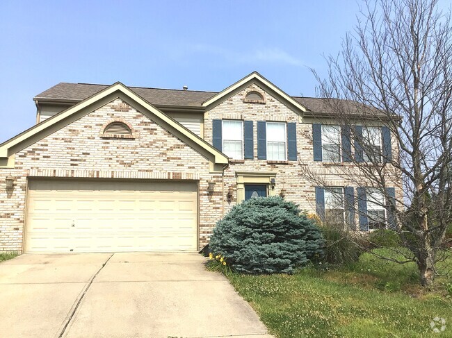
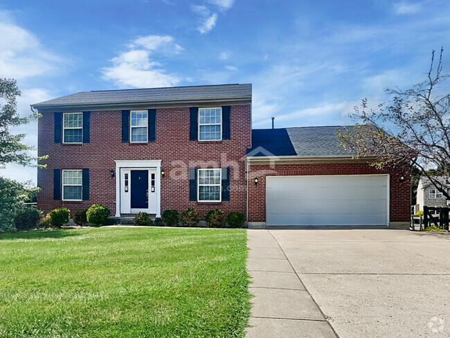
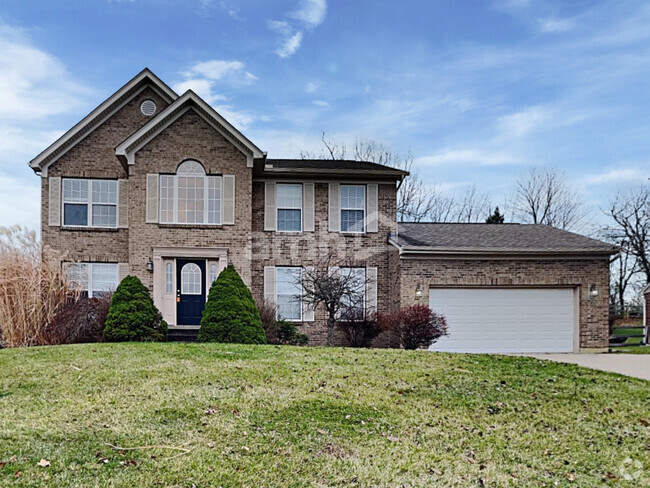
You May Also Like
Similar Rentals Nearby

What Are Walk Score®, Transit Score®, and Bike Score® Ratings?
Walk Score® measures the walkability of any address. Transit Score® measures access to public transit. Bike Score® measures the bikeability of any address.
What is a Sound Score Rating?
A Sound Score Rating aggregates noise caused by vehicle traffic, airplane traffic and local sources
3285 Tulsa Ct
Cincinnati, OH 45238