$1,800 / Month
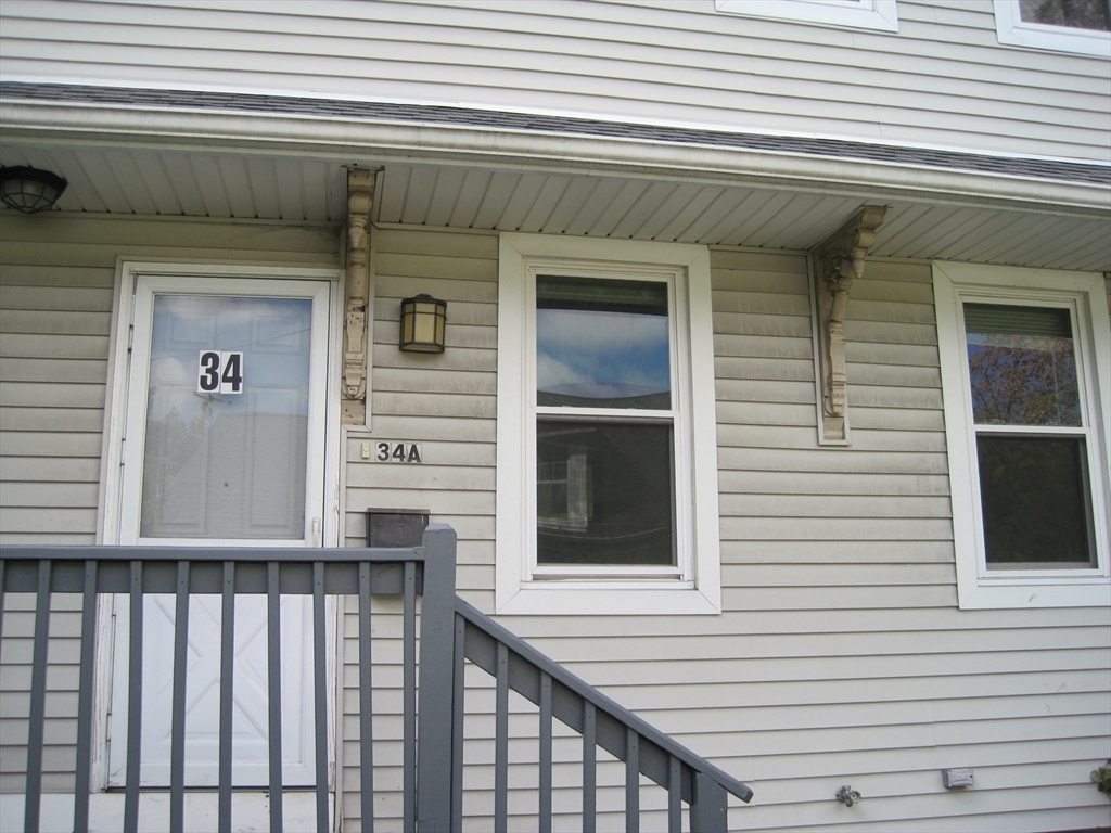
32R Cedar St
Boston, MA 02126
Today
Favorites
617-510-7820
-
Bedrooms
1
-
Bathrooms
1
-
Square Feet
545 sq ft
-
Available
Available Now
Highlights
- Golf Course Community
- Medical Services
- Landscaped Professionally
- Property is near public transit
- Main Floor Primary Bedroom
- Community Pool
32R Cedar St

Favorites
About This Home
Available Now
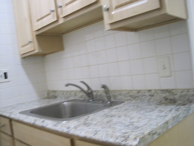
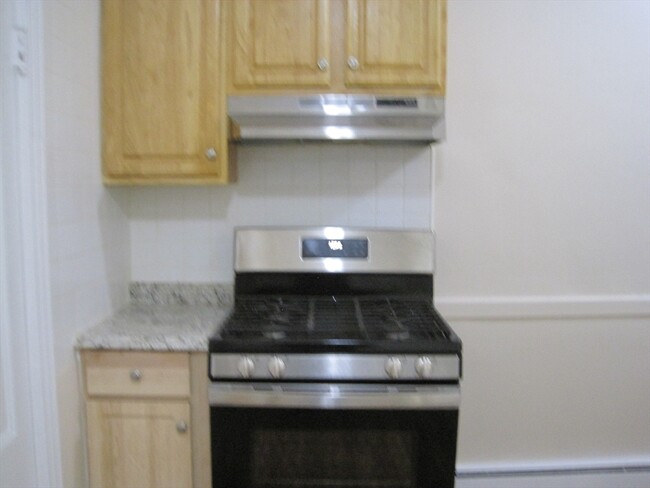
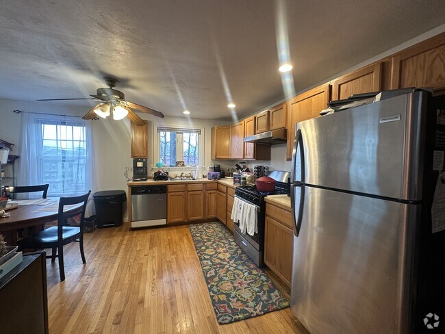
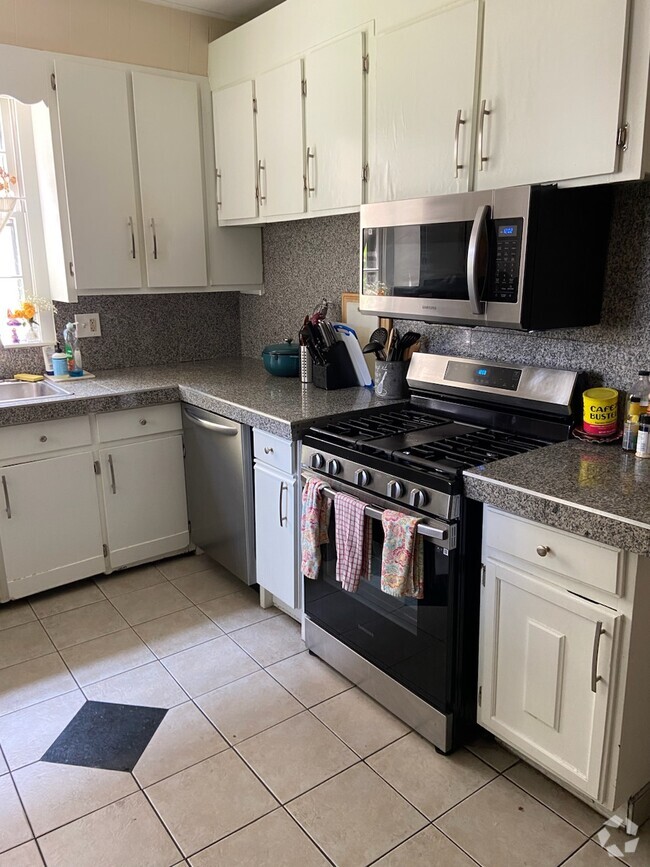
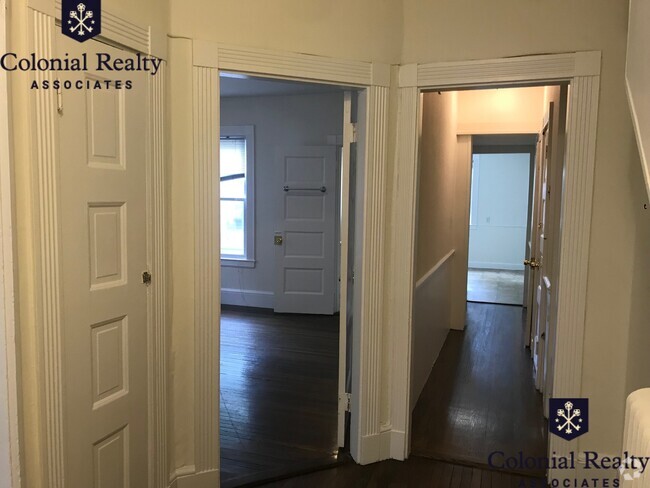
A Commuter's Dream,Lower Mills Area,Vacant and Ready to Move-In,First Floor Unit,Recently Renovated and Updated,Freshly Painted,New Kitchen Cabinets and Appliances. Easy Access to Red Line T via Trolley Station From Central Avenue T Stop and Bus To Ashmont or Forest Hills,Dudley or Ruggles via Mattapan,Nearby Star Market,Fitness Club,Dry Cleaners,Coffee Shop,Restaurants,Bar and Gas Station,Walk or Jog near Neponset River,Close to Downtown Boston,Easy Access to Express Way,Boston Logan Airport and Other Shopping Malls. Tenant Pays Own Heat and Utilities.First Moth and Last Month Rent due when Lease is Signed by Bank Check. A current credit report and Proof of Income is required with all Applications. Landlord reserves the Right to Accept or Reject any application with insufficient information or false information that are provided in the application (if any).
32R Cedar St is a townhome located in Suffolk County and the 02126 ZIP Code. This area is served by the Boston Public Schools attendance zone.
* Price shown is base rent and may not include non-optional fees and utilities.
Price, availability, fees, and any applicable rent special are subject to change without notice.
* Square footage definitions vary. Displayed square footage is approximate.
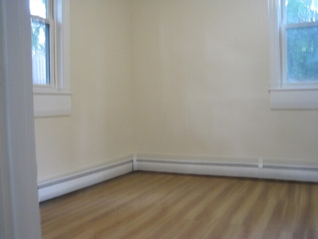
Home Details
Year Built
Built in 1899
Accessible Home Design
Entry on the 1st floor
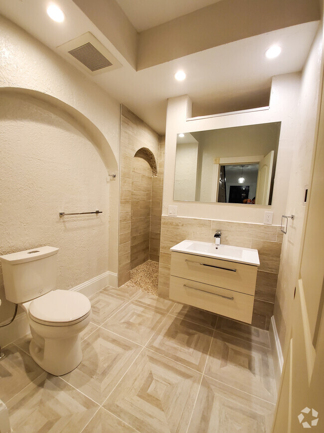
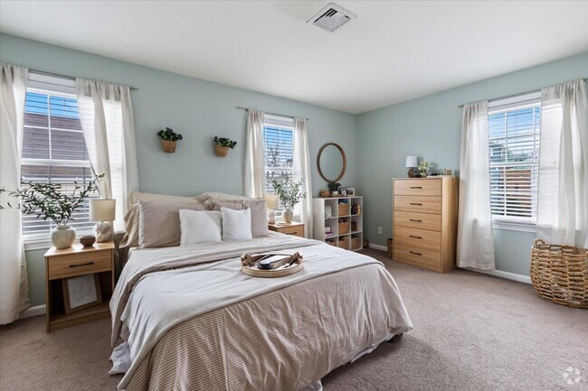
Bedrooms and Bathrooms
1 Primary Bedroom on Main
1 Full Bathroom
Home Design
Property Attached
Interior Spaces
1-Story Property
Window Screens
545 Sq Ft Home
Kitchen
Range with Range Hood
Disposal
Listing and Financial Details
12 Month Lease Term
Assessor Parcel Number 3395813
Rent includes water
Location
Property is near public transit
Property is near schools
Lot Details
Landscaped Professionally
Fenced Yard
Fenced
Outdoor Features
Rain Gutters
Utilities
No Cooling
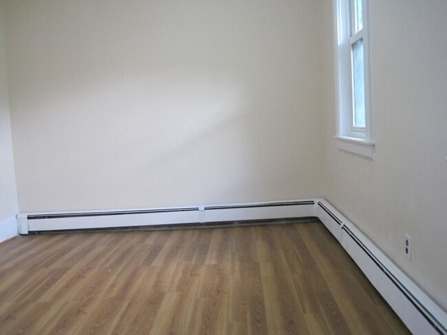
Baseboard Heating
Heating System Uses Natural Gas
Individual Controls for Heating
Community Details
Amenities
Medical Services
Shops
Coin Laundry
Common Area
Overview
No Home Owners Association
Pet Policy
No Pets Allowed
Recreation
Golf Course Community
Community Pool
Jogging Path
Park
Bike Trail
Contact
- Listed by Zainal A. Mahmood | Apollo Realty,Inc.
- Phone Number
-
Source
 MLS Property Information Network
The property listing data and information set forth herein were provided to MLS Property Information Network, Inc. from third party sources, including sellers, lessors and public records, and were compiled by MLS Property Information Network, Inc. The property listing data and information are for the personal, non-commercial use of consumers having a good faith interest in purchasing or leasing listed properties of the type displayed to them and may not be used for any purpose other than to identify prospective properties which such consumers may have a good faith interest in purchasing or leasing. MLS Property Information Network, Inc. and its subscribers disclaim any and all representations and warranties as to the accuracy of the property listing data and information set forth herein. All properties are subject to prior sale, change or withdrawal. Copyright © 2025 MLS Property Information Network, Inc. All rights reserved.
Location
Get Directions
Amenities
- Disposal
- Range
- Refrigerator
- Fenced Lot
West Codman Hill-West Lower Mills is located 10 miles outside of Boston. The Lower Mills District was added to the National Register of Historic Places and is home to a large industrial factory complex— once associated with the oldest producer of chocolate in the United States. For outdoor recreation, visit Roberts Playground, offering soccer fields, a basketball court, and a field hockey area. Along the southern border of town lies the Neponset River, where residents have access to trails for biking and running.
Contemporary and Colonial-style houses are popular in the area.
Learn more about living in West Codman Hill-West Lower Mills
Education
| Colleges & Universities | Distance | ||
|---|---|---|---|
| Colleges & Universities | Distance | ||
| Drive: | 11 min | 3.8 mi | |
| Drive: | 11 min | 5.3 mi | |
| Drive: | 10 min | 5.5 mi | |
| Drive: | 11 min | 5.9 mi |
32R Cedar St is within 11 minutes or 3.8 miles from Curry College. It is also near UMass Boston and Wentworth Inst. of Technology.
Schools


Public Elementary School
Grades PK-6
358 Students
Attendance Zone
Public Elementary, Middle & High School
Grades 2-12
666 Students
Attendance Zone
Public Middle & High School
Grades 6-12
871 Students
Attendance Zone
Public Middle & High School
Grades 6-12
541 Students
Attendance Zone
Public High School
Grades 9-12
472 Students
Attendance Zone
Public High School
Grades 9-12
347 Students
Attendance Zone
Private Elementary & Middle School
Grades PK-8
Nearby
Private High School
Grades 9-12
95 Students
Nearby
School data provided by
 The GreatSchools Rating helps parents compare schools within a state based on a variety of school quality indicators and provides a helpful picture of how effectively each school serves all of its students. Ratings are on a scale of 1 (below average) to 10 (above average) and can include test scores, college readiness, academic progress, advanced courses, equity, discipline and attendance data. We also advise parents to visit schools, consider other information on school performance and programs, and consider family needs as part of the school selection process.
View GreatSchools Rating Methodology
View GreatSchools Rating Methodology
Transportation options available in Boston include Central Avenue Station, located 0.3 mile from 32R Cedar St. 32R Cedar St is near General Edward Lawrence Logan International, located 10.6 miles or 18 minutes away.
| Transit / Subway | Distance | ||
|---|---|---|---|
| Transit / Subway | Distance | ||
|
|
Walk: | 6 min | 0.3 mi |
|
|
Walk: | 11 min | 0.6 mi |
|
|
Walk: | 15 min | 0.8 mi |
|
|
Walk: | 16 min | 0.8 mi |
|
|
Drive: | 3 min | 1.2 mi |
| Commuter Rail | Distance | ||
|---|---|---|---|
| Commuter Rail | Distance | ||
|
|
Walk: | 17 min | 0.9 mi |
| Drive: | 4 min | 1.4 mi | |
| Drive: | 5 min | 1.7 mi | |
|
|
Drive: | 6 min | 2.9 mi |
| Drive: | 6 min | 3.3 mi |
| Airports | Distance | ||
|---|---|---|---|
| Airports | Distance | ||
|
General Edward Lawrence Logan International
|
Drive: | 18 min | 10.6 mi |
Time and distance from 32R Cedar St.
| Shopping Centers | Distance | ||
|---|---|---|---|
| Shopping Centers | Distance | ||
| Walk: | 3 min | 0.2 mi | |
| Walk: | 19 min | 1.0 mi | |
| Drive: | 3 min | 1.1 mi |
32R Cedar St has 3 shopping centers within 1.1 miles, which is about a 3-minute walk. The miles and minutes will be for the farthest away property.
| Parks and Recreation | Distance | ||
|---|---|---|---|
| Parks and Recreation | Distance | ||
|
Mass Audubon's Boston Nature Center and Wildlife Sanctuary
|
Drive: | 5 min | 2.1 mi |
|
Franklin Park Zoo
|
Drive: | 5 min | 2.8 mi |
|
Lower Neponset River Trail
|
Drive: | 5 min | 2.9 mi |
|
Squantum Point Park
|
Drive: | 10 min | 4.6 mi |
|
Dorchester Shores Reservation
|
Drive: | 10 min | 5.2 mi |
32R Cedar St has 5 parks within 5.2 miles, including Mass Audubon's Boston Nature Center and Wildlife Sanctuary, Franklin Park Zoo, and Lower Neponset River Trail.
| Hospitals | Distance | ||
|---|---|---|---|
| Hospitals | Distance | ||
| Walk: | 17 min | 0.9 mi | |
| Drive: | 4 min | 1.8 mi | |
| Drive: | 8 min | 4.6 mi |
32R Cedar St has 3 hospitals within 4.6 miles, the nearest is Carney Hospital which is 0.9 mile away and a 17 minute walk.
You May Also Like
Similar Rentals Nearby


What Are Walk Score®, Transit Score®, and Bike Score® Ratings?
Walk Score® measures the walkability of any address. Transit Score® measures access to public transit. Bike Score® measures the bikeability of any address.
What is a Sound Score Rating?
A Sound Score Rating aggregates noise caused by vehicle traffic, airplane traffic and local sources

32R Cedar St
Boston, MA 02126