33 Agassiz St Unit 33
Cambridge, MA 02140
-
Bedrooms
6
-
Bathrooms
5
-
Square Feet
4,191 sq ft
-
Available
Available Now

33 Agassiz St is an apartment community located in Middlesex County and the 02140 ZIP Code. This area is served by the Cambridge attendance zone.
Apartment Features
- Washer/Dryer
Fees and Policies
The fees below are based on community-supplied data and may exclude additional fees and utilities.
- Parking
-
Surface Lot--
Details
Property Information
-
4 units
Contact
- Contact
Directly north of Harvard Square, the city’s iconic cultural hub, Neighborhood Nine holds a premier spot in the heart of Cambridge, Massachusetts. Sitting northwest of Harvard University, America’s oldest university, Neighborhood Nine boasts a diverse population, walkable streets, tree-lined neighborhoods, and unbeatable amenities.
With great public transit, excellent schools, charming residential streets, and a peaceful atmosphere, it’s almost as if this neighborhood is merely a dream. But luckily for you, it’s real (real upscale). This affluent neighborhood is known for its historic homes, nearby Victorian mansions, and rather pricey apartments, though what do you expect from such a notable neighborhood?
Stop by Danehy Park to play at its numerous athletic fields, explore Fresh Pond Mall’s supermarkets and retailers, and shop your way through Porter Square Shopping Center near the Porter transit stop. Numerous restaurants like Bagelsaurus thrive in this supportive community.
Learn more about living in Neighborhood Nine| Colleges & Universities | Distance | ||
|---|---|---|---|
| Colleges & Universities | Distance | ||
| Walk: | 6 min | 0.3 mi | |
| Walk: | 7 min | 0.4 mi | |
| Drive: | 3 min | 1.2 mi | |
| Drive: | 4 min | 1.7 mi |
 The GreatSchools Rating helps parents compare schools within a state based on a variety of school quality indicators and provides a helpful picture of how effectively each school serves all of its students. Ratings are on a scale of 1 (below average) to 10 (above average) and can include test scores, college readiness, academic progress, advanced courses, equity, discipline and attendance data. We also advise parents to visit schools, consider other information on school performance and programs, and consider family needs as part of the school selection process.
View GreatSchools Rating Methodology
Transportation options available in Cambridge include Porter Square Station, located 0.4 mile from 33 Agassiz St Unit 33. 33 Agassiz St Unit 33 is near General Edward Lawrence Logan International, located 7.2 miles or 17 minutes away.
| Transit / Subway | Distance | ||
|---|---|---|---|
| Transit / Subway | Distance | ||
|
|
Walk: | 7 min | 0.4 mi |
|
|
Drive: | 3 min | 1.3 mi |
|
|
Drive: | 3 min | 1.4 mi |
| Drive: | 5 min | 1.6 mi | |
| Drive: | 5 min | 1.8 mi |
| Commuter Rail | Distance | ||
|---|---|---|---|
| Commuter Rail | Distance | ||
|
|
Walk: | 7 min | 0.4 mi |
|
|
Drive: | 7 min | 3.3 mi |
|
|
Drive: | 8 min | 3.3 mi |
|
|
Drive: | 8 min | 3.8 mi |
| Drive: | 15 min | 7.3 mi |
| Airports | Distance | ||
|---|---|---|---|
| Airports | Distance | ||
|
General Edward Lawrence Logan International
|
Drive: | 17 min | 7.2 mi |
Time and distance from 33 Agassiz St Unit 33.
| Shopping Centers | Distance | ||
|---|---|---|---|
| Shopping Centers | Distance | ||
| Walk: | 5 min | 0.3 mi | |
| Walk: | 7 min | 0.4 mi | |
| Walk: | 9 min | 0.5 mi |
| Parks and Recreation | Distance | ||
|---|---|---|---|
| Parks and Recreation | Distance | ||
|
Harvard-Smithsonian Center for Astrophysics
|
Walk: | 10 min | 0.5 mi |
|
Harvard Museum of Natural History
|
Walk: | 14 min | 0.8 mi |
|
Mineralogical and Geological Museum
|
Walk: | 14 min | 0.8 mi |
|
Longfellow National Historic Site
|
Drive: | 3 min | 1.2 mi |
|
Mystic River Reservation
|
Drive: | 7 min | 3.2 mi |
| Hospitals | Distance | ||
|---|---|---|---|
| Hospitals | Distance | ||
| Drive: | 4 min | 1.4 mi | |
| Drive: | 4 min | 1.6 mi | |
| Drive: | 9 min | 3.5 mi |
| Military Bases | Distance | ||
|---|---|---|---|
| Military Bases | Distance | ||
| Drive: | 21 min | 11.0 mi | |
| Drive: | 31 min | 17.7 mi |
- Washer/Dryer
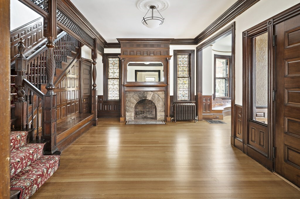
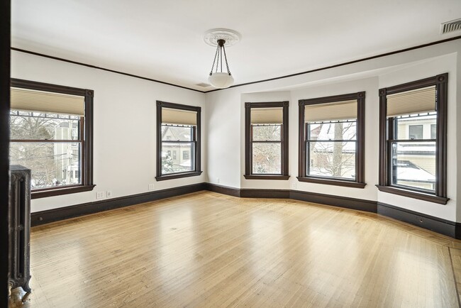
33 Agassiz St Unit 33 Photos
What Are Walk Score®, Transit Score®, and Bike Score® Ratings?
Walk Score® measures the walkability of any address. Transit Score® measures access to public transit. Bike Score® measures the bikeability of any address.
What is a Sound Score Rating?
A Sound Score Rating aggregates noise caused by vehicle traffic, airplane traffic and local sources


