330 Neal Dr
Richmond Hill, ON L4C 3L5
Favorites
905-888-8819

-
Monthly Rent
C$3,500
-
Bedrooms
4 bd
-
Bathrooms
2 ba
-
Square Feet
Details
Available Now
* Price shown is base rent and may not include non-optional fees and utilities.
Price, availability, fees, and any applicable rent special are subject to change without notice.
* Square footage definitions vary. Displayed square footage is approximate.
330 Neal Dr
Favorites
About This Property
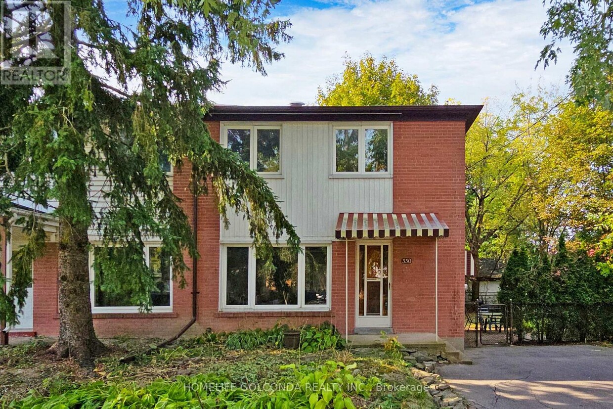
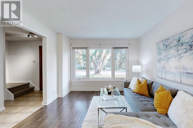
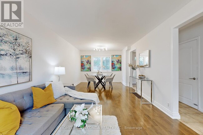
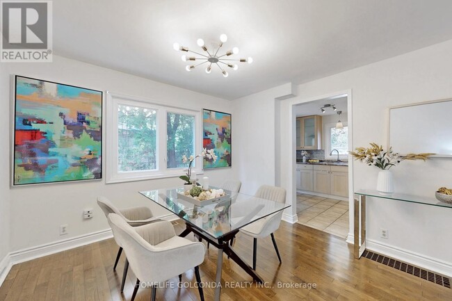
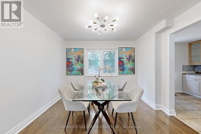
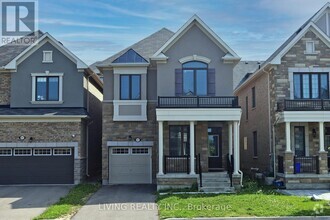
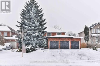
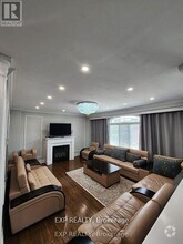
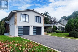
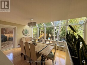
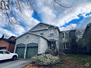
Bright and Spacious 3-Bedroom Semi-Detached Home Located in a Highly Desirable Neighborhood . Featuring Hardwood Floors Throughout the Main Floor,This Home Offers a Functional Layout Perfect for Family Living. The Finished one Bedroom Basement with a Separate entrance. Extra wide 50 feet front lot with Long Private Oversized Driveway. Close to Shopping,Parks,Transit,and Minutes From Top-Ranked Schools Including Bayview Secondary (IB Program). This is a Must-See for Buyers Looking for Convenience and Comfort in a Prime Location! (id:52069) ID#: 2048274
330 Neal Dr is a AA house located in Richmond Hill, ON and the L4C 3L5 Postal Code. This listing has rentals from C$3500
House Features
- Air Conditioning
Fees and Policies
Property Address:
330 Neal Dr,
Richmond Hill,
ON
L4C 3L5
 This Property
 Available Property
Amenities
- Air Conditioning
Education
| Colleges & Universities | Distance | ||
|---|---|---|---|
| Colleges & Universities | Distance | ||
| Drive: | 23 min | 19.1 km | |
| Drive: | 27 min | 27.6 km | |
| Drive: | 30 min | 30.4 km | |
| Drive: | 33 min | 34.5 km |
330 Neal Dr is within 23 minutes or 19.1 kilometers from York Université. It is also near York University and Univ. of St. Michael's.
Transportation options available in Richmond Hill include Finch Station - Southbound Platform, located 14.6 kilometers from 330 Neal Dr. 330 Neal Dr is near Billy Bishop Toronto City Airport, located 39.8 kilometers or 38 minutes away, and Toronto Pearson International, located 43.4 kilometers or 46 minutes away.
| Transit / Subway | Distance | ||
|---|---|---|---|
| Transit / Subway | Distance | ||
|
|
Drive: | 20 min | 14.6 km |
|
|
Drive: | 23 min | 15.7 km |
|
|
Drive: | 21 min | 19.6 km |
|
|
Drive: | 20 min | 21.1 km |
|
|
Drive: | 20 min | 21.2 km |
| Commuter Rail | Distance | ||
|---|---|---|---|
| Commuter Rail | Distance | ||
|
|
Drive: | 4 min | 2.4 km |
|
|
Drive: | 11 min | 7.6 km |
|
|
Drive: | 14 min | 9.3 km |
|
|
Drive: | 12 min | 9.7 km |
|
|
Drive: | 16 min | 10.8 km |
| Airports | Distance | ||
|---|---|---|---|
| Airports | Distance | ||
|
Billy Bishop Toronto City Airport
|
Drive: | 38 min | 39.8 km |
|
Toronto Pearson International
|
Drive: | 46 min | 43.4 km |
Time and distance from 330 Neal Dr.
| Shopping Centers | Distance | ||
|---|---|---|---|
| Shopping Centers | Distance | ||
| Drive: | 3 min | 2.0 km | |
| Drive: | 3 min | 2.0 km | |
| Drive: | 4 min | 2.3 km |
330 Neal Dr has 3 shopping centers within 2.3 kilometers, which is about a 4-minute drive. The kilometers and minutes will be for the farthest away property.
| Military Bases | Distance | ||
|---|---|---|---|
| Military Bases | Distance | ||
| Drive: | 83 min | 83.0 km |
330 Neal Dr is 83.0 kilometers and a 83 minutes from Canadian Forces Base Borden.
You May Also Like
Similar Rentals Nearby
What Are Walk Score®, Transit Score®, and Bike Score® Ratings?
Walk Score® measures the walkability of any address. Transit Score® measures access to public transit. Bike Score® measures the bikeability of any address.
What is a Sound Score Rating?
A Sound Score Rating aggregates noise caused by vehicle traffic, airplane traffic and local sources

330 Neal Dr
Richmond Hill, ON L4C 3L5