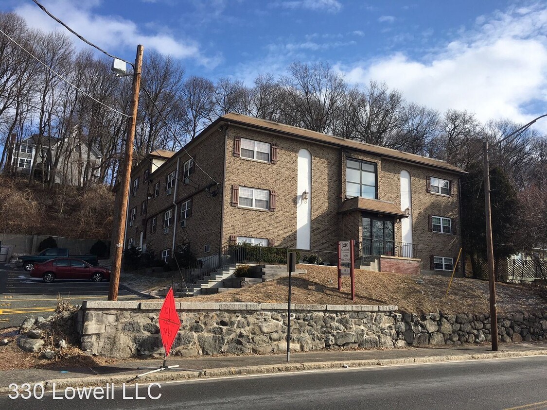
330 Nesmith St
Lowell, MA 01852


Check Back Soon for Upcoming Availability
| Beds | Baths | Average SF |
|---|---|---|
| 1 Bedroom 1 Bedroom 1 Br | 1 Bath 1 Bath 1 Ba | 560 SF |
About This Property
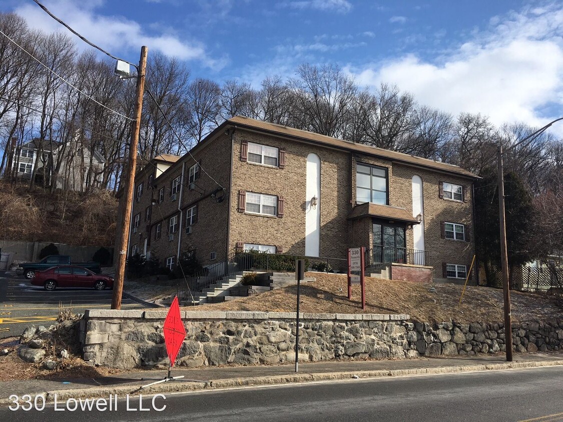
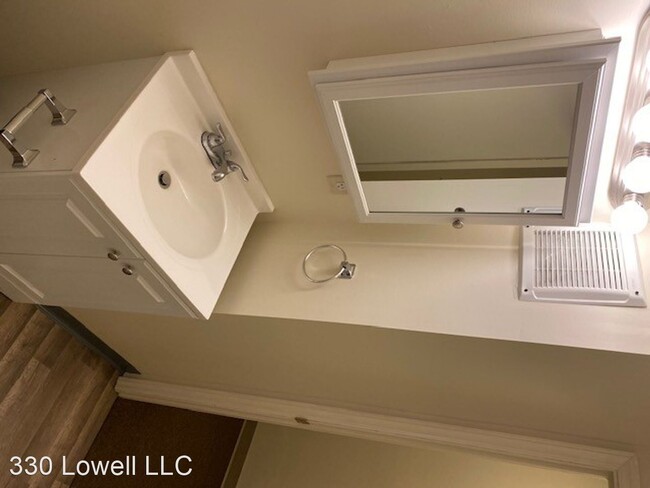
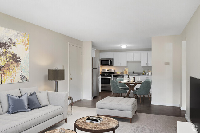
(978) 783-3435 - Coming Soon! 1 Bedroom - Convenient Nesmith Street location! - 330 Nesmith Street - Lowell MA Unit boasts: In Wall AC Units, Washer and Dryer in building common area, 1 assigned parking space per unit No Smoking in the building. Utilities: Hot Water included. Electric heat paid by tenant. Apply today at www.goldpmma.com No Dogs Allowed (RLNE3408277) Pet policies: Cats Allowed, No Dogs Allowed.
330 Nesmith St is an apartment community located in Middlesex County and the 01852 ZIP Code.
Unique Features
- No Dogs Allowed
Fees and Policies
The fees below are based on community-supplied data and may exclude additional fees and utilities.
 This Property
 Available Property
Directly across the Concord River from Downtown, Lowell’s Belvidere neighborhood is a large, tranquil suburban environment that offers direct access to the city’s greatest attractions. The first thing you’ll notice when you cross the bridge out of Downtown is the waterfront Lowell Memorial Auditorium, a popular venue for touring musicians, stage plays, and other performances.
A campus of Lowell General Hospital sits nearby, making Belvidere an excellent location for healthcare professionals. The neighborhood is great for folks who love to stay active, with numerous public parks around and sports facilities for everything from ice skating to football.
Learn more about living in BelvidereBelow are rent ranges for similar nearby apartments
- No Dogs Allowed
| Colleges & Universities | Distance | ||
|---|---|---|---|
| Colleges & Universities | Distance | ||
| Walk: | 20 min | 1.1 mi | |
| Drive: | 4 min | 2.0 mi | |
| Drive: | 20 min | 10.4 mi | |
| Drive: | 18 min | 10.9 mi |
Transportation options available in Lowell include Alewife Station, located 22.2 miles from 330 Nesmith St. 330 Nesmith St is near General Edward Lawrence Logan International, located 31.5 miles or 44 minutes away, and Manchester Boston Regional, located 31.6 miles or 48 minutes away.
| Transit / Subway | Distance | ||
|---|---|---|---|
| Transit / Subway | Distance | ||
|
|
Drive: | 36 min | 22.2 mi |
|
|
Drive: | 33 min | 23.7 mi |
|
|
Drive: | 33 min | 25.0 mi |
| Drive: | 33 min | 25.2 mi | |
|
|
Drive: | 34 min | 26.2 mi |
| Commuter Rail | Distance | ||
|---|---|---|---|
| Commuter Rail | Distance | ||
|
|
Drive: | 4 min | 1.8 mi |
|
|
Drive: | 9 min | 3.8 mi |
|
|
Drive: | 16 min | 10.2 mi |
|
|
Drive: | 17 min | 10.4 mi |
|
|
Drive: | 19 min | 13.2 mi |
| Airports | Distance | ||
|---|---|---|---|
| Airports | Distance | ||
|
General Edward Lawrence Logan International
|
Drive: | 44 min | 31.5 mi |
|
Manchester Boston Regional
|
Drive: | 48 min | 31.6 mi |
Time and distance from 330 Nesmith St.
| Shopping Centers | Distance | ||
|---|---|---|---|
| Shopping Centers | Distance | ||
| Walk: | 19 min | 1.0 mi | |
| Drive: | 4 min | 1.2 mi | |
| Drive: | 6 min | 2.0 mi |
| Parks and Recreation | Distance | ||
|---|---|---|---|
| Parks and Recreation | Distance | ||
|
Lowell National Historical Park
|
Drive: | 3 min | 1.6 mi |
|
Lowell Heritage State Park
|
Drive: | 8 min | 4.4 mi |
|
Lowell-Dracut-Tyngsboro State Forest
|
Drive: | 11 min | 4.8 mi |
|
Ralph Hill Conservation Area
|
Drive: | 16 min | 7.8 mi |
|
Great Brook Farm State Park
|
Drive: | 17 min | 8.0 mi |
| Hospitals | Distance | ||
|---|---|---|---|
| Hospitals | Distance | ||
| Drive: | 6 min | 3.1 mi | |
| Drive: | 18 min | 11.0 mi |
| Military Bases | Distance | ||
|---|---|---|---|
| Military Bases | Distance | ||
| Drive: | 27 min | 15.8 mi |
You May Also Like
Similar Rentals Nearby
What Are Walk Score®, Transit Score®, and Bike Score® Ratings?
Walk Score® measures the walkability of any address. Transit Score® measures access to public transit. Bike Score® measures the bikeability of any address.
What is a Sound Score Rating?
A Sound Score Rating aggregates noise caused by vehicle traffic, airplane traffic and local sources
