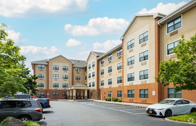
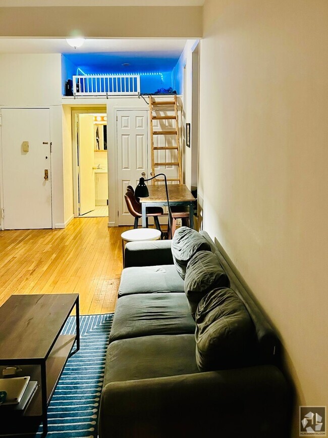
330 S Broadway
330 S Broadway
Tarrytown, NY 10591

Check Back Soon for Upcoming Availability
Situated about 30 miles north of Manhattan, Tarrytown is a picturesque village nestled alongside the eastern banks of the Hudson River. Tarrytown is regarded for its historic character, along with its distinctive small-town allure. Legendary historic structures are among Tarrytown’s main attractions, including mansions like Lyndhurst and Sunnyside, in addition to the longstanding Tarrytown Music Hall.
The commercial heart of the village is strewn along Main Street, where independent shops, coffeehouses, and eateries are housed in rows of colorful, old-fashioned buildings. The many local businesses on Main Street serve as gathering places for Tarrytown’s close-knit community, as well as the numerous year-round events hosted in town. Residents can also come together to enjoy the outdoors at Tarrytown’s many scenic parks, such as Pierson Park, Patriots Park, and Tarrytown Lakes Park.
Learn more about living in Tarrytown| Colleges & Universities | Distance | ||
|---|---|---|---|
| Colleges & Universities | Distance | ||
| Drive: | 7 min | 3.5 mi | |
| Drive: | 10 min | 5.2 mi | |
| Drive: | 10 min | 5.3 mi | |
| Drive: | 13 min | 7.0 mi |
Transportation options available in Tarrytown include Wakefield-241 Street, located 14.5 miles from 330 S Broadway. 330 S Broadway is near Westchester County, located 13.9 miles or 20 minutes away, and Laguardia, located 26.6 miles or 39 minutes away.
| Transit / Subway | Distance | ||
|---|---|---|---|
| Transit / Subway | Distance | ||
|
|
Drive: | 20 min | 14.5 mi |
|
|
Drive: | 19 min | 14.5 mi |
|
|
Drive: | 21 min | 14.9 mi |
|
|
Drive: | 21 min | 15.4 mi |
|
|
Drive: | 22 min | 15.9 mi |
| Commuter Rail | Distance | ||
|---|---|---|---|
| Commuter Rail | Distance | ||
|
|
Drive: | 3 min | 1.3 mi |
|
|
Drive: | 6 min | 2.6 mi |
|
|
Drive: | 5 min | 2.7 mi |
|
|
Drive: | 7 min | 3.4 mi |
|
|
Drive: | 8 min | 4.4 mi |
| Airports | Distance | ||
|---|---|---|---|
| Airports | Distance | ||
|
Westchester County
|
Drive: | 20 min | 13.9 mi |
|
Laguardia
|
Drive: | 39 min | 26.6 mi |
Time and distance from 330 S Broadway.
| Shopping Centers | Distance | ||
|---|---|---|---|
| Shopping Centers | Distance | ||
| Walk: | 4 min | 0.2 mi | |
| Walk: | 16 min | 0.9 mi | |
| Drive: | 3 min | 1.3 mi |
| Parks and Recreation | Distance | ||
|---|---|---|---|
| Parks and Recreation | Distance | ||
|
Stone Barns Center for Food and Agriculture
|
Drive: | 6 min | 3.9 mi |
|
Old Croton Aqueduct State Historic Park
|
Drive: | 7 min | 4.1 mi |
|
Rockefeller State Park Preserve
|
Drive: | 10 min | 6.4 mi |
|
Blauvelt State Park
|
Drive: | 12 min | 6.4 mi |
|
Tallman Mountain State Park
|
Drive: | 13 min | 8.4 mi |
| Hospitals | Distance | ||
|---|---|---|---|
| Hospitals | Distance | ||
| Drive: | 5 min | 3.1 mi | |
| Drive: | 8 min | 5.3 mi | |
| Drive: | 12 min | 7.5 mi |
| Military Bases | Distance | ||
|---|---|---|---|
| Military Bases | Distance | ||
| Drive: | 32 min | 19.4 mi | |
| Drive: | 40 min | 25.7 mi |
You May Also Like
Similar Rentals Nearby
What Are Walk Score®, Transit Score®, and Bike Score® Ratings?
Walk Score® measures the walkability of any address. Transit Score® measures access to public transit. Bike Score® measures the bikeability of any address.
What is a Sound Score Rating?
A Sound Score Rating aggregates noise caused by vehicle traffic, airplane traffic and local sources

