
333 N Camino Alto
Vallejo, CA 94590
-
Bedrooms
2
-
Bathrooms
1
-
Square Feet
856 sq ft
-
Available
Available Now
Highlights
- Pool
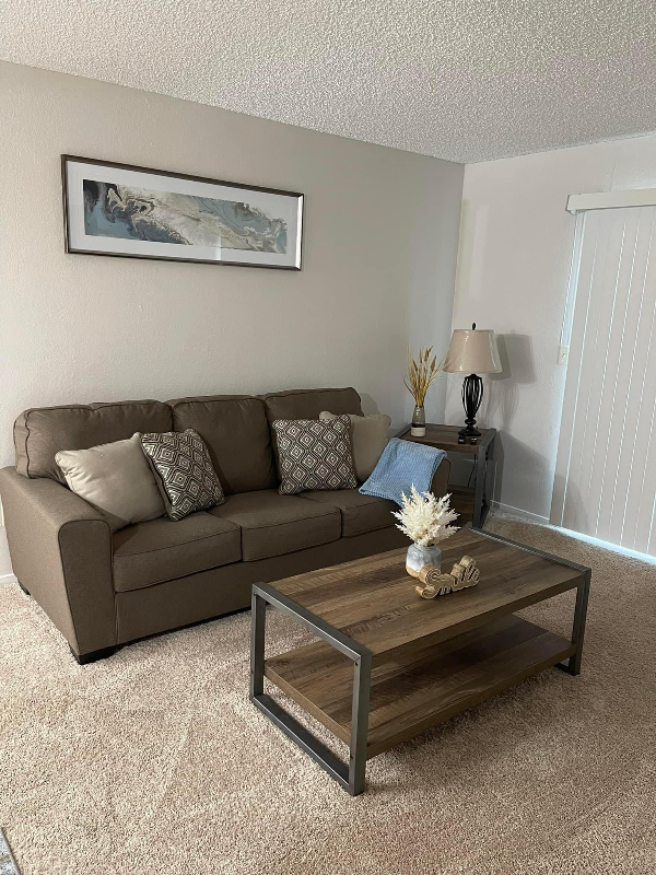
- Furnished
- Fenced Lot
- Security System
- Vaulted Ceiling
- Fitness Center

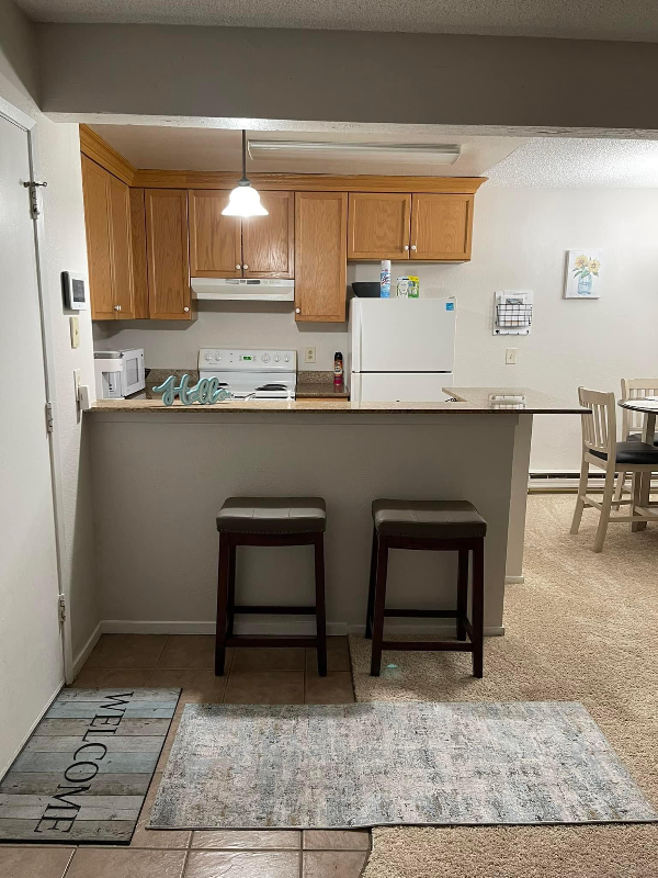
About This Home
Property Id: 1048650 Ground Level cozy 2 Bedroom 1 bath 1 private vanity condo located in Vallejo, Ca very close to Sutter Solano Medical Center (0.3 Mi) & Kaiser Hospital (0.8 Mi). This is a Gated community with parking, pool, hot tub, gym, spa, and onsite laundry. This is an end unit with a large 10x10 backyard patio with a 10 ft fence for privacy. Utilities included. Easy access to parks, shopping, Ferry, and Six Flags Discovery Kingdom. Nearby grocery stores include Food Maxx, Safeway, and Smart & Final Extra.
333 N Camino Alto is a condo located in Solano County and the 94590 ZIP Code. This area is served by the Vallejo City Unified attendance zone.
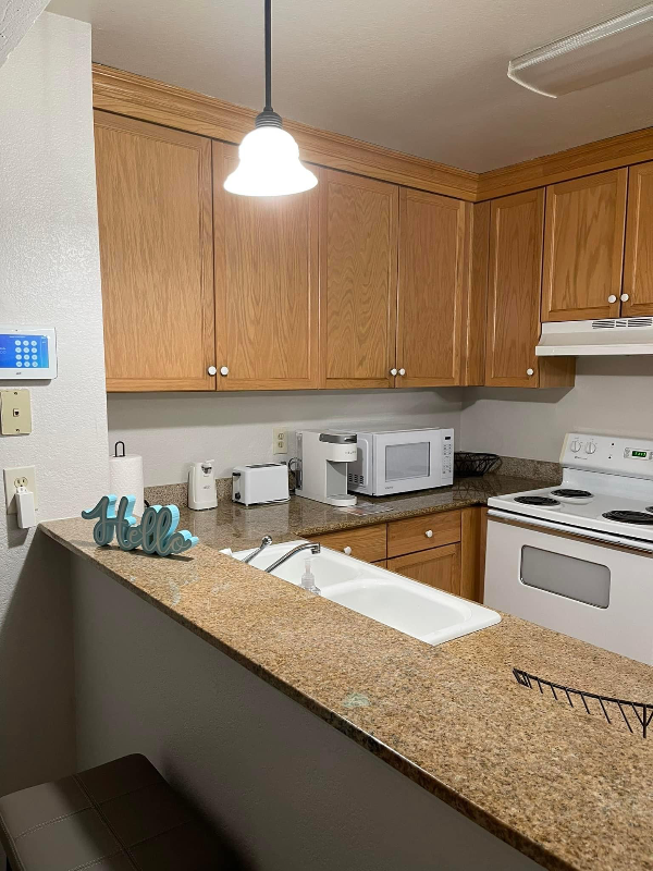
Condo Features
Dishwasher
Microwave
Refrigerator
Disposal
- Cable Ready
- Security System
- Dishwasher
- Disposal
- Microwave
- Oven
- Refrigerator
- Tile Floors
- Vaulted Ceiling
- Furnished
- Fitness Center
- Spa
- Pool
- Fenced Lot
Fees and Policies
The fees below are based on community-supplied data and may exclude additional fees and utilities.
Details
Utilities Included
-
Gas
-
Water
-
Electricity
-
Trash Removal
-
Sewer
Property Information
-
Furnished Units Available
Contact
- Phone Number
- Contact
-
Source

- Cable Ready
- Security System
- Dishwasher
- Disposal
- Microwave
- Oven
- Refrigerator
- Tile Floors
- Vaulted Ceiling
- Furnished
- Fenced Lot
- Fitness Center
- Spa
- Pool
As the largest city in Solano County and the 10th-largest city in the San Francisco Bay Area, West Vallejo has become a hot destination for families, singles, and artistic individuals looking for beautiful historic Victorian homes and a growing community that is much more affordable compared to others in the Bay Area.
There’s plenty to do in West Vallejo, from outdoor activities to nightlife, restaurants, and coffee shops. With easy access to San Francisco by ferry or an hour drive by car away, this mostly suburban community rests far enough from the urban environment to be a mellow break from the hustle and bustle, but close enough that indulging in all of San Francisco’s sights — from the Golden Gate Bridge to the Coit Tower — are never too far away to enjoy.
Learn more about living in West Vallejo| Colleges & Universities | Distance | ||
|---|---|---|---|
| Colleges & Universities | Distance | ||
| Drive: | 10 min | 4.8 mi | |
| Drive: | 17 min | 11.6 mi | |
| Drive: | 17 min | 11.7 mi | |
| Drive: | 20 min | 14.4 mi |


View GreatSchools Rating Methodology
Transportation options available in Vallejo include El Cerrito Del Norte Station, located 17.6 miles from 333 N Camino Alto. 333 N Camino Alto is near Metro Oakland International, located 36.6 miles or 48 minutes away.
| Transit / Subway | Distance | ||
|---|---|---|---|
| Transit / Subway | Distance | ||
|
|
Drive: | 23 min | 17.6 mi |
|
|
Drive: | 24 min | 17.8 mi |
|
|
Drive: | 26 min | 18.4 mi |
|
|
Drive: | 27 min | 18.9 mi |
|
|
Drive: | 26 min | 19.4 mi |
| Commuter Rail | Distance | ||
|---|---|---|---|
| Commuter Rail | Distance | ||
|
|
Drive: | 19 min | 13.4 mi |
|
|
Drive: | 21 min | 15.7 mi |
| Drive: | 30 min | 20.7 mi | |
| Drive: | 31 min | 22.1 mi | |
| Drive: | 32 min | 22.4 mi |
| Airports | Distance | ||
|---|---|---|---|
| Airports | Distance | ||
|
Metro Oakland International
|
Drive: | 48 min | 36.6 mi |
Time and distance from 333 N Camino Alto.
| Shopping Centers | Distance | ||
|---|---|---|---|
| Shopping Centers | Distance | ||
| Walk: | 14 min | 0.7 mi | |
| Walk: | 14 min | 0.8 mi | |
| Walk: | 15 min | 0.8 mi |
| Parks and Recreation | Distance | ||
|---|---|---|---|
| Parks and Recreation | Distance | ||
|
Dan Foley Park
|
Drive: | 3 min | 1.2 mi |
|
Six Flags Discovery Kingdom
|
Drive: | 4 min | 2.2 mi |
|
Benicia State Recreation Area
|
Drive: | 11 min | 6.2 mi |
|
Crockett Hills Regional Park
|
Drive: | 10 min | 6.3 mi |
|
Carquinez Strait Regional Shoreline
|
Drive: | 15 min | 8.5 mi |
| Hospitals | Distance | ||
|---|---|---|---|
| Hospitals | Distance | ||
| Walk: | 8 min | 0.4 mi | |
| Walk: | 14 min | 0.7 mi | |
| Drive: | 3 min | 1.2 mi |
| Military Bases | Distance | ||
|---|---|---|---|
| Military Bases | Distance | ||
| Drive: | 9 min | 4.2 mi | |
| Drive: | 15 min | 10.1 mi |
You May Also Like
What Are Walk Score®, Transit Score®, and Bike Score® Ratings?
Walk Score® measures the walkability of any address. Transit Score® measures access to public transit. Bike Score® measures the bikeability of any address.
What is a Sound Score Rating?
A Sound Score Rating aggregates noise caused by vehicle traffic, airplane traffic and local sources
333 N Camino Alto
Vallejo, CA 94590