$1,250 / Month
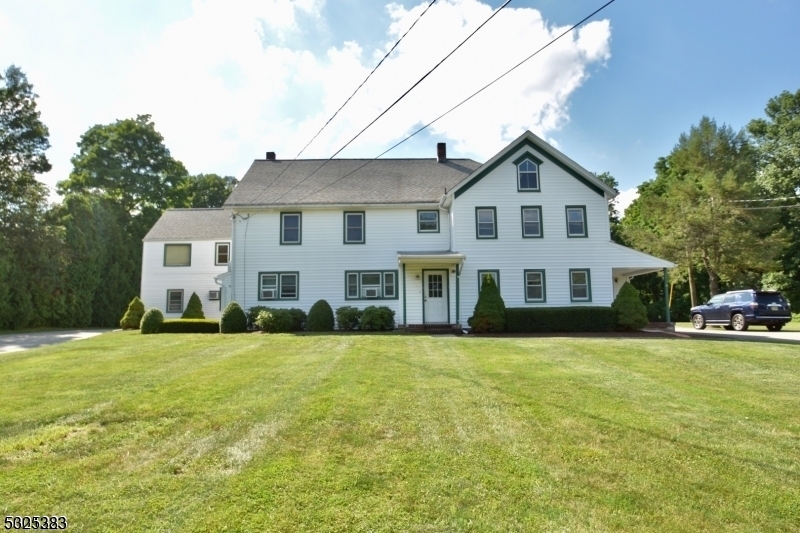
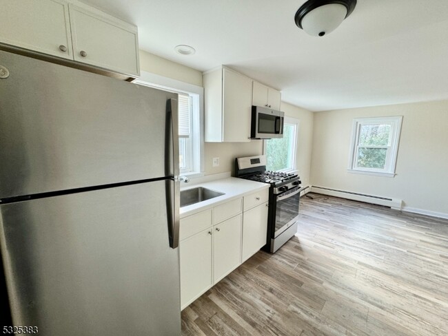
334 Oak Ridge Rd
West Milford, NJ 07438
2 Weeks Ago
Favorites
334 Oak Ridge Rd

Favorites
Check Back Soon for Upcoming Availability
| Beds | Baths | Average SF |
|---|---|---|
| 1 Bedroom 1 Bedroom 1 Br | 1 Bath 1 Bath 1 Ba | — |
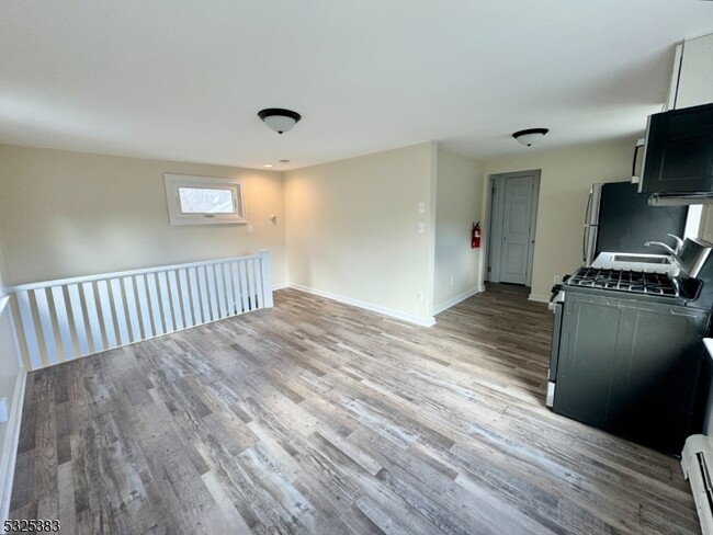
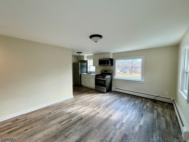
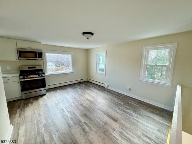
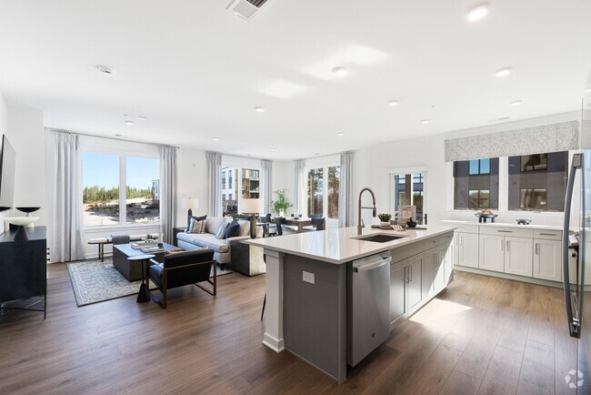
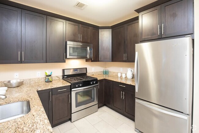
About This Property
WELL KEPT 2ND FLOOR 1 BEDROOM RENTAL WITH PARKING & LAUNDRY ACCESS. THIS UNIT IS VERY CLEAN WITH NATURAL GAS HEATING. WATER INCLUDED .
334 Oak Ridge Rd is an apartment community located in Passaic County and the 07438 ZIP Code.
Features
- Carpet
Fees and Policies
The fees below are based on community-supplied data and may exclude additional fees and utilities.
Property Address:
334 Oak Ridge Rd,
West Milford,
NJ
07438
A sparse suburb known for its dense woodlands and family-friendly atmosphere, West Milford is home to a close-knit community that enjoys outdoor exploration. West Milford is surrounded by Sterling Forest State Park, Wawayanda State Park, Farny State Park, Norvin Green State Forest, and Ringwood State Park. Hiking and mountain biking are second nature to residents of this forested town!
West Milford sits along the edge of New Jersey and New York, offering a reasonable commute into New York City. Manhattan sits about 40 miles southeast of West Milford. Though residents can easily travel to and from the Big Apple, West Milford feels very secluded and offers a laid-back way of life. Surrounded by natural beauty, West Milford is the perfect woodland getaway with affordable rentals and small-town charm.
Learn more about living in West Milford
Amenities
- Carpet
Education
| Colleges & Universities | Distance | ||
|---|---|---|---|
| Colleges & Universities | Distance | ||
| Drive: | 19 min | 12.3 mi | |
| Drive: | 31 min | 17.7 mi | |
| Drive: | 31 min | 19.7 mi | |
| Drive: | 31 min | 23.3 mi |
334 Oak Ridge Rd is within 19 minutes or 12.3 miles from Passaic County C.C., Wanaque. It is also near County College of Morris and William Paterson University.
Transportation options available in West Milford include Grove Street, located 29.8 miles from 334 Oak Ridge Rd. 334 Oak Ridge Rd is near Newark Liberty International, located 40.1 miles or 48 minutes away.
| Transit / Subway | Distance | ||
|---|---|---|---|
| Transit / Subway | Distance | ||
|
|
Drive: | 38 min | 29.8 mi |
|
|
Drive: | 39 min | 30.1 mi |
|
|
Drive: | 39 min | 30.2 mi |
|
|
Drive: | 40 min | 30.6 mi |
|
|
Drive: | 39 min | 30.8 mi |
| Commuter Rail | Distance | ||
|---|---|---|---|
| Commuter Rail | Distance | ||
|
|
Drive: | 24 min | 17.1 mi |
|
|
Drive: | 26 min | 17.2 mi |
|
|
Drive: | 27 min | 17.8 mi |
|
|
Drive: | 26 min | 18.6 mi |
|
|
Drive: | 30 min | 19.8 mi |
| Airports | Distance | ||
|---|---|---|---|
| Airports | Distance | ||
|
Newark Liberty International
|
Drive: | 48 min | 40.1 mi |
Time and distance from 334 Oak Ridge Rd.
| Shopping Centers | Distance | ||
|---|---|---|---|
| Shopping Centers | Distance | ||
| Drive: | 3 min | 1.3 mi | |
| Drive: | 3 min | 1.6 mi | |
| Drive: | 9 min | 5.8 mi |
334 Oak Ridge Rd has 3 shopping centers within 5.8 miles, which is about a 9-minute drive. The miles and minutes will be for the farthest away property.
| Parks and Recreation | Distance | ||
|---|---|---|---|
| Parks and Recreation | Distance | ||
|
Mahlon Dickerson County Reservation
|
Drive: | 15 min | 6.1 mi |
|
Farny State Park
|
Drive: | 18 min | 9.1 mi |
|
Silas Condict County Park
|
Drive: | 13 min | 9.3 mi |
|
Franklin Mineral Museum
|
Drive: | 17 min | 11.2 mi |
|
Sterling Hill Mine Tour & Museum of Fluorescence
|
Drive: | 21 min | 12.5 mi |
334 Oak Ridge Rd has 5 parks within 12.5 miles, including Mahlon Dickerson County Reservation, Farny State Park, and Sterling Hill Mine Tour & Museum of Fluorescence.
| Military Bases | Distance | ||
|---|---|---|---|
| Military Bases | Distance | ||
| Drive: | 63 min | 44.9 mi |
334 Oak Ridge Rd is 44.9 miles and a 63 minute drive from Tamdques Reservation.
You May Also Like
Similar Rentals Nearby


What Are Walk Score®, Transit Score®, and Bike Score® Ratings?
Walk Score® measures the walkability of any address. Transit Score® measures access to public transit. Bike Score® measures the bikeability of any address.
What is a Sound Score Rating?
A Sound Score Rating aggregates noise caused by vehicle traffic, airplane traffic and local sources

334 Oak Ridge Rd
West Milford, NJ 07438