
$1,975 / Month
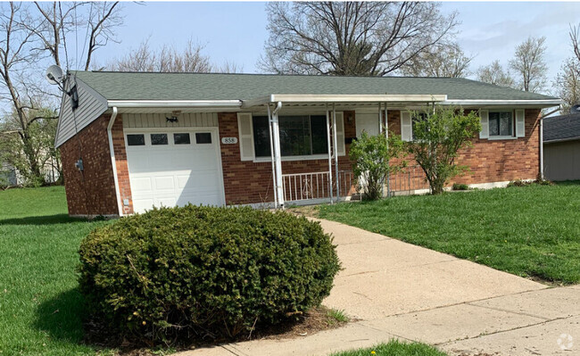
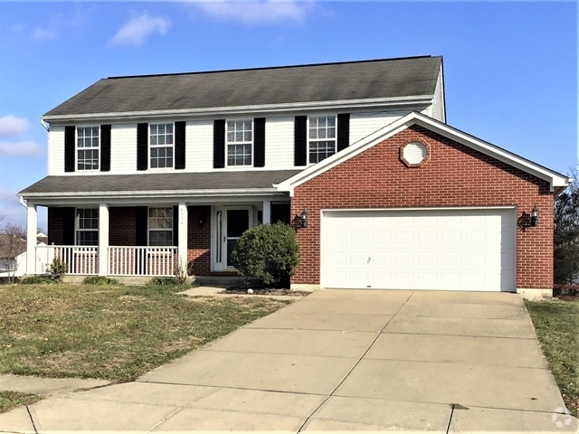
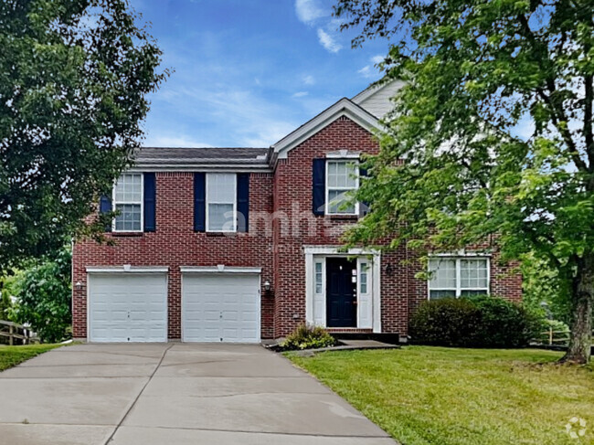
3344 Saffer St
Cincinnati, OH 45211
Today
Favorites
-
Bedrooms
4
-
Bathrooms
2
-
Square Feet
1,613 sq ft
3344 Saffer St

Favorites
About This Home
$1,975 deposit
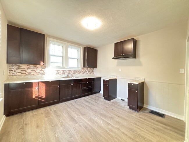
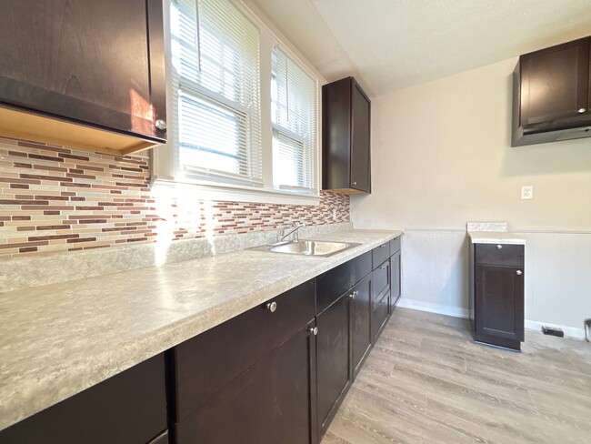
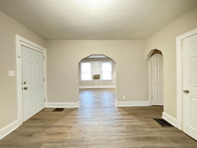
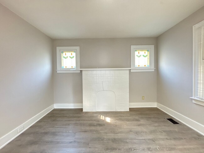
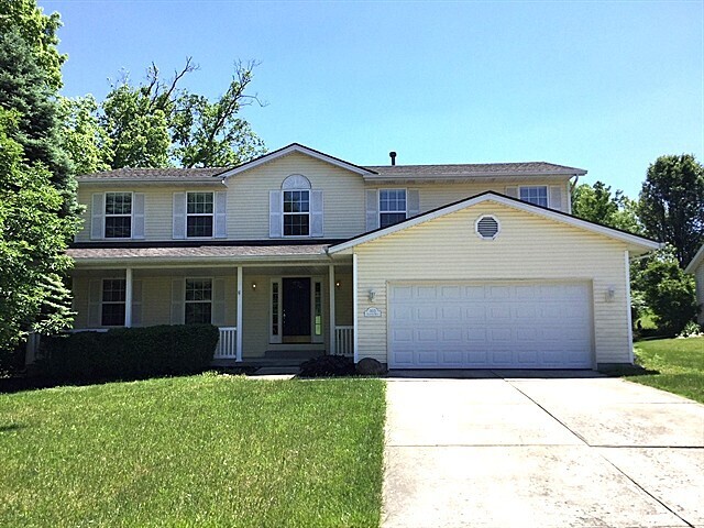
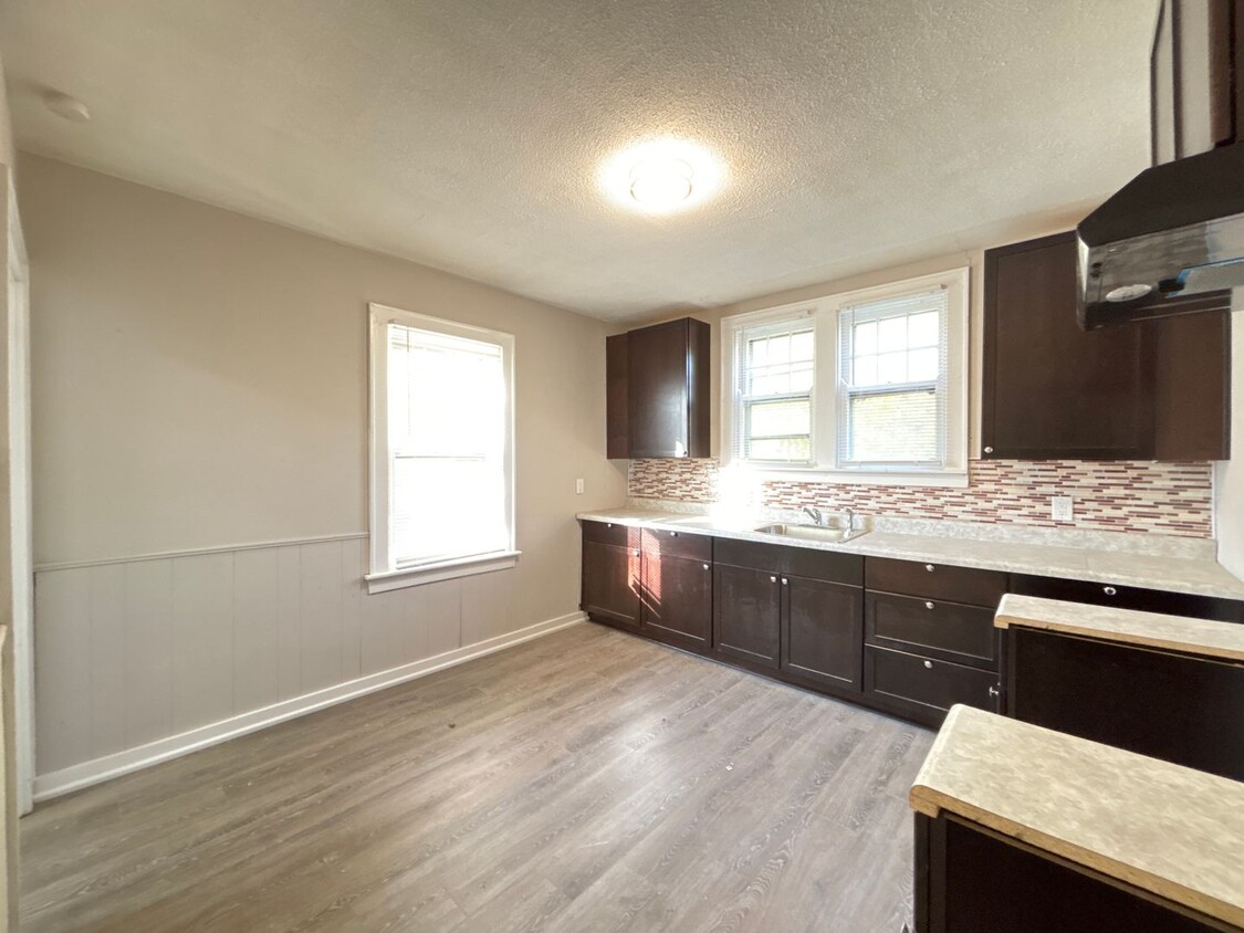
Introducing Home at East Westwood, a newly remodeled 4-bedroom, 2-bathroom house located in the vibrant city of Cincinnati, OH. Nestled in a convenient location, this spacious home offers a comfortable and modern living experience. Step inside and be greeted by the refreshing newly remodeled atmosphere. Additionally, this home features a private driveway, providing hassle-free parking for you and your guests. Whether you're hosting a gathering or enjoying a quiet evening, this house offers the perfect setting. Don't miss the opportunity to make this home your new address. Other details: • The application fee(s) must be paid in full at the time of application submission. These fees are non-refundable should your application be denied or if you choose to cancel the application. All persons over 18 who will be residing in the property must apply and pay the application fee(s) • Make sure to read the qualification requirements before submitting an application • Click this link for our pet policy and application requirements: • Tenant pays all electric/gas utilities • $50 utility fee is paid monthly for water/sewer/trash reimbursement. Overage reimbursements may also apply. • $18.99/month Resident Benefit Package will be charged each month (see details below) All Independence Property Management residents are enrolled in the Resident Benefits Package (RBP) for $18.99/month which includes HVAC air filter delivery (for applicable properties), credit building to help boost your credit score with timely rent payments, $1M Identity Protection, utility concierge service (making utility connection a breeze during your move-in), our best-in-class resident rewards program, and much more! More details upon application. Call or send us a message today / **Scam Alert: We Do Not Advertise on Craigslist**
3344 Saffer St is a house located in Hamilton County and the 45211 ZIP Code. This area is served by the Cincinnati Public Schools attendance zone.
* Price shown is base rent and may not include non-optional fees and utilities.
Price, availability, fees, and any applicable rent special are subject to change without notice.
* Square footage definitions vary. Displayed square footage is approximate.
Location
Get Directions
East Westwood is a small but popular neighborhood roughly six miles northwest of Downtown Cincinnati. It is close to everything you love about the city – the Cincinnati Zoo and Botanical Garden, the University of Cincinnati, and the Duke Energy Convention Center – while still providing a somewhat quieter place to call home. East Westwood is directly south of Interstate 74, making this area popular with commuters. The vast Mt. Airy Forest borders East Westwood on its north end, providing a fantastic back yard filled with hiking trails, a disc golf course, a dog park, the Maple Ridge Lodge, and the Unnewehr House. Single-family homes make up the bulk of the rental scene here, but there’s charm to be found in every listing in East Westwood.
Learn more about living in East Westwood
Education
| Colleges & Universities | Distance | ||
|---|---|---|---|
| Colleges & Universities | Distance | ||
| Drive: | 10 min | 3.7 mi | |
| Drive: | 9 min | 4.0 mi | |
| Drive: | 10 min | 4.4 mi | |
| Drive: | 17 min | 7.3 mi |
3344 Saffer St is within 10 minutes or 3.7 miles from Cincinnati State. It is also near University of Cincinnati and Univ. of Cincinnati, Medical.
Schools


Public Elementary School
Grades PK-6
409 Students
Attendance Zone
Public Middle & High School
Grades 7-12
897 Students
Attendance Zone
Public Middle & High School
Grades 6-12
1,418 Students
Attendance Zone
Private Elementary & Middle School
Grades K-8
189 Students
Nearby
Private Elementary & Middle School
Grades K-8
164 Students
Nearby
Private High School
Grades 9-12
495 Students
Nearby
School data provided by
 The GreatSchools Rating helps parents compare schools within a state based on a variety of school quality indicators and provides a helpful picture of how effectively each school serves all of its students. Ratings are on a scale of 1 (below average) to 10 (above average) and can include test scores, college readiness, academic progress, advanced courses, equity, discipline and attendance data. We also advise parents to visit schools, consider other information on school performance and programs, and consider family needs as part of the school selection process.
View GreatSchools Rating Methodology
View GreatSchools Rating Methodology
Transportation options available in Cincinnati include Brewery District Station, Elm & Henry, located 4.7 miles from 3344 Saffer St. 3344 Saffer St is near Cincinnati/Northern Kentucky International, located 18.7 miles or 34 minutes away.
| Transit / Subway | Distance | ||
|---|---|---|---|
| Transit / Subway | Distance | ||
| Drive: | 10 min | 4.7 mi | |
| Drive: | 10 min | 4.8 mi | |
| Drive: | 10 min | 4.9 mi | |
| Drive: | 11 min | 4.9 mi | |
| Drive: | 11 min | 5.1 mi |
| Commuter Rail | Distance | ||
|---|---|---|---|
| Commuter Rail | Distance | ||
|
|
Drive: | 9 min | 4.7 mi |
| Airports | Distance | ||
|---|---|---|---|
| Airports | Distance | ||
|
Cincinnati/Northern Kentucky International
|
Drive: | 34 min | 18.7 mi |
Time and distance from 3344 Saffer St.
| Shopping Centers | Distance | ||
|---|---|---|---|
| Shopping Centers | Distance | ||
| Drive: | 5 min | 2.4 mi | |
| Drive: | 8 min | 2.5 mi | |
| Drive: | 7 min | 3.0 mi |
3344 Saffer St has 3 shopping centers within 3.0 miles, which is about a 7-minute drive. The miles and minutes will be for the farthest away property.
| Parks and Recreation | Distance | ||
|---|---|---|---|
| Parks and Recreation | Distance | ||
|
Mt. Airy Forest
|
Drive: | 7 min | 3.0 mi |
|
Burnet Woods
|
Drive: | 9 min | 3.8 mi |
|
Buttercup Valley
|
Drive: | 10 min | 3.9 mi |
|
Trailside Nature Center
|
Drive: | 9 min | 3.9 mi |
|
Imago Earth Center
|
Drive: | 13 min | 5.3 mi |
3344 Saffer St has 5 parks within 5.3 miles, including Mt. Airy Forest, Buttercup Valley, and Trailside Nature Center.
| Hospitals | Distance | ||
|---|---|---|---|
| Hospitals | Distance | ||
| Drive: | 7 min | 3.3 mi | |
| Drive: | 10 min | 4.1 mi | |
| Drive: | 10 min | 4.5 mi |
3344 Saffer St has 3 hospitals within 4.5 miles, the nearest is Good Samaritan Hospital which is 3.3 miles away and a 7 minute drive.
| Military Bases | Distance | ||
|---|---|---|---|
| Military Bases | Distance | ||
| Drive: | 72 min | 54.4 mi | |
| Drive: | 78 min | 59.5 mi | |
| Drive: | 81 min | 62.7 mi |
3344 Saffer St has 3 military bases within 62.7 miles, the nearest is Gentile Air Force Station which is 54.4 miles away and a 72 minute drive.
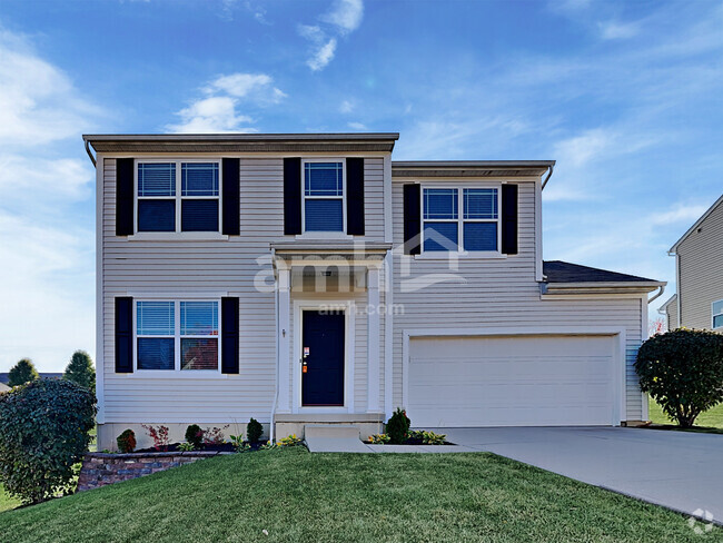
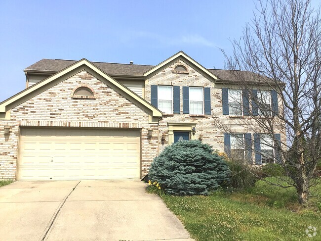
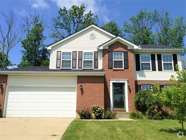
You May Also Like
Similar Rentals Nearby
-
-
-
-
-
-

-
-
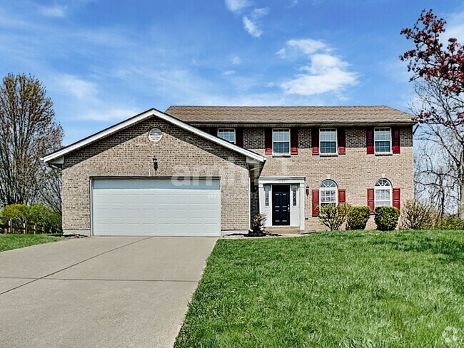 $2,8604 Beds, 2.5 Baths, 3,072 sq ftHouse for Rent
 -
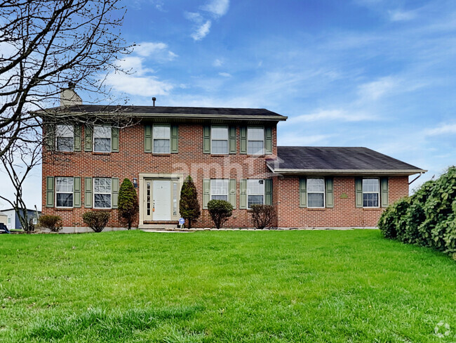 $2,7954 Beds, 2.5 Baths, 2,317 sq ftHouse for Rent
 -
What Are Walk Score®, Transit Score®, and Bike Score® Ratings?
Walk Score® measures the walkability of any address. Transit Score® measures access to public transit. Bike Score® measures the bikeability of any address.
What is a Sound Score Rating?
A Sound Score Rating aggregates noise caused by vehicle traffic, airplane traffic and local sources
3344 Saffer St
Cincinnati, OH 45211