$1,650 / Month
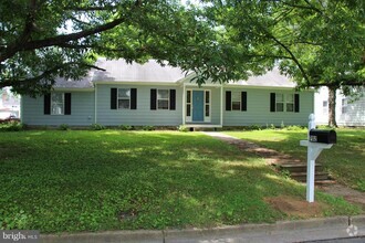
337 N Liberty St
Centreville, MD 21617
Today
Favorites
410-490-0460
-
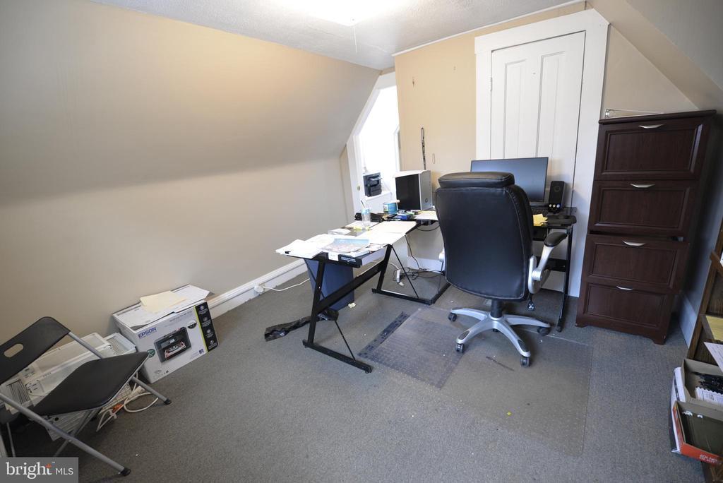
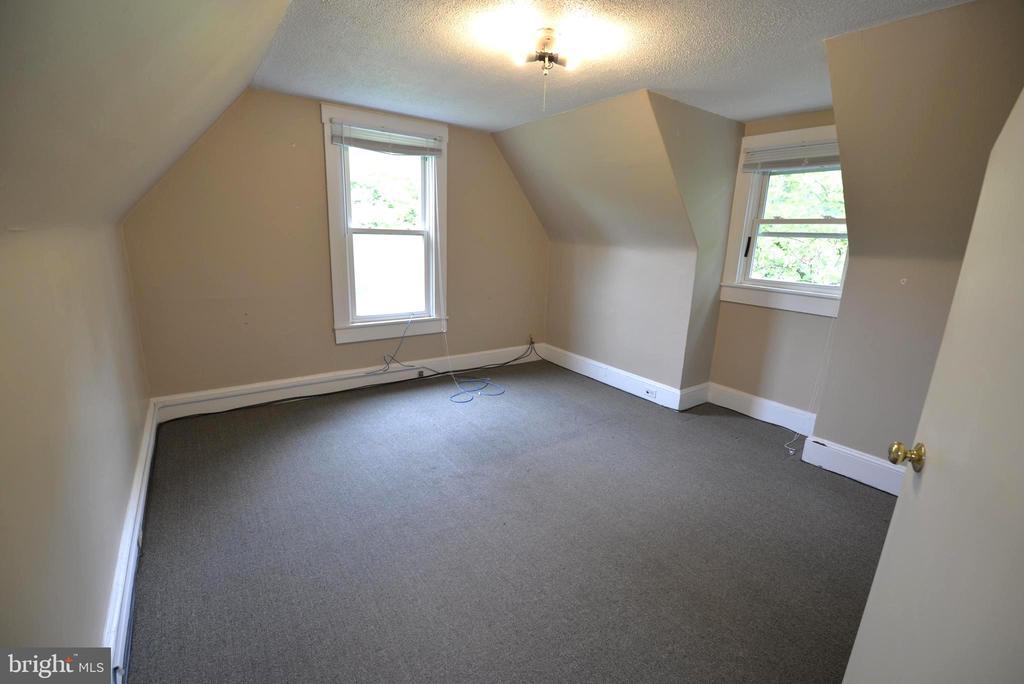
Bedrooms
2
-
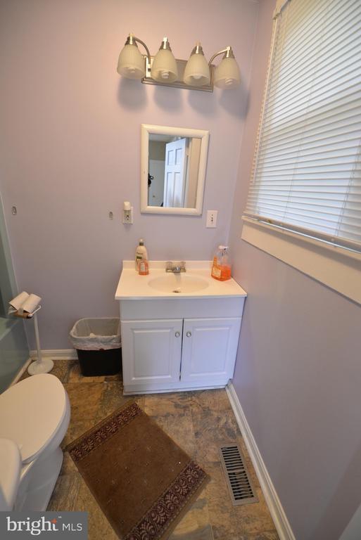
Bathrooms
1
-
Square Feet
--
-
Available
Available Apr 30
337 N Liberty St

Favorites
Contact
- Listed by Christopher J Rosendale III | CR Realty
- Phone Number
- Contact
-
Source
 Bright MLS, Inc.
Copyright © 2025 Bright MLS, Inc.
Location
Get Directions
Situated on the Corsica River — stemming from Chester River and the Chesapeake Bay — Centreville is a quaint small town with a family-friendly atmosphere. Known for its great public schools, local restaurants, and small businesses, Centreville is the ideal city for renters interested in a close-knit community near the waterfront. A few historic landmarks and longstanding homes give Centreville the historic charm its known for.
With such close proximity to the waterfront, residents can easily enjoy swimming, boating, fishing, and wildlife watching at the nearby Eastern Neck National Wildlife Refuge on Kent Island. Pubs, bistros, and seafood eateries can be found in town like Doc’s Riverside Grille, along with county offices, churches, and community parks. The closest major metro area to Centreville is Baltimore, located just 60 miles northwest across the waterfront.
Learn more about living in Centreville
Education
| Colleges & Universities | Distance | ||
|---|---|---|---|
| Colleges & Universities | Distance | ||
| Drive: | 25 min | 16.4 mi | |
| Drive: | 46 min | 30.0 mi | |
| Drive: | 48 min | 30.9 mi | |
| Drive: | 79 min | 49.3 mi |
337 N Liberty St is within 25 minutes or 16.4 miles from Washington College. It is also near Anne Arundel Community College and United States Naval Academy.
Schools


Public Elementary School
Grades PK-2
560 Students
Attendance Zone
Public Elementary School
Grades 3-5
455 Students
Attendance Zone
Public Middle School
Grades 6-8
481 Students
Attendance Zone
Public High School
Grades 9-12
1,209 Students
Attendance Zone
Private Elementary & Middle School
Grades PK-8
135 Students
Nearby
Private High School
Grades 9-12
57 Students
Nearby
School data provided by
 The GreatSchools Rating helps parents compare schools within a state based on a variety of school quality indicators and provides a helpful picture of how effectively each school serves all of its students. Ratings are on a scale of 1 (below average) to 10 (above average) and can include test scores, college readiness, academic progress, advanced courses, equity, discipline and attendance data. We also advise parents to visit schools, consider other information on school performance and programs, and consider family needs as part of the school selection process.
View GreatSchools Rating Methodology
View GreatSchools Rating Methodology
Transportation options available in Centreville include Cromwell Station/Glen Burnie, located 40.9 miles from 337 N Liberty St. 337 N Liberty St is near Baltimore/Washington International Thurgood Marshall, located 46.9 miles or 71 minutes away.
| Transit / Subway | Distance | ||
|---|---|---|---|
| Transit / Subway | Distance | ||
|
|
Drive: | 62 min | 40.9 mi |
|
|
Drive: | 64 min | 43.5 mi |
|
|
Drive: | 70 min | 45.5 mi |
|
|
Drive: | 73 min | 46.8 mi |
|
|
Drive: | 74 min | 47.0 mi |
| Commuter Rail | Distance | ||
|---|---|---|---|
| Commuter Rail | Distance | ||
|
|
Drive: | 76 min | 51.6 mi |
|
|
Drive: | 81 min | 53.4 mi |
|
|
Drive: | 93 min | 60.8 mi |
|
|
Drive: | 104 min | 67.6 mi |
|
|
Drive: | 104 min | 71.9 mi |
| Airports | Distance | ||
|---|---|---|---|
| Airports | Distance | ||
|
Baltimore/Washington International Thurgood Marshall
|
Drive: | 71 min | 46.9 mi |
Time and distance from 337 N Liberty St.
| Shopping Centers | Distance | ||
|---|---|---|---|
| Shopping Centers | Distance | ||
| Walk: | 18 min | 1.0 mi | |
| Drive: | 3 min | 1.6 mi | |
| Drive: | 12 min | 7.9 mi |
337 N Liberty St has 3 shopping centers within 7.9 miles, which is about a 12-minute walk. The miles and minutes will be for the farthest away property.
| Parks and Recreation | Distance | ||
|---|---|---|---|
| Parks and Recreation | Distance | ||
|
Wye Oak State Park
|
Drive: | 16 min | 8.8 mi |
|
Tuckahoe State Park
|
Drive: | 20 min | 10.2 mi |
|
Adkins Arboretum
|
Drive: | 27 min | 11.9 mi |
|
Eastern Neck National Wildlife Refuge
|
Drive: | 66 min | 36.9 mi |
337 N Liberty St has 4 parks within 36.9 miles, including Wye Oak State Park, Tuckahoe State Park, and Adkins Arboretum.
| Military Bases | Distance | ||
|---|---|---|---|
| Military Bases | Distance | ||
| Drive: | 62 min | 40.6 mi |
337 N Liberty St is 40.6 miles and a 62 minute drive from Dover Airforce Base.
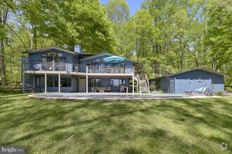
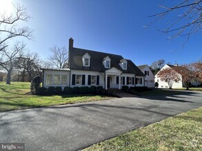
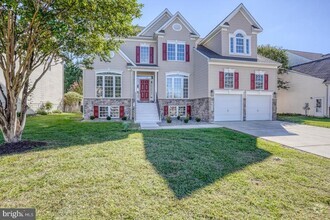
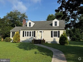
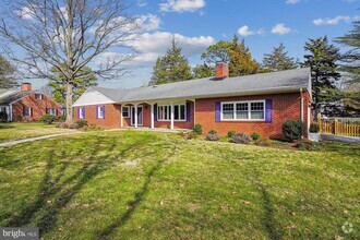
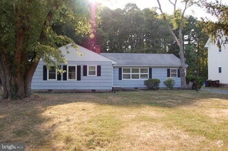
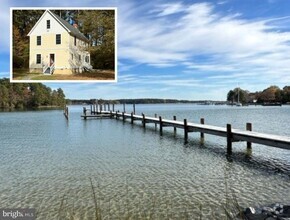
You May Also Like
Similar Rentals Nearby

What Are Walk Score®, Transit Score®, and Bike Score® Ratings?
Walk Score® measures the walkability of any address. Transit Score® measures access to public transit. Bike Score® measures the bikeability of any address.
What is a Sound Score Rating?
A Sound Score Rating aggregates noise caused by vehicle traffic, airplane traffic and local sources

337 N Liberty St
Centreville, MD 21617