$635 / Month
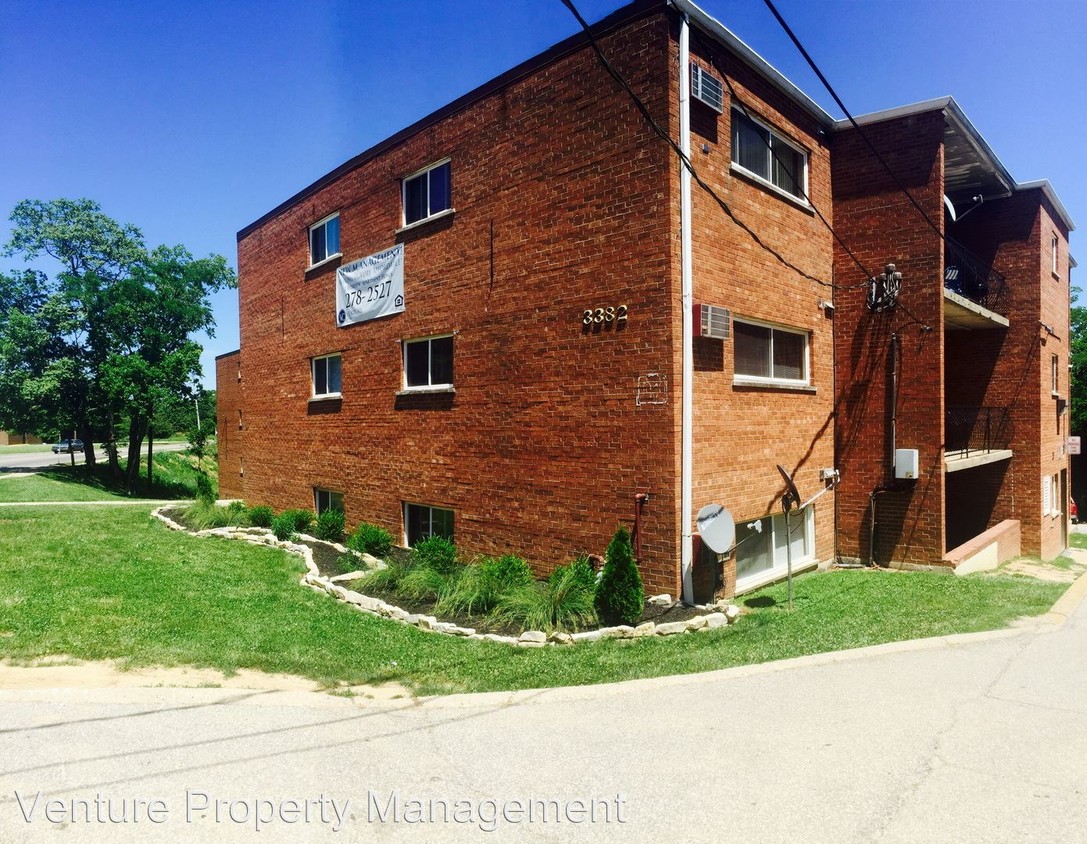
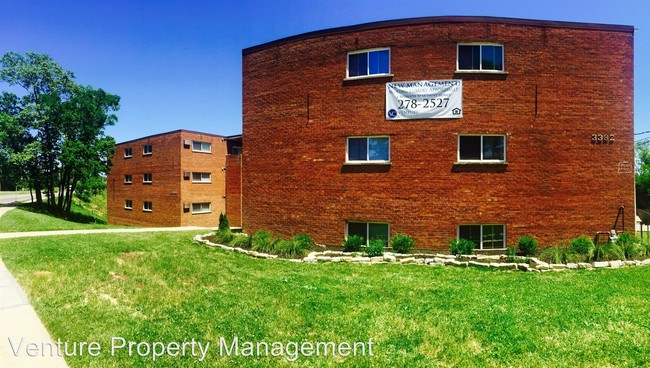
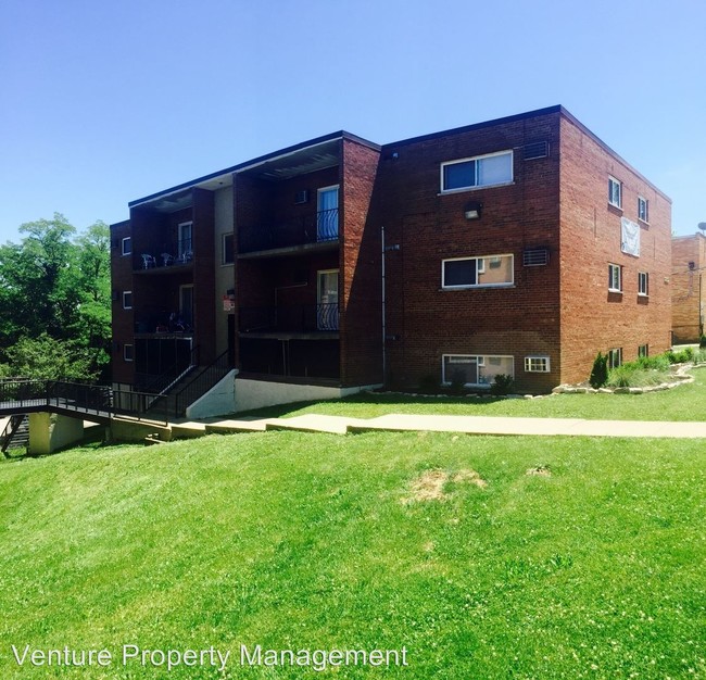
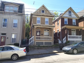
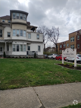
3382 Mchenry Ave
Cincinnati, OH 45225
2 Weeks Ago
Favorites
3382 Mchenry Ave

Favorites
Check Back Soon for Upcoming Availability
| Beds | Baths | Average SF |
|---|---|---|
| 2 Bedrooms 2 Bedrooms 2 Br | 1 Bath 1 Bath 1 Ba | 745 SF |
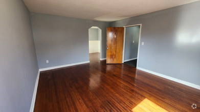
About This Property
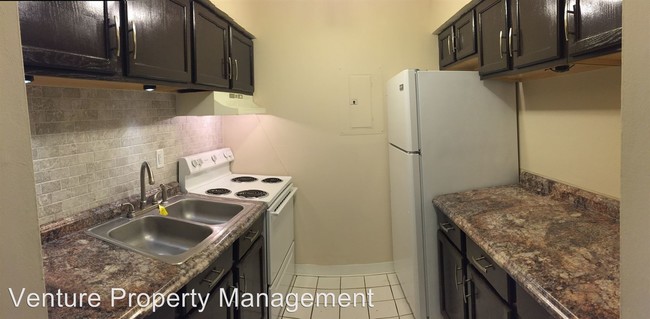
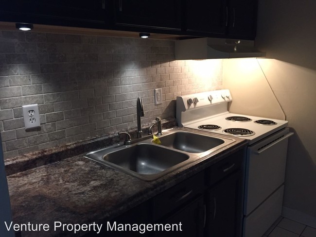
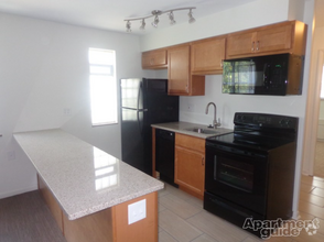
(513) 278-2527 x1 - Making Luxury Affordable! - Newly Renovated Luxury Apartment Home! "Making Luxury Affordable!" 2 Bedrooms & 1 Bathroom w/ Balcony! Rent: $635*/month! Includes: Heat, Water, Sewer, Storage, Trash Removal, and Off Street Parking Incredible Move-in Specials: DEPOSITS AS LOW AS $99! No Application Fees!! Discounted Rental Rates For Qualified Applicants!!! All New: Appliances, Tile Backsplash, Counter-Tops, Paint, Flooring, Fixtures and MORE! Safe & Secure Building: Secured Entry and Security Cameras. Located on the Bus Line! 24-Hour Emergency Maintenance! Close proximity to Hospitals, Shopping, Entertainment, Interstate, etc. Contact Venture Property Management today to schedule a showing! 513-278-2527 ext. #1 Leasing Office Hours: M-F 9am - 6pm, Sat. 10am - 4pm, Sun. Closed (RLNE1828159) Other Amenities - Balcony.
3382 Mchenry Ave is a condo located in Hamilton County and the 45225 ZIP Code.
Location
Get Directions
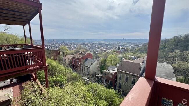
East Westwood is a small but popular neighborhood roughly six miles northwest of Downtown Cincinnati. It is close to everything you love about the city – the Cincinnati Zoo and Botanical Garden, the University of Cincinnati, and the Duke Energy Convention Center – while still providing a somewhat quieter place to call home. East Westwood is directly south of Interstate 74, making this area popular with commuters. The vast Mt. Airy Forest borders East Westwood on its north end, providing a fantastic back yard filled with hiking trails, a disc golf course, a dog park, the Maple Ridge Lodge, and the Unnewehr House. Single-family homes make up the bulk of the rental scene here, but there’s charm to be found in every listing in East Westwood.
Learn more about living in East WestwoodBelow are rent ranges for similar nearby apartments
Education
| Colleges & Universities | Distance | ||
|---|---|---|---|
| Colleges & Universities | Distance | ||
| Drive: | 11 min | 3.8 mi | |
| Drive: | 9 min | 4.0 mi | |
| Drive: | 11 min | 4.5 mi | |
| Drive: | 17 min | 6.6 mi |
3382 Mchenry Ave is within 11 minutes or 3.8 miles from Cincinnati State. It is also near University of Cincinnati and Univ. of Cincinnati, Medical.
Transportation options available in Cincinnati include Brewery District Station, Elm & Henry, located 4.8 miles from 3382 Mchenry Ave. 3382 Mchenry Ave is near Cincinnati/Northern Kentucky International, located 18.8 miles or 34 minutes away.
| Transit / Subway | Distance | ||
|---|---|---|---|
| Transit / Subway | Distance | ||
| Drive: | 11 min | 4.8 mi | |
| Drive: | 11 min | 4.9 mi | |
| Drive: | 11 min | 5.0 mi | |
| Drive: | 11 min | 5.0 mi | |
| Drive: | 11 min | 5.1 mi |
| Commuter Rail | Distance | ||
|---|---|---|---|
| Commuter Rail | Distance | ||
|
|
Drive: | 10 min | 4.7 mi |
| Airports | Distance | ||
|---|---|---|---|
| Airports | Distance | ||
|
Cincinnati/Northern Kentucky International
|
Drive: | 34 min | 18.8 mi |
Time and distance from 3382 Mchenry Ave.
| Shopping Centers | Distance | ||
|---|---|---|---|
| Shopping Centers | Distance | ||
| Drive: | 6 min | 2.4 mi | |
| Drive: | 9 min | 2.7 mi | |
| Drive: | 7 min | 3.0 mi |
3382 Mchenry Ave has 3 shopping centers within 3.0 miles, which is about a 7-minute drive. The miles and minutes will be for the farthest away property.
| Parks and Recreation | Distance | ||
|---|---|---|---|
| Parks and Recreation | Distance | ||
|
Mt. Airy Forest
|
Drive: | 7 min | 2.5 mi |
|
Buttercup Valley
|
Drive: | 10 min | 3.4 mi |
|
Burnet Woods
|
Drive: | 9 min | 3.8 mi |
|
Trailside Nature Center
|
Drive: | 9 min | 4.0 mi |
|
Imago Earth Center
|
Drive: | 13 min | 5.3 mi |
3382 Mchenry Ave has 5 parks within 5.3 miles, including Mt. Airy Forest, Buttercup Valley, and Trailside Nature Center.
| Hospitals | Distance | ||
|---|---|---|---|
| Hospitals | Distance | ||
| Drive: | 8 min | 3.3 mi | |
| Drive: | 10 min | 4.2 mi | |
| Drive: | 11 min | 4.5 mi |
3382 Mchenry Ave has 3 hospitals within 4.5 miles, the nearest is Good Samaritan Hospital which is 3.3 miles away and a 8 minute drive.
| Military Bases | Distance | ||
|---|---|---|---|
| Military Bases | Distance | ||
| Drive: | 72 min | 54.2 mi | |
| Drive: | 79 min | 59.3 mi | |
| Drive: | 81 min | 62.5 mi |
3382 Mchenry Ave has 3 military bases within 62.5 miles, the nearest is Gentile Air Force Station which is 54.2 miles away and a 72 minute drive.
You May Also Like
Similar Rentals Nearby
What Are Walk Score®, Transit Score®, and Bike Score® Ratings?
Walk Score® measures the walkability of any address. Transit Score® measures access to public transit. Bike Score® measures the bikeability of any address.
What is a Sound Score Rating?
A Sound Score Rating aggregates noise caused by vehicle traffic, airplane traffic and local sources

3382 Mchenry Ave
Cincinnati, OH 45225