$2,195 / Month
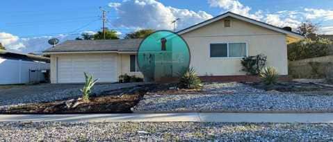
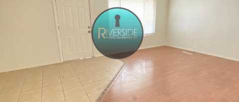
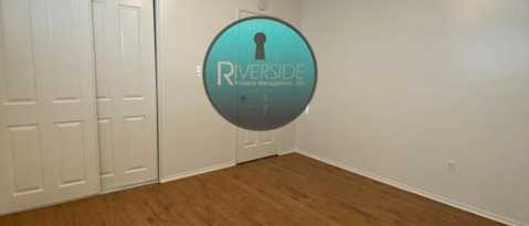
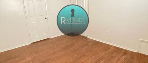
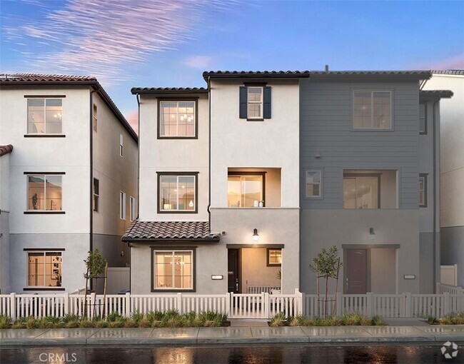
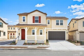
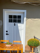
340 E Citron St
Corona, CA 92879
Today
Favorites
-
Bedrooms
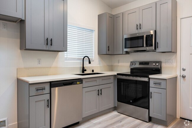
3
-
Bathrooms
2
-
Square Feet
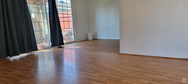
1,278 sq ft
340 E Citron St

Favorites
About This Home
---- SCHEDULE A SHOWING ONLINE AT: ----
340 E Citron St is a condo located in Riverside County and the 92879 ZIP Code.
* Price shown is base rent and may not include non-optional fees and utilities.
Price, availability, fees, and any applicable rent special are subject to change without notice.
* Square footage definitions vary. Displayed square footage is approximate.
Location
Get Directions
Located between the Santa Ana Mountains, Chino Hills State Park, and Lake Mathews Estelle Mountain Reserve, Corona’s residents enjoy a diverse landscape that encompasses everything from abundant retail centers to unspoiled natural beauty. The city’s location offers easy access to both the Inland Empire and Orange County; this along with the abundance of attractive, Spanish-style homes and excellent public schools makes Corona a popular home base for many commuters. The cost of living is relatively low compared to other parts of SoCal, and rental rates for homes and apartments range from the high-end to the highly-affordable.
Corona is also known as the “Circle City”. The town is named for the three-mile circular layout found at Grand Boulevard. This circular hub houses several parks, a farmers market, local eateries, and the Corona Regional Medical Center. Grand Boulevard is one of several commercial hubs in Corona.
Learn more about living in Corona
Education
| Colleges & Universities | Distance | ||
|---|---|---|---|
| Colleges & Universities | Distance | ||
| Drive: | 10 min | 4.7 mi | |
| Drive: | 13 min | 7.2 mi | |
| Drive: | 16 min | 11.3 mi | |
| Drive: | 25 min | 18.7 mi |
340 E Citron St is within 10 minutes or 4.7 miles from Norco College. It is also near La Sierra University and California Baptist University.
Transportation options available in Corona include Apu / Citrus College Station, located 31.5 miles from 340 E Citron St. 340 E Citron St is near Ontario International, located 17.3 miles or 25 minutes away, and John Wayne/Orange County, located 29.8 miles or 37 minutes away.
| Transit / Subway | Distance | ||
|---|---|---|---|
| Transit / Subway | Distance | ||
| Drive: | 41 min | 31.5 mi | |
| Drive: | 40 min | 32.1 mi | |
| Drive: | 42 min | 33.3 mi | |
| Drive: | 44 min | 35.8 mi | |
|
|
Drive: | 44 min | 36.8 mi |
| Commuter Rail | Distance | ||
|---|---|---|---|
| Commuter Rail | Distance | ||
|
|
Drive: | 5 min | 2.0 mi |
|
|
Drive: | 8 min | 4.7 mi |
|
|
Drive: | 12 min | 7.5 mi |
|
|
Drive: | 21 min | 12.8 mi |
|
|
Drive: | 22 min | 14.7 mi |
| Airports | Distance | ||
|---|---|---|---|
| Airports | Distance | ||
|
Ontario International
|
Drive: | 25 min | 17.3 mi |
|
John Wayne/Orange County
|
Drive: | 37 min | 29.8 mi |
Time and distance from 340 E Citron St.
| Shopping Centers | Distance | ||
|---|---|---|---|
| Shopping Centers | Distance | ||
| Walk: | 13 min | 0.7 mi | |
| Walk: | 14 min | 0.7 mi | |
| Walk: | 15 min | 0.8 mi |
340 E Citron St has 3 shopping centers within 0.8 mile, which is about a 15-minute walk. The miles and minutes will be for the farthest away property.
| Parks and Recreation | Distance | ||
|---|---|---|---|
| Parks and Recreation | Distance | ||
|
Hidden Valley Nature Center
|
Drive: | 15 min | 9.1 mi |
|
California Citrus State Historical Park
|
Drive: | 22 min | 12.5 mi |
|
Chino Creek Wetlands and Educational Park
|
Drive: | 19 min | 13.3 mi |
|
Chino Hills State Park
|
Drive: | 40 min | 16.9 mi |
|
Rancho Sonado
|
Drive: | 33 min | 24.8 mi |
340 E Citron St has 5 parks within 24.8 miles, including Hidden Valley Nature Center, California Citrus State Historical Park, and Chino Creek Wetlands and Educational Park.
| Hospitals | Distance | ||
|---|---|---|---|
| Hospitals | Distance | ||
| Walk: | 18 min | 1.0 mi | |
| Drive: | 11 min | 7.6 mi | |
| Drive: | 15 min | 10.3 mi |
340 E Citron St has 3 hospitals within 10.3 miles, the nearest is Corona Regional Medical Center which is 1.0 mile away and a 18 minute walk.
| Military Bases | Distance | ||
|---|---|---|---|
| Military Bases | Distance | ||
| Drive: | 47 min | 23.8 mi |
340 E Citron St is 23.8 miles and a 47 minute drive from March Air Reserve Base.
You May Also Like
Similar Rentals Nearby
-
-
-
-
-
-

-

-
-
-
 $3,3953 Beds, 1 Bath, 1,000 sq ftApartment for Rent
What Are Walk Score®, Transit Score®, and Bike Score® Ratings?
Walk Score® measures the walkability of any address. Transit Score® measures access to public transit. Bike Score® measures the bikeability of any address.
What is a Sound Score Rating?
A Sound Score Rating aggregates noise caused by vehicle traffic, airplane traffic and local sources

340 E Citron St
Corona, CA 92879