

$2,795 / Month
340 N Civic Dr Unit 204
Walnut Creek, CA 94596
2 Weeks Ago
Favorites
340 N Civic Dr Unit 204

Favorites
Check Back Soon for Upcoming Availability
| Beds | Baths | Average SF |
|---|---|---|
| 2 Bedrooms 2 Bedrooms 2 Br | 2 Baths 2 Baths 2 Ba | 1,023 SF |
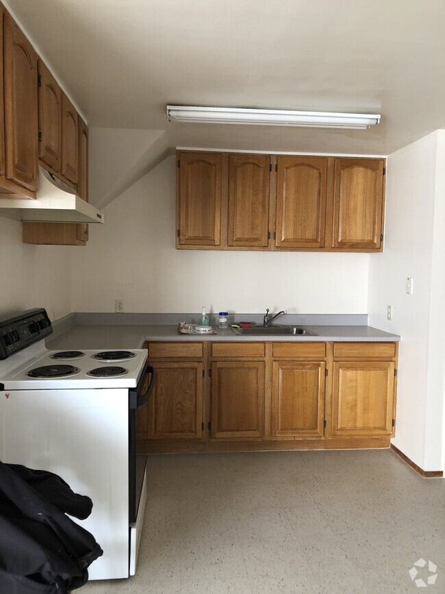
About This Property
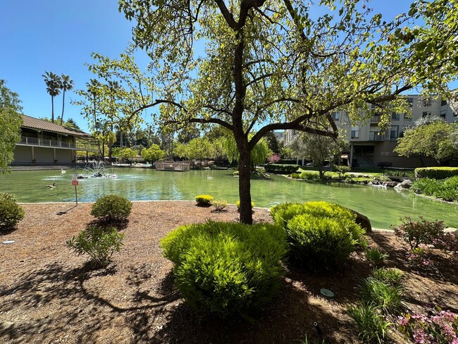
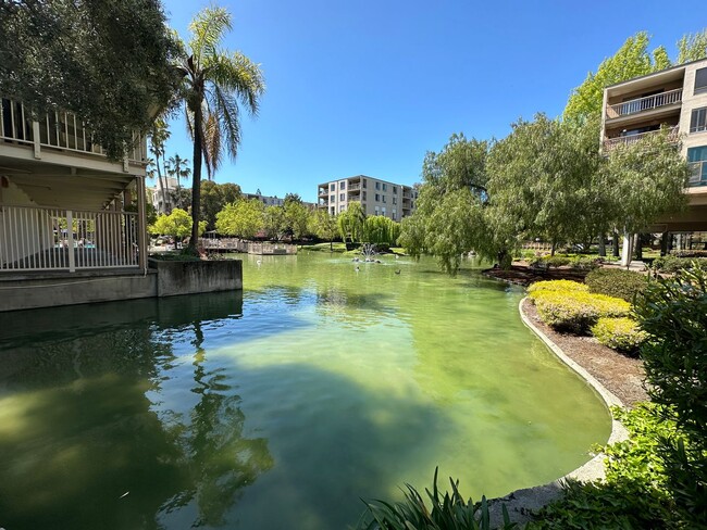
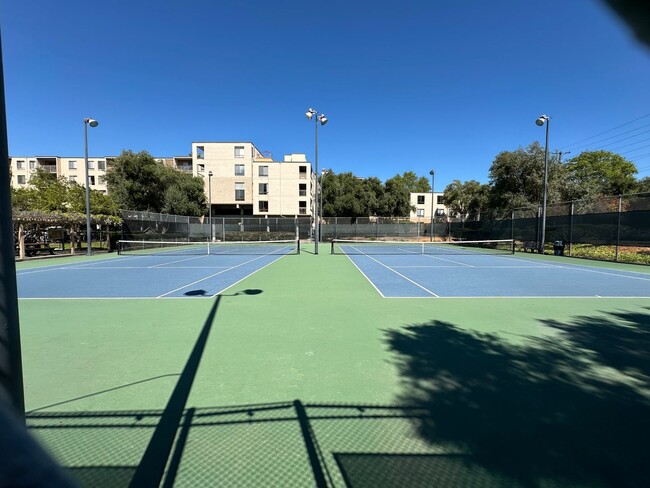
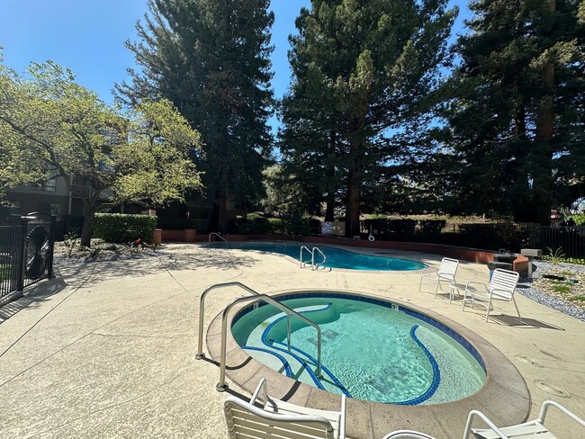
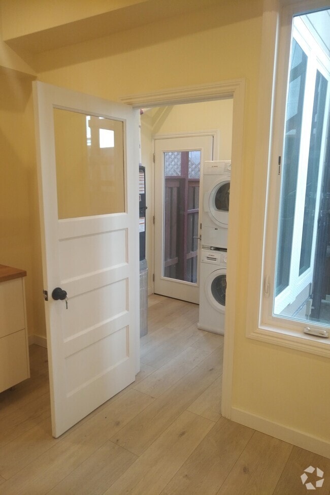
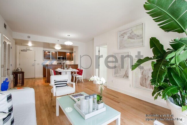
2 bed 2 bath, apx 1,023 sq ft. Located in the Keys condo community. Spacious unit with updates. Close to downtown, shopping, and BART. Gated parking and security access building. 3 community pools, 3 hot tubs, tennis courts, and clubhouse. Water and garbage included.
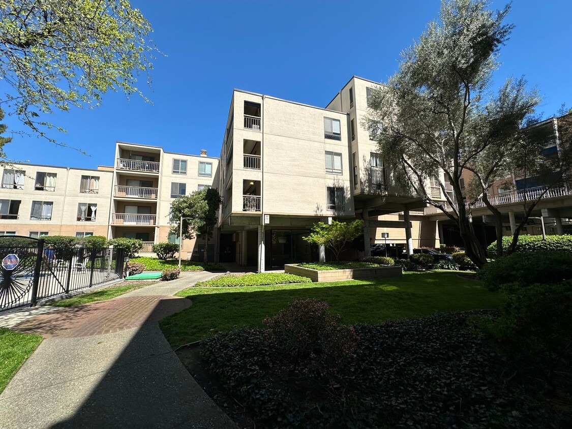
340 N Civic Dr is a condo located in Contra Costa County and the 94596 ZIP Code. This area is served by the Walnut Creek Elementary attendance zone.
Location
Get Directions
The Keys is a small suburban neighborhood located just a few blocks north of Downtown Walnut Creek. The neighborhood itself is almost entirely residential, with several parks and public schools nearby. Residents enjoy prime access to the wealth of shopping, dining, and entertainment in the city center, from the high-end Broadway Plaza open-air mall to the eclectic cafes and bars along Main Street. With convenient access to Interstate 680 and the Pleasant Hill/Contra Costa Centre BART station, living in The Keys puts the entire bay area at your fingertips.
Learn more about living in The KeysBelow are rent ranges for similar nearby apartments
Education
| Colleges & Universities | Distance | ||
|---|---|---|---|
| Colleges & Universities | Distance | ||
| Drive: | 11 min | 4.9 mi | |
| Drive: | 17 min | 7.5 mi | |
| Drive: | 24 min | 15.0 mi | |
| Drive: | 28 min | 18.8 mi |
340 N Civic Dr Unit 204 is within 11 minutes or 4.9 miles from Diablo Valley, Pleasant Hill. It is also near Saint Marys Coll. of Calif. and UC Berkeley.
Schools


Public Elementary School
Grades K-5
497 Students
Nearby
Public Elementary School
Grades K-5
356 Students
Attendance Zone
Public Middle School
Grades 6-8
985 Students
Attendance Zone
Public High School
Grades 9-12
1,571 Students
Attendance Zone
Private Elementary & Middle School
Grades PK-8
259 Students
Nearby
Private Elementary School
Grades K-3
Nearby
Private Middle & High School
Grades 6-12
Nearby
School data provided by
 The GreatSchools Rating helps parents compare schools within a state based on a variety of school quality indicators and provides a helpful picture of how effectively each school serves all of its students. Ratings are on a scale of 1 (below average) to 10 (above average) and can include test scores, college readiness, academic progress, advanced courses, equity, discipline and attendance data. We also advise parents to visit schools, consider other information on school performance and programs, and consider family needs as part of the school selection process.
View GreatSchools Rating Methodology
View GreatSchools Rating Methodology
Transportation options available in Walnut Creek include Walnut Creek Station, located 0.7 mile from 340 N Civic Dr Unit 204. 340 N Civic Dr Unit 204 is near Metro Oakland International, located 24.8 miles or 34 minutes away, and San Francisco International, located 36.8 miles or 52 minutes away.
| Transit / Subway | Distance | ||
|---|---|---|---|
| Transit / Subway | Distance | ||
|
|
Walk: | 14 min | 0.7 mi |
|
|
Drive: | 2 min | 1.2 mi |
|
|
Drive: | 6 min | 4.8 mi |
|
|
Drive: | 10 min | 5.8 mi |
|
|
Drive: | 10 min | 7.4 mi |
| Commuter Rail | Distance | ||
|---|---|---|---|
| Commuter Rail | Distance | ||
|
|
Drive: | 15 min | 11.2 mi |
|
|
Drive: | 24 min | 16.2 mi |
|
|
Drive: | 24 min | 17.9 mi |
|
|
Drive: | 27 min | 19.9 mi |
|
|
Drive: | 26 min | 20.1 mi |
| Airports | Distance | ||
|---|---|---|---|
| Airports | Distance | ||
|
Metro Oakland International
|
Drive: | 34 min | 24.8 mi |
|
San Francisco International
|
Drive: | 52 min | 36.8 mi |
Time and distance from 340 N Civic Dr Unit 204.
| Shopping Centers | Distance | ||
|---|---|---|---|
| Shopping Centers | Distance | ||
| Walk: | 4 min | 0.3 mi | |
| Walk: | 5 min | 0.3 mi | |
| Walk: | 14 min | 0.7 mi |
340 N Civic Dr Unit 204 has 3 shopping centers within 0.7 mile, which is about a 14-minute walk. The miles and minutes will be for the farthest away property.
| Parks and Recreation | Distance | ||
|---|---|---|---|
| Parks and Recreation | Distance | ||
|
Butterfly Habitat Gardens
|
Walk: | 12 min | 0.7 mi |
|
Civic Park
|
Walk: | 12 min | 0.7 mi |
|
Contra Costa Canal Regional Trail
|
Drive: | 2 min | 1.2 mi |
|
Gardens at Heather Farm
|
Drive: | 4 min | 1.9 mi |
|
Heather Farm Park
|
Drive: | 4 min | 2.0 mi |
340 N Civic Dr Unit 204 has 5 parks within 2.0 miles, including Butterfly Habitat Gardens, Civic Park, and Contra Costa Canal Regional Trail.
| Hospitals | Distance | ||
|---|---|---|---|
| Hospitals | Distance | ||
| Drive: | 2 min | 1.5 mi | |
| Drive: | 3 min | 1.5 mi | |
| Drive: | 9 min | 6.3 mi |
340 N Civic Dr Unit 204 has 3 hospitals within 6.3 miles, the nearest is John Muir Medical Center - Walnut Creek Campus which is 1.5 miles away and a 2 minute drive.
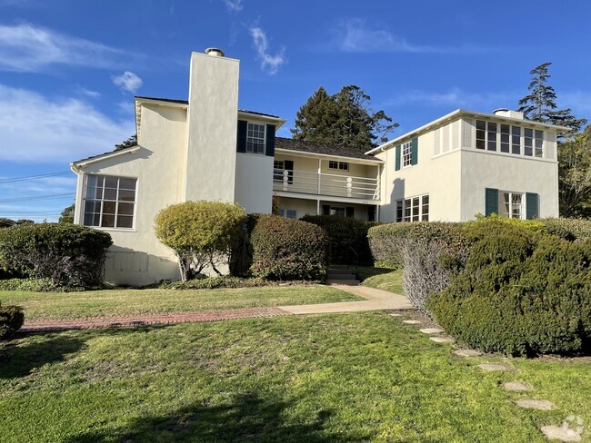
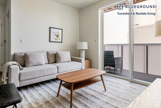
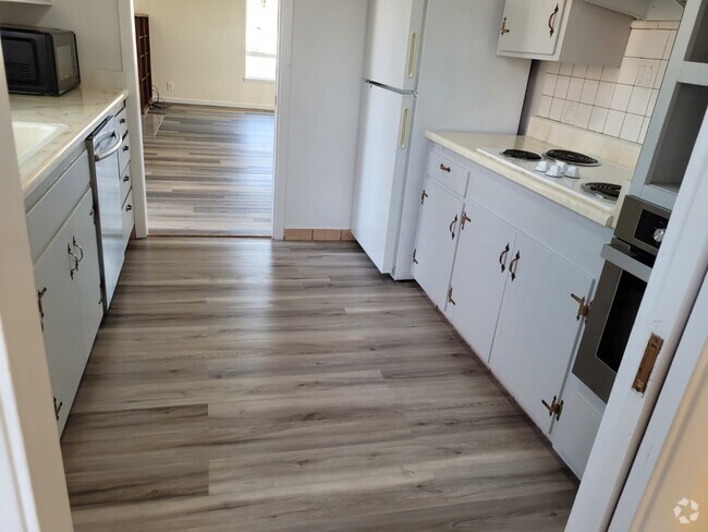
You May Also Like
Similar Rentals Nearby


What Are Walk Score®, Transit Score®, and Bike Score® Ratings?
Walk Score® measures the walkability of any address. Transit Score® measures access to public transit. Bike Score® measures the bikeability of any address.
What is a Sound Score Rating?
A Sound Score Rating aggregates noise caused by vehicle traffic, airplane traffic and local sources
340 N Civic Dr
Walnut Creek, CA 94596