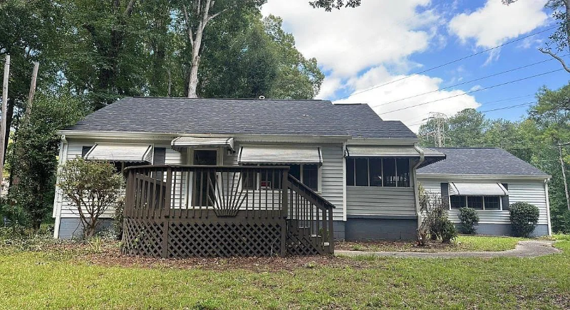
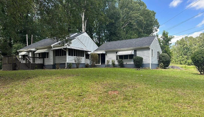
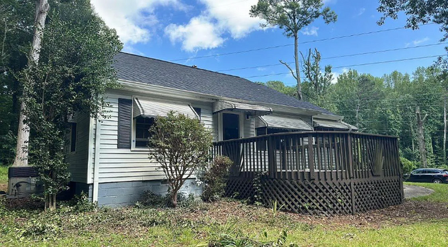
3416 Mt Olive Rd
East Point, GA 30344
-
Bedrooms
3
-
Bathrooms
1
-
Square Feet
--
-
Available
Available Apr 15
Highlights
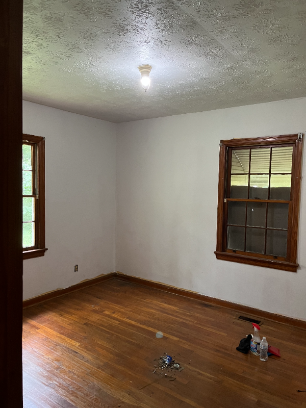
- Hardwood Floors
- Security System

About This Home
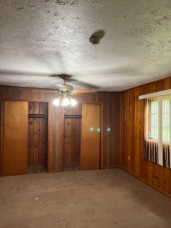
Property Id: 1820389 Beautifully updated home with fresh paint and new carpet. Features a large yard and plenty of parking. Bonus room and lots of storage space. Enjoy the convenience of MARTA bus service right at your doorstep. Quick and easy access to Atlanta Airport (less than 4 miles) and I-285 for smooth travel and commuting. Located in a friendly, well-established neighborhood with Asa G. Hilliard Elementary and Woodland Middle School within walking distance. Just 2.3 miles from the prestigious Woodward Academy. Only 2.5 miles from Camp Creek Marketplace, offering a variety of stores, restaurants, and services including Lowe's, Target, Ross, Publix, Bath & Body Works, Five Below, GameStop, Lane Bryant, Old Navy, and more. Close to downtown Atlanta, Georgia State and Georgia Tech campuses, and Tyler Perry Studios. Renter pays utilities.
3416 Mt Olive Rd is a house located in Fulton County and the 30344 ZIP Code.
House Features
Hardwood Floors
Microwave
Refrigerator
Tile Floors
- Security System
- Microwave
- Oven
- Refrigerator
- Hardwood Floors
- Tile Floors
Contact
- Phone Number
- Contact
-
Source

- Security System
- Microwave
- Oven
- Refrigerator
- Hardwood Floors
- Tile Floors
Aerotropolis refers to an array of Southside Atlanta communities surrounding Hartsfield-Jackson Atlanta International Airport, the world’s busiest airport. The cities of College Park, Chattahoochee Hills, East Point, Fairburn, Forest Park, Union City, Hapeville, Morrow, and Palmetto are all a part of the Aerotropolis Alliance, working together on initiatives to improve their respective communities.
Aerotropolis’ close proximity to the airport makes the region an ideal choice for local employees and frequent travelers alike. A wide variety of rentals are available throughout the region, from luxury apartments and cozy condos to charming townhomes and spacious houses. Getting around from Aerotropolis is easy with access to I-75, I-85, and I-285.
Learn more about living in Aerotropolis| Colleges & Universities | Distance | ||
|---|---|---|---|
| Colleges & Universities | Distance | ||
| Drive: | 14 min | 7.1 mi | |
| Drive: | 18 min | 7.8 mi | |
| Drive: | 16 min | 8.2 mi | |
| Drive: | 17 min | 8.5 mi |
Transportation options available in East Point include College Park, located 2.3 miles from 3416 Mt Olive Rd. 3416 Mt Olive Rd is near Hartsfield - Jackson Atlanta International, located 7.2 miles or 16 minutes away.
| Transit / Subway | Distance | ||
|---|---|---|---|
| Transit / Subway | Distance | ||
|
|
Drive: | 6 min | 2.3 mi |
|
|
Drive: | 8 min | 3.2 mi |
|
|
Drive: | 9 min | 3.8 mi |
|
|
Drive: | 11 min | 5.1 mi |
|
|
Drive: | 11 min | 5.9 mi |
| Commuter Rail | Distance | ||
|---|---|---|---|
| Commuter Rail | Distance | ||
|
|
Drive: | 25 min | 14.5 mi |
| Airports | Distance | ||
|---|---|---|---|
| Airports | Distance | ||
|
Hartsfield - Jackson Atlanta International
|
Drive: | 16 min | 7.2 mi |
Time and distance from 3416 Mt Olive Rd.
| Shopping Centers | Distance | ||
|---|---|---|---|
| Shopping Centers | Distance | ||
| Walk: | 7 min | 0.4 mi | |
| Walk: | 18 min | 1.0 mi | |
| Drive: | 4 min | 1.6 mi |
| Parks and Recreation | Distance | ||
|---|---|---|---|
| Parks and Recreation | Distance | ||
|
West Atlanta Watershed Alliance (WAWA)
|
Drive: | 16 min | 6.4 mi |
|
Cascade Springs Nature Preserve
|
Drive: | 12 min | 7.6 mi |
|
Park Pride
|
Drive: | 17 min | 9.0 mi |
|
Atlanta BeltLine Southwest Connector Spur Trail
|
Drive: | 17 min | 9.8 mi |
|
Zoo Atlanta
|
Drive: | 19 min | 10.1 mi |
| Hospitals | Distance | ||
|---|---|---|---|
| Hospitals | Distance | ||
| Drive: | 15 min | 6.2 mi | |
| Drive: | 19 min | 9.9 mi | |
| Drive: | 21 min | 11.5 mi |
| Military Bases | Distance | ||
|---|---|---|---|
| Military Bases | Distance | ||
| Drive: | 12 min | 5.7 mi | |
| Drive: | 27 min | 17.3 mi |
You May Also Like
What Are Walk Score®, Transit Score®, and Bike Score® Ratings?
Walk Score® measures the walkability of any address. Transit Score® measures access to public transit. Bike Score® measures the bikeability of any address.
What is a Sound Score Rating?
A Sound Score Rating aggregates noise caused by vehicle traffic, airplane traffic and local sources

3416 Mt Olive Rd
East Point, GA 30344