-
Westview Terrace

-

-
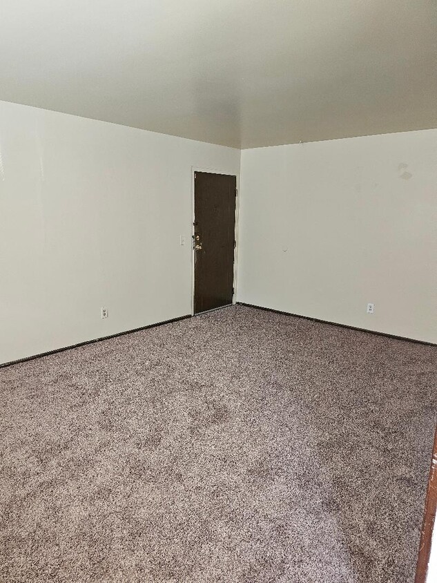
Living Room
-

$725 - $825 / Month
3449 McHenry Ave
Cincinnati, OH 45225
2 Weeks Ago
Favorites
513-666-5535
-
Bedrooms
1 - 2
-
Bathrooms
1
-
Square Feet
750 - 850 sq ft
-
Available
Available Now
3449 McHenry Ave

Favorites
2 Available Units
11
$725
1 bed,
1 bath,
750 sq ft
12 Month Lease, $725 deposit,
Available Now
27
$825
2 beds,
1 bath,
850 sq ft
12 Month Lease, $825 deposit,
Available Now
* Price shown is base rent and may not include non-optional fees and utilities.
Price, availability, fees, and any applicable rent special are subject to change without notice.
* Square footage definitions vary. Displayed square footage is approximate.
About 3449 McHenry Ave Cincinnati, OH 45225
12 Month Lease,
$725 deposit,
Available Now
Free Heat and Water, Off street parking, Laundry in building, Wall to Wall carpet, Secure Building, Clean, Quiet Living 1 Bedroom - $ 725.00 Westwood
Free Heat and Water, Off street parking, Laundry in building, Wall to Wall carpet, Bus Stop in Front of the property, Secure Building, Clean, Quiet Living Westwood
3449 McHenry Ave is an apartment community located in Hamilton County and the 45225 ZIP Code. This area is served by the Cincinnati Public Schools attendance zone.
* Price shown is base rent and may not include non-optional fees and utilities.
Price, availability, fees, and any applicable rent special are subject to change without notice.
* Square footage definitions vary. Displayed square footage is approximate.
Apartment Features
Tub/Shower
Oven
Range
Carpet
- Cable Ready
- Tub/Shower
- Kitchen
- Oven
- Range
- Carpet
- Laundry Facilities
Fees and Policies
The fees below are based on community-supplied data and may exclude additional fees and utilities.
- Parking
-
Surface Lot--
Details
Utilities Included
-
Gas
-
Water
-
Heat
-
Trash Removal
-
Sewer
Lease Options
-
12 Months
Property Information
-
2 units
Contact
- Phone Number
Location
Get Directions
East Westwood is a small but popular neighborhood roughly six miles northwest of Downtown Cincinnati. It is close to everything you love about the city – the Cincinnati Zoo and Botanical Garden, the University of Cincinnati, and the Duke Energy Convention Center – while still providing a somewhat quieter place to call home. East Westwood is directly south of Interstate 74, making this area popular with commuters. The vast Mt. Airy Forest borders East Westwood on its north end, providing a fantastic back yard filled with hiking trails, a disc golf course, a dog park, the Maple Ridge Lodge, and the Unnewehr House. Single-family homes make up the bulk of the rental scene here, but there’s charm to be found in every listing in East Westwood.
Learn more about living in East Westwood
Education
| Colleges & Universities | Distance | ||
|---|---|---|---|
| Colleges & Universities | Distance | ||
| Drive: | 11 min | 3.9 mi | |
| Drive: | 9 min | 4.1 mi | |
| Drive: | 11 min | 4.6 mi | |
| Drive: | 17 min | 7.6 mi |
3449 McHenry Ave is within 11 minutes or 3.9 miles from Cincinnati State. It is also near University of Cincinnati and Univ. of Cincinnati, Medical.
Schools


Public Elementary School
Grades PK-6
409 Students
Attendance Zone
Public Middle & High School
Grades 6-12
1,418 Students
Attendance Zone
Public Middle & High School
Grades 7-12
760 Students
Attendance Zone
Private Elementary & Middle School
Grades K-8
189 Students
Nearby
Private Elementary & Middle School
Grades K-8
164 Students
Nearby
Private High School
Grades 9-12
495 Students
Nearby
School data provided by
 The GreatSchools Rating helps parents compare schools within a state based on a variety of school quality indicators and provides a helpful picture of how effectively each school serves all of its students. Ratings are on a scale of 1 (below average) to 10 (above average) and can include test scores, college readiness, academic progress, advanced courses, equity, discipline and attendance data. We also advise parents to visit schools, consider other information on school performance and programs, and consider family needs as part of the school selection process.
View GreatSchools Rating Methodology
View GreatSchools Rating Methodology
Transportation options available in Cincinnati include Brewery District Station, Elm & Henry, located 4.9 miles from 3449 McHenry Ave. 3449 McHenry Ave is near Cincinnati/Northern Kentucky International, located 18.9 miles or 35 minutes away.
| Transit / Subway | Distance | ||
|---|---|---|---|
| Transit / Subway | Distance | ||
| Drive: | 11 min | 4.9 mi | |
| Drive: | 11 min | 5.0 mi | |
| Drive: | 11 min | 5.1 mi | |
| Drive: | 11 min | 5.1 mi | |
| Drive: | 12 min | 5.2 mi |
| Commuter Rail | Distance | ||
|---|---|---|---|
| Commuter Rail | Distance | ||
|
|
Drive: | 10 min | 4.8 mi |
| Airports | Distance | ||
|---|---|---|---|
| Airports | Distance | ||
|
Cincinnati/Northern Kentucky International
|
Drive: | 35 min | 18.9 mi |
Time and distance from 3449 McHenry Ave.
| Shopping Centers | Distance | ||
|---|---|---|---|
| Shopping Centers | Distance | ||
| Drive: | 6 min | 2.5 mi | |
| Drive: | 9 min | 2.8 mi | |
| Drive: | 7 min | 3.1 mi |
3449 McHenry Ave has 3 shopping centers within 3.1 miles, which is about a 7-minute drive. The miles and minutes will be for the farthest away property.
| Parks and Recreation | Distance | ||
|---|---|---|---|
| Parks and Recreation | Distance | ||
|
Mt. Airy Forest
|
Drive: | 7 min | 2.4 mi |
|
Buttercup Valley
|
Drive: | 9 min | 3.2 mi |
|
Burnet Woods
|
Drive: | 9 min | 3.9 mi |
|
Trailside Nature Center
|
Drive: | 9 min | 4.1 mi |
|
LaBoiteaux Woods
|
Drive: | 12 min | 4.4 mi |
3449 McHenry Ave has 5 parks within 4.4 miles, including Mt. Airy Forest, Buttercup Valley, and Trailside Nature Center.
| Hospitals | Distance | ||
|---|---|---|---|
| Hospitals | Distance | ||
| Drive: | 8 min | 3.4 mi | |
| Drive: | 10 min | 4.3 mi | |
| Drive: | 11 min | 4.6 mi |
3449 McHenry Ave has 3 hospitals within 4.6 miles, the nearest is Good Samaritan Hospital which is 3.4 miles away and a 8 minute drive.
| Military Bases | Distance | ||
|---|---|---|---|
| Military Bases | Distance | ||
| Drive: | 72 min | 54.0 mi | |
| Drive: | 78 min | 59.1 mi | |
| Drive: | 80 min | 62.4 mi |
3449 McHenry Ave has 3 military bases within 62.4 miles, the nearest is Gentile Air Force Station which is 54.0 miles away and a 72 minute drive.
Amenities
- Cable Ready
- Tub/Shower
- Kitchen
- Oven
- Range
- Carpet
- Laundry Facilities
3449 McHenry Ave Photos
-
Westview Terrace
-
-
Living Room
-
Which floor plans are available, and what are the price ranges?
3449 McHenry Ave Cincinnati, OH 45225 has one to two bedrooms with rent ranges from $725/mo. to $825/mo.
Can I see a model or tour 3449 McHenry Ave Cincinnati, OH 45225?
Yes, to view the floor plan in person, please schedule a personal tour.
What neighborhood is the property located in?
3449 McHenry Ave Cincinnati, OH 45225 is in East Westwood in the city of Cincinnati. Here you’ll find three shopping centers within 3.1 miles of the property. Five parks are within 4.4 miles, including Mt. Airy Forest, Buttercup Valley, and Trailside Nature Center.
What Are Walk Score®, Transit Score®, and Bike Score® Ratings?
Walk Score® measures the walkability of any address. Transit Score® measures access to public transit. Bike Score® measures the bikeability of any address.
What is a Sound Score Rating?
A Sound Score Rating aggregates noise caused by vehicle traffic, airplane traffic and local sources
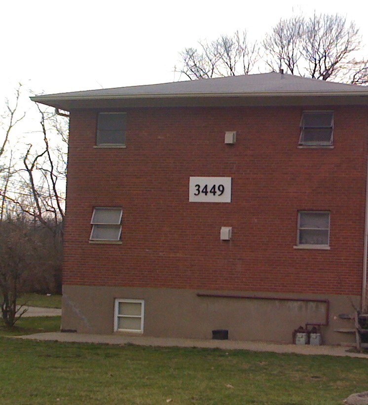
3449 McHenry Ave
Cincinnati, OH 45225