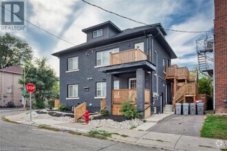
349-349 Wheat Boom Dr.
Oakville, ON L6H 7X5
Favorites
905-257-3633

-
Monthly Rent
C$2,650
-
Bedrooms
2 bd
-
Bathrooms
1 ba
-
Square Feet
Details
Available Now
* Price shown is base rent and may not include non-optional fees and utilities.
Price, availability, fees, and any applicable rent special are subject to change without notice.
* Square footage definitions vary. Displayed square footage is approximate.
349-349 Wheat Boom Dr.
Favorites
About This Property
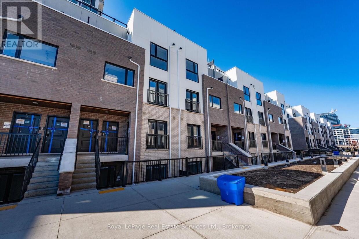
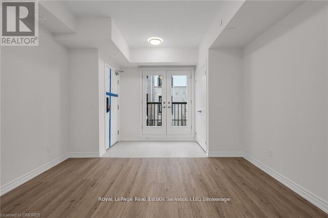
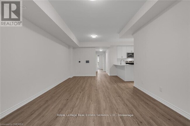
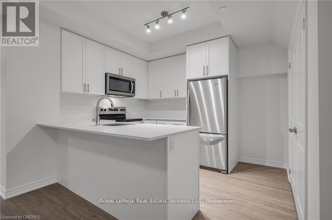
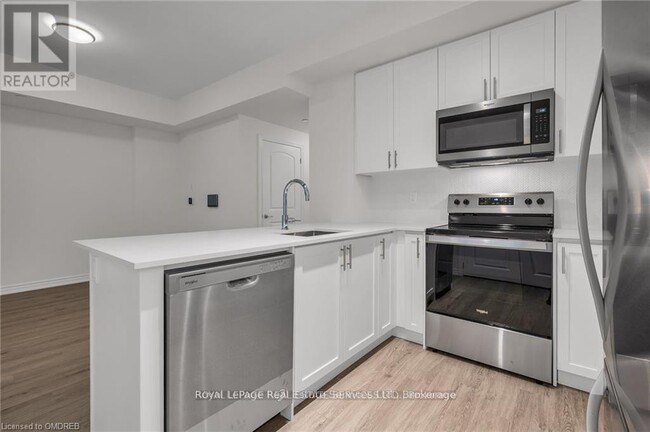
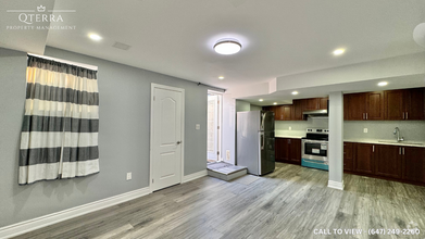
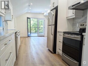
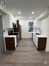
Welcome to Oakvillage this 2 Bedroom,1 Bathroom,stacked Townhome,is in the heart of North Oakville! This spacious Minto Townhome backs onto Green space and offers 1055 square feet of upgraded living space. Tons of Luxury finishes throughout this Home from flooring,quartz countertops,stainless steel appliances and front loading washer/dryer. Walk out from 2nd bedroom to large patio over looking green space. The Spacious Master Bedroom features a walk-in closet. Convenient in-suite Laundry. Large Storage space on the Main floor. Close proximity to scenic walking and hiking trails. Fantastic location,with shopping,restaurants,schools,several parks and quick access to major highways and GO Station. High speed internet included with the condo,1 over sized convenient underground parking space. Samsung 65"" 4K UHD HDR LED TV to be included with the unit for the Tenants use during the duration of the lease period. (id:52069) ID#: 1735614
349-349 Wheat Boom Dr. is a AA house located in Oakville, ON and the L6H 7X5 Postal Code. This listing has rentals from C$2650
Contact
House Features
- Air Conditioning
Fees and Policies
Property Address:
349-349 Wheat Boom Dr.,
Oakville,
ON
L6H 7X5
 This Property
 Available Property
Amenities
- Air Conditioning
Education
| Colleges & Universities | Distance | ||
|---|---|---|---|
| Colleges & Universities | Distance | ||
| Drive: | 27 min | 28.0 km | |
| Drive: | 32 min | 37.6 km | |
| Drive: | 33 min | 38.7 km | |
| Drive: | 38 min | 39.8 km |
349-349 Wheat Boom Dr. is within 27 minutes or 28.0 kilometers from Humber College, Lakeshore. It is also near McMaster University and Humber College, North Campus.
Transportation options available in Oakville include Long Branch Loop, located 25.0 kilometers from 349-349 Wheat Boom Dr.. 349-349 Wheat Boom Dr. is near Toronto Pearson International, located 31.8 kilometers or 32 minutes away, and Billy Bishop Toronto City Airport, located 36.9 kilometers or 37 minutes away.
| Transit / Subway | Distance | ||
|---|---|---|---|
| Transit / Subway | Distance | ||
|
|
Drive: | 25 min | 25.0 km |
|
|
Drive: | 26 min | 25.3 km |
|
|
Drive: | 26 min | 25.6 km |
|
|
Drive: | 26 min | 25.8 km |
|
|
Drive: | 27 min | 25.8 km |
| Commuter Rail | Distance | ||
|---|---|---|---|
| Commuter Rail | Distance | ||
|
|
Drive: | 9 min | 5.7 km |
|
|
Drive: | 13 min | 11.2 km |
|
|
Drive: | 14 min | 11.7 km |
|
|
Drive: | 14 min | 13.9 km |
|
|
Drive: | 16 min | 14.1 km |
| Airports | Distance | ||
|---|---|---|---|
| Airports | Distance | ||
|
Toronto Pearson International
|
Drive: | 32 min | 31.8 km |
|
Billy Bishop Toronto City Airport
|
Drive: | 37 min | 36.9 km |
Time and distance from 349-349 Wheat Boom Dr..
| Shopping Centers | Distance | ||
|---|---|---|---|
| Shopping Centers | Distance | ||
| Walk: | 11 min | 0.9 km | |
| Walk: | 12 min | 1.0 km | |
| Walk: | 14 min | 1.2 km |
349-349 Wheat Boom Dr. has 3 shopping centers within 1.2 kilometers, which is about a 14-minute walk. The kilometers and minutes will be for the farthest away property.
You May Also Like
Similar Rentals Nearby


What Are Walk Score®, Transit Score®, and Bike Score® Ratings?
Walk Score® measures the walkability of any address. Transit Score® measures access to public transit. Bike Score® measures the bikeability of any address.
What is a Sound Score Rating?
A Sound Score Rating aggregates noise caused by vehicle traffic, airplane traffic and local sources

349-349 Wheat Boom Dr.
Oakville, ON L6H 7X5