
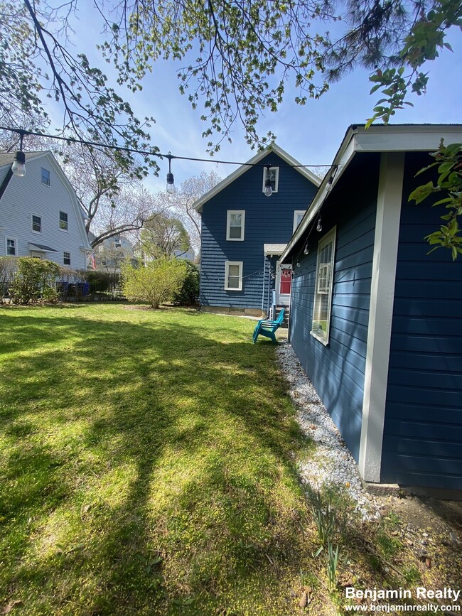
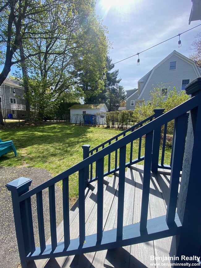
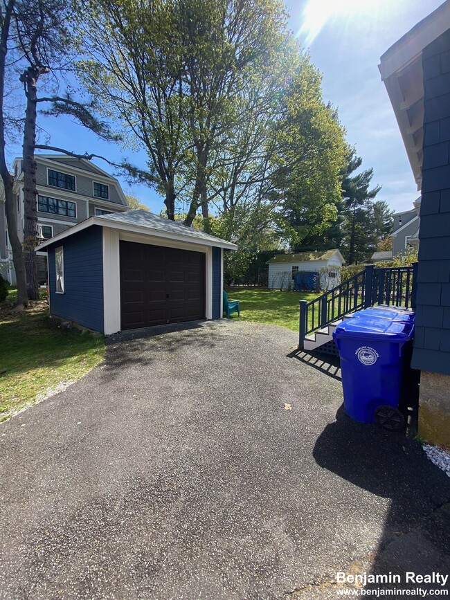
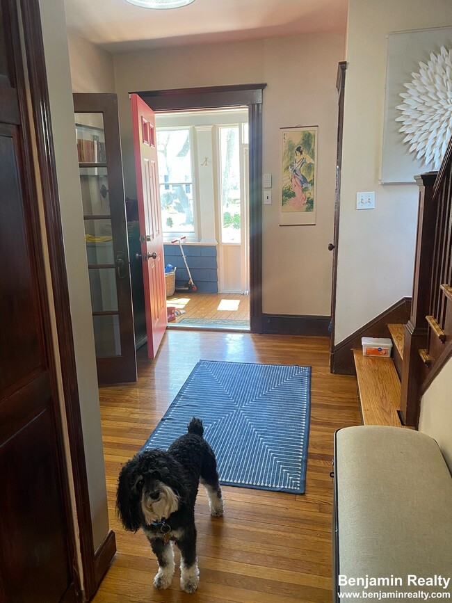
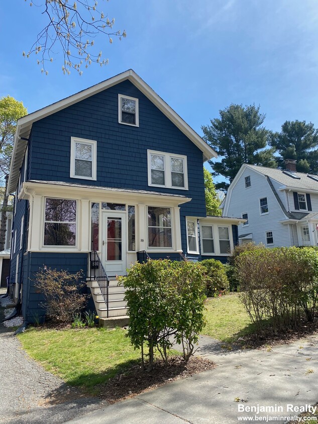
35 Eliot St Unit 35
Chestnut Hill, MA 02467
-
Bedrooms
4
-
Bathrooms
2
-
Square Feet
1,612 sq ft
-
Available
Available Now
Highlights
- Pets Allowed
- Hardwood Floors

35 Eliot St is a house located in Norfolk County and the 02467 ZIP Code.
House Features
Washer/Dryer
Dishwasher
Hardwood Floors
Microwave
- Washer/Dryer
- Dishwasher
- Disposal
- Microwave
- Refrigerator
- Hardwood Floors
- Dining Room
Contact
- Contact
Chestnut Hill Norfolk sits about five miles west of Downtown Boston and Cambridge. Traveling to and from the neighborhood is easy with access to multiple MBTA stations and buses, Route 9, and I-90. Boston Logan International Airport is just ten miles away as well.
Access to higher education, luxury retailers, and nature abound in Chestnut Hill Norfolk. Boston College, Pine Manor College, and Newbury College are all within close proximity to the neighborhood. All kinds of shopping and dining can be found at the Street at Chestnut Hill, the Shops at Chestnut Hill, and Chestnut Hill Square. Chestnut Hill Reservoir, Brookline Reservoir, Hammond Pond Reservation, Dane Park, and Lost Pond Conversation Area all offer opportunities to connect with nature and engage in outdoor recreation.
Learn more about living in Chestnut Hill Norfolk| Colleges & Universities | Distance | ||
|---|---|---|---|
| Colleges & Universities | Distance | ||
| Drive: | 5 min | 1.9 mi | |
| Drive: | 4 min | 2.1 mi | |
| Drive: | 5 min | 2.5 mi | |
| Drive: | 7 min | 3.0 mi |
Transportation options available in Chestnut Hill include Reservoir Station, located 0.7 mile from 35 Eliot St. 35 Eliot St is near General Edward Lawrence Logan International, located 9.1 miles or 18 minutes away.
| Transit / Subway | Distance | ||
|---|---|---|---|
| Transit / Subway | Distance | ||
|
|
Walk: | 13 min | 0.7 mi |
|
|
Walk: | 17 min | 0.9 mi |
|
|
Drive: | 2 min | 1.1 mi |
|
|
Drive: | 2 min | 1.1 mi |
|
|
Drive: | 3 min | 1.1 mi |
| Commuter Rail | Distance | ||
|---|---|---|---|
| Commuter Rail | Distance | ||
|
|
Drive: | 7 min | 3.7 mi |
|
|
Drive: | 7 min | 3.7 mi |
|
|
Drive: | 9 min | 4.7 mi |
|
|
Drive: | 9 min | 5.1 mi |
| Drive: | 12 min | 5.7 mi |
| Airports | Distance | ||
|---|---|---|---|
| Airports | Distance | ||
|
General Edward Lawrence Logan International
|
Drive: | 18 min | 9.1 mi |
Time and distance from 35 Eliot St.
| Shopping Centers | Distance | ||
|---|---|---|---|
| Shopping Centers | Distance | ||
| Drive: | 3 min | 1.4 mi | |
| Drive: | 3 min | 1.5 mi | |
| Drive: | 3 min | 1.7 mi |
| Parks and Recreation | Distance | ||
|---|---|---|---|
| Parks and Recreation | Distance | ||
|
Frederick Law Olmsted National Historic Site
|
Walk: | 15 min | 0.8 mi |
|
Chestnut Hill Reservation
|
Walk: | 15 min | 0.8 mi |
|
Hammond Pond Reservation
|
Drive: | 4 min | 2.3 mi |
|
John Fitzgerald Kennedy National Historic Site
|
Drive: | 5 min | 2.8 mi |
|
Arnold Arboretum of Harvard University
|
Drive: | 7 min | 3.8 mi |
| Hospitals | Distance | ||
|---|---|---|---|
| Hospitals | Distance | ||
| Drive: | 5 min | 2.4 mi | |
| Drive: | 7 min | 2.6 mi | |
| Drive: | 5 min | 2.6 mi |
| Military Bases | Distance | ||
|---|---|---|---|
| Military Bases | Distance | ||
| Drive: | 22 min | 12.6 mi | |
| Drive: | 29 min | 16.5 mi |
- Washer/Dryer
- Dishwasher
- Disposal
- Microwave
- Refrigerator
- Hardwood Floors
- Dining Room
35 Eliot St Photos
What Are Walk Score®, Transit Score®, and Bike Score® Ratings?
Walk Score® measures the walkability of any address. Transit Score® measures access to public transit. Bike Score® measures the bikeability of any address.
What is a Sound Score Rating?
A Sound Score Rating aggregates noise caused by vehicle traffic, airplane traffic and local sources
35 Eliot St
Chestnut Hill, MA 02467