$1,700 / Month
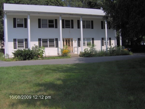
353 East St Unit 4
Wrentham, MA 02093
2 Weeks Ago
Favorites
353 East St Unit 4

Favorites
Check Back Soon for Upcoming Availability
| Beds | Baths | Average SF |
|---|---|---|
| 2 Bedrooms 2 Bedrooms 2 Br | 1 Bath 1 Bath 1 Ba | 700 SF |
About This Property
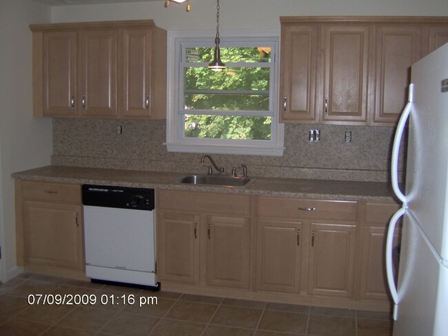
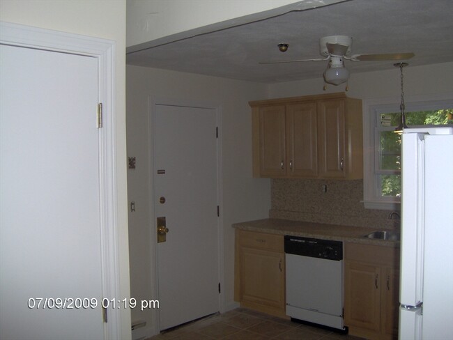
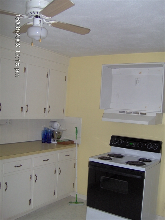
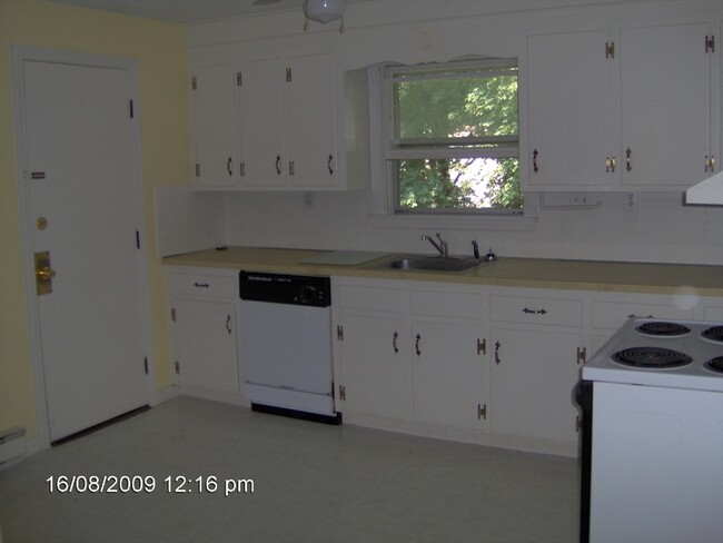
2 Bedroom apartment in great central Wrentham location. Updated kitchen. Large backyard and plenty of parking space. NO PETS. Laundry room on-site. Dumpster on-site. Large backyard and plenty of parking space. Hot water is included. Conveniently located to Routes 1,95 and 495.
353 East St is an apartment community located in Norfolk County and the 02093 ZIP Code.
Property Address:
353 East St,
Wrentham,
MA
02093
495-South is a large area surrounding Interstate 495 about 20 miles south of Boston. This suburban town features peaceful neighborhoods nestled in forested areas paired with commercial developments. Renters have the choice of moderately priced to luxury apartments, condos, and single-family homes. An abundance of shopping and dining choices are scattered along the town’s major thoroughfares. Ponds, creeks, and large natural areas like Franklin State Forest and DelCarte Conservation Area provide relaxing outdoor activities. Residents have access to big-city amenities by driving a bit north into Boston, and the eclectic downtown districts of Worcester and Framingham are situated outside of the western and eastern corners of town.
Learn more about living in 495-SouthBelow are rent ranges for similar nearby apartments
Education
| Colleges & Universities | Distance | ||
|---|---|---|---|
| Colleges & Universities | Distance | ||
| Drive: | 19 min | 11.8 mi | |
| Drive: | 27 min | 15.7 mi | |
| Drive: | 32 min | 16.9 mi | |
| Drive: | 34 min | 17.7 mi |
353 East St Unit 4 is within 19 minutes or 11.8 miles from Wheaton College, Norton. It is also near Stonehill College and Massasoit C.C., Canton Campus.
Transportation options available in Wrentham include Mattapan Station, located 20.4 miles from 353 East St Unit 4. 353 East St Unit 4 is near Rhode Island Tf Green International, located 31.7 miles or 48 minutes away, and General Edward Lawrence Logan International, located 33.4 miles or 49 minutes away.
| Transit / Subway | Distance | ||
|---|---|---|---|
| Transit / Subway | Distance | ||
|
|
Drive: | 31 min | 20.4 mi |
|
|
Drive: | 32 min | 20.8 mi |
|
|
Drive: | 32 min | 20.9 mi |
|
|
Drive: | 36 min | 23.3 mi |
|
|
Drive: | 36 min | 23.6 mi |
| Commuter Rail | Distance | ||
|---|---|---|---|
| Commuter Rail | Distance | ||
|
|
Drive: | 8 min | 4.4 mi |
|
|
Drive: | 9 min | 4.9 mi |
|
|
Drive: | 9 min | 5.0 mi |
|
|
Drive: | 13 min | 7.0 mi |
|
|
Drive: | 15 min | 7.7 mi |
| Airports | Distance | ||
|---|---|---|---|
| Airports | Distance | ||
|
Rhode Island Tf Green International
|
Drive: | 48 min | 31.7 mi |
|
General Edward Lawrence Logan International
|
Drive: | 49 min | 33.4 mi |
Time and distance from 353 East St Unit 4.
| Shopping Centers | Distance | ||
|---|---|---|---|
| Shopping Centers | Distance | ||
| Drive: | 4 min | 2.4 mi | |
| Drive: | 5 min | 2.5 mi | |
| Drive: | 5 min | 2.5 mi |
353 East St Unit 4 has 3 shopping centers within 2.5 miles, which is about a 5-minute drive. The miles and minutes will be for the farthest away property.
| Parks and Recreation | Distance | ||
|---|---|---|---|
| Parks and Recreation | Distance | ||
|
F. Gilbert Hills State Forest
|
Drive: | 10 min | 3.8 mi |
|
Mass Audubon's Stony Brook Wildlife Sanctuary
|
Drive: | 8 min | 4.0 mi |
|
North Attleboro National Fish Hatchery
|
Drive: | 12 min | 6.7 mi |
|
Mass Audubon's Moose Hill Wildlife Sanctuary
|
Drive: | 16 min | 9.4 mi |
|
Borderland State Park
|
Drive: | 20 min | 10.2 mi |
353 East St Unit 4 has 5 parks within 10.2 miles, including F. Gilbert Hills State Forest, Mass Audubon's Stony Brook Wildlife Sanctuary, and North Attleboro National Fish Hatchery.
| Hospitals | Distance | ||
|---|---|---|---|
| Hospitals | Distance | ||
| Drive: | 18 min | 10.0 mi | |
| Drive: | 19 min | 11.1 mi |
353 East St Unit 4 is 10.0 miles from Sturdy Memorial Hospital, and is convenient to other hospitals, including Arbour - Fuller Hospital.
| Military Bases | Distance | ||
|---|---|---|---|
| Military Bases | Distance | ||
| Drive: | 35 min | 18.3 mi |
353 East St Unit 4 is 18.3 miles and a 35 minute drive from US Military Reservation.
You May Also Like
Similar Rentals Nearby


What Are Walk Score®, Transit Score®, and Bike Score® Ratings?
Walk Score® measures the walkability of any address. Transit Score® measures access to public transit. Bike Score® measures the bikeability of any address.
What is a Sound Score Rating?
A Sound Score Rating aggregates noise caused by vehicle traffic, airplane traffic and local sources

353 East St
Wrentham, MA 02093