
$2,850 / Month
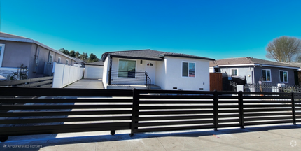
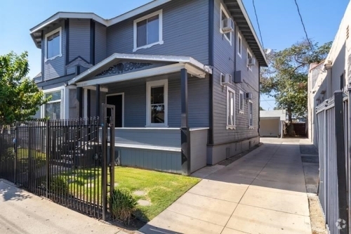
356 S Rall Ave
Avocado Heights, CA 91746
2 Weeks Ago
Favorites
356 S Rall Ave

Favorites
Check Back Soon for Upcoming Availability
| Beds | Baths | Average SF |
|---|---|---|
| 3 Bedrooms 3 Bedrooms 3 Br | 2 Baths 2 Baths 2 Ba | 1,053 SF |
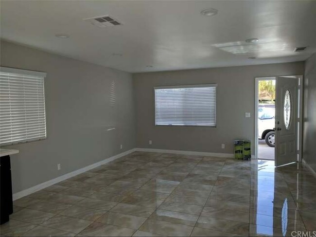
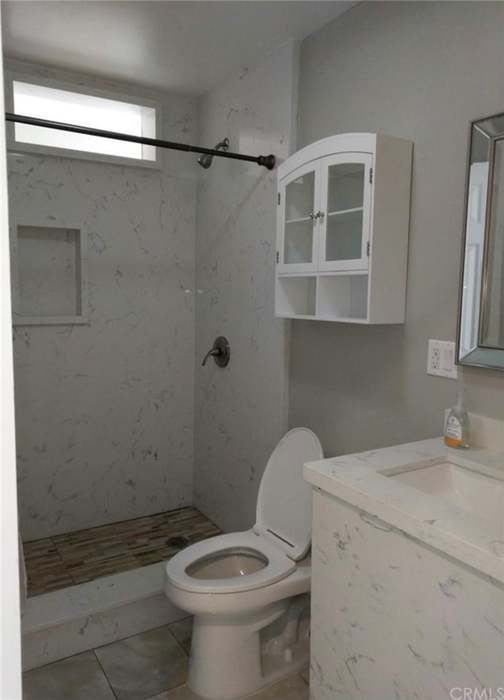
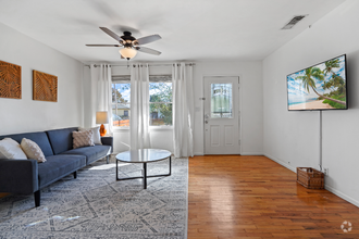
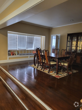
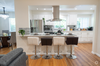
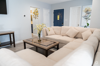
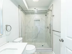
About This Property
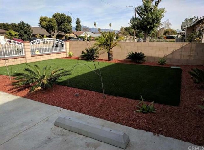
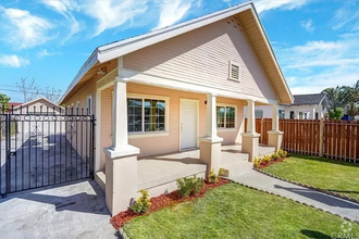
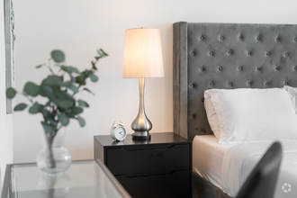
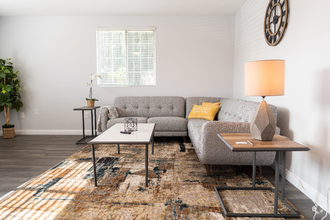
Remodeled home with 3 beds and 2 baths with central AC and Central heat in quiet and nice Neigborhood. Master bedroom with full bath and walking closet. Granite counter tops, stove Microwave, and washer/dryer included. Conveniently located to shopping, restaurants, 605 and 10 freeway, and few blocks to Valley. One block away from the park. Must see to appreciate!
356 S Rall Ave is a house located in Los Angeles County and the 91746 ZIP Code. This area is served by the Bassett Unified attendance zone.
House Features
- Washer/Dryer
- Washer/Dryer Hookup
Fees and Policies
Property Address:
356 S Rall Ave,
Avocado Heights,
CA
91746
Below are rent ranges for similar nearby apartments
Amenities
- Washer/Dryer
- Washer/Dryer Hookup
Education
| Colleges & Universities | Distance | ||
|---|---|---|---|
| Colleges & Universities | Distance | ||
| Drive: | 8 min | 4.0 mi | |
| Drive: | 16 min | 9.9 mi | |
| Drive: | 15 min | 10.5 mi | |
| Drive: | 17 min | 12.0 mi |
356 S Rall Ave is within 8 minutes or 4.0 miles from Rio Hondo Community College. It is also near Whittier College and East Los Angeles College.
Schools
Public Elementary & Middle School
Grades K-8
25 Students
Nearby
Public Elementary & Middle School
Grades K-8
552 Students
Attendance Zone
5
Out of 10
Public Middle School
Grades 6-8
329 Students
Attendance Zone
4
Out of 10
Public High School
Grades 9-12
839 Students
Attendance Zone
6
Out of 10
Private Elementary & Middle School
Grades 5-8
4 Students
Nearby
Private Elementary, Middle & High School
Grades K-11
23 Students
Nearby
Private Elementary & Middle School
Grades PK-8
143 Students
Nearby
Private Elementary School
Grades PK-1
36 Students
Nearby
School data provided by
GreatSchools
The GreatSchools Rating helps parents compare schools within a state based on a variety of school quality indicators and provides a helpful picture of how effectively each school serves all of its students. Ratings are on a scale of 1 (below average) to 10 (above average) and can include test scores, college readiness, academic progress, advanced courses, equity, discipline and attendance data. We also advise parents to visit schools, consider other information on school performance and programs, and consider family needs as part of the school selection process.
Transportation options available in Avocado Heights include Monrovia Station, located 7.7 miles from 356 S Rall Ave. 356 S Rall Ave is near Long Beach (Daugherty Field), located 23.5 miles or 32 minutes away, and Bob Hope, located 29.9 miles or 41 minutes away.
| Transit / Subway | Distance | ||
|---|---|---|---|
| Transit / Subway | Distance | ||
| Drive: | 13 min | 7.7 mi | |
| Drive: | 12 min | 8.6 mi | |
| Drive: | 13 min | 8.7 mi | |
| Drive: | 17 min | 11.9 mi | |
|
|
Drive: | 18 min | 14.3 mi |
| Commuter Rail | Distance | ||
|---|---|---|---|
| Commuter Rail | Distance | ||
|
|
Drive: | 7 min | 3.1 mi |
|
|
Drive: | 8 min | 4.8 mi |
|
|
Drive: | 15 min | 9.3 mi |
|
|
Drive: | 18 min | 10.6 mi |
|
|
Drive: | 21 min | 12.9 mi |
| Airports | Distance | ||
|---|---|---|---|
| Airports | Distance | ||
|
Long Beach (Daugherty Field)
|
Drive: | 32 min | 23.5 mi |
|
Bob Hope
|
Drive: | 41 min | 29.9 mi |
Time and distance from 356 S Rall Ave.
| Shopping Centers | Distance | ||
|---|---|---|---|
| Shopping Centers | Distance | ||
| Walk: | 8 min | 0.5 mi | |
| Walk: | 13 min | 0.7 mi | |
| Walk: | 18 min | 0.9 mi |
356 S Rall Ave has 3 shopping centers within 0.9 mile, which is about a 18-minute walk. The miles and minutes will be for the farthest away property.
| Parks and Recreation | Distance | ||
|---|---|---|---|
| Parks and Recreation | Distance | ||
|
Whittier Narrows Nature Center
|
Drive: | 8 min | 4.5 mi |
|
Whittier Narrows Recreation Area
|
Drive: | 12 min | 5.8 mi |
|
Pio Pico State Historic Park
|
Drive: | 10 min | 6.8 mi |
|
Santa Fe Dam Recreation Area
|
Drive: | 21 min | 8.9 mi |
|
Santa Fe Dam Nature Center
|
Drive: | 21 min | 8.9 mi |
356 S Rall Ave has 5 parks within 8.9 miles, including Whittier Narrows Nature Center, Whittier Narrows Recreation Area, and Pio Pico State Historic Park.
| Hospitals | Distance | ||
|---|---|---|---|
| Hospitals | Distance | ||
| Drive: | 5 min | 2.1 mi | |
| Drive: | 8 min | 3.6 mi | |
| Drive: | 8 min | 4.7 mi |
356 S Rall Ave has 3 hospitals within 4.7 miles, the nearest is Kaiser Foundation Hospital - Baldwin Park which is 2.1 miles away and a 5 minutes drive.
| Military Bases | Distance | ||
|---|---|---|---|
| Military Bases | Distance | ||
| Drive: | 34 min | 25.5 mi | |
| Drive: | 37 min | 30.1 mi |
356 S Rall Ave is 25.5 miles from Los Alamitos Army Airfield, and is convenient to other military bases, including Los Angeles Air Force Base.
You May Also Like
Similar Rentals Nearby
-
-
-
-
 $8,2503 Beds, 2.5 Baths, 1,750 sq ftHouse for Rent
 -
 $8,5005 Beds, 2 Baths, 1,600 sq ftHouse for Rent
 -
 $4,8003 Beds, 2 Baths, 1,484 sq ftHouse for Rent
 -
 $3,7503 Beds, 1 Bath, 1,243 sq ftHouse for Rent
 -
-
 $8,5004 Beds, 2 Baths, 1,649 sq ftHouse for Rent
 -
What Are Walk Score®, Transit Score®, and Bike Score® Ratings?
Walk Score® measures the walkability of any address. Transit Score® measures access to public transit. Bike Score® measures the bikeability of any address.
What is a Sound Score Rating?
A Sound Score Rating aggregates noise caused by vehicle traffic, airplane traffic and local sources
356 S Rall Ave
Avocado Heights, CA 91746