$2,200 / Month
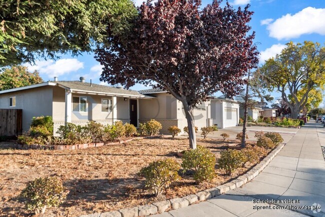
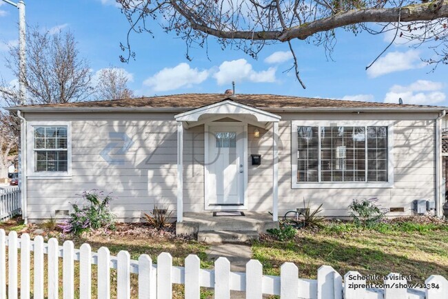
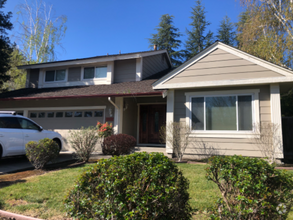
358 Adams Way
Pleasanton, CA 94566
2 Weeks Ago
Favorites
358 Adams Way

Favorites
Check Back Soon for Upcoming Availability
| Beds | Baths | Average SF |
|---|---|---|
| 2 Bedrooms 2 Bedrooms 2 Br | 1 Bath 1 Bath 1 Ba | 700 SF |
About This Property
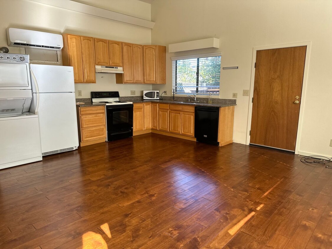
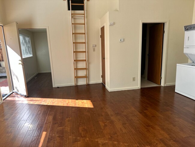
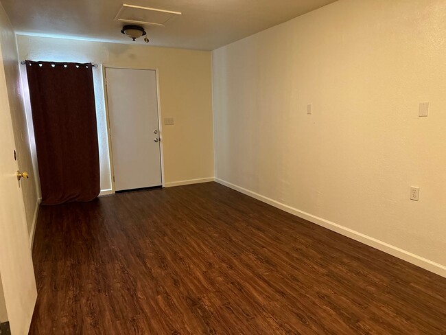
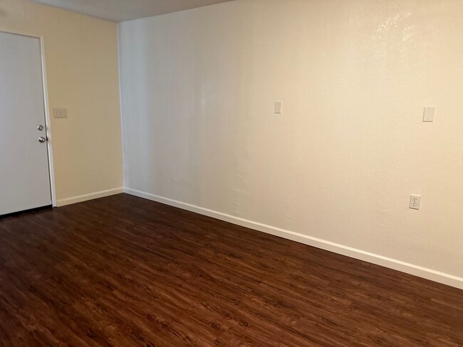
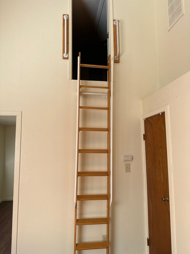
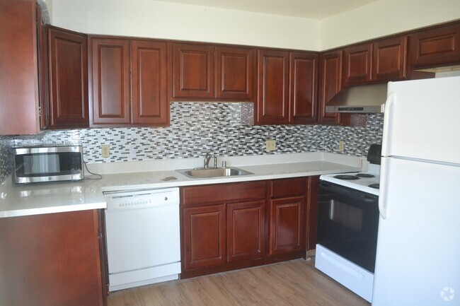
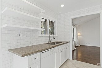
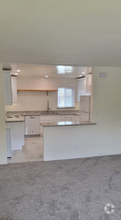
OPEN HOUSE FRIDAY DECEMBER 1ST, (12-12:30 pm)!!!!!!! ADORABLE PRIVATE ADU IN A GREAT PLEASANTON NEIGHBORHOOD! SEPARATE REAR ENTRY & FENCED! SHARP LAMINATE FLOORING THROUGHOUT! 2 BEDROOMS AND A LOFT WHICH CAN BE A THIRD BEDROOM! 1 FULL BATHROOM! KITCHEN OVERLOOKS LARGE FAMILY ROOM! .STACKED LAUNDRY IN THE KITCHEN AREA! AN IDEAL PLEASANTON RENTAL OPPORTUNITY! COME SEE!
358 Adams Way is a house located in Alameda County and the 94566 ZIP Code. This area is served by the Pleasanton Unified attendance zone.
Location
Get Directions
The cities of Livermore, Dublin and Pleasanton form a loosely shaped triangle within California's Tri-Valley region, a cluster of three small valleys about 33 miles east of San Francisco and 35 miles northeast of San Jose. Known for its Mediterranean climate, rolling hills and historic vineyards, this once bucolic region now boasts three separate downtown areas, a bustling business community and some of the best wineries in the state.
At the eastern end of the region lies the city of Livermore. Once known as Livermores, Livermore Ranch and Nottingham, the city sits at the center of Livermore Valley, a historic region dotted with more than 5,000 acres of mostly family-owned vineyards. A pastoral neighborhood known for its charming yet functional hilltop windmills, Livermore hosts the internationally recognized and sometimes controversial center of scientific research, Lawrence Livermore National Laboratories.
Learn more about living in Dublin/Pleasanton/LivermoreBelow are rent ranges for similar nearby apartments
| Beds | Average Size | Lowest | Typical | Premium |
|---|---|---|---|---|
| Studio Studio Studio | 592 Sq Ft | $1,495 | $2,566 | $5,076 |
| 1 Bed 1 Bed 1 Bed | 738 Sq Ft | $700 | $2,713 | $5,819 |
| 2 Beds 2 Beds 2 Beds | 1039 Sq Ft | $2,177 | $3,321 | $6,825 |
| 3 Beds 3 Beds 3 Beds | 1412-1413 Sq Ft | $2,600 | $4,154 | $8,750 |
| 4 Beds 4 Beds 4 Beds | 2638 Sq Ft | $3,133 | $5,141 | $11,000 |
Education
| Colleges & Universities | Distance | ||
|---|---|---|---|
| Colleges & Universities | Distance | ||
| Drive: | 14 min | 7.3 mi | |
| Drive: | 17 min | 8.4 mi | |
| Drive: | 20 min | 12.3 mi | |
| Drive: | 30 min | 18.4 mi |
358 Adams Way is within 14 minutes or 7.3 miles from Las Positas College. It is also near Diablo Valley Coll, San Ramon and Ohlone College, Fremont Campus.
Schools


Public Elementary School
Grades K-5
478 Students
Nearby
Public Elementary School
Grades K-5
641 Students
Attendance Zone
Public Middle School
Grades 6-8
1,050 Students
Attendance Zone
Public High School
Grades 9-12
2,665 Students
Attendance Zone
Private Elementary, Middle & High School
Grades K-12
23 Students
Nearby
Private Elementary School
Grades PK-6
Nearby
School data provided by
 The GreatSchools Rating helps parents compare schools within a state based on a variety of school quality indicators and provides a helpful picture of how effectively each school serves all of its students. Ratings are on a scale of 1 (below average) to 10 (above average) and can include test scores, college readiness, academic progress, advanced courses, equity, discipline and attendance data. We also advise parents to visit schools, consider other information on school performance and programs, and consider family needs as part of the school selection process.
View GreatSchools Rating Methodology
View GreatSchools Rating Methodology
Transportation options available in Pleasanton include Dublin Pleasanton Station, located 4.7 miles from 358 Adams Way. 358 Adams Way is near Metro Oakland International, located 24.7 miles or 34 minutes away, and Norman Y Mineta San Jose International, located 27.2 miles or 37 minutes away.
| Transit / Subway | Distance | ||
|---|---|---|---|
| Transit / Subway | Distance | ||
|
|
Drive: | 10 min | 4.7 mi |
|
|
Drive: | 11 min | 6.3 mi |
|
|
Drive: | 24 min | 14.8 mi |
|
|
Drive: | 30 min | 16.6 mi |
|
|
Drive: | 33 min | 19.5 mi |
| Commuter Rail | Distance | ||
|---|---|---|---|
| Commuter Rail | Distance | ||
| Drive: | 5 min | 1.8 mi | |
| Drive: | 11 min | 6.2 mi | |
| Drive: | 17 min | 9.5 mi | |
| Drive: | 27 min | 16.4 mi | |
|
|
Drive: | 27 min | 17.2 mi |
| Airports | Distance | ||
|---|---|---|---|
| Airports | Distance | ||
|
Metro Oakland International
|
Drive: | 34 min | 24.7 mi |
|
Norman Y Mineta San Jose International
|
Drive: | 37 min | 27.2 mi |
Time and distance from 358 Adams Way.
| Shopping Centers | Distance | ||
|---|---|---|---|
| Shopping Centers | Distance | ||
| Walk: | 9 min | 0.5 mi | |
| Walk: | 11 min | 0.6 mi | |
| Walk: | 12 min | 0.6 mi |
358 Adams Way has 3 shopping centers within 0.6 mile, which is about a 12-minute walk. The miles and minutes will be for the farthest away property.
| Parks and Recreation | Distance | ||
|---|---|---|---|
| Parks and Recreation | Distance | ||
|
Shadow Cliffs Regional Recreation Area
|
Drive: | 6 min | 2.0 mi |
|
Dublin Hills Regional Parks
|
Drive: | 21 min | 9.2 mi |
|
Niles Canyon Railway
|
Drive: | 24 min | 13.7 mi |
|
Pleasanton Ridge Regional Park
|
Drive: | 25 min | 15.4 mi |
|
Garin/Dry Creek Pioneer Parks
|
Drive: | 30 min | 17.0 mi |
358 Adams Way has 5 parks within 17.0 miles, including Shadow Cliffs Regional Recreation Area, Dublin Hills Regional Parks, and Pleasanton Ridge Regional Park.
| Hospitals | Distance | ||
|---|---|---|---|
| Hospitals | Distance | ||
| Drive: | 6 min | 2.8 mi | |
| Drive: | 20 min | 12.9 mi | |
| Drive: | 25 min | 15.0 mi |
358 Adams Way has 3 hospitals within 15.0 miles, the nearest is Stanford Health Care - ValleyCare which is 2.8 miles away and a 6 minute drive.
| Military Bases | Distance | ||
|---|---|---|---|
| Military Bases | Distance | ||
| Drive: | 43 min | 30.0 mi |
358 Adams Way is 30.0 miles and a 43 minute drive from Ames Research Center.
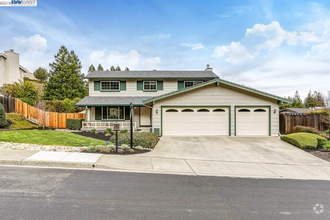
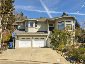
You May Also Like
Similar Rentals Nearby

What Are Walk Score®, Transit Score®, and Bike Score® Ratings?
Walk Score® measures the walkability of any address. Transit Score® measures access to public transit. Bike Score® measures the bikeability of any address.
What is a Sound Score Rating?
A Sound Score Rating aggregates noise caused by vehicle traffic, airplane traffic and local sources

358 Adams Way
Pleasanton, CA 94566