
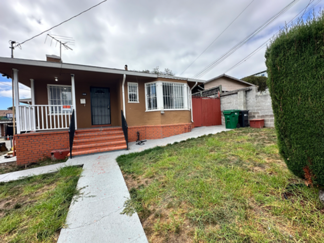
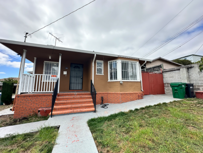
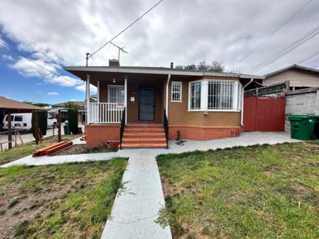
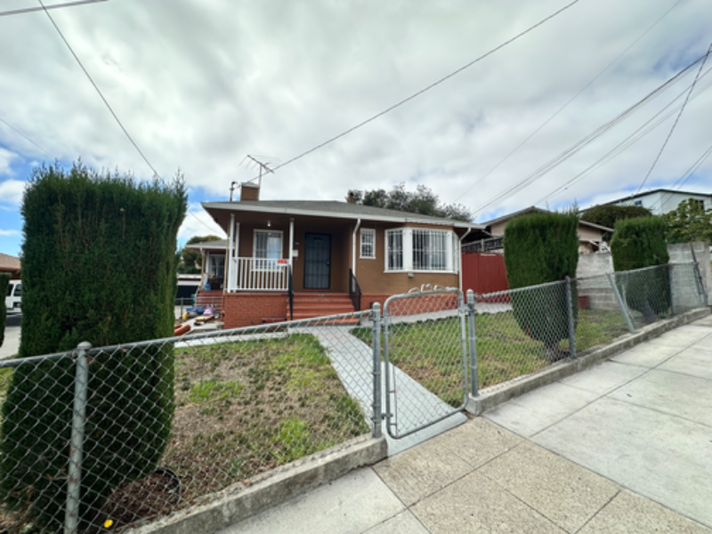
3585 Galindo St
Oakland, CA 94601

-
Monthly Rent
$2,800
-
Bedrooms
2 bd
-
Bathrooms
1 ba
-
Square Feet
Details
About This Property
Property Id: 1583288 Lease Term: Rent is $2,800 per month with security deposit $2,800. Lease Duration: 6 months to 1 year. Utilities: Tenant pays PG&E and water; owner covers trash services Parking: Street parking only Non-smoking property No pets allowed Applicant Requirements: • Application Fee $ Credit Check • Income Verification required • Rental History check required • Employment Verification required
3585 Galindo St is a house located in Alameda County and the 94601 ZIP Code. This area is served by the Oakland Unified attendance zone.
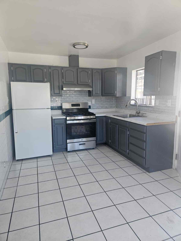
House Features
Hardwood Floors
Refrigerator
Fireplace
Tile Floors
- Fireplace
- Oven
- Refrigerator
- Hardwood Floors
- Tile Floors
- Fenced Lot
- Lawn
Fees and Policies
The fees below are based on community-supplied data and may exclude additional fees and utilities.
Details
Utilities Included
-
Trash Removal
 This Property
 Available Property
- Fireplace
- Oven
- Refrigerator
- Hardwood Floors
- Tile Floors
- Fenced Lot
- Lawn
Mostly a residential neighborhood, Harrington is brimming with family housing and apartments in addition to local businesses. Harrington is located within close proximity to a number of parks, entertainment venues, and higher learning institutions.
Nearby Cesar Chavez Park, Allendale Recreation Center, and Redwood Regional Park offer ample opportunities for engaging in outdoor activities. Peralta Hacienda Historical Park, Oracle Arena, Chabot Space and Science Center, and Children’s Fairyland are not too far from Harrington for a day of adventure. Patten University, Mills College, Merritt College, Holy Names University, and Laney College are all convenient to commute to from Harrington.
With access to the I-580 and I-880, Fruitvale BART station, and Downtown Oakland, Harrington allows for simple commutes and travels. Both Oakland International and San Francisco International Airports are short drives from the neighborhood as well.
Learn more about living in Harrington| Colleges & Universities | Distance | ||
|---|---|---|---|
| Colleges & Universities | Distance | ||
| Drive: | 8 min | 2.8 mi | |
| Drive: | 6 min | 3.0 mi | |
| Drive: | 7 min | 3.8 mi | |
| Drive: | 12 min | 5.3 mi |
Transportation options available in Oakland include Fruitvale Station, located 0.9 mile from 3585 Galindo St. 3585 Galindo St is near Metro Oakland International, located 6.7 miles or 11 minutes away, and San Francisco International, located 27.1 miles or 39 minutes away.
| Transit / Subway | Distance | ||
|---|---|---|---|
| Transit / Subway | Distance | ||
|
|
Walk: | 17 min | 0.9 mi |
|
|
Drive: | 6 min | 3.1 mi |
|
|
Drive: | 7 min | 3.5 mi |
|
|
Drive: | 7 min | 3.8 mi |
|
|
Drive: | 8 min | 4.2 mi |
| Commuter Rail | Distance | ||
|---|---|---|---|
| Commuter Rail | Distance | ||
|
|
Drive: | 7 min | 4.3 mi |
|
|
Drive: | 12 min | 8.1 mi |
|
|
Drive: | 14 min | 10.2 mi |
| Drive: | 21 min | 14.7 mi | |
| Drive: | 23 min | 15.9 mi |
| Airports | Distance | ||
|---|---|---|---|
| Airports | Distance | ||
|
Metro Oakland International
|
Drive: | 11 min | 6.7 mi |
|
San Francisco International
|
Drive: | 39 min | 27.1 mi |
Time and distance from 3585 Galindo St.
| Shopping Centers | Distance | ||
|---|---|---|---|
| Shopping Centers | Distance | ||
| Walk: | 15 min | 0.8 mi | |
| Walk: | 16 min | 0.8 mi | |
| Walk: | 17 min | 0.9 mi |
| Parks and Recreation | Distance | ||
|---|---|---|---|
| Parks and Recreation | Distance | ||
|
Oakland Museum of California
|
Drive: | 7 min | 3.5 mi |
|
Lakeside Park
|
Drive: | 7 min | 4.5 mi |
|
Rotary Nature Center
|
Drive: | 8 min | 4.8 mi |
|
Lakeside Park Garden Center
|
Drive: | 7 min | 4.8 mi |
|
Joaquin Miller Park
|
Drive: | 12 min | 5.7 mi |
| Hospitals | Distance | ||
|---|---|---|---|
| Hospitals | Distance | ||
| Drive: | 5 min | 2.9 mi | |
| Drive: | 8 min | 3.2 mi | |
| Drive: | 8 min | 5.1 mi |
| Military Bases | Distance | ||
|---|---|---|---|
| Military Bases | Distance | ||
| Drive: | 15 min | 6.9 mi | |
| Drive: | 16 min | 7.8 mi |
You May Also Like
What Are Walk Score®, Transit Score®, and Bike Score® Ratings?
Walk Score® measures the walkability of any address. Transit Score® measures access to public transit. Bike Score® measures the bikeability of any address.
What is a Sound Score Rating?
A Sound Score Rating aggregates noise caused by vehicle traffic, airplane traffic and local sources
3585 Galindo St
Oakland, CA 94601