

$2,900 / Month
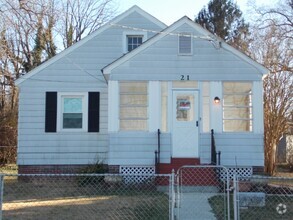
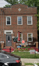
36 Hawaii Ave NE
Washington, DC 20011
1 Day Ago
Favorites
202-710-1489
-
Bedrooms
2
-
Bathrooms
2
-
Square Feet
3,555 sq ft
-
Available
Available Now
Highlight
- Central Heating and Cooling System
36 Hawaii Ave NE

Favorites
About This Home
Available Now
Link to apply:
36 Hawaii Ave NE is a house located in District of Columbia County and the 20011 ZIP Code. This area is served by the District Of Columbia Public Schools attendance zone.
* Price shown is base rent and may not include non-optional fees and utilities.
Price, availability, fees, and any applicable rent special are subject to change without notice.
* Square footage definitions vary. Displayed square footage is approximate.
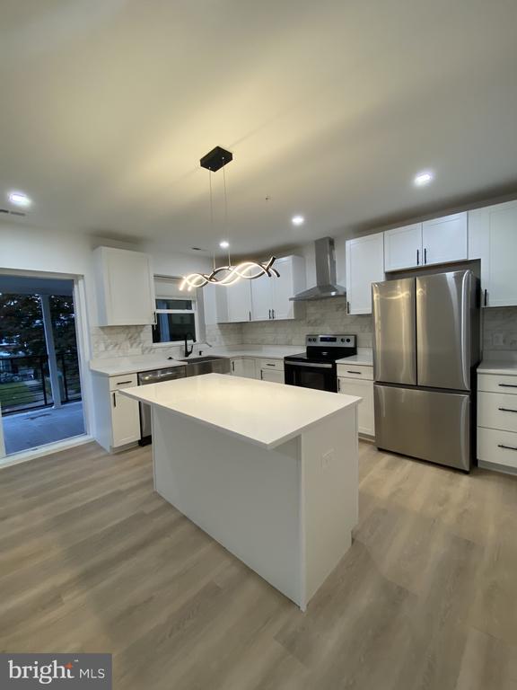
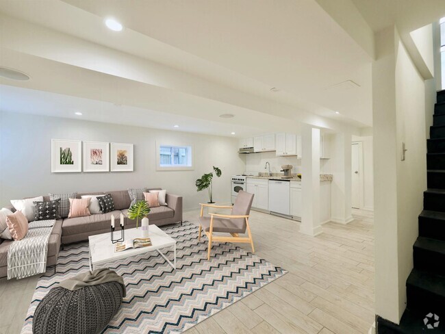
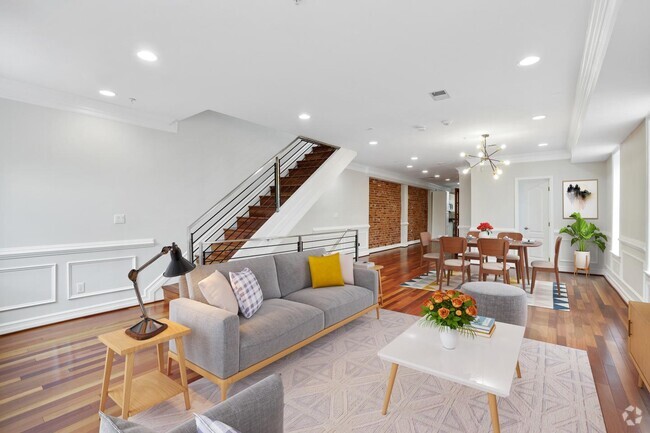
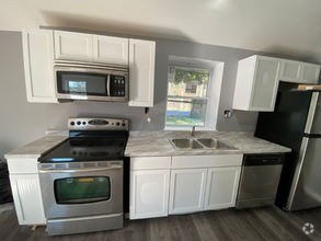
Home Details
Home Type
Semi-Detached or Twin Home
Year Built
Built in 1941
Bedrooms and Bathrooms
2 Main Level Bedrooms
2 Full Bathrooms
Home Design
Brick Exterior Construction
Brick Foundation
Interior Spaces
3,470 Sq Ft Home
Property has 1 Level
Listing and Financial Details
Security Deposit $2,900
12-Month Min and 24-Month Max Lease Term
Available 3/17/25
Assessor Parcel Number 3675//0001
Residential Lease
Lot Details
2,663 Sq Ft Lot
Parking
Off-Street Parking
Utilities
Central Heating and Cooling System
Natural Gas Water Heater
Public Septic
Community Details
Overview
Fort Totten Subdivision
Pet Policy
No Pets Allowed
Contact
- Listed by Emerald Taylor-Drummond | Compass
- Phone Number
- Contact
-
Source
 Bright MLS, Inc.
Copyright © 2025 Bright MLS, Inc.
Location
Get Directions
Pleasant Hill begins along Allison Street between Rock Creek Cemetery and Fort Totten Park. It extends south to Scale Gate Road, on the west side of the Catholic University of America. This small neighborhood also borders the Armed Forces Retirement Home-Washington, a National Historic District that includes President Lincoln's Cottage. Hawaii Avenue runs through the neighborhood and offers several bus stops. The neighborhood is hilly and wooded, featuring brick apartment buildings and townhomes along shady streets.
Learn more about living in Pleasant Hill
Education
| Colleges & Universities | Distance | ||
|---|---|---|---|
| Colleges & Universities | Distance | ||
| Walk: | 21 min | 1.1 mi | |
| Drive: | 5 min | 2.0 mi | |
| Drive: | 6 min | 2.6 mi | |
| Drive: | 9 min | 3.7 mi |
36 Hawaii Ave NE is within 21 minutes or 1.1 miles from Catholic University. It is also near Trinity Washington University and Howard University.
Schools

Public Elementary School
Grades PK-5
206 Students
Attendance Zone
Public Middle School
Grades 6-8
357 Students
Attendance Zone
Public High School
Grades 9-12
868 Students
Attendance Zone
Private Elementary School
Grades PK-6
101 Students
Nearby
Private Middle & High School
Grades 7-12
43 Students
Nearby
School data provided by
 The GreatSchools Rating helps parents compare schools within a state based on a variety of school quality indicators and provides a helpful picture of how effectively each school serves all of its students. Ratings are on a scale of 1 (below average) to 10 (above average) and can include test scores, college readiness, academic progress, advanced courses, equity, discipline and attendance data. We also advise parents to visit schools, consider other information on school performance and programs, and consider family needs as part of the school selection process.
View GreatSchools Rating Methodology
View GreatSchools Rating Methodology
Transportation options available in Washington include Fort Totten, located 1.3 miles from 36 Hawaii Ave NE. 36 Hawaii Ave NE is near Ronald Reagan Washington Ntl, located 9.1 miles or 17 minutes away, and Baltimore/Washington International Thurgood Marshall, located 32.0 miles or 45 minutes away.
| Transit / Subway | Distance | ||
|---|---|---|---|
| Transit / Subway | Distance | ||
|
|
Drive: | 3 min | 1.3 mi |
|
|
Drive: | 3 min | 1.5 mi |
|
|
Drive: | 4 min | 1.8 mi |
|
|
Drive: | 6 min | 2.4 mi |
|
|
Drive: | 7 min | 3.4 mi |
| Commuter Rail | Distance | ||
|---|---|---|---|
| Commuter Rail | Distance | ||
|
|
Drive: | 8 min | 3.9 mi |
|
|
Drive: | 8 min | 4.2 mi |
|
|
Drive: | 11 min | 4.9 mi |
|
|
Drive: | 10 min | 5.0 mi |
| Drive: | 14 min | 5.9 mi |
| Airports | Distance | ||
|---|---|---|---|
| Airports | Distance | ||
|
Ronald Reagan Washington Ntl
|
Drive: | 17 min | 9.1 mi |
|
Baltimore/Washington International Thurgood Marshall
|
Drive: | 45 min | 32.0 mi |
Time and distance from 36 Hawaii Ave NE.
| Shopping Centers | Distance | ||
|---|---|---|---|
| Shopping Centers | Distance | ||
| Walk: | 11 min | 0.6 mi | |
| Drive: | 4 min | 1.3 mi | |
| Drive: | 3 min | 1.5 mi |
36 Hawaii Ave NE has 3 shopping centers within 1.5 miles, which is about a 3-minute walk. The miles and minutes will be for the farthest away property.
| Parks and Recreation | Distance | ||
|---|---|---|---|
| Parks and Recreation | Distance | ||
|
Mount Rainier Nature Center
|
Drive: | 6 min | 2.8 mi |
|
Meridian Hill Park
|
Drive: | 7 min | 3.0 mi |
|
National Zoo
|
Drive: | 9 min | 3.5 mi |
|
Hillwood Estate, Museum & Gardens
|
Drive: | 10 min | 3.7 mi |
|
Rock Creek Park
|
Drive: | 9 min | 3.9 mi |
36 Hawaii Ave NE has 5 parks within 3.9 miles, including Mount Rainier Nature Center, Meridian Hill Park, and Rock Creek Park.
| Hospitals | Distance | ||
|---|---|---|---|
| Hospitals | Distance | ||
| Drive: | 4 min | 1.7 mi | |
| Drive: | 4 min | 1.9 mi | |
| Drive: | 6 min | 3.1 mi |
36 Hawaii Ave NE has 3 hospitals within 3.1 miles, the nearest is MedStar Washington Hospital Center which is 1.7 miles away and a 4 minute drive.
| Military Bases | Distance | ||
|---|---|---|---|
| Military Bases | Distance | ||
| Walk: | 22 min | 1.1 mi | |
| Drive: | 15 min | 5.7 mi |
36 Hawaii Ave NE is 1.1 miles from US Soldiers & Airmens Home, and is convenient to other military bases, including Naval Observatory.
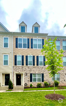
You May Also Like
Similar Rentals Nearby


What Are Walk Score®, Transit Score®, and Bike Score® Ratings?
Walk Score® measures the walkability of any address. Transit Score® measures access to public transit. Bike Score® measures the bikeability of any address.
What is a Sound Score Rating?
A Sound Score Rating aggregates noise caused by vehicle traffic, airplane traffic and local sources

36 Hawaii Ave NE
Washington, DC 20011