364 Westwood Ave
Long Branch, NJ 07740

-
Monthly Rent
$2,750
-
Bedrooms
2 bd
-
Bathrooms
1 ba
-
Square Feet
100 sq ft
Details

Discover Homeownership
Renting vs. Buying
-
Housing Cost Per Month: $2,750
-
Rent for 30 YearsRenting doesn't build equity Future EquityRenting isn't tax deductible Mortgage Interest Tax Deduction$0 Net Return
-
Buy Over 30 Years$1.08M - $1.92M Future Equity$486K Mortgage Interest Tax Deduction$88K - $929K Gain Net Return
-
Contact
Long Branch City is the coastal area of Long Branch. Residents of this section of town can enjoy relaxed beach life while only being 55 miles south of New York City. Within Long Branch City, residents can walk along Long Branch Boardwalk to view scenic beaches and journey to the many oceanfront restaurants. For shopping, residents will have to travel a bit out of town to Highway 35 to find premier shopping destinations like Monmouth Mall, Shrewsbury Plaza, and many more.
The rental scene in Long Branch City is made up of houses, apartments, and condos in a range of prices. Whether you’re a renter looking for a luxury apartment, a quiet condo overlooking the ocean, or a Colonial-style house situated near a main road, Long Branch City has a spot for everyone.
Learn more about living in Long Branch City| Colleges & Universities | Distance | ||
|---|---|---|---|
| Colleges & Universities | Distance | ||
| Walk: | 17 min | 0.9 mi | |
| Drive: | 4 min | 1.6 mi | |
| Drive: | 16 min | 10.1 mi | |
| Drive: | 21 min | 11.0 mi |
Transportation options available in Long Branch include Coney Island-Stillwell Avenue, located 51.3 miles from 364 Westwood Ave. 364 Westwood Ave is near Newark Liberty International, located 48.9 miles or 61 minutes away, and John F Kennedy International, located 66.6 miles or 93 minutes away.
| Transit / Subway | Distance | ||
|---|---|---|---|
| Transit / Subway | Distance | ||
|
|
Drive: | 73 min | 51.3 mi |
|
|
Drive: | 74 min | 51.7 mi |
|
|
Drive: | 76 min | 52.1 mi |
|
|
Drive: | 74 min | 52.2 mi |
|
|
Drive: | 74 min | 52.5 mi |
| Commuter Rail | Distance | ||
|---|---|---|---|
| Commuter Rail | Distance | ||
|
|
Walk: | 12 min | 0.6 mi |
|
|
Drive: | 6 min | 2.2 mi |
|
|
Drive: | 6 min | 2.3 mi |
|
|
Drive: | 8 min | 4.2 mi |
|
|
Drive: | 10 min | 4.5 mi |
| Airports | Distance | ||
|---|---|---|---|
| Airports | Distance | ||
|
Newark Liberty International
|
Drive: | 61 min | 48.9 mi |
|
John F Kennedy International
|
Drive: | 93 min | 66.6 mi |
Time and distance from 364 Westwood Ave.
| Shopping Centers | Distance | ||
|---|---|---|---|
| Shopping Centers | Distance | ||
| Drive: | 4 min | 1.5 mi | |
| Drive: | 3 min | 1.6 mi | |
| Drive: | 6 min | 3.0 mi |
| Parks and Recreation | Distance | ||
|---|---|---|---|
| Parks and Recreation | Distance | ||
|
Twin Lights State Historic Site
|
Drive: | 16 min | 8.6 mi |
|
Murray Farmhouse and Barn
|
Drive: | 18 min | 9.6 mi |
|
Poricy Brook Fossil Beds
|
Drive: | 20 min | 9.8 mi |
|
Huber Woods Environmental Center
|
Drive: | 20 min | 10.7 mi |
|
Hartshorne Woods Park
|
Drive: | 24 min | 11.5 mi |
| Hospitals | Distance | ||
|---|---|---|---|
| Hospitals | Distance | ||
| Walk: | 13 min | 0.7 mi |
| Military Bases | Distance | ||
|---|---|---|---|
| Military Bases | Distance | ||
| Drive: | 9 min | 4.1 mi | |
| Drive: | 10 min | 6.3 mi | |
| Drive: | 21 min | 13.8 mi |
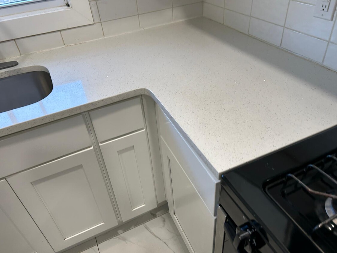
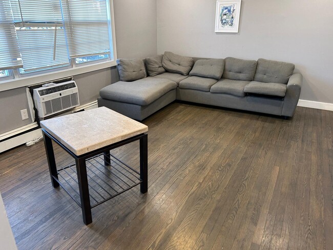
364 Westwood Ave Photos
What Are Walk Score®, Transit Score®, and Bike Score® Ratings?
Walk Score® measures the walkability of any address. Transit Score® measures access to public transit. Bike Score® measures the bikeability of any address.
What is a Sound Score Rating?
A Sound Score Rating aggregates noise caused by vehicle traffic, airplane traffic and local sources


