369 Tappan St
Brookline, MA 02445
-
Habitaciones
2
-
Baños
1
-
Pies cuadrados
1,200 pies²
-
Disponible
Disp. ahora

369 Tappan St se encuentra en Norfolk County en el código postal 02445. Esta área está atendida por la zona de asistencia del Brookline.
Características del apartamento
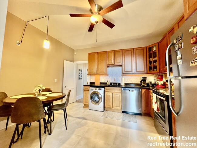
- Lavadora/Secadora
Tarifas y políticas
Las siguientes cuotas se basan en información proporcionada por la comunidad y es posible que no incluyan cuotas adicionales o servicios básicos.
Detalles
Información de la propiedad
-
3 unidades
Contactar
- Listado Por Micah Snyder
- Número de Teléfono
- Contactar
Cinco millas al oeste del centro de la ciudad de Boston y justo al sur de Allston, Washington Square ofrece a los residentes un ambiente de la ciudad y un sentido de comunidad suburbana. Algunos llama a este vecindario de Brookline una mayúscula de Cambridge, que satisface las necesidades de las familias sin sacrificar la diversión de Boston. Buen transporte público y rápido acceso a la ciudad agregan un atractivo especial, que atraen a profesionales jóvenes y los estudiantes de la cercana ciudad de Boston College y de la Boston University. La arquitectura se lleva a cabo desde las elaboradas a victorianos lujosos y familiares de fin del siglo pasado y homes y edificios de apartamentos moderno.
Obtén más información sobre la vida en Washington Square| Institutos y Universidades | Distancia de | ||
|---|---|---|---|
| Institutos y Universidades | Dist. | ||
| En coche: | 5 minutos | 2.1 mi | |
| En coche: | 4 minutos | 2.2 mi | |
| En coche: | 5 minutos | 2.4 mi | |
| En coche: | 4 minutos | 2.4 mi |


Ver la metodología de calificación de GreatSchools
Las opciones de transporte disponibles en Brookline incluyen Tappan Street Station, a 0.1 milla de 369 Tappan St. 369 Tappan St está cerca de General Edward Lawrence Logan International, a 8.2 millas o 17 minutos de distancia.
| Tránsito / metro | Distancia de | ||
|---|---|---|---|
| Tránsito / metro | Dist. | ||
|
|
A pie: | 1 minuto | 0.1 mi |
|
|
A pie: | 3 minutos | 0.2 mi |
|
|
A pie: | 4 minutos | 0.2 mi |
|
|
A pie: | 5 minutos | 0.3 mi |
|
|
A pie: | 7 minutos | 0.4 mi |
| Tren suburbano | Distancia de | ||
|---|---|---|---|
| Tren suburbano | Dist. | ||
|
|
En coche: | 6 minutos | 3.2 mi |
|
|
En coche: | 9 minutos | 3.7 mi |
|
|
En coche: | 11 minutos | 3.9 mi |
|
|
En coche: | 8 minutos | 4.0 mi |
| En coche: | 11 minutos | 5.2 mi |
| Aeropuertos | Distancia de | ||
|---|---|---|---|
| Aeropuertos | Dist. | ||
|
General Edward Lawrence Logan International
|
En coche: | 17 minutos | 8.2 mi |
Tiempo y distancia desde 369 Tappan St.
| Centros comerciales | Distancia de | ||
|---|---|---|---|
| Centros comerciales | Dist. | ||
| A pie: | 4 minutos | 0.2 mi | |
| A pie: | 9 minutos | 0.5 mi | |
| En coche: | 4 minutos | 1.9 mi |
| Parques y recreación | Distancia de | ||
|---|---|---|---|
| Parques y recreación | Dist. | ||
|
Chestnut Hill Reservation
|
A pie: | 13 minutos | 0.7 mi |
|
Frederick Law Olmsted National Historic Site
|
A pie: | 22 minutos | 1.2 mi |
|
John Fitzgerald Kennedy National Historic Site
|
En coche: | 3 minutos | 1.3 mi |
|
Coit Observatory
|
En coche: | 5 minutos | 2.8 mi |
|
Charles River Reservation
|
En coche: | 6 minutos | 3.2 mi |
| Medico | Distancia de | ||
|---|---|---|---|
| Medico | Dist. | ||
| En coche: | 3 minutos | 1.4 mi | |
| En coche: | 3 minutos | 1.4 mi | |
| En coche: | 4 minutos | 1.7 mi |
| Bases militares | Distancia de | ||
|---|---|---|---|
| Bases militares | Dist. | ||
| En coche: | 23 minutos | 13.7 mi | |
| En coche: | 29 minutos | 14.7 mi |
- Lavadora/Secadora
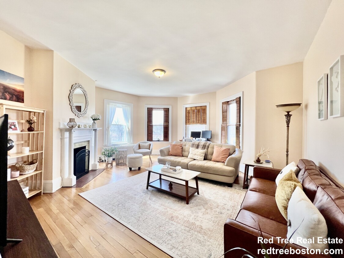
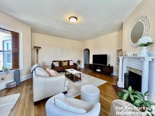
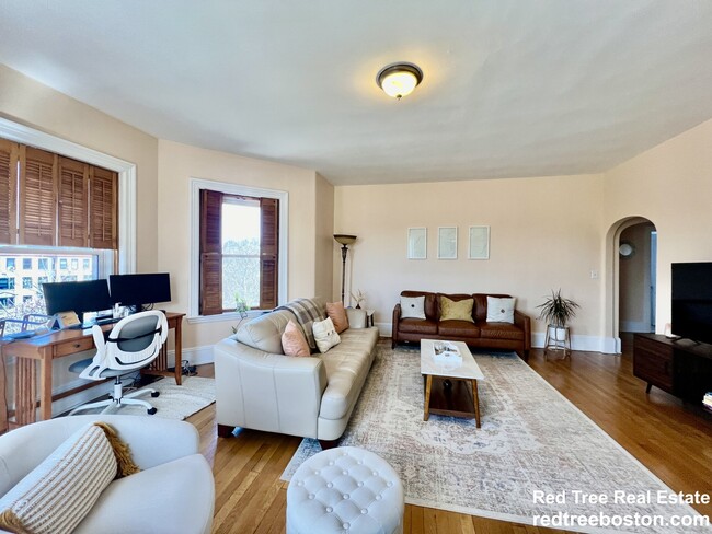
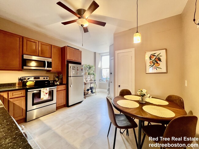
369 Tappan St Fotos
¿Qué son las clasificaciones Walk Score®, Transit Score® y Bike Score®?
Walk Score® mide la viabilidad peatonal de cualquier dirección. Transit Score® mide el acceso a transporte público. Bike Score® mide la infraestructura de rutas para bicicletas de cualquier dirección.
¿Qué es una clasificación de puntaje de ruido?
La clasificación de puntaje de ruido es el conjunto del ruido provocado por el transito de vehículos o de aviones y de fuentes locales.

369 Tappan St
Brookline, MA 02445